Fish Creek (Oneida Lake) facts for kids
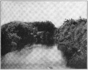
Fish Creek is a river in New York State. The Haudenosaunee people called it Tege-soken, which means "between the mouths." This river flows into the eastern end of Oneida Lake.
Fish Creek starts where its East and West branches meet near a small town called Blossvale. From there, it flows southwest for about 11 miles (18 km). It passes through the towns of Annsville and Vienna. The last mile of the creek is part of the Erie Canal, a famous waterway. This canal connects to Oneida Lake at Sylvan Beach.
The creek drains a large area of land, about 529 square miles (1,370 km²). This area is part of the Tug Hill plateau in Central New York. Fish Creek is the biggest river that flows into Oneida Lake. It provides about half of all the water that enters the lake.
Contents
Exploring Fish Creek's Geography
Even though the main part of Fish Creek is short, its branches are quite long. The East Branch stretches for about 42 miles (68 km). The West Branch is about 28 miles (45 km) long. If you measure from its farthest starting point in Lewis County, Fish Creek is 53 miles (85 km) long. It drains parts of Oneida, Lewis, and Oswego Counties.
Besides the East and West branches, the only other major river that joins Fish Creek is Wood Creek. Wood Creek flows in from the east through the Erie Canal. Most of the land around Fish Creek is countryside. The main towns in the area are Florence, Williamstown, Camden, Annsville, and Vienna. The East Branch provides about 46% of the water in Fish Creek. The West Branch adds about 42%, and Wood Creek contributes about 12%.
East Branch: Where it Starts
The East Branch of Fish Creek begins in southern Lewis County. It forms where two smaller streams, Sixmile and Sevenmile Creeks, meet. This spot is about 10 miles (16 km) west of Lyons Falls. The East Branch generally flows south. It receives water from Sucker Brook on its east side.
Further along, it enters a narrow valley where it is held back by a small dam, forming the City of Rome Reservoir. After the reservoir, Florence Creek joins it from the west. Then, the East Branch flows past Taberg before meeting the West Branch.
West Branch: Its Journey
The West Branch starts in marshy areas near Williamstown. This is in eastern Oswego County. It flows mostly southeast. At Camden in Oneida County, the Mad River joins it from the north. Cobb Brook also joins it shortly after, also from the north.
The West Branch continues southeast and receives the Little River from the west. It then flows past McConnellsville. Finally, it turns east to meet the East Branch.
Water Flow in Fish Creek
Most of the water in Fish Creek comes from melting snow on the Tug Hill. This area is famous for getting a lot of snow in winter! The amount of rain and snow over the watershed usually ranges from 51 to 59 inches (1,300 to 1,500 mm) each year. Some parts of Tug Hill can get as much as 196 inches (5,000 mm) of snow.
The river's water levels are usually highest in April. They are lowest during July and August. If there are high water levels in winter (from November to March), it's usually because of rainfall.
The U.S. Geological Survey (USGS) measures water flow on the East and West Branches. For example, the East Branch near Taberg had an average flow of 543 cubic feet per second (15.4 m³/s) between 1923 and 2013. This shows how much water moves through the river.
A Look Back: Fish Creek's History
The name Fish Creek might come from a special event. The Oneida people used to hold an annual fishing feast where the East and West branches meet. In the spring, they would place stakes across the creek to make a temporary dam out of brush.
They would then guide all the fish, including many Atlantic salmon, downstream to this barrier. After the fish were trapped by a second brush dam, they were easy to catch with spears and nets. The feast that followed was shared equally among all families in the tribe.
Sadly, after dams were built on the Oswego River, salmon disappeared from Fish Creek. The Oswego River carries water from Oneida Lake to Lake Ontario and then to the St. Lawrence River and the Atlantic Ocean. However, salmon were brought back to Fish Creek in 1997.
How People Use Fish Creek
The East Branch of Fish Creek has a dam called Kessinger Dam, built in 1909. This dam helps provide drinking water for the nearby city of Rome. Water is sent through a 1 mile (1.6 km) tunnel and a 7-mile (11 km) pipeline to different reservoirs around the city.
Another smaller stream, Florence Creek, also has a dam at Glenmore since 1926. This dam provides water for the city of Oneida.
Fun and Recreation on Fish Creek
The upper part of the East Branch is a great place for fishing. It is stocked with brook trout. Many other parts of both the East and West Branches also offer good fishing for wild brook, brown, and rainbow trout.
Between Point Rock and Taberg, the East Branch flows through a steep valley. This area is known for its exciting whitewater rapids. This 9.4-mile (15.1 km) stretch is sometimes called the "River of No Return." It is rated as Class II–IV by American Whitewater, meaning it has challenging rapids. In 1978, part of the East Branch was considered for special protection as a National Wild and Scenic River. However, it did not get this protection because there wasn't enough local support.
 | Calvin Brent |
 | Walter T. Bailey |
 | Martha Cassell Thompson |
 | Alberta Jeannette Cassell |


