Garden Island (South Australia) facts for kids

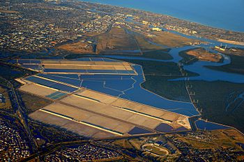
An aerial view of the Port River area. Garden Island is at the top right, next to Torrens Island.
|
|
| Geography | |
|---|---|
| Location | Gulf St Vincent |
| Coordinates | 34°48′26″S 138°32′04″E / 34.807170°S 138.534450°E |
| Area | 150 ha (370 acres) |
| Administration | |
| Demographics | |
| Population | 0 |
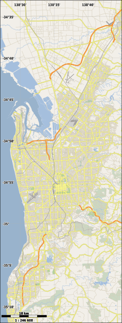
Garden Island is an island in South Australia. It is about 14 kilometers (9 miles) north-west of Adelaide. The island is part of a river system that flows into Gulf St Vincent.
Garden Island is special for a few reasons. It has a large mangrove forest. It was also used as a landfill site for many years. The island is also home to a unique ship graveyard. People enjoy recreational boating activities around the island. Since 1973, parts of Garden Island have been protected areas.
Contents
Where is Garden Island?
Garden Island is located in Gulf St Vincent. It is part of the Port River system. The island is about 15 kilometers (9.3 miles) north-west of Adelaide's city center. It sits just south-east of Torrens Island.
The island is completely within the suburb of Garden Island. It lies between the Port River and Barker Inlet. Several waterways surround it. These include Angas Inlet to the north and Eastern Passage to the east. This passage narrows into Angas Channel. To the south is North Arm.
You can reach Garden Island by road or by boat. A bridge connects the island to the mainland. There are also three boat ramps on the northern coast. These ramps are connected to the road system. An electric power transmission line crosses the island. It ends at the Torrens Island Power Station.
How Garden Island Was Formed
Garden Island was formed a long time ago. This happened when sea levels rose at the start of the Holocene period. The rising sea had three main effects.
First, rivers had to create new mouths to the sea. Second, ocean currents formed beaches and sand dunes. This created the Lefevre Peninsula. This process is called longshore drift. Third, rivers like the River Torrens and Sturt River were blocked from flowing directly into Gulf St Vincent. They were forced to flow north into the Port River system. This led to the formation of islands like Torrens Island and Garden Island.
Plants and Animals on Garden Island
Flora: Plants on the Island
The main plant found on Garden Island is the Avicennia marina. This plant is also known as the Grey or white mangrove. These mangroves grow along the coastline of Garden Island. They are especially common on the island's east end. They grow in the intertidal zone, which is the area covered by water at high tide and exposed at low tide.
History of Garden Island
European Use of the Island
Since 1836, most of Garden Island has been crown land. This means it is owned by the government. In 1962, the entire island became a reserve. It was managed by the South Australian Harbors Board. The first public road opened on the island in 1968. People started using the island for boating and as a landfill site in the 1970s.
The Landfill Site
Garden Island was used as a landfill from about 1972 until 2000. A landfill is a place where trash is buried. This landfill covered 54 hectares (133 acres) of the island's 150 hectares (370 acres). It handled waste for almost half of Adelaide. The gas produced by the buried waste is now collected. This system started in 2015. Even in 2014, it was still allowed to use parts of the island for landfill.
The Multifunction Polis Idea
Garden Island was once considered for a project called the Multifunction Polis. This was a plan for a new planned community in 1987. It was meant to house 250,000 people. However, the plan was stopped in 1998. As of 2014, the land, including Garden Island, was still set aside for this purpose.
Garden Island Ships' Graveyard
The Garden Island Ships' Graveyard is a unique place. It has the remains of 25 old ships. These ships were abandoned between 1909 and 1945. They were made of iron and wood. Today, these old wrecks are homes for birds. They are also a popular spot for canoeing.
The area was also used to store explosives from the 1880s. The ships in the graveyard were built between 1857 and 1920. Famous ships include the Santiago and the schooner Dorothy H. Sterling. There are also other sailing ships, steamships, and iron barges. The Government of South Australia promotes the ship graveyard as a fun canoeing trail.
Fun Activities and Tourism
Since the 1970s, Garden Island has been a popular spot for boating. People enjoy recreational boating activities. They use the waters around the island, like the Barker Inlet and Port River.
Protected Areas on Garden Island
Garden Island has been part of several protected areas. These areas help to keep the island and its environment safe.
- The Barker Inlet – St Kilda Aquatic Reserve has protected the island since 1973. This reserve covers all parts of the island below high water mark.
- The Adelaide Dolphin Sanctuary was created in 2005. It covers the entire island.
- The Torrens Island Conservation Park includes some land on the east end of the island. This land is exposed at low water. This park has protected the area since 2014.
 | Chris Smalls |
 | Fred Hampton |
 | Ralph Abernathy |


