Geography of Evans County, Georgia facts for kids
 |
|
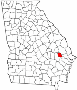
| Map of Georgia with Evans County in red | |
| Area | |
| Total | 182.85 sq mi (473.6 km2) |
| Land | 178.65 sq mi (462.7 km2) |
| Water | 4.2 sq mi (11 km2) |
| Latitude | 32°16′ N |
| Longitude | 81° 89′ W |
| Borders | |
| Candler County | |
| Bulloch County | |
| Bryan County | |
| Liberty County | |
| Tattnall County | |
Welcome to Evans County! This county is located in the state of Georgia, which is in the Southeastern United States in North America. It's a fun place to learn about geography.
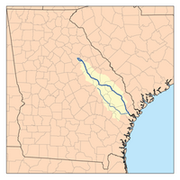
Evans County covers a total area of about 183 square miles. Most of this area, around 179 square miles, is land. The rest, about 4 square miles, is water. The most important river here is the Canoochee River, which flows right through the county.
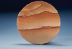
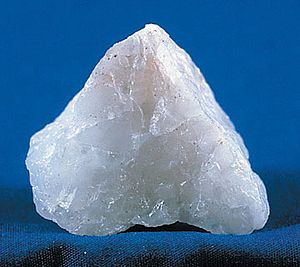
The land in Evans County is part of Georgia's coastal plain. This means it's mostly made up of sedimentary rocks. You can also find other rocks like sandstone and claystone, plus lots of sand and gravel. Near the Canoochee River, some of the sand is bright white quartz!
Evans County enjoys a mild climate. In January, the average temperature is around 50 degrees Fahrenheit. In July, it warms up to about 83 degrees Fahrenheit. The county gets about 48 inches of rain each year. The land here is not very high, ranging from about 65 feet to 228 feet above sea level.
Contents
Exploring Evans County's Land
Evans County is located in the coastal plain region of Georgia. This area is mostly made of sedimentary rocks. These rocks are formed over a long time from layers of sand, mud, and other materials. The coastal plain is separated from another region called the Piedmont by something called the Fall Line. This line runs through cities like Augusta, Georgia, Macon, Georgia, and Columbus, Georgia.
How the Land Formed
Much of Evans County's land is covered by sandstone and claystone. These rocks are from a time called the Neogene era, which started about 23 million years ago. You can also find sands and gravels from even older times, like the Pliocene and Pleistocene eras. Some areas have soft deposits of rock and sand from old marshes and lagoons. There are even small areas of dune sand.
Types of Rocks and Soils
Besides sedimentary rocks, Evans County has thin layers of sand and red and yellow clay. The amount of sand can be different in various places, from a few inches to several feet deep. Near the Canoochee River, you'll find beautiful white quartz sand. This sand has medium-sized grains. There's even a spot near Bull Creek with about 50 acres of this medium-grain sand. This pure white sand could be used to make bottle glass, but it's a bit tricky to get out of the ground.
Most of Evans County is in the Southern Coastal Plain Major Land Resource Area. A smaller part in the south is in the Atlantic Coastal Flatwoods Major Land Resource Area. These are names for different types of land regions.
Rivers, Creeks, and Ponds
The most important body of water in Evans County is the Canoochee River. This river is about 108 miles long and flows through southeastern Georgia.
Besides the river, there are several ponds where you might go fishing or just enjoy nature. These include Cypress Pond, Dyess Pond, Beasley Pond, and Tippins Lake. Many smaller creeks also flow through the county, such as Grice Creek, Billy Fork Creek, and Cedar Creek.
Evans County's Climate
Evans County has a mild climate, which means it doesn't get too hot or too cold. The average temperature in January is around 49.8 degrees Fahrenheit, and in July, it's about 82.7 degrees Fahrenheit. The county receives an average of 48 inches of rain every year.
The land's height above sea level ranges from about 65 feet at its lowest point to 228 feet at its highest. Evans County doesn't experience many tornadoes compared to the U.S. average. Between 1950 and 2004, only two people were injured by a tornado in the county.
| City | Jan | Feb | Mar | Apr | May | Jun | Jul | Aug | Sep | Oct | Nov | Dec |
|---|---|---|---|---|---|---|---|---|---|---|---|---|
| Bellville | 61 36 |
66 39 |
73 44 |
79 50 |
86 59 |
91 67 |
94 71 |
92 70 |
87 65 |
80 54 |
71 45 |
63 38 |
| Claxton | 61 36 |
66 39 |
73 44 |
79 50 |
86 59 |
91 67 |
94 71 |
92 70 |
87 65 |
80 54 |
71 45 |
63 38 |
| Daisy | 61 36 |
66 39 |
73 44 |
79 50 |
86 59 |
91 67 |
94 71 |
92 70 |
87 65 |
80 54 |
71 45 |
63 38 |
| Hagan | 61 36 |
66 39 |
73 44 |
79 50 |
86 59 |
91 67 |
94 71 |
92 70 |
87 65 |
80 54 |
71 45 |
63 38 |
| Temperatures are given in °F format, with highs on top of lows | ||||||||||||
Natural Resources and Farming
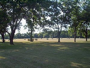
Evans County is an important area for farming. It has about 199 acres of farmland and 796 acres of orchards. The farms in Evans County sell agricultural products worth an average of $92,983.
Crops and Water Use
Two of the main crops grown in the county are corn and cotton. Farmers also plant and harvest other crops like soybeans, wheat, and various vegetables. A lot of land is also used for growing fruit in orchards.
People in Evans County use about 269,420 gallons of water each day. The water system can actually provide much more, up to 3,720,000 gallons daily! There's also a large storage capacity of 700,000 gallons in elevated tanks.
 | Leon Lynch |
 | Milton P. Webster |
 | Ferdinand Smith |


