
Evans County, Georgia facts for kids
Quick facts for kids
Evans County
|
||
|---|---|---|

Evans County Courthouse in Claxton
|
||
|
||

Location within the U.S. state of Georgia
|
||
 Georgia's location within the U.S. |
||
| Country | ||
| State | ||
| Founded | 1914 | |
| Named for | Clement A. Evans | |
| Seat | Claxton | |
| Largest city | Claxton | |
| Area | ||
| • Total | 187 sq mi (480 km2) | |
| • Land | 183 sq mi (470 km2) | |
| • Water | 4.0 sq mi (10 km2) 2.1%% | |
| Population
(2020)
|
||
| • Total | 10,774 | |
| • Density | 59/sq mi (23/km2) | |
| Time zone | UTC−5 (Eastern) | |
| • Summer (DST) | UTC−4 (EDT) | |
| Congressional district | 12th | |

Evans County is a county in the southeastern part of Georgia, a state in the United States. In 2020, about 10,774 people lived there. The main town, or county seat, is Claxton.
Evans County was officially created on November 3, 1914. It was named after Clement A. Evans, an important person from Georgia. The county is known for its beautiful natural areas, including the Canoochee River.
The economy of Evans County includes jobs in manufacturing, education, and health care. Some big employers are Claxton Poultry Company and Evans Memorial Hospital.
Contents
History of Evans County

Evans County was created on November 3, 1914. This happened after people in Georgia voted to approve a new law. The county was formed from parts of Bulloch and Tattnall counties.
The county was named to honor Clement A. Evans. He was a state senator, a general in the Confederate States Army, a Methodist minister, and a writer.
People wanted a new county for several reasons. They wanted to be closer to the courthouse. They also hoped for more jobs and new businesses like hotels and restaurants. The arrival of the Savannah and Western Railroad helped create new towns like Bellville, Claxton, Daisy, and Hagan. These towns later became part of Evans County.
Not everyone agreed with creating a new county. Some worried about higher taxes. But in the end, the new county was approved.
The main building for county business is the Evans County Courthouse in Claxton. It was finished in 1923. Before that, county business took place in the White Building.
In 1940, Mrs. Josie Mae Rogers became the first female sheriff in Evans County, and in Georgia. She was appointed after her father, the sheriff, passed away. Later, the people of the county elected her to the position.
Also in 1940, a large military camp called Camp Stewart was created. This camp later became Fort Stewart. Many people had to move from their homes to make way for the camp.
The late 1950s and 1960s brought important growth to Evans County.
- In 1958, a long-term study on heart disease called the Evans County Heart Study began. It helped scientists learn a lot about health.
- In 1964, a site was approved for the Claxton-Evans County Airport.
- In 1967, Evans Memorial Hospital opened, improving health care for the community.
In 1975, students at Claxton High School helped build a special two-seat airplane. It was the only one of its kind ever built.
Several buildings in Evans County, including the courthouse, are now on the National Register of Historic Places. This means they are important historical sites.
Since 2008, August 11 has been celebrated as Evans County Day. This day marks the county's founding.
Geography and Nature

Evans County covers about 187 square miles. Most of this is land, with about 4 square miles of water. The main river flowing through the county is the Canoochee River. It is a smaller river that flows into the Ogeechee River.
There are also several ponds and smaller streams in the county. These include Cypress Pond, Dyess Pond, and Grice Creek.
Land and Rocks
Evans County is in Georgia's coastal plain region. This area mostly has sedimentary rocks. The land is covered by thin sand and red and yellow clay. Along the Canoochee River, you can find white quartz sand.
Plants and Animals

Evans County is home to many special plants and animals. Some protected plants found here include the Georgia plume and different types of pitcher plants. Other plants include beardtongue, Stewartia, and sweetbay.
Protected animals in the area include the red-cockaded woodpecker, the indigo snake, and the southern bald eagle. You might also find Bachman's sparrow and the spotted turtle.
Climate
Evans County has a mild climate, meaning it's not too hot or too cold. It's known as a humid subtropical climate. The average temperature in January is about 49.8 degrees Fahrenheit, and in July, it's about 82.7 degrees Fahrenheit. The county gets about 48 inches of rain each year.
The county is also pretty safe from tornadoes. Only two injuries have been reported from tornadoes in the county between 1950 and 2004.
| City | Jan | Feb | Mar | Apr | May | Jun | Jul | Aug | Sep | Oct | Nov | Dec |
|---|---|---|---|---|---|---|---|---|---|---|---|---|
| Bellville | 61 36 |
66 39 |
73 44 |
79 50 |
86 59 |
91 67 |
94 71 |
92 70 |
87 65 |
80 54 |
71 45 |
63 38 |
| Claxton | 61 36 |
66 39 |
73 44 |
79 50 |
86 59 |
91 67 |
94 71 |
92 70 |
87 65 |
80 54 |
71 45 |
63 38 |
| Daisy | 61 36 |
66 39 |
73 44 |
79 50 |
86 59 |
91 67 |
94 71 |
92 70 |
87 65 |
80 54 |
71 45 |
63 38 |
| Hagan | 61 36 |
66 39 |
73 44 |
79 50 |
86 59 |
91 67 |
94 71 |
92 70 |
87 65 |
80 54 |
71 45 |
63 38 |
| Temperatures are given in °F format, with highs on top of lows | ||||||||||||
Neighboring Counties
Evans County shares borders with these other counties:
- Bulloch County – to the northeast
- Bryan County – to the east
- Liberty County – to the southeast
- Tattnall County – to the southwest
- Candler County – to the northwest
Towns and Communities
The main towns and communities in Evans County are:
People of Evans County
| Historical population | |||
|---|---|---|---|
| Census | Pop. | %± | |
| 1920 | 6,594 | — | |
| 1930 | 7,102 | 7.7% | |
| 1940 | 7,401 | 4.2% | |
| 1950 | 6,653 | −10.1% | |
| 1960 | 6,952 | 4.5% | |
| 1970 | 7,290 | 4.9% | |
| 1980 | 8,428 | 15.6% | |
| 1990 | 8,724 | 3.5% | |
| 2000 | 10,495 | 20.3% | |
| 2010 | 11,000 | 4.8% | |
| 2020 | 10,774 | −2.1% | |
| 2023 (est.) | 10,754 | −2.2% | |
| U.S. Decennial Census 1790–1880 1890–1910 1920–1930 1930–1940 1940–1950 1960–1980 1980–2000 2010 |
|||
| Race | Number | Percent |
|---|---|---|
| White (not Hispanic) | 6,038 | 56.04% |
| Black or African American (not Hispanic) | 3,083 | 28.62% |
| Native American | 15 | 0.14% |
| Asian | 78 | 0.72% |
| Pacific Islander | 11 | 0.1% |
| Other/Mixed | 312 | 2.9% |
| Hispanic or Latino | 1,237 | 11.48% |
In 2020, there were 10,774 people living in Evans County. These people lived in 4,020 households.
Famous People from Evans County

Evans County has been home to several notable people:
- James Kicklighter is a film director from Bellville.
- Joseph Kennedy was born in Claxton. He became a state senator.
- Albert Parker and Ira S. Womble Sr. made Claxton famous with their fruitcake companies.
- Cartha Deke DeLoach worked for the FBI.
- Dr. Curtis Gordon Hames did important research on heart disease.
- Charles Gordon Edwards and William Washington Larsen became United States Representatives.
Economy and Jobs

Evans County has a mix of different jobs. Many people work in manufacturing, education, health care, and retail. The Claxton-Evans County Industrial Park is a big source of manufacturing jobs. They make concrete poles and process metals there.
Major employers in the county include:
- Evans Memorial Hospital
- Camellia Health and Rehabilitation
- Claxton Poultry Company
- Georgia Department of Corrections
- Pinewood Christian Academy
- Valmont Newmark
Outside the towns, farming is very important. Major crops include corn, cotton, and soybeans. There are also many pecan and other fruit orchards. The food industry is a common place for people in Evans County to work.
Culture and Traditions
Evans County has a rich culture shaped by its diverse population. People from many backgrounds live here, including White, Black, Native American, Asian, and Hispanic or Latino groups. This mix of cultures makes Evans County unique.
Local Customs and Events

Evans County has several annual events:
- The annual rattlesnake roundup started in 1968. It is now called the Claxton Rattlesnake and Wildlife Festival.
- The Cruisin' in the Country Bike Ride began in 1995. It's a long bike ride that attracts many people.
- Other events include the Martin Luther King Day parade in January.
- Christmas in Claxton is held on the first Saturday in December. It features arts, crafts, food, and a Parade of Lights.
- There are also barrel racing events and tractor pulls.
Food and Cuisine

The food in Evans County is varied and delicious. You can find seafood, corn on the cob, and chicken and dumplings. Other popular dishes include Brunswick stew, fried chicken, and cornbread. Local favorites also include pecans, peaches, and peanuts. Because of the diverse community, you can also find Mexican and Chinese restaurants.
Buildings and Architecture

Many buildings and homes in Evans County are listed on the National Register of Historic Places.
- In Claxton, you can find the Dr. James W. Daniel House and the Evans County Courthouse.
- In Hagan, there is the George W. DeLoach House.
- Other interesting places include the Daisy Post Office and the Bellville train depot.
Some antebellum houses were built before the county was formed. Many of these homes are in the Plantation Plain style. Examples include the A.D. Eason House and the Thomas A. Durrence House.
Media
The Claxton Enterprise is the local weekly newspaper. It has been published since 1912 and serves Evans County.
Evans County also has a local radio station, WCLA. It broadcasts on both AM and FM. The station plays music and covers local sports, including Claxton High School and Pinewood Christian Academy games. It also broadcasts University of Georgia Bulldog sports and Atlanta Braves baseball.
Sports and Fun Activities
Sports in Evans County are popular, especially at the local schools.
- Claxton High School and Pinewood Christian Academy both have sports programs.
- These programs include football, baseball, basketball, track and field, softball, and tennis. Claxton High School also has a golf team.
- Claxton High School's boys' track and field team won state championships in 1983. Their boys' basketball team won in 1988.
There are also public areas for recreation:
- The Evans County Public Fishing Area in Claxton has three lakes for fishing. It also has campsites and picnic areas.
- Parks include Bacon Ford Park and the Senior Citizens Park in Claxton.
- In Hagan, you can visit the Maggie Mae Lewis Children's Park and the Bradley Memorial Park.
- The Evans Heights Golf Club is a place for golf lovers.
Transportation

Transportation in Evans County is managed by the Georgia Department of Transportation.
Major Roads
Several important U.S. highways and state routes pass through Evans County:
- U.S. Route 25
- U.S. Route 280
- U.S. Route 301
- State Route 30
- State Route 73
- State Route 129
- State Route 169
- State Route 292
Air Travel
The Claxton-Evans County Airport provides air travel services. It was approved in 1964 and opened in 1971. The airport is located northeast of Claxton. It has a 5,000-foot runway and other facilities for planes.
Education
Evans County has both public and private schools.
Public Schools
Public education in most of Evans County is managed by the Evans County School District. This district serves students from kindergarten through 12th grade. There are three public schools:
- Claxton Elementary School
- Claxton Middle School
- Claxton High School
These schools are accredited, meaning they meet high educational standards. There are about 1,888 students and 122 teachers in the public school system.
Private Schools
Pinewood Christian Academy is a private school located in Bellville. It was founded in 1970 and has about 685 students.
Images for kids
-
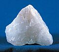
Milky quartz sample
-
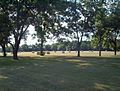
Bales of hay adjacent to a pecan tree orchard outside of Claxton, Georgia in Evans County

See also
 In Spanish: Condado de Evans para niños
