Germany Valley facts for kids
Quick facts for kids Germany Valley |
|
|---|---|

Germany Valley
|
|
| Floor elevation | 2,100 ft (640 m) |
| Geography | |
| Country | United States |
| State | West Virginia |
| County | Pendleton |
| Population center | Riverton |
Germany Valley is a beautiful valley located high in the Allegheny Mountains of eastern West Virginia. It was first settled by German farmers in the mid-1700s. Today, it's part of the Spruce Knob-Seneca Rocks National Recreation Area within the Monongahela National Forest. However, many parts of the valley are still privately owned.
The valley is famous for its many karst features and caves. Karst means the land has features like sinkholes and caves formed by water dissolving rock. Dozens of caves have been found and mapped here. Because of its special features, the area was named a National Natural Landmark in 1973. It's called the Germany Valley Karst Area. The National Park Service said it's one of the biggest karst areas in the country.
Contents
Where is Germany Valley?
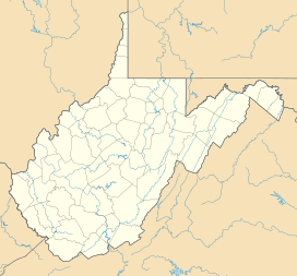
Germany Valley is in the northern part of Pendleton County, West Virginia. It sits near the top of the North Fork South Branch Potomac River. The valley floor is about 2,100 feet (640 meters) high. The mountains around it are much taller, about 500 to 1,200 feet (150–370 meters) higher.
The valley is about 10 miles (16 km) long and 2.5 miles (4 km) wide. It runs mostly from northeast to southwest. North Fork Mountain is on its east side, and the River Knobs are on its west side.
You can get into the valley by car from the west through places like Riverton Gap or Hinkle Gap. The town of Riverton is also nearby. Near the southern end of the valley, there's a popular viewpoint along U.S. Route 33. Seneca Rocks are also close to the northern part of the valley.
Many places in or near the valley are named after the families who first settled there. These include Judy Gap, Bennett Gap, and Teter Gap. There are also hills and knobs named Bland Hills, Dolly Ridge, and Harman Knob.
The Valley's Past
Early Settlers (1700s)
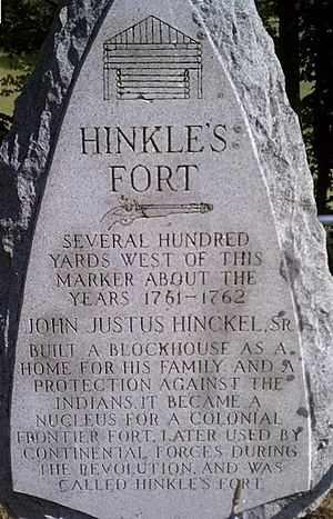
Germany Valley got its name from the German families who were the first to live there. The Hinkle family was one of the first to arrive in 1761. John Justus Hinkle, Sr., his wife, and their twelve children moved there from North Carolina. They were looking for cheap farmland and a place with fewer attacks from Native American tribes. They also liked the rich soil and gentle land.
Soon, other families like the Teters joined them. Many Pennsylvania Dutch families also moved from Pennsylvania. These settlers brought their traditions, like putting hex signs on their barns. This was a unique custom for West Virginia.
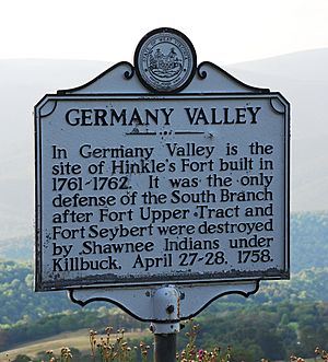
Native Americans were still in the area. The famous Great Indian Warpath passed near the valley. British forts nearby had been destroyed in Native American uprisings. Because of this, the Hinkle family built a strong blockhouse called Hinkle's Fort in 1762. This fort helped protect the settlers from raids. During the American Revolutionary War, the fort became a training spot for local soldiers. The fort is gone now, but a stone monument marks its old location.
These farming families kept their German language and old customs for a long time. That's why the valley became known as "German Settlement" or "Germany Valley." Other families, like the Scotch-Irish, also moved to the area. Even though the community grew, it stayed quite isolated. Farmers mostly raised cattle, horses, and sheep. They grew crops to feed their animals. It was hard to sell goods in bigger markets because the roads were poor.
In 1781, a religious leader named Bishop Francis Asbury visited the valley. He was one of the first Methodist missionaries in the United States. He wrote in his journal about preaching to about ninety "Dutch folk" (Germans) who seemed to enjoy his words. He also mentioned visiting a large spring called Judy Spring.
Life in the 1800s
During the American Civil War, people in Germany Valley mostly supported the Confederacy. However, nearby areas had different views. Pendleton County was a border area, and people often fought among themselves. Many men from the valley joined local groups like the Pendleton Scouts and fought for the Confederacy. Other groups, like the Swamp Dragons, supported the Union. There were often clashes between these groups. Union army units also raided the valley several times during the war.
The valley used to have many beautiful trees, including black walnut trees. At first, settlers cut down trees for their own needs. Later, in the 1800s, lumber companies became interested. They cut down the remaining forests and took the wood to distant railroads. Because transportation was difficult, there weren't many large sawmills in the valley. However, smaller sawmills were present.
The Valley's Amazing Geology
Germany Valley is built on very old limestones from a time called the Ordovician period. The valley was formed by a large fold in the Earth's layers, called an anticline, that has worn away over time. The mountains on either side, North Fork Mountain and the River Knobs, are also part of this fold.
Caves and Sinkholes
Germany Valley is famous for its New Market limestone bedrock. This pale gray limestone tends to erode with deep cracks when exposed to the surface. This erosion creates amazing caves with large passages and big rooms. The valley has many sink holes (holes in the ground), streams that disappear underground, and rocky areas. This makes it a popular place for people who love to explore caves.
New Market limestone is rich in calcium carbonate. It also has potassium and phosphorus. These ingredients make it valuable for quarries. Quarries are places where rock is dug out of the ground. This limestone is used to fertilize farm fields and lawns. It's also used in making steel and coal. The Greer Limestone Plant operates in the valley because of this valuable rock.
Exploring the Caves
Germany Valley is home to many important caves. Here are some of the most well-known:
- Seneca Caverns is a show cave that you can visit. A settler named Laven Teter discovered it around 1780. However, the Seneca Native Americans may have used it before that. It opened to the public in 1928 and got electricity in 1930. Visitors can walk along a 0.75-mile (1.2 km) path and go down 165 feet (50 meters) below the surface. You can see many cool rock formations called speleothems, like "Mirror Lake" and "Niagara Falls Frozen Over."
- Stratosphere Balloon Cave is near Seneca Caverns. It's named after a huge rock formation that looks like a high-altitude balloon. This cave was also open to the public in the 1930s but closed in 1939. It reopened in 2006. You need a guide and pay a fee to enter, as it doesn't have electricity.
- Hellhole is a very important cave for people who study caves. It has over 28 miles (45 km) of passages, making it the 11th longest cave in the U.S. It's also the deepest cave in the valley, going down 518 feet (158 meters). Hellhole is a crucial winter home, called a hibernaculum, for bats. About 45% of the world's Virginia big-eared bats hibernate here!
- Schoolhouse Cave was used to mine saltpeter (a material for gunpowder) during the French and Indian War (1754–63). It might be the second oldest saltpeter mine in West Virginia. During the Civil War, it was mined to help the Union forces. Like Hellhole, Schoolhouse Cave was important for early cave explorers in the 1930s and 1940s. It's known as a great place for "vertical cavers" who like to climb down deep drops.
- Memorial Day Cave was found by cavers in 1999 and first entered in 2001. In 2002, they found a 125-foot (38 m) drop into a mile-long canyon! This cave is now known to be over 14 miles (22.5 km) long and 430 feet (131 m) deep.
- Judy Spring is a stream where you can find trout. It's also a cave that SCUBA divers can enter.
- Shoveleater Cave has over 4 miles (6.4 km) of mapped passages.
Other caves in the area include Harman Pit, Apex Cave, Ruddle Cave, Harper's Pit, and Convention 2000 Cave.
Protecting Our Bats
Hellhole cave is very important for bats. From the 1940s to the 1980s, explorers mapped about 8.5 miles (13.7 km) of its passages. The cave is in the same type of rock, New Market Limestone, that is mined by the Greer Limestone Company nearby.
The entrance to Hellhole is on private land. In 1986, Greer Limestone Company leased the entrance and began to limit access to the cave. However, they did allow the West Virginia Division of Natural Resources (WV DNR) to go into the cave twice a year. This was to count the populations of endangered bat species. Later, Greer also allowed some limited exploration and mapping of the cave.
In 1995 and 1997, new parts of Hellhole were discovered, showing it was much larger than first thought. By this time, the U.S. Fish and Wildlife Service said Hellhole was a critical home for two endangered bat species: the Indiana bat and the Virginia big-eared bat. About 45% of the world's Virginia big-eared bats hibernate in Hellhole.
Greer Limestone set up special "buffer zones" where they wouldn't work or blast too close to the known parts of the cave. But the problem was, the full size of the cave wasn't known yet!
Hellhole is a perfect home for these bats because it's unusually cold, around 47 degrees Fahrenheit (8 degrees Celsius). Most caves in West Virginia are warmer. This cold temperature is vital for the bats to survive their hibernation. The cave stays cold because it traps cold air. If the quarry accidentally broke into the cave at a lower level, the cold air would escape. This would make the cave too warm for the bats.
After the new discoveries in 1997, Greer Limestone stopped allowing more exploration. Cavers worried that the quarry didn't want to find more cave areas because that would mean less limestone for them to mine.
In 2000, Greer wanted to get a new permit to continue mining and expand their quarry. This made many cavers concerned. They believed that mining without knowing the full extent of the cave could harm the bats' home.
After many discussions with Greer, government agencies, and caving groups, a special group called the Germany Valley Karst Survey (GVKS) was hired in 2002. Their job was to map the Hellhole cave system. They could only work during the summer months to avoid disturbing the bats. Since then, the known size of Hellhole has grown to 24.9 mapped miles (40.1 km) and a depth of 519 feet (158.2 m). The GVKS-Greer contract ended in 2007.
Category:Monongahela National Forest Category:Landforms of Pendleton County, West Virginia Category:Valleys of West Virginia Category:German-American history Category:German-American culture in West Virginia Category:National Natural Landmarks in West Virginia Category:Pennsylvania German culture in Virginia
 | Mary Eliza Mahoney |
 | Susie King Taylor |
 | Ida Gray |
 | Eliza Ann Grier |


