Great Indian Warpath facts for kids
The Great Indian Warpath (GIW) was a very old and important network of trails used by Native Americans in eastern North America. It was also called the Great Indian War and Trading Path or the Seneca Trail. This path stretched from what is now upper New York all the way down to Alabama.
Native American tribes like the Catawba, Cherokee, and Iroquois Confederacy used these trails. They traveled for trading goods, communicating with other tribes, and sometimes for war. The British traders gave the path its name by combining Native American words. "Mishimayagat" meant "Great Trail" to some tribes, and "Athawominee" meant "Path where they go armed" to others.
Contents
History of the Path
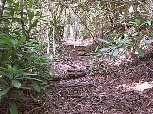
We don't know exactly how old the Great Indian Warpath is. Many parts of these trails were first made by animals, like buffalo, looking for salt licks. Native Americans later used these animal paths. They used them for trading and talking with other tribes long before Europeans arrived.
For example, in 1728, a man named William Byrd II saw a part of the trail in Virginia. He noted that Native Americans could easily travel 25 miles a day on foot. They carried their supplies and even heavy packs of animal skins.
By the 1700s, much of the Valley of Virginia was used as a hunting ground. It was also a travel route and a warpath between different Native American groups.
European Settlers and the Path
When European settlers arrived, they also started using these trails. During the French and Indian War (1756–1763), the Seneca Trail in the north became a boundary. It marked the edge of where settlers were allowed to live.
In 1763, King George III made a rule. He said settlers could not move past the Allegheny Mountains. This rule tried to keep people from settling too far west. The line he drew roughly followed the Seneca Trail.
The Path's Route
The Great Indian Warpath was very long. It had many branches and changed slightly over time. Today, many modern roads follow parts of these ancient trails.
Alabama Section
In the south, the Great Indian Warpath started near Mobile, Alabama, by the Gulf of Mexico. It went north and northeast. It crossed the Tennessee River near Guntersville, Alabama. The path then followed the Tennessee River upstream, near where Bridgeport, Alabama, is today. It crossed the Tennessee River again at a place called the Great Creek Crossing.
Tennessee Section
After leaving Alabama, the path went through the Nickajack area in Tennessee. This area was named by the Cherokee people. The path then followed the south bank of the Tennessee River.
It continued through Running Water Valley to Lookout/Will's Valley. Here, it met another important trail called the Cumberland Trail. Both trails crossed the foot of Lookout Mountain. Later, a road called Old Wauhatchie Pike followed this same route.
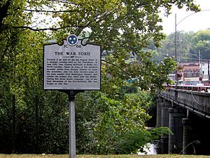
The path then crossed the lower Chattanooga Valley to the Citico site. This was a very important town for the Mississippian culture hundreds of years ago. The path then went east to Missionary Ridge, where it split into branches. One branch went northeast, crossing the Chickamauga River at a shallow ford. Another branch went directly east, crossing at a ford where the Brainerd Mission was later built.
From Old Chickamauga Town, another branch went across Hickory Valley. It joined the main path again before crossing the stream at Harrison, Tennessee. In the Overhill Cherokee country, the path went north to the town of Chota on the Little Tennessee River. Another trail, the Warriors' Path, went south from Chota to Great Tellico (now Tellico Plains).
Virginia Section
In Virginia, much of U.S. Route 11 (which runs next to Interstate 81) was built along the Great Indian Warpath. From the Cumberland Gap at the Tennessee border, a branch called the Chesapeake Branch went northeast. It passed through places like Abingdon, Marion, Roanoke, and up the Shenandoah Valley through Lexington and Winchester. From Winchester, most routes went into West Virginia, then into Maryland and Pennsylvania.
Other branches led to different rivers and areas. One branch went south from Roanoke toward the Catawba country in South Carolina. This trading path later became known as part of the Great Wagon Road. Another branch, the Ohio branch, went up the Holston Valley to the New River. It then followed the New and Kanawha rivers to Native American settlements in Ohio and western Pennsylvania.
West Virginia Section
Many branches of the Great Indian Warpath crossed West Virginia. One eastern route, however, skipped the state entirely. It followed what is now U.S. Route 15 from Winchester to Frederick, Maryland. The Winchester Pike (now U.S. 11) went through Martinsburg before crossing the Potomac River near Hagerstown, Maryland.
A more western branch of the Seneca Trail crossed West Virginia along routes that became U.S. Route 19 and U.S. Route 219. Route 19 winds through the mountains from Bluefield to Beckley, and then to Sutton and Morgantown before entering Pennsylvania. Route 219 followed the Bluestone River and Greenbrier rivers, passing through places like White Sulphur Springs and Marlinton.
Maryland Section
From crossing the Potomac River at Hagerstown, Maryland, the Seneca Trail (U.S. Route 11) continued north toward the Cumberland Valley and Chambersburg, Pennsylvania.
Because the mountains in Virginia and West Virginia were hard to cross, many travelers used other routes. One important route was Nemacolin's Path, which went through the Cumberland Narrows in Maryland and western Pennsylvania. This path connected Cumberland, Maryland, with Brownsville, Pennsylvania, on the Ohio River. Later, this route became known as the National Road (now U.S. Route 40).
Another major Native American route crossed the Potomac River closer to where Washington, D.C., is today. It went through the Sugarland/Seneca valley area of Montgomery County, Maryland. This route followed the foothills of the Alleghenies. Another branch from Frederick, Maryland, went east to Baltimore. From there, paths could lead to the Delmarva Peninsula or other Native American lands.
Pennsylvania Section
The Great Indian Warpath continued its north route through Pennsylvania along three main paths. These paths were pushed westward as more settlements were built. The easternmost route followed the Appalachian foothills, similar to what is now U.S. Route 15. It went from the Potomac River through Frederick, Maryland, and Gettysburg to the Susquehanna River.
Another route followed Pennsylvania's Cumberland Valley (U.S. Routes 11 and 81). It went from the Potomac River through Chambersburg and Carlisle, Pennsylvania. Both these routes joined to cross the Susquehanna River near Camp Hill (a suburb of Harrisburg). They then followed the river's branches further north.
The westernmost routes actually crossed the Allegheny Mountains. One of these became Interstate 79, which crossed into the Great Lakes area at Erie, Pennsylvania. After the French and Indian War, these western paths became more used as Native American groups moved westward.
An important east-west route in Pennsylvania became the Philadelphia and Lancaster Turnpike. This road later became the Main Line of the Pennsylvania Railroad and U.S. Route 30.
New York Section
The trails from Virginia and Pennsylvania came together in New York where the Susquehanna River and Chemung River meet. These trails led to where the Seneca Trail started or ended in western New York, near Niagara Falls. The Seneca people of the Iroquois and other groups had used these paths around the Great Lakes for centuries.
In 1775, the American colonies made an agreement with the Six Nations (Iroquois Confederacy). They promised to keep the roads open and safe for the Six Nations and their allies.
The Iroquois Confederacy's main trail ended in the west at Buffalo. It crossed to the Onondaga Valley and met the Mohawk River at the "great carrying place" (now Rome). It then followed the Mohawk River to Schenectady and ended in the east at Albany. Today, New York State Route 5 largely follows this ancient path.
After that, the Great Indian Warpath crossed the Hudson River into New England. It followed the Mohawk Trail, which is now mostly New York State Route 2 and Massachusetts Route 2. From there, the Great Trail network eventually reached Newfoundland, which was its northern end.
 | Jewel Prestage |
 | Ella Baker |
 | Fannie Lou Hamer |


