South Branch Potomac River facts for kids
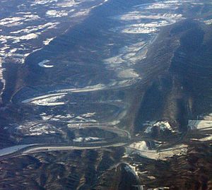
The South Branch Potomac River is a cool river that starts high up in the mountains of Highland County, Virginia, near a place called Hightown. It flows for about 139 miles (224 km) through beautiful landscapes. Eventually, it meets up with the North Branch Potomac River near Green Spring, West Virginia, in Hampshire County. When these two branches join, they form the main Potomac River!

Contents
What's in a Name?
Long ago, the Native Americans who lived in this area called the South Branch Potomac River the Wappatomaka. This name was also used by the first European settlers. Over time, people used different versions of the name, like Wappatomica River, Wapacomo River, and even South Fork Potomac River.
You can still find places in the river valley that use parts of the "Wappatomaka" name. For example, there's a historic farm called Wappocomo farm built in 1774, and a small community named Wappocomo near Hanging Rocks. Both are north of Romney.
Where Does the South Branch Potomac River Flow?
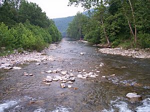
The South Branch starts as a small, winding stream northwest of Hightown, Virginia, on the eastern side of Lantz Mountain. It flows northeast through quiet communities like New Hampden and Blue Grass. At Forks of Waters, another stream called Strait Creek joins it, and the river then crosses into Pendleton County, West Virginia.
The river continues its journey northeast, flowing past mountains like Jack Mountain and Sandy Ridge. Near Franklin, it meets U.S. Route 220 and U.S. Route 33. After Franklin, the South Branch enters the Monongahela National Forest. It picks up more water from streams like Reeds Creek, Mill Run, and Deer Run near Upper Tract.
The river then winds through a scenic area between Big Mountain and Cave Mountain, bending around a rock outcrop called Eagle Rock. It flows into Grant County, where it carves out a 20-mile (32 km) long canyon known as Smoke Hole Canyon. At Cabins, it meets the North Fork of the South Branch. From there, it flows east towards Petersburg. This is where the South Branch Valley Railroad begins, following the river all the way to its end at Green Spring.

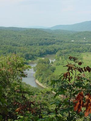
As the river flows east from Petersburg into Hardy County, it becomes wider and calmer, making it good for canoes and small boats. It splits into several channels, forming large islands, as it heads northeast to Moorefield. In Moorefield, it's joined by the South Fork South Branch Potomac River. Then, it continues north to Old Fields, where Anderson Run and Stony Run add more water.
At McNeill, the South Branch enters a famous section called the Trough. Here, the river is squeezed between Mill Creek Mountain and Sawmill Ridge. This area is a special home for bald eagles! The Trough continues into Hampshire County and ends south of Glebe.
The South Branch keeps flowing north, passing many old farms. It's joined by several smaller streams like Buffalo Run, Mill Run, McDowell Run, and Mill Creek near Vanderlip. The river also goes under U.S. Route 50 and forms Valley View Island near Romney.
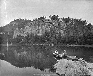
North of Romney, the river makes a big horseshoe bend at Wappocomo's Hanging Rocks. It then flows northeast past Springfield. After a couple more big bends, the South Branch flows under an old railroad bridge between Green Spring and South Branch Depot. Finally, it joins the North Branch to create the mighty Potomac River!
Rivers and Streams That Join the South Branch
Many smaller rivers and streams flow into the South Branch Potomac River, adding to its size and flow. These are called tributaries.
- Big Run (West Virginia)
- Buffalo Creek (West Virginia)
- Lunice Creek (West Virginia)
- Mill Creek (West Virginia)
- Mill Run (West Virginia)
- North Fork South Branch Potomac River (West Virginia)
- Mill Creek (West Virginia)
- Seneca Creek (West Virginia)
- South Fork South Branch Potomac River (West Virginia/Virginia)
- Kettle Creek (West Virginia)
The North Fork South Branch Potomac River
The North Fork South Branch Potomac River is about 43.6 miles (70.2 km) long. It starts just north of the Virginia/West Virginia border in Pendleton County. It's formed where two streams, the Laurel Fork and Straight Fork, meet near Big Mountain.
From Circleville, the North Fork flows northeast through Pendleton County, with mountains on either side. At Seneca Rocks, it's joined by Seneca Creek. The North Fork then continues northeast along the western side of North Fork Mountain. It flows east through North Fork Gap and finally joins the main South Branch Potomac River at Cabins, west of Petersburg.

The South Fork South Branch Potomac River
The South Fork South Branch Potomac River, sometimes just called the South Fork River, begins in Highland County, Virginia, near Monterey. It flows north-northeast for about 68.4 miles (110.1 km) until it meets the South Branch Potomac River at Moorefield in Hardy County, West Virginia. For a while, from 1896 to 1929, it was even called the Moorefield River to avoid confusion with the main South Branch.
 | Roy Wilkins |
 | John Lewis |
 | Linda Carol Brown |


