
Gray, Maine facts for kids
Quick facts for kids
Gray, Maine
|
|
|---|---|

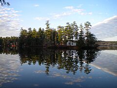
A clear view of Loon Island on a calm day on Forest Lake
|
|
| Motto(s):
"At the Heart of It All"
|
|

Location in Cumberland County and the state of Maine.
|
|
| Country | United States |
| State | Maine |
| County | Cumberland |
| Incorporated | 1778 |
| Villages |
|
| Area | |
| • Total | 45.99 sq mi (119.11 km2) |
| • Land | 43.27 sq mi (112.07 km2) |
| • Water | 2.72 sq mi (7.04 km2) |
| Elevation | 272 ft (83 m) |
| Population
(2020)
|
|
| • Total | 8,269 |
| • Density | 191/sq mi (73.8/km2) |
| Time zone | UTC-5 (Eastern (EST)) |
| • Summer (DST) | UTC-4 (EDT) |
| ZIP Codes |
04039 (Gray)
04071 (Raymond) |
| Area code(s) | 207 |
| FIPS code | 23-28870 |
| GNIS feature ID | 0582497 |
Gray is a town located in Cumberland County, Maine, in the United States. In 2020, about 8,269 people lived there. Gray is part of the larger Portland area. It sits right in the middle of Maine's two biggest cities, Portland and Lewiston. Many main roads meet in Gray, including state Routes 4, 26, 100, 115, and 202.
Gray is known for being home to the Maine Department of Inland Fisheries and Wildlife. This department has a fish hatchery and a wildlife park in Gray. The town also hosts the Gray/Portland Weather Forecast Office. This office helps forecast weather and issues warnings for both New Hampshire and western Maine. Gray also has beautiful lakes like Little Sebago Lake, Crystal Lake, and Forest Lake.
Contents
History of Gray
The land where Gray is now was given to a group from Boston on March 27, 1736. The first settlers arrived in the spring of 1738. However, during the French and Indian Wars, the settlement faced attacks. In 1745, Native Americans attacked, burning buildings and killing animals. The settlers had to leave. The village was settled again in 1751 but was destroyed once more in 1755.
Because of these attacks, a fort called Fort Gray was built in 1755. It had a strong blockhouse inside a tall wooden fence. The town was first called Boston, then New Boston, and finally New Town. On June 19, 1778, New Boston Plantation officially became the town of Gray. It was named after Thomas Gray, who owned some of the land.
Gray was mostly a farming town, but it also had quarries for stone. Other businesses included mills for grinding grain, sawmills for cutting wood, and places to make leather. There were also businesses that made carriages, sleighs, and parts for weaving machines.
The Mayall Mill: A Story of Smuggling
In 1791, Samuel Mayall started the first successful water-powered woolen mill in North America in Gray. This was a big deal because British guilds (groups of skilled workers) did not want other countries to make woolen goods. They even tried to stop British technology from leaving England.
Samuel Mayall was very clever. He secretly brought plans for the machinery out of England. He hid them inside large bundles of cloth meant for trade. When the British guilds found out, they tried to harm him. They sent him a hat with poisoned pins and a box with loaded pistols set to fire when opened. Luckily, Mayall was suspicious and avoided these traps.
After Samuel Mayall died in 1831, his daughters, Mary and Phanela, took over the mills. They even built another mill in 1834. The Mayall family owned the mills until around 1879. The business closed in 1902. Today, you can still see the old ruins of the mill, and they are open for people to visit.
The Stranger: A Civil War Story

During the American Civil War, something unusual happened in Gray. The body of a Confederate soldier was accidentally sent to Gray. Instead of sending the body away, a group called the "Ladies of Gray" decided to give the soldier a proper burial. They paid for a gravestone that simply said, "Stranger."
Later, a statue for the "Unknown Soldier" was put up in Gray Village Center. Every Memorial Day, people remember this unknown soldier. A Confederate flag is placed at the grave. The Civil War was very hard for Gray. The town sent more men to fight than almost any other town in Maine. Today, the Gray Village Cemetery has over 178 Union soldiers buried there, along with the one Confederate soldier.
Geography and Nature
Gray covers about 45.99 square miles (119.11 square kilometers). Most of this area is land, but about 2.72 square miles (7.04 square kilometers) is water. Gray has several lakes, including most of Little Sebago Lake and Crystal Lake. Collyer Brook flows through the town. Little Sebago Lake has had some issues with an invasive plant called milfoil, which can harm the lake's ecosystem.
Gray is shaped a bit like a crooked square on a map. It is surrounded by five other towns: Windham to the southwest, Cumberland to the southeast, North Yarmouth to the northeast, New Gloucester to the north, and Raymond to the northwest.
Gray and its neighbor, New Gloucester, are very connected. They share similar people, culture, and businesses. They even share the same school district, Maine School Administrative District 15. Since the 1990s, more and more houses and shops have been built in Gray. This growth has caused some residents to worry about the town changing too much.
Climate
Gray experiences all four seasons. Summers are generally warm, and winters are cold with a lot of snow. Spring and autumn bring mild temperatures and beautiful changes in nature.
Population Changes
| Historical population | |||
|---|---|---|---|
| Census | Pop. | %± | |
| 1790 | 577 | — | |
| 1800 | 987 | 71.1% | |
| 1810 | 1,310 | 32.7% | |
| 1820 | 1,479 | 12.9% | |
| 1830 | 1,575 | 6.5% | |
| 1840 | 1,740 | 10.5% | |
| 1850 | 1,788 | 2.8% | |
| 1860 | 1,767 | −1.2% | |
| 1870 | 1,738 | −1.6% | |
| 1880 | 1,798 | 3.5% | |
| 1890 | 1,517 | −15.6% | |
| 1900 | 1,388 | −8.5% | |
| 1910 | 1,270 | −8.5% | |
| 1920 | 1,139 | −10.3% | |
| 1930 | 1,189 | 4.4% | |
| 1940 | 1,378 | 15.9% | |
| 1950 | 1,631 | 18.4% | |
| 1960 | 2,184 | 33.9% | |
| 1970 | 2,939 | 34.6% | |
| 1980 | 4,344 | 47.8% | |
| 1990 | 5,904 | 35.9% | |
| 2000 | 6,820 | 15.5% | |
| 2010 | 7,761 | 13.8% | |
| 2020 | 8,269 | 6.5% | |
| sources: | |||
In 2010, Gray had 7,761 people living there. Most of the people were White. About 30% of homes had children under 18 living in them. Many families live in Gray. The average age of people in Gray was about 40.6 years old.
Education
- Maine School Administrative District 15
Photo gallery
-
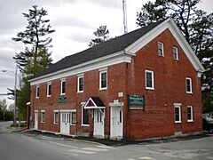
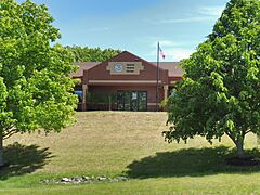
Henry Pennell Municipal Complex
-
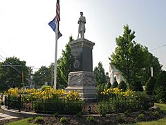
Centrally located Monument Square in the heart of Gray Village.
-
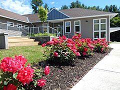
Newly renovated Gray Public Library provides a media hub with books, movies, music, and more.
-
Town of Gray Maine Historical Society & Museum
-
A clear view of tiny Loon Island on a perfectly calm day on Forest Lake in Gray
-
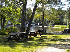
Wilkies Beach Gray Maine
-
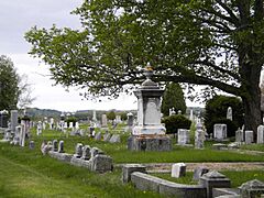
Gray Village Cemetery: Final resting place of approximately 5,500 Gray residents.
-

A view of Dry Mills one-room schoolhouse with a meadow filled with spring flowers.
-
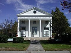
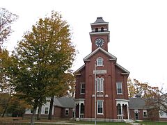
Stimson Memorial Hall
-
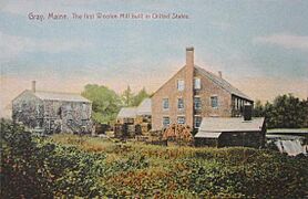
Mayall Mill c. 1908
-

Gray Corner in 1908
-
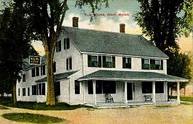
The Elm House c. 1910
-
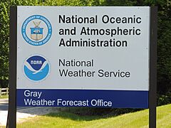
National Weather Service Office in Gray
-
National Weather Service Office in Gray


Notable People from Gray
Many interesting people have come from Gray, including:
- Wendell Abraham Anderson, a politician
- Susan Austin, a politician
- Cuke Barrows, a professional baseball player
- Todd Chretien, an activist
- Walter B. Gibson, an author and magician
- Simon Greenleaf, a lawyer and legal expert
- Samuel Mayall, a U.S. congressman and mill owner
- Reuben Ruby, a business owner and someone who worked to end slavery
- Warren H. Vinton, a state lawmaker
Places to Visit
- The official website for the Town of Gray
- The Gray Historical Society
- The Gray Public Library
- The Mayall Mills State Historic Site
See also
 In Spanish: Gray (Maine) para niños
