Great Lakes Council facts for kids
Quick facts for kids Great Lakes CouncilNew South Wales |
|||||||||||||||
|---|---|---|---|---|---|---|---|---|---|---|---|---|---|---|---|

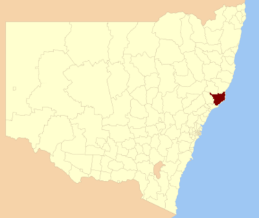
Location in New South Wales
|
|||||||||||||||
| Population | 34,430 (2011 census) | ||||||||||||||
| • Density | 10.1985/km2 (26.414/sq mi) | ||||||||||||||
| Established | 7 March 1906 | ||||||||||||||
| Abolished | 12 May 2016 | ||||||||||||||
| Area | 3,376 km2 (1,303.5 sq mi) | ||||||||||||||
| Time zone | AEST (UTC+10) | ||||||||||||||
| • Summer (DST) | AEDT (UTC+11) | ||||||||||||||
| Mayor | Jan McWilliams | ||||||||||||||
| Council seat | Forster | ||||||||||||||
| Region | Mid North Coast | ||||||||||||||
| State electorate(s) |
|
||||||||||||||
| Federal Division(s) | Paterson | ||||||||||||||
| Website | Great Lakes Council | ||||||||||||||
|
|||||||||||||||
The Great Lakes Council was a type of local government in the Mid North Coast region of New South Wales, Australia. It was like a local group that managed services and rules for a specific area. This area was located near the beautiful shores of Port Stephens, Myall Lakes, and Wallis Lake. Important roads like the Pacific Highway also ran through it.
The Great Lakes Council was in charge from 1906 until May 12, 2016. On that date, it joined with two other councils, the City of Greater Taree and Gloucester Shire, to create a new, larger council called the Mid-Coast Council.
The Great Lakes area is very special because it's home to the Myall Lakes wetlands. These wetlands are important worldwide and are protected under something called the Ramsar Convention. They are a big part of the local economy, especially for things like fishing and tourism.
Contents
Why Did the Council Change?
In 2015, the NSW Government looked at how local councils were set up. They wanted to see if some councils should join together. At first, the Great Lakes Council was not planned to merge with any other areas.
However, the Gloucester Shire Council suggested that Gloucester, Great Lakes, and Greater Taree councils should combine. After a review, this idea was approved. So, in May 2016, the Great Lakes Council was officially dissolved and became part of the new Mid-Coast Council.
Towns and Localities
The Great Lakes Council area included many towns and smaller places. Here are some of them:
- Allworth
- Blueys Beach
- Bombah Point
- Boolambayte
- Boomerang Beach
- Booral
- Booti Booti
- Bulahdelah
- Bundabah
- Bungwahl
- Bunyah
- Carrington
- Charlotte Bay
- Coolongolook
- Coomba Bay
- Coomba Park
- Crawford River
- Darawank
- Elizabeth Beach
- Failford
- Forster
- Girvan
- Green Point
- Hawks Nest
- Limeburners Creek
- Markwell
- Mayers Flat
- Minimbah
- Monkerai
- Mungo Brush
- Myall Lake
- Nerong
- Nooroo
- North Arm Cove
- Pindimar
- Sandbar
- Seal Rocks
- Shallow Bay
- Smiths Lake
- Stroud Road
- Stroud
- Tahlee
- Tarbuck Bay
- Tea Gardens
- Terreel
- The Branch
- Tiona
- Topi Topi
- Tuncurry
- Upper Karuah River
- Upper Myall
- Violet Hill
- Wallingat
- Wallis Lake
- Wards River
- Warranulla
- Washpool
- Weismantels
- Whoota
- Willina
- Wootton
- Yagon
Who Lived in the Area?
In 2011, about 34,430 people lived in the Great Lakes Council area. Slightly more than half were female (51.0%) and 49.0% were male. About 3.8% of the people were Aboriginal and Torres Strait Islander people.
The people living in the Great Lakes area were generally older. The average age was 52 years, which was much higher than the national average of 37 years. This was because a large number of residents (30.6%) were 65 years or older. Children aged 0 to 14 made up 15.4% of the population.
Most people in the area (over 82%) said their family background was Australian or Anglo-Saxon. Also, more than 66% of residents identified with Christianity. Most households (92.6%) spoke only English at home.
The population grew slowly between 2001 and 2011. The average weekly income for people in the Great Lakes Council area was about half of the national average.
How the Council Worked
Before it was dissolved, the Great Lakes Council had nine councillors. These councillors were chosen by the people living in the area through a special voting system. All councillors served for a fixed four-year term. The mayor was chosen by the councillors themselves at their first meeting.
The last election for the council was held on September 8, 2012. Here's how the council was made up:
| Party | Councillors | |
|---|---|---|
| Independents and Unaligned | 8 | |
| Labor Party | 1 | |
| Total | 9 | |
The councillors who were elected in 2012, and who served until the council was dissolved in 2016, included:
| Councillor | Party | Notes | |
|---|---|---|---|
| Jan McWilliams | Independent | Mayor | |
| Len Roberts | Unaligned | ||
| Karen Hutchinson | Independent | Elected on Jan McWilliams's ticket | |
| Tony Summers | Independent | ||
| Linda Gill | Independent | ||
| John Weate | Country Labor | ||
| Leigh Vaughan | Unaligned | ||
| Jim Morwitch | Independent | ||
| Carol McCaskie | Unaligned | Elected on Len Roberts's ticket | |
 | Charles R. Drew |
 | Benjamin Banneker |
 | Jane C. Wright |
 | Roger Arliner Young |

