Harpeth River facts for kids
Quick facts for kids Harpeth |
|
|---|---|
 |
|
| Country | United States |
| State | Tennessee |
| Physical characteristics | |
| River mouth | 36°18′13″N 87°9′10″W / 36.30361°N 87.15278°W |
The Harpeth River is a major stream in central Tennessee, United States. It flows for about 115 miles (185 km). The Harpeth is an important branch of the Cumberland River. From there, its waters join the Ohio River and then the mighty Mississippi River. This means the Harpeth is part of the huge Mississippi River system.
A special part of the lower Harpeth is called a "scenic river." This means it's protected for its natural beauty.
Contents
Where Does the Harpeth River Flow?
The Harpeth River starts in the western part of Rutherford County, Tennessee. This is near a place called College Grove. For many years, a factory near the river recycled old car batteries. This caused some pollution in the upper part of the river.
Journey Through Franklin
The river flows west into Franklin. Franklin is a big town and a suburb of Nashville. The Harpeth River is the main source of drinking water for this area.
A few miles northwest of Franklin, the river turns more towards the northwest. Here, another important stream joins the Harpeth. This stream is called the West Harpeth River. It drains water from the southern part of Williamson County.
Near where these two rivers meet, there's an old plantation house. It's called "Meeting of the Waters." The river also flows close to the historic Natchez Trace trail. Soon after, the Harpeth enters Davidson County. Here, it meets another key branch, the Little Harpeth River.
Flowing Near Nashville Suburbs
The Harpeth River flows near Bellevue, a suburb of Nashville. After this, it enters Cheatham County.
In Cheatham County, the river takes many twists and turns. It's very winding! A few miles into Cheatham County, the South Harpeth River joins in. This is another major branch. It brings water from parts of Davidson, Cheatham, and Williamson counties.
Amazing Engineering at the Narrows
Cheatham County is home to a cool engineering project from the early 1800s. A man named Montgomery Bell built an iron mill here. It was called "Pattison Forge."
The Harpeth River makes a big horseshoe bend here, about 7 miles long. Bell's workers dug a tunnel through about 200 yards (180 meters) of solid rock. They used black powder to blast through the rock. This tunnel helped to power his mill by diverting river water.
Today, you can still see the Montgomery Bell Tunnel. It's a famous historical engineering site. Only the tunnel and some leftover slag (waste from iron making) remain from the old mill.
Ancient History at Mound Bottom
Right at the "Narrows of the Harpeth" is an ancient site called Mound Bottom. This place has amazing earth mounds built by Native Americans. These mounds were created between 950 and the 1400s. They were used for ceremonies and burials by the Mississippian culture. This culture lived in the area long before Europeans arrived.
The Montgomery Bell Tunnel and the tall cliffs nearby are now part of Harpeth River State Park. This park connects many natural, historic, and archaeological sites along the lower Harpeth River.
The Harpeth's Final Stretch
From the Narrows, the Harpeth River flows mostly north. It still has many bends. For its last part, the Harpeth forms the border between Dickson and Cheatham counties.
A few miles before the river ends, there are three islands. The United States Army Corps of Engineers once thought about building a dam here. But they decided it wasn't worth the cost.
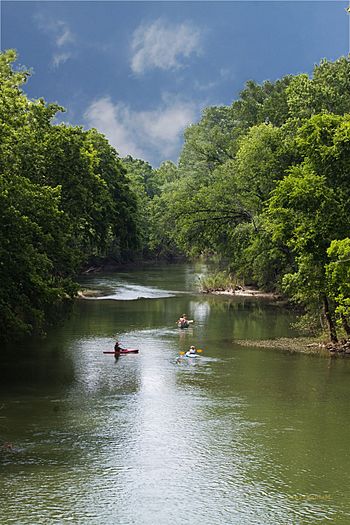
The lower part of the Harpeth River is very popular for canoeing. Many businesses offer canoe rentals and trips here.
The Harpeth River finally flows into the Cumberland River near Ashland City. This is the main town in Cheatham County. A bridge on State Route 49 near the mouth is named after Montgomery Bell. The very end of the Harpeth is partly underwater because of the Cheatham Dam on the Cumberland River.
After a small dam in Franklin was removed, the Harpeth became Tennessee's second-longest river without dams. The longest is the Buffalo River.
Accessing the Harpeth River
Many places allow you to put in or take out canoes and kayaks.
Kingston Springs Access Points
These spots are in Cheatham County, west of Nashville:
- Turkey Creek - about 438 E. Kingston Springs Rd.
- Kingston Springs City Park - 589 Park Street, Kingston Springs, TN 37082
- Gossett Tract - 1230 Cedar Hill Road, Kingston Springs, TN 37082
- Narrows of the Harpeth - 1254 Narrow of the Harpeth Road, Kingston Springs, TN 37082
- Harris Street Bridge Canoe Access - 1672 Cedar Hill Road, Kingston Springs, TN 37082
- Hwy 70 Canoe Access - 1007 Cedar Hill Road / 1294 Hwy 70, Kingston Springs, 37082
Franklin Access Points
These spots are in Franklin:
- Fieldstone Park - about 2194 Fieldstone Pkwy.
- Meeting of the Waters - about 3176 Del Rio Pike
- The Rope Swing - Old Natchez Trace
- Moran Rd - Moran Rd
Bellevue/West Davidson County Access Points
These spots are in Davidson County, west of Nashville:
- Hwy 100 Canoe Access - 7701 Hwy 100, Nashville, TN 37221
- Newsom's Mill - 8729 Newsom Station Road, Nashville, TN 37221
- Hidden Lake - 7851 McCrory Lane, Nashville, TN 37221
 | Janet Taylor Pickett |
 | Synthia Saint James |
 | Howardena Pindell |
 | Faith Ringgold |

