
Haskell County, Kansas facts for kids
Quick facts for kids
Haskell County
|
|
|---|---|

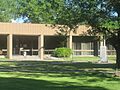
Haskell County Courthouse in Sublette (2010)
|
|

Location within the U.S. state of Kansas
|
|
 Kansas's location within the U.S. |
|
| Country | |
| State | |
| Founded | March 23, 1887 |
| Named for | Dudley Haskell |
| Seat | Sublette |
| Largest city | Sublette |
| Area | |
| • Total | 578 sq mi (1,500 km2) |
| • Land | 578 sq mi (1,500 km2) |
| • Water | 0.4 sq mi (1 km2) 0.06%% |
| Population
(2020)
|
|
| • Total | 3,780 |
| • Density | 6.5/sq mi (2.5/km2) |
| Time zone | UTC−6 (Central) |
| • Summer (DST) | UTC−5 (CDT) |
| Congressional district | 1st |
Haskell County is a county in the state of Kansas. Its main city and county seat is Sublette. In 2020, about 3,780 people lived there. The county is named after Dudley C. Haskell, who was a member of Congress many years ago.
Contents
History of Haskell County
For thousands of years, the Great Plains of North America were home to nomadic Native American groups.
In 1854, the Kansas Territory was created. Then, in 1861, Kansas became the 34th U.S. state. Haskell County itself was officially started in 1887.
The 1918 Flu Outbreak
Some historians believe that Haskell County was where the very first cases of the 1918 flu pandemic began. This was a serious illness that spread around the world. A local doctor named Loring Miner noticed how unusual and strong this flu was. He warned health officials about it.
Dr. Miner described how people got very sick with headaches, body aches, and high fevers. The illness moved quickly through the body. Some historians say that his warning was the only one of its kind in the world at that time.
It was not until after the year 2000 that researchers looked back and found this possible link. They suggest the illness might have spread when soldiers from Haskell County traveled to Camp Funston (now Fort Riley). From there, they went to Europe for World War I.
However, not everyone agrees on Haskell County's role. Many experts think that the county's connection to the flu's start was just a coincidence.
Surviving the Dust Bowl
Haskell County faced tough times during the "Dust Bowl" period from 1930 to 1937. This was a time of severe drought and dust storms in the Midwest.
But the county found ways to improve its economy. The arrival of the railroad helped. Also, finding oil and gas fields, and digging deep wells for irrigation, made a big difference. These changes helped the area recover from the difficult Dust Bowl years.
The first rodeo and fair in Sublette happened in 1916. This fair is still held in the same spot today. The first school district in the county was started in Santa Fe in 1887. A woman named Amanda I. Watkins, who owned a lot of land, was even called "World Wheat Queen" in 1926.
Geography of Haskell County

Haskell County covers about 578 square miles. Most of this area is land, with only a tiny bit (0.06%) being water.
It is known for being the flattest county in all of Kansas.
Neighboring Counties
Haskell County shares its borders with these other counties:
- Finney County (north)
- Gray County (east)
- Meade County (southeast)
- Seward County (south)
- Stevens County (southwest)
- Grant County (west)
- Kearny County (northwest)
People and Population

| Historical population | |||
|---|---|---|---|
| Census | Pop. | %± | |
| 1890 | 1,077 | — | |
| 1900 | 457 | −57.6% | |
| 1910 | 993 | 117.3% | |
| 1920 | 1,455 | 46.5% | |
| 1930 | 2,805 | 92.8% | |
| 1940 | 2,088 | −25.6% | |
| 1950 | 2,606 | 24.8% | |
| 1960 | 2,990 | 14.7% | |
| 1970 | 3,672 | 22.8% | |
| 1980 | 3,814 | 3.9% | |
| 1990 | 3,886 | 1.9% | |
| 2000 | 4,307 | 10.8% | |
| 2010 | 4,256 | −1.2% | |
| 2020 | 3,780 | −11.2% | |
| 2023 (est.) | 3,630 | −14.7% | |
| U.S. Decennial Census 1790–1960 1900–1990 1990–2000 2010–2020 |
|||
In 2000, there were 4,307 people living in Haskell County. The population density was about 8 people per square mile. Most people (about 85%) were White. About 23.57% of the population were Hispanic or Latino.
Many households (about 43.6%) had children under 18 living with them. Most households (about 69.4%) were married couples. The average household had almost three people.
The median age in the county was 31 years old. This means half the people were younger than 31, and half were older. About 32.9% of the population was under 18.
The median income for a household in the county was about $38,634 per year. For families, it was about $43,354. About 11.6% of all people in the county lived below the poverty line.
Education
Haskell County has two main school districts:
- Sublette USD 374
- Satanta USD 507
Communities

Haskell County has several communities, including cities, small towns, and even a former town that no longer exists.
Cities
Unincorporated community
- Tice (This is a small community not officially organized as a city.)
Ghost town
- Santa Fe (This was a town in the past, but it is no longer inhabited.)
Townships
.svg)
Haskell County is divided into three areas called townships. The population numbers for these townships include the people living in any cities within them.
| Township | FIPS | Population center |
Population | Population density /km2 (/sq mi) |
Land area km2 (sq mi) |
Water area km2 (sq mi) |
Water % | Geographic coordinates |
|---|---|---|---|---|---|---|---|---|
| Dudley | 18825 | 1,814 | 4 (9) | 499 (193) | 0 (0) | 0.03% | 37°30′40″N 101°0′28″W / 37.51111°N 101.00778°W | |
| Haskell | 30625 | 1,971 | 4 (10) | 498 (192) | 0 (0) | 0.07% | 37°32′25″N 100°51′43″W / 37.54028°N 100.86194°W | |
| Lockport | 41675 | 522 | 1 (3) | 498 (192) | 0 (0) | 0.09% | 37°34′19″N 100°43′11″W / 37.57194°N 100.71972°W | |
| Sources: | ||||||||
Images for kids
-
Haskell County Courthouse in Sublette (2010)
See also
 In Spanish: Condado de Haskell (Kansas) para niños
