
Image: Costa Rica relief location map
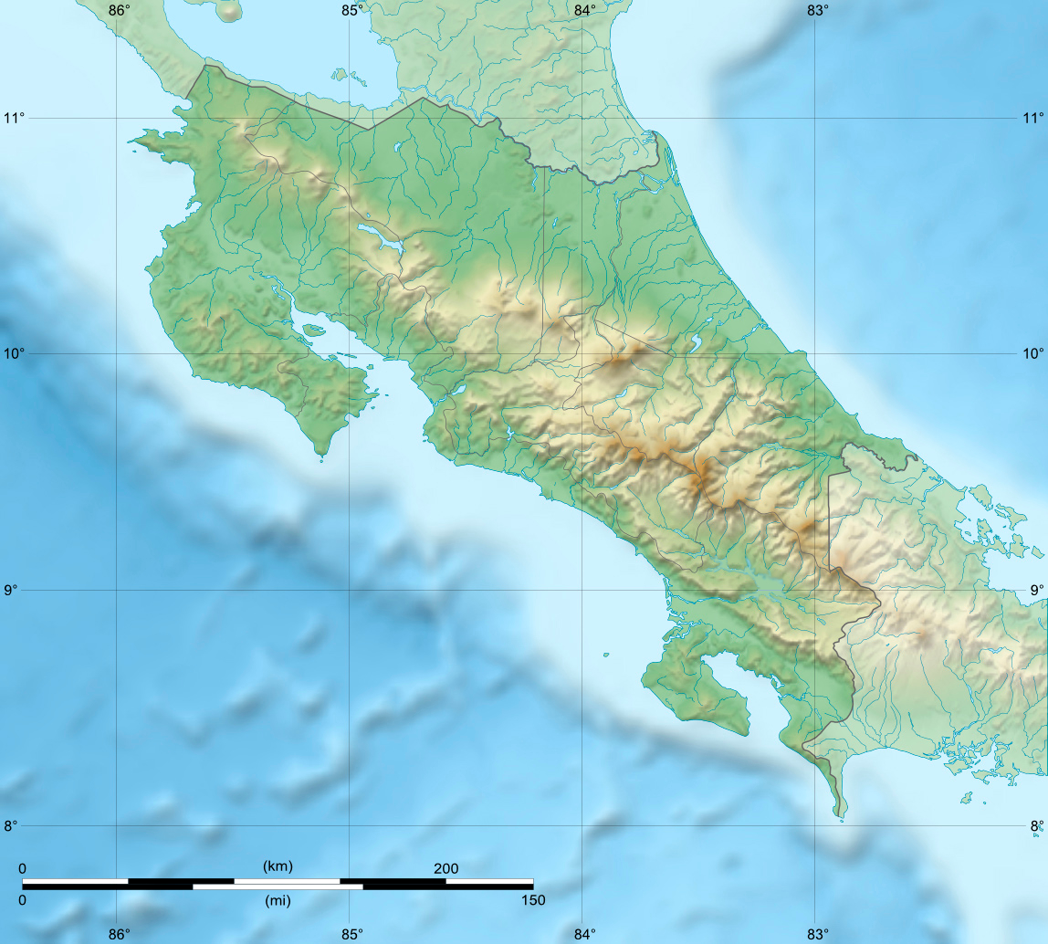
Description: Blank relief map of Costa Rica for geo-location purpose. Note : The Isla del Coco, out of the map, is not shown. Scale : 1:14,816,000 (accuracy : about 3,7 km)
Title: Costa Rica relief location map
Credit: Own work Bathymetry : NGDC ETOPO2v2 (public domain) ; Topography : NASA Shuttle Radar Topography Mission (SRTM30 v.2) (public domain) ; Shoreline and additional data : VMap-0 (public domain).
Author: Eric Gaba (Sting - fr:Sting)
Permission: Attribution and Share-Alike required Any use of this map can be made as long as you credit me (Eric Gaba – Wikimedia Commons user: Sting) as the author and distribute the copies and derivative works under the same license(s) that the one(s) stated below. A message with a reply address would also be greatly appreciated.
Usage Terms: Creative Commons Attribution-Share Alike 4.0
License: CC BY-SA 4.0
License Link: https://creativecommons.org/licenses/by-sa/4.0
Attribution Required?: Yes
Image usage
The following 40 pages link to this image:
- Abangares River
- Aguas Zarcas volcanic field
- Aranjuez River
- Barranca River
- Cacho Negro Volcano
- Cerro Cedral
- Cerro Chirripó
- Cerro Kamuk
- Cerro de la Muerte
- Chato Volcano
- Chopo Volcano
- Congo Volcano
- Coto Colorado River
- Craugastor phasma
- Craugastor taurus
- Golfo Dulce, Costa Rica
- Guacimal River
- Irazú Volcano
- Isthmohyla xanthosticta
- Jesús María River
- Lake Arenal
- Lake Cachí
- Lake Cote
- Lake Hule
- Lake Río Cuarto
- Miravalles Volcano
- Mount Chirripó
- Orosí Volcano
- Pelado Hill
- Platanar Volcano
- Porvenir Volcano
- Poás Volcano
- Reventazón River
- Savegre River
- Sierpe River
- Telire River
- Tenorio Volcano
- Tortuguero Volcano
- Turrialba Volcano
- Térraba River
