Interstate 70 in West Virginia facts for kids
Quick facts for kids
Interstate 70 |
||||
|---|---|---|---|---|
|
Location of I-70 (in red) in West Virginia
|
||||
| Route information | ||||
| Maintained by WVDOH | ||||
| Length | 14.45 mi (23.26 km) | |||
| Existed | 1963–present | |||
| Major junctions | ||||
| West end | ||||
|
||||
| East end | ||||
| Location | ||||
| Counties: | Ohio | |||
| Highway system | ||||
| Main route of the Interstate Highway System Main • Auxiliary • Business West Virginia Routes
|
||||
Interstate 70 (I-70) is a major highway that crosses the United States. It stretches all the way from Utah to Baltimore, Maryland. A small part of I-70 goes through the Northern Panhandle of West Virginia. This section is in Ohio County, passing through the city of Wheeling.
The West Virginia part of I-70 is the shortest section in any state it crosses. It is only about 14.45 miles (23.26 km) long. The Fort Henry Bridge carries I-70 over the Ohio River and into downtown Wheeling. After the bridge, the highway goes into the Wheeling Tunnel. I-70 also connects with I-470, which is a bypass around Wheeling. This bypass is the only extra Interstate highway in West Virginia. Near the state line, I-70 passes by The Highlands, a big shopping center. Many cars use this highway every day, usually between 27,000 and 53,000 vehicles.
The first road in Wheeling was a post road built in 1794. It connected Wheeling to Morgantown. Later, the National Road was finished in 1818. This was the first road to connect Wheeling to another state, Cumberland, Maryland. In 1926, the National Road became known as U.S. Route 40 (US 40). The I-70 highway was planned in 1956. It was built as a modern highway with no cross streets. This means you don't stop for traffic lights. The first parts of I-70 in West Virginia opened in 1963. The whole highway was finished in 1971.
Contents
Exploring I-70 in West Virginia
When I-70 enters West Virginia from Ohio, it first crosses the western part of the Ohio River. It lands on Wheeling Island, which is a busy island in the river. The highway goes over some shops and has an exit for Zane Street. Here, US 40 and US 250 join I-70. They travel together for a short distance.
Bridges and Tunnels
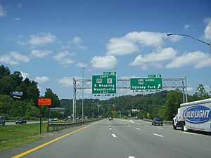
Next, I-70 crosses the main part of the Ohio River on the Fort Henry Bridge. This bridge is high above the city of Wheeling. It also crosses the Greater Wheeling Trail, a path along the river. There is a complicated exit that lets drivers get to downtown Wheeling. As you drive east, US 40 leaves I-70 at this exit. It then joins West Virginia Route 2 (WV 2). These roads go through downtown Wheeling on separate one-way streets.
After this exit, I-70 enters the Wheeling Tunnel. This tunnel is about a quarter-mile long. It goes through Wheeling Hill. Right after the tunnel, US 250 leaves I-70. There is also a ramp that was planned for WV 2, but it was never fully built.
Through Wheeling and Beyond
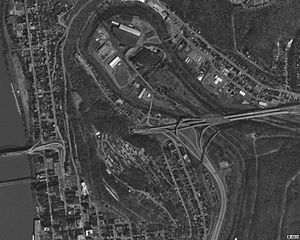
As I-70 turns south, it meets US 40 and WV 88 again. The ramps for these roads go under I-70, next to Wheeling Creek. These exits are tricky because they are surrounded by hills. Wheeling University is located near the highway as I-70 approaches the area of Elm Grove. Washington Avenue gives access to the university.
I-70 then meets the end of I-470. I-470 is a highway that goes around Wheeling. It is the only extra Interstate highway in West Virginia. Between the tunnel and I-470, the Greater Wheeling Trail runs next to I-70. Another exit in Wheeling gives access to US 40 and WV 88. After leaving the city, the highway turns east and goes into a deep valley.
Shopping and Wildlife
The highway climbs over Two-Mile Hill. It then has an exit for Cabela Drive. This road leads to The Highlands, a very large shopping area. After The Highlands, I-70 continues northeast through wooded areas. It has an exit for Dallas Pike. I-70 then passes north of the Bear Rocks Lake Wildlife Management Area. Finally, it crosses the state line into Pennsylvania.
The section of I-70 in West Virginia is the shortest of all 10 states it passes through. It is only 14.45 miles (23.26 km) long. For comparison, the longest part of I-70 is in Colorado, which is 451 miles (726 km) long. The West Virginia Department of Transportation (WVDOT) counts how many vehicles use the highway each day. This is called "annual average daily traffic" (AADT). In 2012, they found that about 27,000 vehicles used the Fort Henry Bridge. Near the exit for US 40 in Elm Grove, about 53,000 vehicles used the highway. These numbers are just for the West Virginia part of I-70. This highway is part of the National Highway System. This system includes important roads for the country's economy, defense, and travel.
History of I-70 in West Virginia
The first road to reach Wheeling, Virginia, was a post road. It connected Wheeling to Morgantown in 1794. The National Road was the first road to connect Wheeling to another state. It linked Wheeling to Cumberland, Maryland, in the east. President Thomas Jefferson ordered the National Road to be built in 1806. It was finished in 1818.
In 1926, the United States Numbered Highway System was created. The National Road through the Northern Panhandle was named US 40. US 40 connected Vallejo, California, to Atlantic City, New Jersey. In 1956, the Interstate Highway System was formed. This plan included I-70 as a new highway across the panhandle. It was designed as a modern highway with no intersections or traffic lights. This means much of I-70 is separate from the old National Road and US 40.
The first part of I-70 to be built in West Virginia was the Fort Henry Bridge. It crosses the main channel of the Ohio River and was finished in 1955. The WVDOT started buying land for I-70 in 1961. The Wheeling Tunnel, which connects downtown Wheeling to Elm Grove, was finished in 1967. It cost millions of dollars. The bridge that carries I-70 from Ohio to Wheeling Island was finished in 1968.
Construction of I-70 across the panhandle was almost done by September 1971. Only one side of the highway was finished in the last 1.2-mile (1.9 km) section near Elm Grove. The governor, Arch A. Moore Jr., and Senator Jennings Randolph were there for the opening of this part of the highway. The second side of the highway was finished by the end of 1971.
Recent Challenges and Repairs
In January 2005, the Fort Henry Bridge, the Vietnam Veterans Memorial Bridge (for I-470), and the Wheeling Suspension Bridge all closed. This happened because barges broke loose during heavy floods on the Ohio River. No traffic could enter mainland West Virginia from Ohio or Wheeling Island for a few days. The Wheeling Tunnel was closed for repairs in 2007, 2008, and 2010. Drivers had to take detours through city streets or use the I-470 loop.
After traffic problems during the 2008 tunnel repairs, some local leaders suggested closing the tunnels completely. They wanted to build the highway over Wheeling Hill instead. But people living on Wheeling Hill and the NAACP were against this idea. So, the plans were dropped. The tunnel repair project ended up costing more than double the original price.
I-70 Exit List
The entire route is in Ohio County.
| Location | Mile | Roads intersected | Notes | ||
|---|---|---|---|---|---|
| Ohio River | 0.0 | Ohio state line | |||
| Wheeling Island | 0.3 | West end of US 40 / US 250 overlap; westbound exit and eastbound entrance | |||
| Ohio River | 0.5 | 0.80 | Fort Henry Bridge | ||
| Wheeling | 0.7 | 1.1 | 1A | East end of US 40 overlap | |
| 0.8– 1.1 |
1.3– 1.8 |
Wheeling Tunnel | |||
| 1.3 | 2.1 | 1B | East end of US 250 overlap | ||
| 1.9 | 3.1 | 2A | |||
| 2.6 | 4.2 | 2B | Access to Wheeling Jesuit University | ||
| 4.5 | 7.2 | 4 | Westbound exit is via exit 5 | ||
| 4.8 | 7.7 | 5A | Westbound exit and eastbound entrance | ||
| 5.3 | 8.5 | 5 | Westbound access to WV 88 | ||
| | 9.5 | 15.3 | 10 | Access to The Highlands shopping complex | |
| | 10.9 | 17.5 | 11 | ||
| 14.45 | Pennsylvania state line | ||||
 | Stephanie Wilson |
 | Charles Bolden |
 | Ronald McNair |
 | Frederick D. Gregory |


