Isle au Haut, Maine facts for kids
Quick facts for kids
Isle au Haut, Maine
|
|
|---|---|

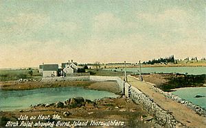
Birch Point and Burnt Island Thoroughfare c. 1908
|
|

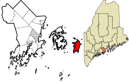
Location in Knox County and the state of Maine.
|
|
| Country | United States |
| State | Maine |
| County | Knox |
| Incorporated | 1874 |
| Villages | Isle Au Haut Lookout |
| Area | |
| • Total | 113.20 sq mi (293.19 km2) |
| • Land | 12.52 sq mi (32.43 km2) |
| • Water | 100.68 sq mi (260.76 km2) |
| Elevation | 0 ft (0 m) |
| Population
(2020)
|
|
| • Total | 92 |
| • Density | 1.2/sq mi (3.2/km2) |
| Time zone | UTC-5 (Eastern (EST)) |
| • Summer (DST) | UTC-4 (EDT) |
| ZIP code |
04645
|
| Area code(s) | 207 |
| FIPS code | 23-35135 |
| GNIS feature ID | 0582530 |
Isle au Haut (pronounced "Eye-la-ho") is a small town in Knox County, Maine, United States. It is located on an island with the same name in Penobscot Bay. In 2020, 92 people lived there.
Part of Acadia National Park is on Isle au Haut. You can reach the island by taking a ferry from Stonington. The ferry ride is about 6 miles long and takes around 45 minutes.
Contents
Island History
Long ago, Native Americans lived on the island. They left behind piles of shells from their oyster meals. The island was part of the Penobscot Abenaki territory.
In 1604, a French explorer named Samuel de Champlain visited the island. He called it "Isle au Haut," which means "High Island" in French. This name came from the island's tall hills. Later, in 1614, English Captain John Smith also explored the coast. He noted that it was the highest island in Penobscot Bay.
Early Settlers and Life
In 1792, Henry Barter was given land on the island. By 1800, about 50 English and Scottish settlers lived there. They made a living by raising sheep, farming, and fishing.
In 1808, a sad event happened on the island. Smugglers shot and killed a federal customs officer. In the mid-1800s, most people worked in fishing and boatbuilding. Isle au Haut officially became a town on February 28, 1874. It was separated from the town of Deer Isle.
Changes Over Time
By the late 1800s, about 275 people lived on the island year-round. A small village grew near the Isle au Haut Thoroughfare. In the 1880s, people from cities like Boston started visiting for vacations. They built summer homes at a private club called Point Lookout.
In 1910, 178 people lived on the island all year. There were also 15 families who came for the summer. As boats started using motors instead of sails, some fishermen moved to the mainland. This made it easier for them to work. By 1935, the number of year-round residents dropped to 75.
Isle au Haut Today
Today, lobster fishing is still the main job on the island. Parts of Acadia National Park cover about 60% of the island. These park areas attract some tourists. Many vacation homes are on the island, especially in summer. These homes make the island's population much larger during the warmer months.
Linda Greenlaw wrote a book about lobster fishing on the island called The Lobster Chronicles (2003). Gordon Bok also wrote a song called 'The hills of Isle au Haut'. Electricity came to the island in 1970, and telephone service in 1988.
Island Geography
The town of Isle au Haut covers about 113.20 square miles (293.19 square kilometers). Most of this area is water (100.68 square miles or 260.76 square kilometers). The land area is about 12.52 square miles (32.43 square kilometers). The island itself is about 6 miles (9.7 km) long and 2 miles (3.2 km) wide. It is located in Penobscot Bay, which is part of the Gulf of Maine and the Atlantic Ocean.
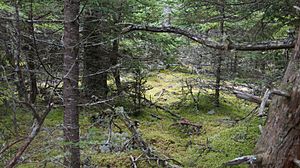
Mount Champlain is the highest point on the island, at 540 feet (165 meters) tall. It is part of a ridge that runs through the middle of the island. Other nearby peaks include Rocky Mountain (511 feet or 156 meters) and Sawyer Mountain (486 feet or 148 meters). The island has low hills covered by pine and spruce trees. The coastline is mostly made of granite rocks, with a few small beaches and salt marshes.
Long Pond is a small freshwater lake on the eastern side of the island. It is warmer and more protected than the ocean. People use it for fun activities. Sometimes, you might even see a float plane land there.
Island Population
| Historical population | |||
|---|---|---|---|
| Census | Pop. | %± | |
| 1830 | 315 | — | |
| 1880 | 274 | — | |
| 1890 | 206 | −24.8% | |
| 1900 | 182 | −11.7% | |
| 1910 | 160 | −12.1% | |
| 1920 | 102 | −36.2% | |
| 1930 | 89 | −12.7% | |
| 1940 | 97 | 9.0% | |
| 1950 | 82 | −15.5% | |
| 1960 | 68 | −17.1% | |
| 1970 | 45 | −33.8% | |
| 1980 | 57 | 26.7% | |
| 1990 | 46 | −19.3% | |
| 2000 | 79 | 71.7% | |
| 2010 | 73 | −7.6% | |
| 2020 | 92 | 26.0% | |
As of the census in 2010, there were 73 people living in Isle au Haut. These people lived in 42 households, and 17 of these were families. The population density was about 5.8 people per square mile (2.2 per square kilometer).
Most of the people living in the town were White (91.8%). A small number were African American, Native American, or Asian. About 13.7% of the residents were under 18 years old. The average age of people in the town was 49.5 years.
Places to Visit
- Isle au Haut Light - This is a historic lighthouse on the island.
Getting Around
- There is a ferry that travels to and from Stonington. This is the main way to get to and from the island.
Famous People from Isle au Haut
- Abel Douglass - A pioneer and sea captain.
- Linda Greenlaw - An author, fisherman, and captain.
See also
 In Spanish: Isle au Haut para niños


