Kennebago Divide facts for kids
Quick facts for kids Kennebago Divide |
|
|---|---|
| Highest point | |
| Elevation | 3,775 ft (1,151 m) |
| Prominence | 360 ft (110 m) |
| Listing | New England 100 Highest #96 |
| Geography | |
| Location | Franklin / Oxford counties, Maine, U.S. |
| Topo map | USGS Little Kennebago Lake |
| Climbing | |
| Easiest route | trailless bushwhack |
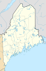
Kennebago Divide is a mountain located in Maine, a state in the United States. This mountain sits right on the border between Franklin and Oxford counties. It's also sometimes called the North Peak of Kennebago Divide. The very top of the mountain is in Franklin County. It's about 1.5 miles (2.4 km) southeast of the border with Québec, which is in Canada.
Kennebago Divide has other mountains nearby. To its northeast, you'll find White Cap Mountain. To the south, there is Snow Mountain.
Water's Journey from Kennebago Divide
Kennebago Divide is part of a large watershed. A watershed is an area of land where all the water drains into a common spot. For Kennebago Divide, the water eventually flows into the upper Androscoggin River.
The Androscoggin River then flows into Merrymeeting Bay. This bay is an estuary, which is where a river meets the sea. Here, the Androscoggin River joins the Kennebec River. Finally, all this water flows into the Gulf of Maine, which is part of the Atlantic Ocean.
How Water Flows from Different Sides
Water from the southeast side of Kennebago Divide takes a specific path. It drains into Bear Brook. From there, it flows into the Kennebago River. The Kennebago River then leads to Cupsuptic Lake. After that, the water travels through a series of other lakes. It then reaches the Rapid River and Umbagog Lake. Umbagog Lake is actually where the Androscoggin River begins!
The south end of Kennebago Divide has its own water path. Water from this side drains into Wiggle Brook. This brook also flows into the Kennebago River.
On the northwest side of Kennebago Divide, water drains into Porter Brook. Porter Brook then joins the Cupsuptic River. This river also flows into Cupsuptic Lake, connecting to the larger watershed system.
 | James Van Der Zee |
 | Alma Thomas |
 | Ellis Wilson |
 | Margaret Taylor-Burroughs |


