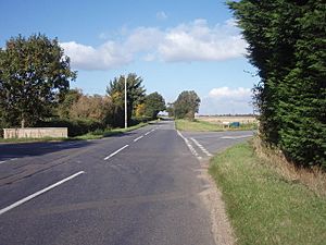
King Street (Roman road) facts for kids
King Street is a modern road in eastern England that follows the path of an ancient Roman road. It runs in a straight line between the City of Peterborough and South Kesteven in Lincolnshire. This name has been used for a long time for the part of the road still in use today, which stretches from Ailsworth Heath in the south to Kate's Bridge in the north.
The old Roman road continued north-west from Kate's Bridge to Bourne. From there, it joined another major Roman road called Ermine Street south of Ancaster. The part of Ermine Street it joined is known as High Dike. In the south, King Street connected with Ermine Street near the River Nene, north of a Roman town called Durobrivae. Experts identify this entire Roman route as road number 26.
Where King Street Ran
Archaeologists have found that the Roman King Street was much longer than the modern road. Its path started near the border of Ailsworth and Castor, just north of the River Nene. This was where it left the Roman Ermine Street. This area was a busy industrial zone by the end of the 2nd century, producing tiles, metal items, and especially pottery.
South of this point, Ermine Street runs along the edge of The Fens (a marshy area). But to the north, Ermine Street goes further inland. King Street, however, stayed closer to the fen edge. While Ermine Street crossed the River Welland at a natural shallow spot near Stamford, King Street crossed the Welland at Lolham Bridges. This crossing needed more advanced engineering to build.
At Kate's Bridge, the road crossed the River Glen. Even until the 1820s, the road used the same crossing point, even though the river itself had moved a long time ago. Near Park Wood, the road seems to have been close to the Car Dyke, which was a large Roman canal.
From near Thurlby crossroads, the Roman road went straight towards the spot where Bourne Abbey was later built. In some places, you can still see signs of the old road in the modern landscape. For example, the modern road in the south follows the Roman path through Elsea Wood. The Car Dyke is to the east, and the border between Elsea Wood and Math Wood seems to follow the edge of the Roman road's cleared area, which was kept clear for safety. The road, the Car Dyke, and the Math Wood boundary are all parallel here.
North of Bourne, not much of the Roman road is still used. However, it has left its mark as property boundaries and faint soil lines. This part of the road is sometimes called the 'Long Hollow Road'. This is because some of it runs along the bottom of the Long Hollow, which is a wide, shallow valley. This valley forms the upper part of the river basin for the River East Glen.
From Bourne Abbey, the Roman road went along Meadowgate, then past Cawthorpe to Clipseygap Lane, Hanthorpe, and the Roman town at Stainfield. On the boulder clay ridge, it forms the boundaries of woods. In the East Glen valley, a smaller modern road follows its path near Hanby. It passed through the small Roman town at Sapperton and up the Long Hollow to Ropsley Heath. From there, a modern road follows it closely to where it joins Ermine Street, about a kilometer south of the Roman town of Ancaster.
Why King Street Was Important
Ermine Street was one of the main roads built by the Romans in the 1st century, early in their time in Britannia (Roman Britain). King Street seems to have been part of a plan to develop the region, along with the Car Dyke, during the rule of Emperor Hadrian (117–138 AD). It might have been built after his visit to Britain in 122 AD.
From Bourne, a tidal waterway known as the Bourne–Morton Canal (or Old Ea in the Middle Ages) allowed boats to reach the sea. The sea was only at the far end of Bourne North Fen. This meant that goods from the fen and coast, like salt and animal products such as birds, meat, wool, fish, and leather, could be moved across the fen. Normally, the fen would have made such travel very difficult. This trade might explain why six Roman roads branched out from or near Bourne. The Long Hollow Road and King Street were two of these, connecting the north and south to the main Roman road system through Ermine Street.
How King Street Was Built
Archaeologists dug up a part of the road at the southern edge of Bourne. They found that the road was built by digging two shallow, parallel trenches into the ground. These trenches were then filled with gravel to create raised edges, like kerbs. Coarse sand was used to form the road surface between these edges.
This was a clever way to use the materials available. South of Kate's Bridge, the road goes over areas with these types of minerals. However, closer to the excavated site, there was mostly soft Cornbrash rock. This suggests that this part of the road was built from the south, moving north, with materials carried along the newly built sections. Further north, in the Long Hollow, Cornbrash from Sapperton seems to have been used. Again, this material was used north of where it was found.
B.B. Simmons, an archaeologist, has spent a lot of time digging at a Roman town site next to the road in Sapperton. His work has helped us understand more about King Street.
|
 | Mary Eliza Mahoney |
 | Susie King Taylor |
 | Ida Gray |
 | Eliza Ann Grier |


