Lawrence County, Indiana facts for kids
Quick facts for kids
Lawrence County, Indiana
|
|
|---|---|

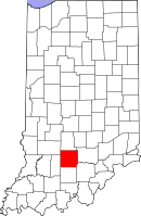
Location in the state of Indiana
|
|

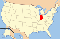
Indiana's location in the U.S.
|
|
| Country | |
| State | |
| Founded | 1818 |
| Named for | James Lawrence |
| County seat | Bedford |
| Largest city | Bedford (population and area) |
| Incorporated Municipalities |
|
| Government | |
| • Type | County |
| • Body | Board of Commissioners |
| Area | |
| • Total | 451.93 sq mi (1,170.5 km2) |
| • Land | 449.17 sq mi (1,163.3 km2) |
| • Water | 2.76 sq mi (7.1 km2) |
| Area rank | 20th largest county in Indiana |
| Elevation | 502 ft (153 m) |
| Population
(2020)
|
|
| • Total | 45,011 |
| • Rank | 33rd largest county in Indiana |
| • Density | 99.5973/sq mi (38.4547/km2) |
| Time zone | UTC−5 (Eastern) |
| • Summer (DST) | UTC−4 (Eastern) |
| ZIP Codes |
47264, 47420-47421, 47436-47437, 47446, 47451, 47462, 47467, 47470
|
| Area code | 812 and 930 |
| Congressional district | 9th |
| Indiana Senate district | 44th |
| Indiana House of Representatives districts | 65th and 73rd |
| FIPS code | 18-093 |
| GNIS feature ID | 0451703 |
|
|
Lawrence County is a county in Indiana, a state in the U.S.. In 2020, about 45,011 people lived here. The main town, or county seat, is Bedford. Lawrence County is part of the Bedford area, which includes nearby towns and communities.
Contents
History of Lawrence County
Lawrence County was created in 1818. It was formed from land that used to be part of Orange County. The county got its name from Captain James Lawrence. He was a brave naval officer during the War of 1812. He famously said, "Don't give up the ship!" before he died.
Before the Battle of Tippecanoe, not many people of European descent lived here. This was because Native American groups lived in the area. The first signs of a settlement in Lawrence County were near Leesville. However, Bono was the very first established settlement in the county.
Geography and Nature
Lawrence County covers about 451.93 square miles (1,170.5 square kilometers). Most of this area, about 449.17 square miles (1,163.3 square kilometers), is land. The rest, about 2.76 square miles (7.1 square kilometers), is water.
Neighboring Counties
Lawrence County shares its borders with several other counties:
- Monroe County to the north
- Jackson County to the east
- Washington County to the southeast
- Orange County to the south
- Martin County to the west
- Greene County to the northwest
Main Roads
Many important roads pass through Lawrence County. These roads help people travel and transport goods.
 U.S. Route 50
 State Road 37
 State Road 54
 State Road 58
 State Road 60
 State Road 158
 State Road 446
 State Road 450
 State Road 458
Protected Natural Areas
Part of the Hoosier National Forest is located in Lawrence County. This forest is a large protected area. It offers beautiful natural spaces for wildlife and outdoor activities.
Towns and Communities
Lawrence County has several cities, towns, and smaller communities.
Cities and Towns
Census-Designated Places
These are areas that are like towns but are not officially incorporated as cities or towns.
Smaller Communities
Many smaller, unincorporated communities are also part of Lawrence County.
Townships
Lawrence County is divided into several townships, which are smaller local government areas.
Interesting Places to Visit
Lawrence County has some unique sights and parks.
- The Joe Palooka Statue is a statue of a famous comic strip character. It was put up in 1948 and can be found near the town hall in Oolitic.
- Spring Mill State Park is a popular park located near Mitchell. It offers many outdoor activities and historical sites.
Astronauts from Lawrence County
Lawrence County is proud to be the home of several astronauts who have traveled to space!
- Virgil I. "Gus" Grissom was born and grew up in Mitchell. He was one of the first American astronauts. Sadly, he passed away during the Apollo 1 accident.
- Charles "Charlie" Walker was born and raised in Bedford. He flew on several Space Shuttle missions.
- Kenneth "Kenny" Bowersox was born in Virginia but grew up in Bedford. He has also flown on Space Shuttle missions and commanded the International Space Station.
The Virgil I. Gus Grissom Memorial is located at Spring Mill State Park near Mitchell. It has many items from his space career. This includes "The Molly Brown," the space capsule he commanded during the Gemini 3 mission.
Climate and Weather
| Weather chart for Bedford, Indiana | |||||||||||||||||||||||||||||||||||||||||||||||
|---|---|---|---|---|---|---|---|---|---|---|---|---|---|---|---|---|---|---|---|---|---|---|---|---|---|---|---|---|---|---|---|---|---|---|---|---|---|---|---|---|---|---|---|---|---|---|---|
| J | F | M | A | M | J | J | A | S | O | N | D | ||||||||||||||||||||||||||||||||||||
|
2.8
37
18
|
2.7
43
22
|
3.8
53
31
|
4.5
64
40
|
5
74
51
|
4.1
82
60
|
4.5
86
64
|
4.2
85
62
|
3.1
79
53
|
3.2
67
41
|
3.9
54
33
|
3.3
42
23
|
||||||||||||||||||||||||||||||||||||
| temperatures in °F precipitation totals in inches source: The Weather Channel |
|||||||||||||||||||||||||||||||||||||||||||||||
|
Metric conversion
|
|||||||||||||||||||||||||||||||||||||||||||||||
In Bedford, the average temperatures change throughout the year. In January, the average low is about 18°F (minus 8°C). In July, the average high is about 86°F (30°C). The coldest temperature ever recorded was minus 29°F (minus 34°C) in January 1994. The hottest was 111°F (44°C) in July 1930.
The amount of rain and snow also varies. February usually has the least precipitation, about 2.70 inches (6.9 cm). May typically has the most, with about 5.04 inches (12.8 cm).
Population Information
| Historical population | |||
|---|---|---|---|
| Census | Pop. | %± | |
| 1820 | 4,116 | — | |
| 1830 | 9,234 | 124.3% | |
| 1840 | 11,782 | 27.6% | |
| 1850 | 12,097 | 2.7% | |
| 1860 | 13,692 | 13.2% | |
| 1870 | 14,628 | 6.8% | |
| 1880 | 18,543 | 26.8% | |
| 1890 | 19,792 | 6.7% | |
| 1900 | 25,729 | 30.0% | |
| 1910 | 30,625 | 19.0% | |
| 1920 | 28,228 | −7.8% | |
| 1930 | 35,583 | 26.1% | |
| 1940 | 35,045 | −1.5% | |
| 1950 | 34,346 | −2.0% | |
| 1960 | 36,564 | 6.5% | |
| 1970 | 38,038 | 4.0% | |
| 1980 | 42,472 | 11.7% | |
| 1990 | 42,836 | 0.9% | |
| 2000 | 45,922 | 7.2% | |
| 2010 | 46,134 | 0.5% | |
| 2020 | 45,011 | −2.4% | |
| 2023 (est.) | 45,084 | −2.3% | |
| U.S. Decennial Census 1790-1960 1900-1990 1990-2000 2010 |
|||
In 2010, there were 46,134 people living in Lawrence County. These people lived in 18,811 households. About 12,906 of these were families. The county had about 102.7 people per square mile (39.7 per square kilometer). There were also 21,074 housing units.
Most people in the county, 97.3%, were white. Other groups included 0.5% Asian, 0.4% black or African American, and 0.3% American Indian. About 1.2% of the population was of Hispanic or Latino origin.
Of the households, 31.2% had children under 18 living with them. About 54.1% were married couples. The average household had 2.42 people. The average family had 2.92 people. The median age in the county was 41.6 years.
The median income for a household was $47,697 per year. For a family, it was $50,355. About 15.8% of the population lived below the poverty line. This included 23.4% of those under 18.
See also
 In Spanish: Condado de Lawrence (Indiana) para niños
 | Aaron Henry |
 | T. R. M. Howard |
 | Jesse Jackson |

