Le Roy, New York facts for kids
Quick facts for kids
Le Roy, New York
Bellona
|
|
|---|---|

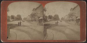
Main Street in Le Roy looking west, from Robert N. Dennis collection of stereoscopic views
|
|

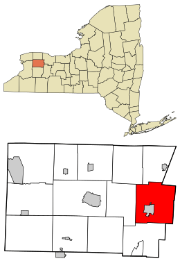
Location in Genesee County and the state of New York.
|
|
| Country | United States |
| State | New York |
| County | Genesee |
| Government | |
| • Type | Town Council |
| Area | |
| • Total | 42.17 sq mi (109.23 km2) |
| • Land | 42.08 sq mi (109.00 km2) |
| • Water | 0.09 sq mi (0.23 km2) |
| Population
(2020)
|
|
| • Total | 7,662 |
| • Density | 181.69/sq mi (70.146/km2) |
| Time zone | UTC-5 (Eastern (EST)) |
| • Summer (DST) | UTC-4 (EDT) |
| ZIP Code |
14482
|
| Area code(s) | 585 |
| FIPS code | 36-037-42037 |
Le Roy, often spelled LeRoy, is a town in Genesee County, New York, United States. In 2020, about 7,662 people lived there. The town is named after Herman Le Roy, who was one of the first landowners. Le Roy is located near the southwestern edge of Monroe County. A smaller area called the village of Le Roy is also found within the town. Did you know that the famous Jell-O gelatin dessert was first invented and made right here in Le Roy?
Contents
History of Le Roy
The first settlers arrived in this area in 1793. The town of Le Roy was officially created in 1812. It was first called the "Town of Bellona." This name came from a part of the town of Caledonia.
In 1813, the name was changed to "Le Roy." This new name honored Herman LeRoy, a businessman from New York City who bought and sold land.
Jell-O's Sweet History
The popular Jell-O dessert was invented and first made in Le Roy. You can even visit the Jell-O Museum in town to learn all about it! The company General Foods closed the Jell-O factory in Le Roy in 1964. They moved their operations to Dover, Delaware.
Local Innovators
Le Roy was also home to Calvin Keeney. He was the first person to successfully grow a type of green bean that didn't have strings. That's a pretty cool invention for gardeners!
You can also find a large, 100-inch tall (that's over 8 feet!) replica of the Statue of Liberty in Le Roy. It weighs 290 pounds and stands on Wolcott Street, next to Oatka Creek.
Geography and Nature
The town of Le Roy covers about 42.2 square miles (109.2 square kilometers) of land. There is no large body of water within its borders.
The eastern edge of the town forms the border with Monroe and Livingston counties.
Oatka Creek and Transportation
Oatka Creek, a small river that flows into the Genesee River, runs north through the town. This creek was important in the past because it provided water power for early mills. The New York State Thruway (which is Interstate 90) crosses the northern part of the town. The western end of Interstate 490 is also located here.
Rocks and Quarries
The town sits on top of a special rock layer called the Onondaga Formation. This rock forms a ridge that faces north. It's full of fossils from the Devonian age, which was millions of years ago! This limestone rock is dug up in quarries and used for building roads. It's also used to make portland cement, a key ingredient in concrete. A community named Lime Rock, located in the eastern part of town, gets its name from this rock.
Population of Le Roy
| Historical population | |||
|---|---|---|---|
| Census | Pop. | %± | |
| 1820 | 2,611 | — | |
| 1830 | 3,909 | 49.7% | |
| 1840 | 4,323 | 10.6% | |
| 1850 | 3,473 | −19.7% | |
| 1860 | 4,247 | 22.3% | |
| 1870 | 4,627 | 8.9% | |
| 1880 | 4,469 | −3.4% | |
| 1890 | 4,722 | 5.7% | |
| 1900 | 4,823 | 2.1% | |
| 1910 | 5,442 | 12.8% | |
| 1920 | 5,510 | 1.2% | |
| 1930 | 6,007 | 9.0% | |
| 1940 | 5,838 | −2.8% | |
| 1950 | 6,275 | 7.5% | |
| 1960 | 6,779 | 8.0% | |
| 1970 | 7,991 | 17.9% | |
| 1980 | 8,019 | 0.4% | |
| 1990 | 8,176 | 2.0% | |
| 2000 | 7,790 | −4.7% | |
| 2010 | 7,641 | −1.9% | |
| 2020 | 7,662 | 0.3% | |
| U.S. Decennial Census | |||
In 2000, there were 7,790 people living in Le Roy. About 96% of the people were White, and nearly 2% were Black or African American. There were also smaller groups of Native American and Asian people. About 1% of the population was of Hispanic or Latino background.
Many households (about 31.9%) had children under 18 living with them. The average household had about 2.49 people. The median age in the town was 38 years old.
Communities and Places in Le Roy
- Fort Hill – This is a small community in the northwest part of the town. It's north of Le Roy village on Route 19. This spot was once a prehistoric Native American village.
- Le Roy – This is the main village, located on Route 5 and Oatka Creek.
- Le Roy Airport (5G0) – A small airport for private planes. It's east of the village on Route 5.
- Lime Rock – Another small community on Route 5, close to the eastern town line. It's east of Le Roy village.
The 2011 School Mystery
In August 2011, something unusual happened at the LeRoy Junior-Senior High School. Several students, mostly girls, started showing strange symptoms. These included sudden movements, sounds, and trouble speaking.
People were worried and wanted to know what was happening. Doctors worked to understand the situation. They eventually suggested that the symptoms were related to stress and anxiety, which can sometimes cause physical reactions.
Some people, including the students and their families, felt that there might be another cause. They wondered if something in the environment was making them sick. A famous environmental activist, Erin Brockovich, even came to town to investigate if pollution from an old train accident could be the cause.
Many of the students shared their stories in the news and on social media. As more attention came to the situation, more students started showing similar symptoms.
Doctors encouraged the students to stay away from the media, and as the news attention faded, many of the students' symptoms improved. By the end of the school year, most of the students who received help felt better. Tests done around the school and town found no environmental causes for the illness. Experts later noted that social media might have played a role in how quickly the symptoms spread among the students.
Notable People from Le Roy
- Seth M. Gates – He was a U.S. congressman who represented New York.
- Ruth Webster Lathrop – A doctor and professor at a medical college in Philadelphia.
- Erin K. O'Shea – She is the President of the Howard Hughes Medical Institute (HHMI) and a professor at Harvard University.
- Pearle Bixby Waite – A man from Le Roy who invented the modern recipe for JELL-O. His wife is said to have come up with the name!
See also
 In Spanish: Le Roy (Nueva York) para niños

