List of heritage places in Fremantle facts for kids
Fremantle is a city in Western Australia with many amazing old buildings and places. These special spots are called heritage places because they are important parts of history. They tell us stories about how people lived and worked a long time ago.
This list shows you some of these cool heritage places in Fremantle that are officially protected. In 2017, there were 252 of these places, including buildings, monuments, and even parks! Many of them are found in the Fremantle West End Heritage area, which is a historic part of the city with about 250 old buildings. This whole area was added to the special list in 2016.
This information comes from a database called "inHerit," which keeps track of all these important places. It helps make sure these historical treasures are looked after for future generations.
Discovering Fremantle's Historic Places
| Name | Location | Number in inHerit |
What's Special About It? | Image |
|---|---|---|---|---|
| Fremantle Passenger Terminal | Victoria Quay 32°02′51″S 115°44′52″E / 32.04750°S 115.74778°E |
03363 | This building was finished in 1962. It's also known as the Victoria Quay Function and Exhibition Centre. |  |
| Atwell Buildings | 112–122 High St 32°03′15″S 115°44′50″E / 32.05413°S 115.74716°E |
00929 | These buildings were constructed in 1893. | |
| ANZ Bank Building | 86 High St 32°03′16″S 115°44′44″E / 32.054521°S 115.745675°E |
00924 | This bank building was built in 1930. | 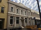 |
| Frank Cadd Building | 33 Phillimore St. 32°03′15.7″S 115°44′36.7″E / 32.054361°S 115.743528°E |
00983 | Also called Fares House, it was built in 1890. It's now part of the University of Notre Dame Australia. | 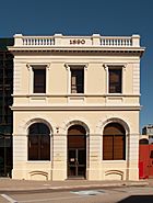 |
| Hotel Fremantle & residence (at rear) | 6 High St. 32°03′20″S 115°44′33″E / 32.05558°S 115.742531°E |
00900 | The residence was built in 1885, and the hotel in 1899. During World War II, it was used as a hospital. It is now part of the University of Notre Dame. |  |
| Turton | 25 Harvest Rd., North Fremantle 32°02′00″S 115°45′24″E / 32.03326°S 115.75666°E |
01036 | This house was built in 1904 and designed by Talbot Hobbs. | |
| Fremantle Post Office | 13–15 Market St. 32°03′12″S 115°44′45″E / 32.05333°S 115.74583°E |
00951 | Built in 1907, this post office was designed by Hillson Beasley. |  |
| Houses | 13–15 Thompson Rd., North Fremantle 32°01′59″S 115°45′18″E / 32.033183°S 115.754961°E |
01043 | These houses were built in 1897. | |
| Duty Free Store | 10 Elder Place 32°03′10″S 115°44′46″E / 32.052678°S 115.746077°E |
03705 | This building was designed by Joseph Francis Allen and built in 1907. | |
| National Hotel | 98 High St. 32°03′16″S 115°44′46″E / 32.0544°S 115.7462°E |
00926 | The hotel was built in 1895, with a second floor added in 1902. It has been damaged by fire twice. |  |
| Tolley & Co. Warehouse | 1 Pakenham St. 32°03′13″S 115°44′39″E / 32.05354°S 115.74419°E |
00968 | This warehouse was built in 1897. Tolley & Co. were known for selling wine and spirits. | 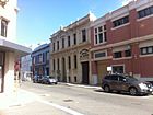 |
| Tarantella Night Club | 5 Mouat St. 32°03′19″S 115°44′34″E / 32.05515°S 115.7429°E |
00958 | This building used to be the German Consulate and a shipping office. | 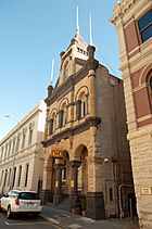 |
| Dalkeith House | 160 High St. 32°03′09″S 115°45′07″E / 32.052584°S 115.751904°E |
00931 | This private home was built in 1897 for James Gallop and designed by O.H Nicholson. | |
| Imperial Chambers | 35–55 Market St corner Leake St. 32°03′15″S 115°44′46″E / 32.05416°S 115.74612°E |
00954 | Built in 1896 for Edwin Foss. | 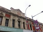 |
| Fremantle Railway Station | Phillimore St. 32°03′07″S 115°44′44″E / 32.05194°S 115.74556°E |
00974 | This train station was built in 1907. | 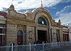 |
| Fremantle Fire Station | 18 Phillimore St. 32°03′15″S 115°44′36″E / 32.05417°S 115.74333°E |
00982 | Built in 1908, this fire station was kept even when a new one was built in 1977. |  |
| Howard Smith Building | 1–3 Mouat St. 32°03′17.0″S 115°44′34.5″E / 32.054722°S 115.742917°E |
00957 | 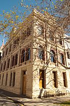 |
|
| Film and Television Institute (Fremantle Boys' School) | 92 Adelaide St. 32°03′03″S 115°44′57″E / 32.05077°S 115.749217°E |
00842 | This building was a boys' school from 1854 to 1855, built by people who were prisoners at the time. |  |
| Commercial Hotel | 80 High St 32°03′17″S 115°44′43″E / 32.05461°S 115.74537°E |
00921 | There has been a hotel here since the 1840s. The current building was rebuilt in 1908. | 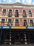 |
| Wilhelmsen House (Dalgety & Co, Elder Building) | 11 Cliff St, Cnr Phillimore St. 32°03′19″S 115°44′32″E / 32.05531°S 115.7421°E |
00854 | Built in 1902 and designed by Talbot Hobbs. It was once the headquarters for the Royal Australian Navy during World War II. | 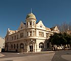 |
| Princess Theatre (fmr) | 29–33 Market St cnr Leake St. 32°03′14″S 115°44′46″E / 32.0538°S 115.746°E |
00953 | This theatre was built in 1912 on the site of an older hotel. | 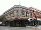 |
| Union Bank | 4 High St Cnr Cliff St. 32°03′20″S 115°44′32″E / 32.055667°S 115.742246°E |
00899 | Finished in 1889, this building became the Flying Angel Mission in 1930. | 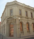 |
| St. Patrick's Basilica and Presbytery | 47 Adelaide St. 32°03′03″S 115°45′00″E / 32.0509°S 115.7500°E |
00845 | This large church was built between 1910 and 1916. | 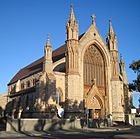 |
| North Fremantle Town Hall (fmr) | 222 Queen Victoria St North Fremantle 32°02′06″S 115°45′13″E / 32.034940°S 115.753630°E |
01038 | Built in 1902, this building also included a library from 1906. | |
| Marich Buildings, Fremantle | 20–28 Henry St Cnr High St. 32°03′18″S 115°44′39″E / 32.055035°S 115.744211°E |
00885 | These buildings were constructed in 1897. |  |
| Christian Brothers College, Fremantle | 41–51 Ellen St. 32°03′06″S 115°45′10″E / 32.05167°S 115.75278°E |
00898 | This is also known as Christian Brothers College (CBC), St. Patrick's School, and Edmund Hall. | |
| Westpac Building | 22 High St Cnr Mouat St 32°03′19″S 115°44′36″E / 32.05526°S 115.743405°E |
00908 | Built in 1892, this building has also been home to Western Australian Bank and Challenge Bank. |  |
| Fremantle Arts Centre | 1–21 Finnerty St. 32°02′51″S 115°45′14″E / 32.047634°S 115.75382°E |
00875 | Built between 1861 and 1886, it was once a hospital and a US Navy barracks during World War II. |  |
| Fremantle Grammar School | 200 High St. 32°03′04″S 115°45′22″E / 32.05111°S 115.75611°E |
00894 | This school was built in 1885. It has also been a church and a college, and is now a private home. | 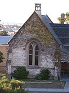 |
| North Fremantle War Memorial (Fallen Soldier's Memorial, North Fremantle) | cnr Queen Victoria St & Harvest Rd North Fremantle 32°02′07″S 115°45′13″E / 32.035298°S 115.753546°E |
01039 | This memorial was built in 1923 to honor soldiers who died in World War I. Names from World War II were added in 1945. |  |
| North Fremantle Post Office | 211–217 Queen Victoria St., North Fremantle 32°02′11″S 115°45′12″E / 32.036324°S 115.75334°E |
01037 | Built in 1898, this building was a police station for 70 years before becoming a post office. | |
| Fremantle Customs House (Falk & Company Warehouse) | 2 Henry St, cnr 41 Phillimore St 32°03′17″S 115°44′32″E / 32.054649°S 115.742359°E |
00879 | Built in 1888, this building was developed after the land was reclaimed from the Swan River. |  |
| Central Chambers | 61–63 High St. 32°03′16.9″S 115°44′42.6″E / 32.054694°S 115.745167°E |
00917 | This building was constructed in 1906. | 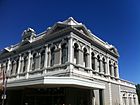 |
| Adelaide Steamship House | 10–12 Mouat St. 32°03′18″S 115°44′35″E / 32.05500°S 115.74306°E |
00959 | Built in 1900 for the Adelaide Steamship Company. |  |
| Matilda Bay Brewing Company Building | 130 Stirling Hwy North Fremantle 32°01′24″S 115°45′13″E / 32.02326°S 115.75374°E |
03649 | Built in 1930, this was originally a Ford Motor Company factory. | |
| Adelec Buildings, Fremantle | 26–36 High St. 32°03′19″S 115°44′38″E / 32.05528°S 115.74389°E |
00912 | These buildings, also known as Fothergills' Building, were built in 1906. |  |
| Woolworth's Building (facade only) | 4–16 Adelaide St. 32°03′14″S 115°44′50″E / 32.05388°S 115.747206°E |
00843 | ||
| Commercial Building | 16 High St 32°03′19″S 115°44′34″E / 32.055416°S 115.742882°E |
00905 | This commercial building was built in 1895. | 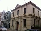 |
| Proclamation Tree and Marmion Memorial | cnr Adelaide & Parry Sts 32°03′00″S 115°45′00″E / 32.050122°S 115.749979°E |
00841 | This is a Moreton Bay Fig tree planted in 1890, next to a memorial. | 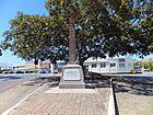 |
| Two Houses | 2 & 4 Barnett St 32°02′56″S 115°45′05″E / 32.048773°S 115.751505°E |
00848 | Built in 1896, one of these houses was owned by Isaac Bolton, a famous coach builder. | |
| Commercial Building | 2–6 Market St cnr Elder Place 32°03′11″S 115°44′45″E / 32.053008°S 115.745804°E |
00950 | This commercial building was built in 1915. | 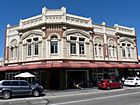 |
| Old Customs House | 4–8 Phillimore St cnr Cliff St 32°03′17″S 115°44′32″E / 32.054649°S 115.742359°E |
00977 | This building, also known as Phillimore Chambers, was built in 1908. |  |
| Electricity Substation, Fremantle | 12 Parry St 32°03′01″S 115°45′02″E / 32.050317°S 115.750593°E |
03711 | Built in 1932, this building was used for electricity and trams. | 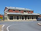 |
| Chamber of Commerce Building | 16 Phillimore St 32°03′15″S 115°44′35″E / 32.054191°S 115.742920°E |
00980 | Built in 1912, the Fremantle Chamber of Commerce still uses this building today. | 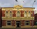 |
| C.Y. O'Connor Memorial | 1 Cliff St 32°03′15″S 115°44′30″E / 32.054051°S 115.741672°E |
00852 | This monument honors C. Y. O'Connor and was designed by Pietro Porcelli in 1911. | 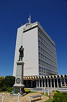 |
| House | 75 Ellen St 32°03′02″S 115°45′22″E / 32.05055°S 115.75612°E |
00870 | This house was built in 1895. | |
| Town House Triple | 23–27 Ellen St 32°03′07″S 115°45′07″E / 32.051976°S 115.751843°E |
03706 | These three stone houses were built in 1880, before the gold rush. | |
| Four Terrace Houses | 19–25 Point St 32°03′09″S 115°44′58″E / 32.052397°S 115.749442°E |
00986 | These houses were built in 1897 after the land was sold by the Mechanics Institute. | |
| Bank of Australasia (fmr) (Dept. of Health Building) | 18 High St 32°03′19″S 115°44′35″E / 32.055371°S 115.743044°E |
00906 | Built in 1901, this building later became offices for the Commonwealth Marine Branch. | 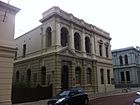 |
| Taylor Memorial Drinking Fountain & Horse Trough | cnr Market & Phillimore Sts 32°03′09″S 115°44′44″E / 32.052484°S 115.745536°E |
00949 | This drinking fountain and horse trough was built in 1903. | |
| Commercial Bank (fmr) | 20 High St 32°03′19″S 115°44′35″E / 32.055377°S 115.743135°E |
00907 | This former bank building was constructed in 1901. | |
| Commonwealth Bank building | 82 High St 32°03′16″S 115°44′44″E / 32.054568°S 115.745523°E |
00923 | Built in 1934, this building was also used by the Hospital Benefit Fund of WA. | 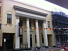 |
| St John's Anglican Church, Fremantle (St John The Evangelist Church) | 3 Adelaide St 32°03′13″S 115°44′53″E / 32.05367°S 115.74814°E |
00844 | This church was built in 1879. | 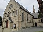 |
| PS Art Studio & Gallery | 26 Pakenham Street 32°03′16″S 115°44′42″E / 32.05438°S 115.74497°E |
18772 | Built in 1907, this is one of the few warehouses in Fremantle that still looks the same inside. | |
| Tannatt Chambers | 8 High St 32°03′20″S 115°44′34″E / 32.05553°S 115.74265°E |
00903 | This building was designed by E. M. Dean Smith and built in 1902. | 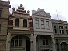 |
| Four Terrace Houses | 18–24 Queen Victoria St 32°02′56″S 115°45′00″E / 32.048832°S 115.750110°E |
00251 | ||
| Robert Harper Flour Building (fmr) (Jebsens) | 49 Phillimore St cnr Pakenham St 32°03′13″S 115°44′39″E / 32.053579°S 115.744195°E |
00984 | This building was constructed in 1890. | 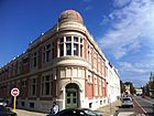 |
| Marine House | 7–9 Leake St 32°03′15″S 115°44′43″E / 32.054128°S 115.745416°E |
00944 | Built in the 1890s, this building has been used by many different companies. | |
| Kreglinger Buildings | 16–20 Mouat St 32°03′19″S 115°44′36″E / 32.05516°S 115.74329°E |
00961 | These buildings were constructed in 1890. | |
| Seppelts Building Facade | 5 Pakenham St 32°03′14″S 115°44′40″E / 32.05401°S 115.74433°E |
00969 | The front of this building was added in 1893 when it was turned into a warehouse. | |
| Bank of Adelaide building | 60–64 High St 32°03′18″S 115°44′41″E / 32.054892°S 115.744689°E |
00918 | Built in 1910, a third floor was added to this bank building in the 1990s. | |
| Cellars Restaurant | 10 High St 32°03′20″S 115°44′34″E / 32.055516°S 115.742711°E |
00904 | This building was constructed in 1900. |  |
| Wesley Church | cnr Market & Cantonment Sts 32°03′13″S 115°44′46″E / 32.053497°S 115.746210°E |
00955 | This church was built in 1889 and extended in 1928. | 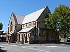 |
| Moreton Bay Fig Group | St Johns Square 32°03′13″S 115°44′55″E / 32.053512°S 115.748506°E |
04364 | This is a group of six Moreton Bay Fig trees. | |
| Marine House | 9 Pakenham St 32°03′15″S 115°44′40″E / 32.054288°S 115.744429°E |
00971 | Built in 1904, only the front of this building remains today. | |
| Tum Tum Tree, Hua Sen Restaurant | 130–132 High St 32°03′12″S 115°44′57″E / 32.053411°S 115.749278°E |
02853 | This is a Norfolk Island Hibiscus tree, planted around 1950, which shades the restaurant's outdoor area. | |
| P & O Building (Australian Union Steamships Navigation, Company Building) | 17 Phillimore St 32°03′18″S 115°44′34″E / 32.05496°S 115.74275°E |
00981 |  |
|
| Quartermaine's Building | 3–5 Henry St 32°03′17″S 115°44′37″E / 32.054673°S 115.743703°E |
00880 | Built in 1907 as a warehouse, it is now residential apartments. |  |
| Cleopatra Hotel | 24 High St 32°03′19″S 115°44′37″E / 32.055171°S 115.743591°E |
00910 | The Cleopatra Hotel was built in 1882 on the site of an even older hotel. |  |
| Lance Holt School | 10 Henry St 32°03′17″S 115°44′39″E / 32.054637°S 115.744094°E |
00882 | This building was a coffee house in 1892 and became a school in the 1970s. |  |
| Samson House | 61 & 63 Ellen St 32°03′04″S 115°45′19″E / 32.050996°S 115.755162°E |
0869 | Built in 1889 for Michael Samson, who was the mayor of Fremantle. It was designed by Talbot Hobbs. |  |
| Hillcrest | 23 Harvest Rd cnr Turton St, North Fremantle 32°02′01″S 115°45′22″E / 32.033554°S 115.756150°E |
01035 | Built in 1901, this building has been a Salvation Army home and a maternity hospital. | |
| Commercial Building | 14 Mouat St 32°03′18″S 115°44′36″E / 32.055016°S 115.743254°E |
00960 | This building was constructed in 1890, before the gold rush brought many changes to the area. | 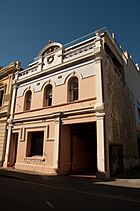 |
| Princess Chambers (Biddles Building) | 21–27 Market St 32°03′13″S 115°44′45″E / 32.053629°S 115.745918°E |
00952 | Built in 1899, this building was designed by Edwin Summerhayes. | |
| Westpac Bank | 66–70 High St 32°03′17″S 115°44′42″E / 32.054756°S 115.745008°E |
00919 | This building, originally the Commercial Bank of Australia, was built in 1908. | 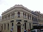 |
| Music School | 21 Parry St 32°03′09″S 115°45′04″E / 32.052444°S 115.750991°E |
00973 | Built in 1897, this building became a music school in 1953. | |
| Great Southern Roller Flour Mill | Thompson Rd, North Fremantle | 03645 | Built in 1922, this mill was known for its 'Dingo' Flour. |  |
| House | 19 Quarry St 32°02′57″S 115°45′04″E / 32.049235°S 115.751156°E |
00988 | This house was built in 1891 for a policeman named James Gilchrist. | |
| His Majesty's Hotel | 2–8 Mouat St 32°03′17″S 115°44′35″E / 32.054645°S 115.743138°E |
00975 | Built between 1903 and 1904, this hotel was also known as His Lordship's Larder. |  |
| Victoria Quay | Victoria Quay 32°03′00″S 115°44′46″E / 32.050°S 115.746°E |
03602 | This area includes many important port buildings like the Immigration Centre, markets, and workshops. |  |
| Seppelts Warehouse | 7 Pakenham St 32°03′15″S 115°44′39″E / 32.054031°S 115.744283°E |
00970 | This building was originally a home in 1880 before being turned into a warehouse in 1908. | |
| Lenaville (Shenton House) | 186 High St 32°03′06″S 115°45′19″E / 32.051562°S 115.755268°E |
00936 | Built in 1884, this building was named Lenaville after one of its owners, Lena Blacker, who ran it as a boarding house. | |
| Dux Factory | 25 Quarry St 32°02′55″S 115°45′06″E / 32.048623°S 115.75178°E |
00989 | This building was a bottling factory in 1895 and is now home to Fremantle Press. | |
| Dalgety's Bond Store (fmr) (Elder Buildings) | 1 Phillimore St 32°03′20″S 115°44′30″E / 32.055418°S 115.741750°E |
00976 | Built in 1902, this building was designed by Talbot Hobbs. | |
| Princess May Reserve | 92 Adelaide Street 32°03′01″S 115°44′57″E / 32.050373°S 115.749292°E |
00851 | This area includes the Princess May Girls' School and the Film & TV Institute. | |
| McIlwraith Building (Scottish House, Patrick's Building) | 10–12 Phillimore St 32°03′16″S 115°44′34″E / 32.054380°S 115.742653°E |
00978 | Built in 1898 using Donnybrook stone. | 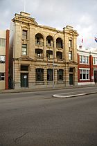 |
| Phillimore Chambers | 7–11 Phillimore St cnr Cliff St 32°03′18″S 115°44′33″E / 32.055132°S 115.742362°E |
00979 | This building was constructed in 1899. |  |
| Pearse's Buildings (Commercial Bank (fmr)) | 72–78 High St 32°03′17″S 115°44′43″E / 32.054672°S 115.745222°E |
00920 | Built around 1900 for James Pearse, these buildings were used as offices and showrooms. | 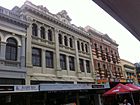 |
| McDonald Smith Building | 22–32 Cliff St. 32°03′22″S 115°44′34″E / 32.0562°S 115.742734°E |
00858 | This two-story commercial building was built in 1895. |  |
| Courthouse/Police Station complex | 45 Henderson St. 32°03′17″S 115°45′01″E / 32.0548°S 115.7502°E |
00878 | This complex, built between 1896 and 1903, includes the police station, courthouse, and a lock-up. |  |
| R.S.L. Club | 81–83 High Street 32°03′13.2″S 115°44′44.7″E / 32.053667°S 115.745750°E |
00922 | This club building was constructed in 1903. | 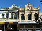 |
| Reckitt & Colman Building Facade | 21–29 Cliff St. 32°03′22″S 115°44′33″E / 32.0561°S 115.7425°E |
00855 | The front of this building was built between 1890 and 1895. The cottages behind it were removed in 1967. |  |
| Holdsworth House | 1 Bateman St 32°03′11″S 115°45′20″E / 32.05312°S 115.75566°E |
04550 | Built in 1895, this house is part of a group of homes developed by Lionel Holdsworth. | |
| Oceanic Hotel | 8 Collie St. 32°03′24″S 115°44′45.5″E / 32.05667°S 115.745972°E |
00862 | This hotel was bought by the Sannyasins in the 1980s and is now residential units. | 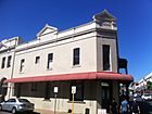 |
| Federal Hotel, Fremantle | 23–25 William St. 32°03′17″S 115°44′52″E / 32.0548°S 115.7479°E |
01018 | This three-story hotel was built in 1887 and expanded in 1904. It was known as Rosie O'Grady's for many years. | 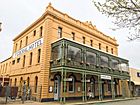 |
| Commissariat Buildings (fmr) (Customs House & Bonded Warehouse, Maritime Museum) | Cliff St, Croke Ln and Marine Tce. 32°03′25″S 115°44′33″E / 32.05694°S 115.74250°E |
00857 | Built by prisoners between 1850 and 1852, this building now houses the Western Australian Museum Shipwreck Galleries. |  |
| Athena Lodge (fmr) | 35 High St. 32°03′20″S 115°44′38″E / 32.05548°S 115.74385°E |
00913 | This building was constructed in 1901. | |
| Union Stores Building | 41–47 High St. 32°03′18.9″S 115°44′39.6″E / 32.055250°S 115.744333°E |
00915 | This building was constructed in 1895. |  |
| Old Kerosene Store | Arthur Head, Western end of Mews Rd. 32°03′27″S 115°44′30″E / 32.0576°S 115.7417°E |
00846 | Built in 1884, this building is now home to Kidogo Arthouse. |  |
| Round House and Arthur Head Reserve | Arthur Head, Western end of High St. 32°03′22″S 115°44′29″E / 32.05611°S 115.74139°E |
00896 | The Roundhouse, a very old building, was constructed between 1830 and 1831. |  |
| Fremantle Municipal Tramways Car Barn (fmr) | 1 High St. 32°03′22″S 115°44′31″E / 32.056032°S 115.742013°E |
00897 | Built in 1905, only the front of this building remains today. | |
| Ardmore Residential Units (Ardmore Terrace Houses) | 203–215 High St. 32°03′10″S 115°45′09″E / 32.05284°S 115.75253°E |
00938 | These homes were built in 1907. |  |
| House | 36 Wray Ave. 32°03′36″S 115°45′10″E / 32.05987°S 115.75276°E |
01025 | This seven-room house was built in 1897 for a dressmaker named Caroline Wade. | |
| Orient Hotel | 39 High St. 32°03′19.47″S 115°44′38.45″E / 32.0554083°S 115.7440139°E |
00914 | This hotel was built in 1902. |  |
| Bank of New South Wales (fmr) (Dalgety Building, Millennium) | 7 High St corner Cliff St. 32°03′21″S 115°44′33″E / 32.055818°S 115.742567°E |
00902 | Built in 1899 for the Bank of New South Wales, this building was completed when the inner harbor was being built. |  |
| Sail and Anchor Hotel | 64 South Tce, Cnr Henderson St. 32°03′21″S 115°44′55″E / 32.05583°S 115.74861°E |
01002 | This hotel, originally called the Freemasons' Hotel, was built between 1901 and 1903. |  |
| Owston's Buildings | 9–23 High St. 32°03′21″S 115°44′35″E / 32.05570°S 115.7430°E |
00909 | These buildings were designed by Frederick William Burwell and built in 1903. |  |
| Esplanade Park, Fremantle | Marine Terrace 32°03′29″S 115°44′42″E / 32.05806°S 115.74500°E |
17714 | 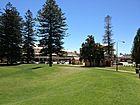 |
|
| South Fremantle Post Office | 174 Hampton Rd. South Fremantle 32°03′57″S 115°45′27″E / 32.065917°S 115.757564°E |
01045 | Built in 1896, the design of this post office is similar to other works by George Temple-Poole. | |
| Esplanade Hotel | 46 Marine Tce cnr of Collie and Essex streets 32°03′27″S 115°44′47″E / 32.05750°S 115.74639°E |
00947 | This hotel was built in 1875 and renovated in 1985 for the America's Cup sailing race. | 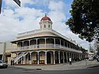 |
| Fremantle Synagogue | 92 South Terrace 32°03′24.7″S 115°44′59.3″E / 32.056861°S 115.749806°E |
01010 | Built in 1902, this was the first synagogue built specifically for its purpose in Western Australia. | 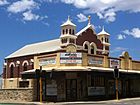 |
| Artillery Barracks & Fremantle Harbour Signal Stn (fmr) (Victoria Barracks) | cnr Queen Victoria & Burt Sts. 32°03′42.74″S 115°45′15.84″E / 32.0618722°S 115.7544000°E |
00991 | These military buildings were constructed in stages between 1911 and 1956. | 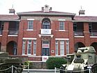 |
| Dalkeith Opera House/King's Theatre | 52–62 South Tce. 32°03′21.35″S 115°44′53.26″E / 32.0559306°S 115.7481278°E |
01003 | Built around 1908, this building is now the Metropolis Night Club. | |
| Grieve and Piper Buildings | 28 Mouat St 32°03′22″S 115°44′37″E / 32.05598°S 115.74374°E |
00962 | Built in 1890, these buildings were converted into an art gallery in 1976. | |
| Trades Hall (fmr) | 6 Collie St. 32°03′25″S 115°44′45″E / 32.0570°S 115.7457°E |
00864 | This building was designed by Joseph Allen and built in 1904. | 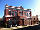 |
| Wray Avenue Precinct | Wray Ave 32°03′41″S 115°45′22″E / 32.061462°S 115.755978°E |
01026 | This area includes most of the buildings along Wray Avenue, some of which are also listed individually. | 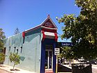 |
| Fremantle Prison | The Terrace 32°03′18″S 115°45′13″E / 32.05500°S 115.75361°E |
01014 | Built by prisoners between 1852 and 1859, this prison was added to the World Heritage list in 2010. | 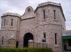 |
| Fremantle Town Hall | 8 William St. 32°03′15″S 115°44′53″E / 32.0542°S 115.7480°E |
01015 | This town hall was completed in 1886 and built in the Second Empire style. | 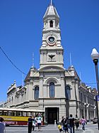 |
| Monument Hill & War Memorials | High, Knutsford & Bateman Sts. 32°03′08″S 115°45′26″E / 32.05229°S 115.757237°E |
03956 | This area includes the Fremantle War Memorial and other memorials on Obelisk Hill. | 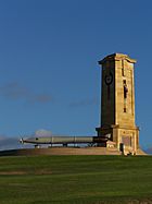 |
| The Tannery | 22 Russell St 32°03′37″S 115°45′03″E / 32.06038°S 115.75094°E |
04588 | Built in 1854, this building was once a tannery and fellmongering business. | |
| Three Terraced Houses | 20–24 Essex St 32°03′23″S 115°44′53″E / 32.05646°S 115.74797°E |
00873 | These three houses were built around 1880. One was home to Frederick Jones, a shipbuilder and Fremantle councillor. |  |
| Fremantle Markets | cnr South Tce & Henderson St. 32°03′22.5″S 115°44′57″E / 32.056250°S 115.74917°E |
01006 | These famous markets were built between 1898 and 1902. | 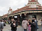 |
| Two Attached Houses | 70–72 Hampton Rd. 32°03′29″S 115°45′22″E / 32.05801°S 115.75606°E |
00876 | These houses were built in 1896 for Charles Henry Pierce. | |
| W D Moore & Co Warehouse | 42–46 Henry St. 32°03′22.86″S 115°44′41.02″E / 32.0563500°S 115.7447278°E |
00890 | The current building dates from 1869, with the front added in 1899. The owner, William Dalgety Moore, was a very important businessman in Fremantle. |  |
| P&O Hotel | 25 High St. 32°03′20″S 115°44′36.4″E / 32.05556°S 115.743444°E |
00911 | Originally the Victoria Hotel (around 1870), it was renamed P&O in 1901. It is now part of the University of Notre Dame Australia. |  |
| Ocean View | 134 Solomon Street, Beaconsfield 32°03′52″S 115°45′36″E / 32.06437°S 115.75999°E |
1033 | ||
| Victoria Hall | 179 High St 32°03′13″S 115°45′00″E / 32.053700°S 115.749918°E |
00935 | Built between 1896 and 1897, this hall was renamed Victoria Hall to celebrate Queen Victoria's Diamond Jubilee. | 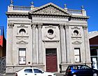 |
| House and Detached Shop, Fremantle | 40–42 Holdsworth St 32°03′12″S 115°45′13″E / 32.053225°S 115.753662°E |
00943 | Built around 1850, this was originally a bakery. | |
| Strelitz Buildings | 30 Mouat St 32°03′22″S 115°44′38″E / 32.05608°S 115.74380°E |
00963 | Built in 1897 for Richard Strelitz, a consul for Denmark. Herbert Hoover once lived here. |  |
| House & Moreton Bay Fig Tree | 195 High St 32°03′12″S 115°45′03″E / 32.053344°S 115.75089°E |
00937 | The house was built in 1886. The Moreton Bay Fig tree here is thought to be the source of many other trees in the area. | |
| Water Police Station & Quarters | 10–20 Marine Tce 32°03′26″S 115°44′36″E / 32.057276°S 115.743371°E |
00945 | The current building was built in 1903, but this site has been used by the Water Police since 1851. | |
| Court House (fmr) | 18 Marine Tce cnr Mouat St 32°03′26″S 115°44′36″E / 32.057276°S 115.743363°E |
00946 | Built in 1884, this building has had many different uses over the years. | 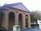 |
| Interfoods | 14 South Tce 32°03′19″S 115°44′51″E / 32.055383°S 115.747553°E |
03712 | Built in 1897, the first restaurant here opened in 1901. | |
| Warwick | 79 Solomon St 32°03′35″S 115°45′29″E / 32.059811°S 115.758032°E |
02906 | Built in 1898 for Charles Hudson, a merchant. It was later used as nurses' quarters for Fremantle Hospital. | |
| Scots Presbyterian Church | 86 South Tce 32°03′23″S 115°44′58″E / 32.05643°S 115.74954°E |
01009 | This church was built in 1890. | 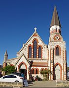 |
| Two Terrace Houses | 14–16 Nairn St 32°03′21″S 115°44′47″E / 32.05589°S 115.74651°E |
00964 | These houses were built between 1890 and 1891 and restored in 1983. | |
| Evan Davies Building | 13 South Tce 32°03′21″S 115°44′50″E / 32.055737°S 115.747331°E |
00861 | This building, originally the Literary Institute, was built in 1899. |  |
| Pair of Two-Storey Terrace Houses | 10–12 Wray Ave 32°03′34″S 115°45′07″E / 32.05956°S 115.75194°E |
01020 | These houses were built in 1897. | |
| Fowler's Warehouse | 38–40 Henry St 32°03′21″S 115°44′41″E / 32.055969°S 115.744687°E |
00889 | Fowler's started at this site in 1854. The current building was built between 1899 and 1900 and is now owned by the City of Fremantle. |  |
| Higham's Buildings | 101 High St cnr Market St 32°03′17″S 115°44′47″E / 32.054733°S 115.746272°E |
00927 | The original Higham's store started in the 1850s. The building looks as it does today after additions in the 1890s and 1900s. | 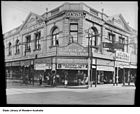 |
| Four Terrace Houses | 87–93 South Tce 32°03′32″S 115°45′03″E / 32.058970°S 115.750862°E |
04202 | These houses were built in 1880. | |
| Norfolk Street 26–28 | 26–28 Norfolk St 32°03′26″S 115°44′56″E / 32.057097°S 115.748788°E |
00966 | Built in 1865, this building is known for its early use of a special type of beam called a Flitch beam. | |
| Ajax Buildings (Purdies) | 49–59 High St 32°03′19″S 115°44′41″E / 32.055162°S 115.744624°E |
00916 | These buildings were constructed in 1908. | |
| Mills & Co Building (fmr) | 19–21 Essex St 32°03′24″S 115°44′54″E / 32.056771°S 115.748267°E |
03708 | Built between 1905 and 1906 for William Sandover & Co. | |
| House | 196 South Tce 32°03′43″S 115°45′10″E / 32.061872°S 115.752694°E |
01005 | Built around 1901, this house is a typical example of homes from that time. | |
| Victoria Pavilion | Fairburn St 32°03′22″S 115°45′00″E / 32.05611°S 115.75000°E |
00874 | This grandstand at Fremantle Oval was built in 1897 and named after Queen Victoria for her Diamond Jubilee. |  |
| The Knowle (on Fremantle Hospital grounds) | Alma St | 03226 | Built in 1853 by prisoners, this was the first building of the Fremantle Hospital. | |
| Manning Buildings & Chambers | William, High, Market Sts & South Tce | 00928 | These buildings were constructed in 1902. | 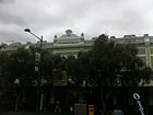 |
| Port Flour Mill | 15 Essex St 32°03′25″S 115°44′53″E / 32.05697°S 115.74804°E |
00871 | Built in 1862, this mill used limestone from Arthur Head. | |
| Warehouse Complex | 37–45 Cliff St 32°03′24″S 115°44′34″E / 32.056707°S 115.742716°E |
00860 | Owned by George Shenton, additions to this complex were completed in 1903. | |
| Commercial Buildings | 17–23 South Tce cnr Collie St 32°03′22″S 115°44′51″E / 32.055998°S 115.747635°E |
00997 | These commercial buildings were constructed in 1895. | |
| Two Houses | 12–14 Norfolk St 32°03′28″S 115°44′52″E / 32.057642°S 115.747691°E |
00967 | Both houses were built before 1880, possibly as early as 1860. |  |
| Doig and Horne Building | 119–123 High St 32°03′16″S 115°44′48″E / 32.054516°S 115.746798°E |
00930 | Built in 1895, this building was joined to the Atwell building in 1906. An arcade was added in 1929. | |
| House | 16 Essex St 32°03′24″S 115°44′51″E / 32.05668°S 115.74758°E |
00872 | This house was built sometime between 1845 and 1879. | |
| Commercial Building | 85–87 High St 32°03′17″S 115°44′45″E / 32.054848°S 115.745748°E |
00925 | Built around 1901 for former mayor George Davies, this building was renovated in 1971. | |
| Sweetman's House | 9 Russell St 32°03′40″S 115°45′00″E / 32.061144°S 115.750024°E |
00992 | This house was built in the 1880s for William Sweetman. | |
| Mercantile Stevedores Warehouse | 27–29 Henry St 32°03′22″S 115°44′39″E / 32.05598°S 115.74419°E |
00886 | This warehouse was built in 1898. | |
| Hall and Solomon Building, Davis Wool Stores | 52 Henry St 32°03′24″S 115°44′42″E / 32.05660°S 115.74496°E |
00892 | Built around 1880, this building is named after F. and C. Hall and Elias Solomon. | 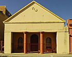 |
| Norfolk Island pine | Marine Tce | 04363 | This is a Norfolk Island pine tree located in Esplanade Park, Fremantle. | |
| House | 31 Russell St 32°03′39″S 115°45′03″E / 32.06088°S 115.750898°E |
00993 | This house received a Fremantle award. | |
| Sadliers Warehouse/Customs Agency | 34–36 Henry St 32°03′20″S 115°44′40″E / 32.055650°S 115.744524°E |
00888 | Built in 1881 and 1885, this warehouse was turned into homes in 1992. | 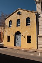 |
| Town House | 37 Ellen St 32°03′06″S 115°45′09″E / 32.051744°S 115.752401°E |
00866 | This home was built in 1897. |  |
| Lionel Samson Building (Samson Cottage) | 31–35 Cliff St 32°03′23″S 115°44′32″E / 32.056363°S 115.742155°E |
00856 | The cottage was built in 1835 and expanded in 1895. | |
| Atwell | 77 Solomon St 32°03′34″S 115°45′29″E / 32.059573°S 115.757950°E |
02907 | Built in 1898 for Henry Atwell, a Fremantle businessman. | |
| Star Hotel | 5 Essex St 32°03′27″S 115°44′50″E / 32.05745°S 115.74729°E |
03707 | Built in 1878 and rebuilt in 1914, this hotel is now used for backpacker accommodation. | |
| Seven Terrace Houses | 18–30 Holdsworth St 32°03′13″S 115°45′09″E / 32.053489°S 115.752566°E |
00941 | These seven "gentleman's residences" were built in 1886. | |
| CBH Grain Silos (Fremantle Grain Terminal, Co-operative Bulk Handling Silos) | North Quay, Port of Fremantle | 03921 | These grain silos were built in 1948 but were taken down in 2000. | |
| Central Wool Company | 21–23 Henry St 32°03′21″S 115°44′39″E / 32.055716°S 115.744084°E |
00884 | This building has been used as shops and a warehouse since the 1880s. It is now part of the University of Notre Dame Fremantle. | |
| Eight Terrace Houses | 2–16 Price St 32°03′45″S 115°45′02″E / 32.062480°S 115.750632°E |
00987 | These houses were built in 1899. | |
| Bateman Buildings | 47 Henry St 32°03′24″S 115°44′41″E / 32.056697°S 115.744597°E |
00891 | These buildings were constructed in 1870. | |
| Nine Terrace Houses & 2 Shops | 79–93 South Tce 32°03′31″S 115°45′02″E / 32.058666°S 115.750683°E |
00999 | These homes and shops were built between 1880 and 1930. | |
| Fremantle Technical College Annexe | 41 South Tce 32°03′24″S 115°44′56″E / 32.056656°S 115.748847°E |
01007 | This building was originally the Infants and Girls School, built in 1877. | 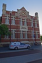 |
| Clyde Cottages – 5 Terrace Houses | 11–19 Russell St 32°03′40″S 115°45′01″E / 32.061117°S 115.750238°E |
00994 | These five houses were built in 1899. | |
| P J Morriss Building | 13–19 Mouat St 32°03′21″S 115°44′35″E / 32.055952°S 115.742957°E |
00956 | Built in 1896, this building is now part of Notre Dame University. | |
| Two Houses | 18–20 Nairn St 32°03′21″S 115°44′47″E / 32.055880°S 115.746450°E |
00965 | These houses were built in 1887 for Edward Davies. | |
| Terrace of Six Houses | 19–29 Holdsworth St 32°03′12″S 115°45′15″E / 32.053394°S 115.754063°E |
00942 | These homes for workers were built in 1903. | |
| Lilly's Buildings | 34–42 Cliff St 32°03′23″S 115°44′35″E / 32.056437°S 115.742940°E |
00859 | Built in 1897 for James Lilly, a well-known businessman. It is now part of the University of Notre Dame Australia. | |
| Mills & Wares Warehouse (fmr) | 2–4 Croke Lane 32°03′25″S 115°44′33″E / 32.056859°S 115.742593°E |
00865 | Designed by Talbot Hobbs in 1891, this warehouse was turned into apartments around 2002. | |
| Two Terrace Houses | 87–89 South Tce 32°03′33″S 115°45′03″E / 32.059032°S 115.750715°E |
03717 | This building is now the South Terrace Medical Centre. | |
| Building | 7–9 William St 32°03′16″S 115°44′53″E / 32.054527°S 115.747991°E |
01017 | ||
| Warders Cottages | 7, 19–29, 31 Henderson St 32°03′20″S 115°44′58″E / 32.055535°S 115.749411°E |
00877 | These cottages were built in 1851 and 1858 to house prison guards. |  |
| Group of Four Houses | 19–25 Suffolk Street 32°03′29″S 115°44′59″E / 32.058145°S 115.749670°E |
03481 | This group includes one two-story house and three single-story houses, built between 1870 and 1886. | |
| Warders' Terrace | 3–11 Holdsworth St 32°03′15″S 115°45′05″E / 32.054256°S 115.751374°E |
00940 | Built in 1897, these homes were used as accommodation for prison warders. | |
| Beaconsfield Primary School (fmr) | Cnr Hampton Rd & Lefroy St, Beaconsfield 32°04′02″S 115°45′29″E / 32.067217°S 115.758123°E |
01031 RHP 23 January 2009 |
This school has three buildings from 1894, 1898, and 1913–1914. It stopped being a school in 1978 and is now an education office. |
See also
- Fremantle West End Heritage area
 | Kyle Baker |
 | Joseph Yoakum |
 | Laura Wheeler Waring |
 | Henry Ossawa Tanner |

