List of historic places in British Columbia Coast facts for kids
The British Columbia Coast is a beautiful part of Canada, known for its stunning natural scenery, deep forests, and many islands. But it's also a place rich in history! All over this coast, you can find special spots that are recognized as important historic places. These places tell us stories about the past, from ancient Indigenous cultures to early European settlers, and how people lived and worked here long ago.
These historic places are officially listed on the Canadian Register of Historic Places. This register helps protect and celebrate buildings, sites, and areas that have played a big part in Canada's history. By learning about them, we can understand more about where we come from and the amazing events that shaped our country.
Contents
Discovering Historic Treasures
The British Columbia Coast, not including Vancouver Island, has many unique historic sites. These places are found in different areas like the Central Coast Regional District, Kitimat-Stikine Regional District, Mount Waddington Regional District, Powell River Regional District, Skeena-Queen Charlotte Regional District, Strathcona Regional District, and Sunshine Coast Regional District. Let's explore some of these fascinating spots!
Indigenous Heritage Sites
Many of the most important historic places on the BC Coast are connected to the rich history and culture of Indigenous peoples. These sites often hold deep meaning and tell stories that have been passed down through generations.
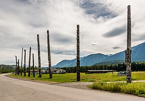
Kitwankul National Historic Site
Near the Kitwankul Creek and River, you'll find the Kitwankul National Historic Site. This special place is known for its incredible totem poles. These tall, carved poles tell stories, show family histories, and represent important events for the Gitanyow people. They are like giant history books carved from wood!
Gitwangak Battle Hill
Gitwangak Battle Hill is another significant site. It's a place where the Gitwangak people bravely defended their territory. This hill was a natural fortress, and its history shows the strength and resilience of the local communities.
Kitselas Canyon
The Kitselas Canyon is a powerful natural landmark that has been important to the Kitselas First Nation for thousands of years. It was a key location for fishing, trade, and travel, and many traditional stories are connected to this dramatic canyon.
Metlakatla Pass
Metlakatla Pass is a historic waterway that was vital for travel and trade among Indigenous communities. Its strategic location made it an important gathering place and a route for canoes moving along the coast.
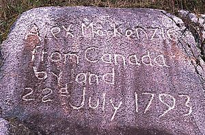
First Crossing of North America
The "First Crossing of North America" National Historic Site marks the spot where explorer Alexander Mackenzie completed the first recorded crossing of North America by land in 1793. He reached the Pacific Ocean near Bella Coola, a place that had been home to Indigenous peoples for centuries. This site represents a meeting point of different histories.
Historic Buildings and Structures
The BC Coast is also home to many interesting buildings and structures that show us how people lived and worked in the past.
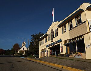
Powell River Townsite Historic District
The Powell River Townsite is a unique place that was built around a large pulp and paper mill. It's considered a National Historic Site because it's one of the best examples of a "company town" in Canada. Many of its original buildings, like the Patricia Theatre, are still standing and used today. It's like stepping back in time to see how industrial towns were designed.
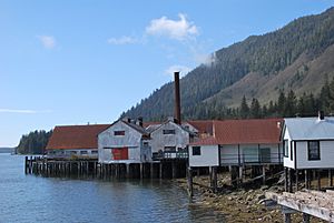
North Pacific Cannery
The North Pacific Cannery National Historic Site, located in Port Edward, is the oldest surviving salmon cannery in British Columbia. Canneries were super important for the economy of the coast, processing the huge amounts of salmon caught here. This site shows what life was like for the workers, including many Indigenous, Chinese, and Japanese people, who lived and worked there.
Butedale Cannery
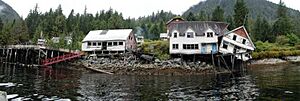
The Butedale Cannery is another historic cannery site, located in the remote community of Butedale. While no longer active, it stands as a reminder of the once-thriving fishing and canning industry that shaped many coastal communities.
Old Skeena Bridge
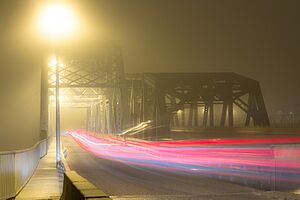
Near Terrace, you can find the Old Skeena Bridge. This bridge was a vital link for transportation, connecting communities across the Skeena River. It's a great example of early 20th-century engineering.
Hagwilget Bridge
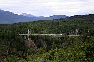
The Hagwilget Bridge, near Hazelton, is a very impressive and historic suspension bridge. It crosses a deep canyon and has been an important crossing point for Indigenous peoples for centuries, with earlier versions of the bridge built by local communities. The current bridge is a testament to both Indigenous ingenuity and later engineering.
Anyox Powerhouse No. 1
In the ghost town of Anyox, you'll find the remains of Powerhouse No. 1. Anyox was once a booming mining town, and this powerhouse provided the electricity needed for its operations. It's a relic of a time when mining was a major industry on the coast.
George Little House
The George Little House in Terrace is a historic home named after the founder of the city. It represents the early settlement and development of the Terrace area and gives us a look into the lives of its first residents.
Great War Veterans' Association Hall
Also in Terrace, the Great War Veterans' Association Hall is a building that served as a meeting place for veterans of World War I. It's a reminder of the sacrifices made by Canadian soldiers and the community support for them after the war.
British Columbia Provincial Police Station
The British Columbia Provincial Police Station in Terrace is a historic building that once housed the local police force. It shows how law and order were maintained in developing communities on the coast.
Kwinitsa Railway Foreman's Residence
The Kwinitsa Railway Foreman's Residence, near Terrace, was home to the person in charge of a section of the railway. Railways were crucial for connecting remote areas and transporting goods, and this house tells a small part of that story.
Pacific Roundhouse
The Pacific Roundhouse, located north of Terrace, was a building used to store and repair railway locomotives. It's a significant part of the railway history of the region, showing the infrastructure needed to keep trains running.
Lighthouses of the Coast
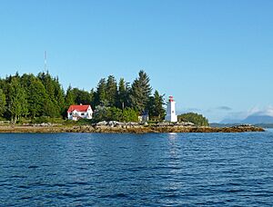
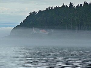
Lighthouses are iconic symbols of coastal areas, guiding ships safely through often dangerous waters. The BC Coast has several historic lighthouses, each with its own story.
Pulteney Point Lighthouse
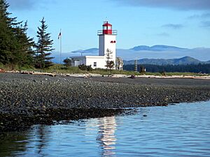
Located on the southwestern tip of Malcolm Island, the Pulteney Point Lighthouse has been guiding ships for many years. Lighthouses like this one were essential for maritime safety, especially in stormy weather.
Dryad Point Lighthouse
The Dryad Point Lighthouse is found on the northeast tip of Campbell Island. Its light helps ships navigate through the intricate waterways of the Central Coast.
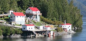
Boat Bluff Lighthouse
At the southern tip of Sarah Island, the Boat Bluff Lighthouse stands guard. These remote lighthouses were often operated by lighthouse keepers and their families, who lived isolated lives to ensure the safety of others.
Egg Island Lighthouse
Egg Island Lighthouse is located off the coast at the entrance to the Queen Charlotte Strait. Its position makes it a crucial navigational aid for vessels entering or leaving the strait.
Langara Point Lighthouse
The Langara Point Lighthouse is situated on Langara Island, one of the most westerly points in British Columbia. It's a very important lighthouse for ships traveling along the outer coast.
McInnes Island Lighthouse
McInnes Island Lighthouse is found off the southern tip of Price Island. Like other lighthouses, it plays a vital role in maritime safety in this rugged coastal region.
Green Island Lighthouse
East of Dundas Island in Chatham Sound, you'll find the Green Island Lighthouse. This lighthouse helps guide ships through the busy waters near Prince Rupert.
Triple Island Lighthouse
The Triple Island Lighthouse National Historic Site of Canada is a very unique and important lighthouse located off Prince Rupert. It's built on a small, rocky island and is known for its sturdy construction, designed to withstand the powerful Pacific storms. It's a true symbol of resilience.
Merry Island Lighthouse
At the eastern tip of Merry Island, the Merry Island Lighthouse helps guide boats in the Sunshine Coast area. It's a reminder of the many smaller lights that contribute to safe passage along the coast.
Other Important Historic Sites
Beyond buildings and lighthouses, other types of sites hold historical significance.
Capilano Shipwreck
The Capilano Shipwreck lies in the Strait of Georgia south of Savary Island. Shipwrecks are like underwater time capsules, telling stories of maritime travel, trade, and sometimes, unfortunate events. They are important for understanding the history of shipping in the region.
Meziadin Fish Ladder
The Meziadin Fish Ladder, near the Nass River, is a structure built to help salmon bypass natural barriers and reach their spawning grounds. It's important for understanding both the natural environment and human efforts to support the vital salmon populations.
Simon Gunanoot Gravesite
The Simon Gunanoot Gravesite is located at Graveyard Point on Bowser Lake. Simon Gunanoot was a famous Gitxsan trapper who became a folk hero after evading capture for many years in the early 20th century. His story is an important part of local history and Indigenous rights.
Kitsumgallum Pioneer Cemetery
The Kitsumgallum Pioneer Cemetery in Terrace is a burial ground for early settlers of the area. Cemeteries like this offer a quiet place to reflect on the lives of those who helped build the communities we know today.
Terrace Heritage Park Museum
The Terrace Heritage Park Museum is a place where local history is preserved and shared. Museums are fantastic for learning more about the past through artifacts, photos, and stories from the community.
Telegraph Creek
The community of Telegraph Creek itself is a historic site. It was a key point on the Yukon Telegraph Trail, which connected remote areas of British Columbia and the Yukon. It played a big role in communication and transportation during the gold rush era.
Yukon Telegraph Trail
The Yukon Telegraph Trail is a long route that once carried telegraph lines through the Kitimat-Stikine Regional District. This trail was a vital communication link in the late 19th and early 20th centuries, connecting distant communities before modern technology existed. It shows the incredible effort it took to build infrastructure in challenging wilderness.
These historic places on the British Columbia Coast are more than just old sites; they are living reminders of the people, events, and cultures that have shaped this incredible part of Canada. Visiting them helps us connect with the past and understand our shared heritage.
Images for kids
 | Laphonza Butler |
 | Daisy Bates |
 | Elizabeth Piper Ensley |


