Litchfield, New Hampshire facts for kids
Quick facts for kids
Litchfield, New Hampshire
|
|||
|---|---|---|---|
|
Town
|
|||

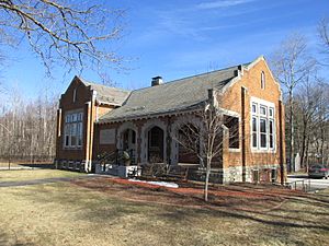
Aaron Cutler Memorial Library
|
|||
|
|||

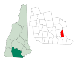
Location in Hillsborough County, New Hampshire
|
|||
| Country | United States | ||
| State | New Hampshire | ||
| County | Hillsborough | ||
| Incorporated | 1734 in Massachusetts, 1749 in New Hampshire | ||
| Government | |||
| • Type | Town Meeting (SB2) | ||
| Area | |||
| • Total | 15.31 sq mi (39.64 km2) | ||
| • Land | 14.92 sq mi (38.65 km2) | ||
| • Water | 0.38 sq mi (0.99 km2) 2.50% | ||
| Elevation | 127 ft (39 m) | ||
| Population
(2020)
|
|||
| • Total | 8,478 | ||
| • Density | 568/sq mi (219.3/km2) | ||
| Time zone | UTC−5 (Eastern) | ||
| • Summer (DST) | UTC−4 (Eastern) | ||
| ZIP code |
03052
|
||
| Area code(s) | 603 | ||
| FIPS code | 33-42260 | ||
| GNIS feature ID | 0873648 | ||
Litchfield is a town in Hillsborough County, New Hampshire, United States. It's a place where many people live and work. In 2020, about 8,478 people called Litchfield home.
Contents
History of Litchfield
Before European settlers arrived, the area was home to the Abenaki people. They were very good at fishing and farming. Over 30 ancient Native American sites have been found along the Merrimack River in Litchfield. Some artifacts found there are thousands of years old!
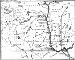
Most of Litchfield was once part of a much larger town called Dunstable. This big town was set up in the 1600s and stretched across the border between New Hampshire and Massachusetts. Many towns and cities in both states were later created from Dunstable.
The area that became Litchfield was first known as "Naticook." In 1656, William Brenton, who was a colonial governor of Rhode Island, was given land that included much of today's Litchfield. In 1729, the name was changed to "Brenton's Farm."
The town was officially made a part of Massachusetts on July 4, 1734. The first town meeting was held later that month to choose town leaders. In 1749, the land was given to a new group of settlers. They named it "Litchfield" after George Henry Lee, who was the Earl of Lichfield. Litchfield then became part of the Province of New Hampshire on June 5, 1749.
Litchfield doesn't have one big town center or main village. It used to be mostly farmland. However, starting in the 1970s, many people moved to Litchfield. This happened because it became a "bedroom community" or "exurb" for Greater Boston. This means people live in Litchfield but travel to Boston or nearby cities for work. The original town hall was on New Hampshire Route 3A. The current town hall is now in the middle of town, where Hillcrest Road and Albuquerque Avenue meet. There aren't many big shopping areas, but you can find some small businesses, convenience stores, and restaurants.
Geography of Litchfield
Litchfield covers about 39.6 square kilometers (about 15.3 square miles). Most of this area is land, with a small part (about 1.0 square kilometer or 0.4 square miles) being water. Water makes up about 2.5% of the town.
The highest point in Litchfield is the top of Rocky Hill. It's located in the Litchfield State Forest and is about 109 meters (357 feet) above sea level. Sea level is the average height of the ocean's surface.
Litchfield shares its borders with several other towns:
- To the north is Manchester.
- To the east is Londonderry.
- To the south is Hudson.
- To the west is Merrimack.
- To the southwest is Nashua.
The Merrimack River separates Litchfield from Merrimack and Nashua. There isn't a bridge directly connecting Litchfield and Merrimack. The closest bridges to cross the river are south, between Nashua and Hudson, or north, between Manchester and Bedford.
There are two islands in the Merrimack River that are within Litchfield's borders. These islands have been called "Minnewawa," "Nunnehaha," the Naticook Islands, and Reed's Islands. The northern island is fully in Litchfield. The southern island is split between Litchfield and Merrimack, forming the only land border between the two towns. However, both islands are owned by Merrimack.
Neighboring Towns
- Manchester (north)
- Londonderry (east)
- Hudson (south & southeast)
- Nashua (southwest)
- Merrimack (west)
Population Changes
| Historical population | |||
|---|---|---|---|
| Census | Pop. | %± | |
| 1790 | 357 | — | |
| 1800 | 372 | 4.2% | |
| 1810 | 382 | 2.7% | |
| 1820 | 465 | 21.7% | |
| 1830 | 505 | 8.6% | |
| 1840 | 481 | −4.8% | |
| 1850 | 447 | −7.1% | |
| 1860 | 352 | −21.3% | |
| 1870 | 345 | −2.0% | |
| 1880 | 291 | −15.7% | |
| 1890 | 252 | −13.4% | |
| 1900 | 243 | −3.6% | |
| 1910 | 255 | 4.9% | |
| 1920 | 213 | −16.5% | |
| 1930 | 286 | 34.3% | |
| 1940 | 341 | 19.2% | |
| 1950 | 427 | 25.2% | |
| 1960 | 721 | 68.9% | |
| 1970 | 1,420 | 96.9% | |
| 1980 | 4,150 | 192.3% | |
| 1990 | 5,516 | 32.9% | |
| 2000 | 7,360 | 33.4% | |
| 2010 | 8,271 | 12.4% | |
| 2020 | 8,478 | 2.5% | |
| U.S. Decennial Census | |||
Litchfield's population has grown a lot over the years, especially since the 1970s. In 2000, there were 7,360 people living in Litchfield. About 33.4% of the population was under 18 years old. The average age in Litchfield was 33 years old.
Education in Litchfield
Litchfield has three public schools that serve students from kindergarten through high school:
- Griffin Memorial School (Kindergarten to 4th grade)
- Litchfield Middle School (5th to 8th grade)
- Campbell High School (9th to 12th grade)
Transportation in Litchfield
Two main New Hampshire state highways pass through Litchfield:
- New Hampshire Route 3A runs close to the Merrimack River. It enters Litchfield from Hudson in the south and leaves into Manchester in the north. This road is also known as the Charles Bancroft Highway.
- New Hampshire Route 102 (Derry Road) crosses the very southeastern part of town. It enters Hudson at both its borders with Litchfield.
Even though Litchfield borders Merrimack to the west, you can't get there directly because there are no bridges across the Merrimack River in Litchfield. To get to Londonderry, which is east of Litchfield, people mainly use Hillcrest Road. This road is the main east-west route through the center of Litchfield.
Litchfield does not have any airports or train services within its town limits. The closest airport for commercial flights is Manchester–Boston Regional Airport. This airport is located near the border of Londonderry and Manchester, close to Litchfield's northern border. For train service, the closest option is the MBTA Commuter Rail system's Lowell Line. You can catch this train at the Charles A. Gallagher Transit Terminal in Lowell, Massachusetts. The nearest Amtrak stations are in Boston.
A long time ago, in the early 1900s, there was a trolley that ran through Litchfield. However, it was stopped many years ago and has fallen apart. You can still find a few small parts of it, like a section of the old rail trail and a broken-down trolley bridge in Parker Park.
Notable People
- Clifton Clagett (1762–1829), a US congressman
- Jack McQuesten (1836–1909), an Alaskan and Yukon pioneer and explorer
- Jennifer Simard (born 1970), an actress nominated for a Tony Award
See also
 In Spanish: Litchfield (Nuevo Hampshire) para niños
 | Charles R. Drew |
 | Benjamin Banneker |
 | Jane C. Wright |
 | Roger Arliner Young |


