Merrimack, New Hampshire facts for kids
Quick facts for kids
Merrimack, New Hampshire
|
||
|---|---|---|
|
Town
|
||
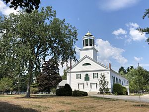
First Church of Merrimack
|
||
|
||
| Motto(s):
One Town...Four Villages
|
||
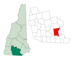
Location in Hillsborough County, New Hampshire
|
||
| Country | United States | |
| State | New Hampshire | |
| County | Hillsborough | |
| Settled | 1673 | |
| Incorporated | April 2, 1746 | |
| Villages | Merrimack Reeds Ferry South Merrimack Thorntons Ferry |
|
| Area | ||
| • Total | 33.4 sq mi (86.6 km2) | |
| • Land | 32.6 sq mi (84.4 km2) | |
| • Water | 0.8 sq mi (2.2 km2) 2.55% | |
| Elevation | 180 ft (50 m) | |
| Population
(2020)
|
||
| • Total | 26,632 | |
| • Density | 817/sq mi (315.6/km2) | |
| Time zone | UTC−5 (Eastern) | |
| • Summer (DST) | UTC−4 (Eastern) | |
| ZIP code |
03054
|
|
| Area code(s) | 603 | |
| FIPS code | 33-47540 | |
| GNIS feature ID | 0873663 | |
Merrimack is a town in Hillsborough County, New Hampshire, United States. It's a place where many people live and work. In 2020, about 26,632 people called Merrimack home.
The town is made up of four main areas, sometimes called villages. These are Merrimack Village, Thorntons Ferry, Reeds Ferry, and South Merrimack.
Contents
History of Merrimack
Early Settlers and Name Origin
The first people known to live in this area arrived after the last ice age. These were Native American tribes. The name Merrimack comes from a Native American word. It means "sturgeon," which is a type of large fish.
The Pennacook people named the Merrimack River after this fish. Many sturgeon used to live in the river. The Pennacooks spelled the name Monnomoke or Merramake. When the town officially became a town, it took the river's name. They spelled it "Merrymac" at first.
Becoming a Town
The land that is now Merrimack was first mentioned in records in 1662. A Native American leader named Passaconaway asked for land in this region. European settlers came to the area in the late 1600s. At that time, two different colonies, New Hampshire and Massachusetts, both claimed the land.
Merrimack was originally part of a larger land grant from 1673 called Dunstable. In 1734, Massachusetts organized the area as "Naticook." This included parts of what are now Litchfield and Merrimack.
In 1746, the border between Massachusetts and New Hampshire changed. The land that was part of Massachusetts became part of New Hampshire. The province then combined several areas into one large territory again.
Founding and Growth
On April 2, 1746, Governor Benning Wentworth signed a paper to make the land from Pennichuck Brook to the Souhegan River the "Town of Merrymac." Fewer than 50 families lived there at the time. Native American tribes like the Pawtucket, Nashaway, and Pennacook camped along the rivers. The Pennacooks were the largest group. Their chief, Passaconaway, led all the tribes in the Merrimack Valley.
On June 5, 1750, the town's official paper was approved. This added more land to the north, called "Souhegan East." This new part was north of the Souhegan River.
Important People and Changes
Matthew Thornton, who signed the Declaration of Independence, lived and is buried in Merrimack. You can still visit the Signer's House and Matthew Thornton Cemetery in town.
The first meetinghouse, where people gathered for church and town business, was built in the town's exact center. Over time, the town grew and changed. The church and government became separate. New churches and a new town hall were built in more convenient spots.
In the 1800s, the Boston and Maine Railroad built tracks through Merrimack. This helped the town grow. Later, cars became popular, and Merrimack changed from a farming area to a place where people lived and commuted to jobs in Boston or nearby New Hampshire cities.
Since 1970, Merrimack has been home to an Anheuser-Busch brewery. This is one of their smaller plants. You can take a tour there and see some of the famous Budweiser Clydesdales horses. In 1995, a school board decision in Merrimack caused a lot of discussion.
Geography of Merrimack
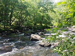
Merrimack covers about 33.4 square miles (86.6 square kilometers). Most of this is land, but about 2.55% is water. The highest point in Merrimack is a hill in the northwest. It is about 180 feet (512 meters) above sea level.
Neighboring Towns
Merrimack is next to several other towns:
- Bedford, New Hampshire (north)
- Manchester, New Hampshire (northeast)
- Litchfield, New Hampshire (east)
- Nashua, New Hampshire (south)
- Hollis, New Hampshire (southwest)
- Amherst, New Hampshire (west)
Merrimack's Villages
Merrimack is made up of different areas that used to be separate villages. Today, these areas have grown together. Their exact borders are not always clear because of new buildings and neighborhoods.
Thorntons Ferry
This area is near Naticook Lake and Continental Boulevard. It is named after Matthew Thornton, who signed the Declaration of Independence. He lived and is buried in Merrimack. Thorntons Ferry Elementary School is located here.
Reeds Ferry
This is the northern part of town. Reeds Ferry is centered around Bedford Road and Daniel Webster Highway. The area near Baboosic Lake might also be considered part of Reeds Ferry now. Reeds Ferry Elementary School is on Lyons Road.
South Merrimack
This area is usually the southwestern part of town. It is centered around Pennichuck Square on Route 101A and Continental Boulevard. The southeastern part of town, near Harris Pond, might also be included here.
Merrimack Village
This is the main center of town. It is located where the Public Library is, at the corner of Baboosic Lake Road and Daniel Webster Highway. Merrimack Village grew along the Souhegan River, which cuts through the town. James Mastricola Elementary School, James Mastricola Upper Elementary School, Merrimack High School, the library, and the town hall are all on land that James Mastricola once owned.
Population of Merrimack
| Historical population | |||
|---|---|---|---|
| Census | Pop. | %± | |
| 1790 | 819 | — | |
| 1800 | 926 | 13.1% | |
| 1810 | 1,048 | 13.2% | |
| 1820 | 1,162 | 10.9% | |
| 1830 | 1,191 | 2.5% | |
| 1840 | 1,113 | −6.5% | |
| 1850 | 1,250 | 12.3% | |
| 1860 | 1,119 | −10.5% | |
| 1870 | 1,066 | −4.7% | |
| 1880 | 1,042 | −2.3% | |
| 1890 | 951 | −8.7% | |
| 1900 | 1,234 | 29.8% | |
| 1910 | 1,039 | −15.8% | |
| 1920 | 1,022 | −1.6% | |
| 1930 | 1,084 | 6.1% | |
| 1940 | 1,253 | 15.6% | |
| 1950 | 1,908 | 52.3% | |
| 1960 | 2,989 | 56.7% | |
| 1970 | 8,595 | 187.6% | |
| 1980 | 15,406 | 79.2% | |
| 1990 | 22,156 | 43.8% | |
| 2000 | 25,119 | 13.4% | |
| 2010 | 25,494 | 1.5% | |
| 2020 | 26,632 | 4.5% | |
| U.S. Decennial Census | |||
In 2010, there were 25,494 people living in Merrimack. There were 9,503 households, which are groups of people living together. Most households (62.6%) were married couples. About 36.7% of households had children under 18.
The average age of people in Merrimack in 2010 was 40.7 years old. About 24.5% of the population was under 18.
Economy in Merrimack
Many businesses have their homes in Merrimack. These companies provide many jobs for people in the town and nearby areas.
Some of the largest employers in Merrimack include:
| Merrimack's largest employers (2019) | |||
|---|---|---|---|
| Business | What they do | Employees | Started in Merrimack |
| Fidelity Investments | Financial services (helping people manage money) | 6,000 | 1996 |
| Connections, Inc. | Selling computers and technology | 1,077 | 1998 |
| Merrimack Premium Outlets | Retail stores (shopping mall) | 900 | 2012 |
| BAE Systems | Defense systems (technology for defense) | 816 | 1988 |
| Merrimack School District | Education (schools) | 800 | – |
| Atrium Maquet Getinge Group | Making sterile medical products | 700 | 2013 |
| Anheuser-Busch, Inc. | Brewery and distribution | 531 | 1970 |
| Kollsman/Elbit Systems of America | Electro-optics (technology using light) | 500 | 1991 |
| Brookstone, Inc | Selling products through mail order and stores | 256 | |
| St. Gobain | Making special coated fabrics | 253 | 1984 |
The Merrimack Premium Outlets opened in 2012. It's a large shopping area with many stores. It covers about 560,000 square feet and is located off Exit 10 of the Everett Turnpike.
Education in Merrimack
The Merrimack School District manages six public schools in Merrimack. These schools are:
- Thorntons Ferry Elementary School
- Reeds Ferry Elementary School
- James Mastricola Elementary School
- James Mastricola Upper Elementary School
- Merrimack Middle School
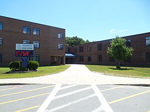
- Merrimack High School
Merrimack High School has won many state championships in sports. These include baseball, softball, football, soccer, track, cross-country, lacrosse, skiing, volleyball, and basketball.
The Academy for Science and Design was a special school that focused on science, math, engineering, and design. It started in Merrimack in 2007 but later moved to Nashua. Another school, the Gate City Charter School for the Arts, opened in 2014.
Merrimack is also home to the Thomas More College of Liberal Arts. This college is known for its strong liberal arts programs.
Annual Events
The Rock'N Ribfest used to be a popular yearly event in Merrimack. It was held from 2003 to 2018. The money raised helped many local charities. In 2019, the Merrimack Rotary Club took over the event and renamed it the Great American Ribfest and Food Truck Festival. This festival takes place on the Anheuser-Busch grounds. It features BBQ food, games and activities for kids, music, and other fun entertainment.
Notable People from Merrimack
Many interesting people have connections to Merrimack:
- Mickey Gasper (born 1995), a professional baseball player.
- Christy Karacas (born 1975), a creator and director of animated shows like Superjail! and Robotomy.
- Walter Kittredge (1834–1905), a musician from the time of the Civil War.
- David Lozeau, an artist and writer of children's books.
- Tim Schaller (born 1990), a former NHL hockey player.
- Forrest Sherman (1896–1951), an admiral in the United States Navy who was a very important leader.
- Matthew Thornton (1714–1803), one of the Founding Fathers who signed the United States Declaration of Independence.
See also
 In Spanish: Merrimack (Nuevo Hampshire) para niños
 | Georgia Louise Harris Brown |
 | Julian Abele |
 | Norma Merrick Sklarek |
 | William Sidney Pittman |


