Lupaca facts for kids
Quick facts for kids
Lupaca kingdom
|
|||||||||
|---|---|---|---|---|---|---|---|---|---|
| c. 1150–c. 1600 | |||||||||

|
|||||||||
| Capital | Cutimbo (1150-1463), Chucuito (1463-1600) |
||||||||
| Common languages | Aymara | ||||||||
| Government | Diarchy | ||||||||
| Historical era | Late Intermediate | ||||||||
|
• Established
|
c. 1150 | ||||||||
|
• Conquered by the Inca Empire under Pachacuti
|
c. 1463 | ||||||||
|
• Revolt crushed by Topa Inca Yupanqui
|
c. 1473 | ||||||||
|
• Disestablished
|
c. 1600 | ||||||||
|
|||||||||
The Lupaca people were an important group of the ancient Aymaras. They lived for many centuries near Lake Titicaca in Peru. Their lands might have also reached into Bolivia.
The Lupacas and other Aymara groups formed strong kingdoms. This happened after the Tiwanaku Empire fell apart around the 11th century. In the mid-1400s, the powerful Inca Empire conquered them. Later, in the 1530s, the Spanish Empire took control.
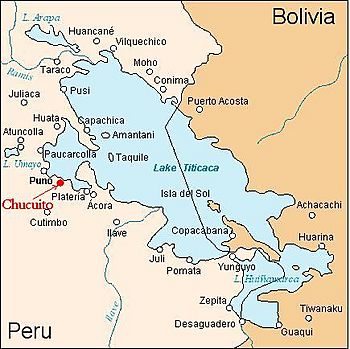
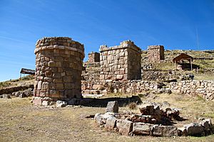
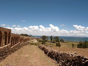
The first home of the Lupaca kings was probably Cutimbo. Today, this is an archaeological site. Later, when the Incas ruled, the capital of their province was Chucuito. This is still a village today, where you can find the ancient site of Inca Uyu.

Contents
History of the Lupaca Kingdom
The Lupaca people lived in seven main towns. All of these are still cities or villages in the Puno region of Peru today. These towns include Chucuito, Acora, Ilave, Juli, Pomata, Yunguyo and Zepita.
Life Under Inca Rule
The Inca emperor Pachacuti (who ruled from 1438 to 1471) brought the Lupaca into the growing Inca Empire. Later, during the rule of Topa Inca Yupanqui (1471-1493), the Lupaca rebelled. The Incas quickly stopped this revolt, along with a rebellion by their northern neighbors, the Colla.
In the 1500s, the Incas counted the people in the Chucuito area. They used a special knotted string record called a Quipu. This record was later explained to the Spanish. It showed that about 100,000 people lived there. Most of them were Aymara.
Arrival of the Spanish
The Lupaca did not have much contact with the Spanish until 1538. At that time, the Lupaca and Colla went to war with each other. The Colla asked the Spanish in Cusco for help. Hernando Pizarro led a Spanish army south. They defeated the Lupaca near the Desaguadero River, which flows from Lake Titicaca.
Even after this defeat, the Lupaca remained rich and powerful. A Spaniard named Garci Diez de San Miguel visited them in 1567. He wrote that the Lupaca seemed "extraordinarily wealthy." At that time, there were some Spanish priests and traders in the Lupaca kingdom. However, the Spanish had not yet taken over their lands completely. This was done through a system called encomienda. This system gave large estates and control over local people to Spaniards.
Like the Incas, the Lupaca people were divided into two main groups. Each group had its own leader. The "Alassa" or upper group was led by Qari. The "Massaa" or lower group was led by Kusi. These leaders controlled many people and much land.
The Vertical Archipelago: How the Lupaca Lived
The Lupaca lived on the Altiplano. This is a high, cold plateau with many mountains. Lake Titicaca is very high up, at about 3,812 metres (12,507 ft). It can even freeze every month of the year. Only a small part of the land in these highlands is good for farming.
Farming in the Highlands
Only a few crops can grow well in these cold conditions. These include potatoes, oca, olluco, and quinoa. Farmers used special methods like terracing and Waru Waru (raised beds) to help keep the crops warm.
The Lupaca's real wealth came from their herds of llamas and alpacas. These animals grazed on the high, barren lands, even up to the snowline at about 4,800 metres (15,700 ft).
Connecting with Other Lands
A smart way the Lupaca dealt with the cold highlands was by creating what is called the "vertical archipelago". This means they set up small communities in warmer, lower areas. Some were to the west, towards the Pacific Ocean. Others were to the east, towards the Amazon River basin.
The western communities were about 200 kilometres (120 mi) away. They were in desert valleys with irrigation. These areas provided important crops like maize (corn), cotton, and chili peppers for the Lupaca living on the Altiplano. The eastern communities provided coca and other tropical products.
Llama caravans were used to carry goods and messages between these distant communities. This system of controlling areas far apart was common for Andean kingdoms. It also shows that travel and trade were safe during that time.
What Happened to the Lupaca?
The Lupaca kingdom stopped appearing in Spanish records around the late 1500s. Its people slowly became part of the larger Aymara population. The Spanish took more and more control over the Lupaca and other highland kingdoms. They reduced the power of the traditional leaders.
The Spanish also forced many Aymara people to work in the silver mines of Potosí. They also made them move into new towns called "reductions." The Spanish took much of the Lupaca's land, especially the warmer farming areas of their "vertical archipelago." On top of all this, new diseases from Europe caused many people to die.
Archaeological Sites
- Inka Tunuwiri
- Inka Uyu
- Cutimbo
- Mayqu Amaya
- Mulluq'u
- Q'inq'u
See also
 In Spanish: Lupaca para niños
 | Roy Wilkins |
 | John Lewis |
 | Linda Carol Brown |


