Mackinac Island, Michigan facts for kids
Quick facts for kids
Mackinac Island, Michigan
|
||
|---|---|---|
| City of Mackinac Island | ||
|
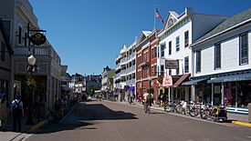
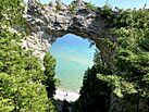
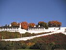
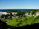
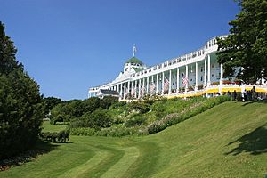
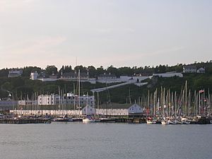
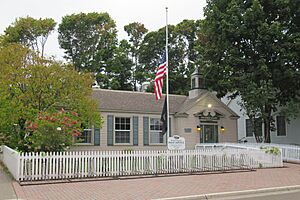
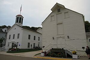
From left to right, top to bottom: Downtown Mackinac Island along M-185; Arch Rock; the famous Grand Hotel porch; Fort Mackinac; downtown Mackinac Island with the Mackinac Bridge in the background.
|
||
|
||
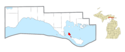
Location within Mackinac County
|
||
| Country | ||
| State | ||
| County | Mackinac | |
| Settled | 1671 | |
| Established | February 2, 1817 (borough) | |
| Incorporated | March 25, 1847 (village) March 20, 1900 (city) |
|
| Government | ||
| • Type | Mayor–council | |
| Area | ||
| • Total | 18.84 sq mi (48.80 km2) | |
| • Land | 4.35 sq mi (11.27 km2) | |
| • Water | 14.49 sq mi (37.53 km2) 76.91% | |
| Elevation | 594 ft (181 m) | |
| Population
(2020)
|
||
| • Total | 583 | |
| • Density | 134.02/sq mi (51.75/km2) | |
| Time zone | UTC-5 (EST) | |
| • Summer (DST) | UTC-4 (EDT) | |
| ZIP code(s) |
49757
|
|
| Area code(s) | 906 | |
| FIPS code | 26-50280 | |
| GNIS feature ID | 1620659 | |
Mackinac Island (pronounced MAK-ə-naw or MAK-ə-nə) is a special city in Mackinac County, Michigan, in the United States. In 2020, about 583 people lived there.
This city is famous for its unique rule: no cars are allowed! People get around by walking, biking, or using horse-drawn carriages. This rule started in 1895 to protect the island's horses and people. Only emergency vehicles and snowmobiles in winter can use motors.
Mackinac Island was once a very important place for fur trading in the 1700s. Many of its early residents spoke French. After the War of 1812, more English-speaking people moved there. The city includes all of Mackinac Island and also Round Island, which has no people living on it. Most of the city is part of a state park and a national forest.
The island is also home to the famous Grand Hotel, which was built in the late 1800s. It became a popular summer spot for visitors. The movie Somewhere in Time was filmed here in 1980, and for that, they made a special exception to allow cars for the movie crew.
Contents
History of Mackinac Island
Early Native American History
Long ago, a small tribe called Mi-shi-ne-macki naw-go lived on Mackinac Island. They were connected to the larger Ottawa tribe from Ottawa Island. One winter, almost all of the Mi-shi-ne-macki naw-go were wiped out by the Seneca tribe. Only two people survived by hiding in caves.
To remember this tribe, the Ottawa and Chippewa (Ojibwe) people named the island Mi-shi-ne-macki-nong. By the 1700s, it was known as Michilimackinac, which means "Great Turtle."
French and British Influence
French traders and missionaries visited the island as early as 1654. They were involved in the very profitable fur trade. The French set up trading posts all around the Great Lakes, including on Michilimackinac.
After France lost a war in 1763, the British took over the area. They built a fort there. During the American Revolutionary War, the British left the fort.
Becoming Part of the United States
By 1782, Americans set up a military base on the island. In 1796, after a treaty with Great Britain, the island officially became part of the United States. It was then part of the Northwest Territory.
In the early 1800s, about 250 people lived on Mackinac Island. Most of them were of French-Canadian and Métis (mixed French and Native American) background. French was the main language. The fur trade was very important. In the summer, the population could grow to 4,000 people as traders and Native Americans came to the island.
After the War of 1812, the U.S. stopped British fur traders from working in American lands. This changed how Canadians and Native Americans traded. In 1831, a famous French writer named Alexis de Tocqueville visited the island. He wrote about its unique mix of French and Native American cultures.
Establishing the City
In 1817, the people of Mackinac Island asked to form a local government. The Michigan Territory created the Township of Michilimackinac. Then, on April 6, 1817, the Borough of Michilimackinac was formed. A "warden," like a mayor, was chosen. The American Fur Company was a big business on the island's Main Street.
In 1818, Mackinac Island became the county seat for Michilimackinac County. The borough later became a village. A long-lasting wharf was built, which was used for coal later on.
In 1847, the island officially became the Village of Mackinac.
Mackinac Island as a Resort
In the late 1800s, Mackinac Island became a popular summer vacation spot. People from big cities like Chicago and Detroit came to visit. The Grand Hotel was built as a fancy place for guests. Just like in the fur trade days, summer is still the busiest time on the island, full of tourists and fun.
In 1882, the county seat was moved from Mackinac Island to St. Ignace. This happened because more people had moved to the western part of the county.
The Car Ban
In 1895, personal cars were banned on the island. This was to protect the health of the horses and the people. When the first cars arrived, they scared the horses. So, a group called Mackinac Island Carriage Tours asked the village to ban these "dangerous horseless carriages." This ban is still in place today. Only city emergency vehicles (like ambulances and fire trucks) and snowmobiles in winter are allowed to use motors.
In 1899, the Michigan Legislature created the City of Mackinac Island. It combined the Township of Holmes and the Village of Mackinac. Round Island was also included in the city limits.
Today, 82% of Mackinac Island is part of the Mackinac Island State Park. This park is managed by the Mackinac Island State Park Commission. The city and the park work together on important issues, like the car ban.
Geography of Mackinac Island
Mackinac Island city covers about 18.84 square miles (48.80 square kilometers). Most of this area is water (14.49 sq mi or 37.53 sq km). The land area is about 4.35 square miles (11.27 square kilometers).
The city is located on Mackinac Island itself. It also includes all of nearby Round Island. Round Island is south of Mackinac Island and has no people living on it. The United States Forest Service owns and manages Round Island as a wilderness area.
Even though the city limits cover all of Mackinac Island, the State of Michigan owns 82% of the land. This land is managed by the Mackinac Island State Park Commission. The city government only has direct control over 18% of the island.
You can reach Mackinac Island by taking ferries across Lake Huron. Mackinac Island is one of only seven cities in Michigan that are made up entirely of islands.
The island has a special highway called M-185. This state highway is unique because cars are banned on it! Only people walking, biking, or using horse-drawn vehicles can use it. In downtown Mackinac Island, M-185 is called "Main Street." Elsewhere, it's known as "Lake Shore Road."
Neighborhoods on Mackinac Island
- Harrisonville: This neighborhood is also called "the village." It's located just past the Grand Hotel and up a hill.
- Hubbard's Annex: This is a summer cottage area and historic district. It was planned in 1882 and includes a public park called the Commons.
Population of Mackinac Island
| Historical population | |||
|---|---|---|---|
| Census | Pop. | %± | |
| 1880 | 720 | — | |
| 1890 | 750 | 4.2% | |
| 1900 | 665 | −11.3% | |
| 1910 | 714 | 7.4% | |
| 1920 | 493 | −31.0% | |
| 1930 | 566 | 14.8% | |
| 1940 | 508 | −10.2% | |
| 1950 | 572 | 12.6% | |
| 1960 | 942 | 64.7% | |
| 1970 | 517 | −45.1% | |
| 1980 | 479 | −7.4% | |
| 1990 | 469 | −2.1% | |
| 2000 | 523 | 11.5% | |
| 2010 | 492 | −5.9% | |
| 2020 | 583 | 18.5% | |
| U.S. Decennial Census | |||
Population in 2020
In 2020, there were 583 people living in Mackinac Island. There were 220 households and 120 families. The population density was about 134 people per square mile (51.75 people per square kilometer).
Population in 2010
In 2010, the city had 492 people. There were 240 households. About 73.8% of the people were White, 18.1% were Native American, and 1.2% were African American. About 2.2% of the population was Hispanic or Latino.
The average age in the city was 42.5 years old. About 17.7% of residents were under 18.
Arts and Culture on Mackinac Island
Mackinac Island is famous for its many fudge shops. Making fudge is a big tradition on the island. They make it the old-fashioned way, on cold marble slabs.
The island is also the finish line for two big annual boat races:
- The Chicago Yacht Club Race to Mackinac, from Chicago.
- The Port Huron to Mackinac Boat Race, from Port Huron.
Historic Sites and Buildings
Many places on Mackinac Island are listed on the National Register of Historic Places. This means they are important historical sites. Some of these include:
- Fort Mackinac
- Grand Hotel
- Indian Dormitory
- Mission Church
- Mission House
- Round Island Light
- Robert Stuart House
- Michigan Governor's Summer Residence
Education on Mackinac Island
The island has its own school district called the Mackinac Island School District. It operates one school, the Mackinac Island Public School. This school teaches students from pre-kindergarten all the way through 12th grade.
See also
 In Spanish: Mackinac Island (Míchigan) para niños
 | Dorothy Vaughan |
 | Charles Henry Turner |
 | Hildrus Poindexter |
 | Henry Cecil McBay |


