Malad City, Idaho facts for kids
Quick facts for kids
Malad City, Idaho
|
|
|---|---|

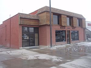
City Hall in March 2010
|
|
| Motto(s):
Where Idaho Begins
|
|

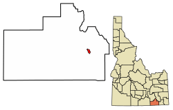
Location of Malad City in Oneida County, Idaho.
|
|
| Country | |
| State | |
| County | Oneida |
| Founded | 1864 |
| Area | |
| • Total | 1.64 sq mi (4.25 km2) |
| • Land | 1.64 sq mi (4.25 km2) |
| • Water | 0.00 sq mi (0.00 km2) |
| Elevation | 4,551 ft (1,387 m) |
| Population
(2020)
|
|
| • Total | 2,299 |
| • Density | 1,302.25/sq mi (502.67/km2) |
| Time zone | UTC−7 (Mountain (MST)) |
| • Summer (DST) | UTC−6 (MDT) |
| ZIP code |
83252
|
| Area code(s) | 208, 986 |
| FIPS code | 16-50140 |
| GNIS feature ID | 2410911 |
Malad City is a small city in Idaho, United States. It is the main city and the county seat of Oneida County, Idaho. In 2020, about 2,299 people lived there.
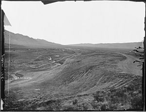
The city gets its name from the nearby Malad River. "Malad" is a French word meaning "sickly" or "bad." Malad City is located next to Interstate 15. It sits on the east side of the Malad Valley. The city is about 13 miles (21 km) from the Utah/Idaho border.
Contents
History of Malad City

Malad City was started in 1864. It is one of the oldest towns in the state of Idaho. The city got its name from a Scottish-Canadian trapper named Donald Mackenzie. He traveled through the valley between 1818 and 1821 with other trappers.
Some of his men got sick while camping there. Mackenzie thought the bad water from the main stream made them ill. So, he named the stream "Malade," which means "sick" or "bad" in French. Later, another group of trappers led by Jim Bridger found out the water was not the problem. The men had likely eaten beaver that had eaten poisonous plants. Native tribes knew about this danger. They would boil their food to make it safe.
Welsh Heritage
Malad began as a settlement for Welsh members of LDS Church. These settlers brought their Welsh traditions with them. Some early town meetings even had notes taken in both English and Welsh.
The city is very proud of its Welsh background. Malad claims to have more people of Welsh descent per person than anywhere outside of Wales. For many years, Malad celebrated its Welsh heritage. They held an annual "eisteddfod," which is a music and poetry contest. This event was like the famous contests held in Wales for over 900 years.
The eisteddfod was an all-day event. People came from all over southeastern Idaho to attend. It featured Welsh music, songs, and storytelling. This tradition continued until 1916. In 2004, the annual Malad Valley Welsh Festival was started. This festival aimed to bring back the old eisteddfod tradition.
Early Explorers and Settlers
In the summer of 1843, John C. Fremont and his group of 39 men passed by where Malad City is today.
LDS prophet Brigham Young visited the Malad Valley in 1855. In 1856, he asked members of the Church of Jesus Christ of Latter-day Saints from Utah to move to the area. A group of 15 families, led by Ezra Barnard, traveled to the Malad Valley. They started a community called Fort Stuart. The next year, in 1857, Fort Stuart was renamed Malad City. A U.S. post office opened in 1865.
Growth and Challenges
By 1886, Malad City was the fastest-growing village in eastern Idaho. The city became an important trading center. It was a key stop between Salt Lake City and Butte, Montana. In 1906, the railroad came to Malad City. This made travel to Salt Lake City much faster, taking only four hours by train. Because of the railroad, the city's population doubled over the next 15 years.
On June 19, 1910, Malad had a flood. An earthen dam called Deep Creek Dam, located northeast of the city, broke.
On March 27, 1975, a 6.1 magnitude earthquake shook the Pocatello Valley. This area is near the Idaho-Utah border. The earthquake's center was only 15 miles (24 km) southwest of Malad City. Malad City was hit the hardest by the quake. Almost two-thirds of its homes and businesses were damaged.
In late 2003, a widespread influenza outbreak happened. Malad was one of the hardest-hit communities in the nation. So many people got sick in early December 2003 that the city almost shut down. The entire school district in Malad closed for three days. This was done to stop students from spreading the illness. About one-third of the students became sick. Church services and Christmas events were also canceled.
Local Businesses and Economy
Malad City once had the oldest department store in Idaho. Evans Co-op opened in 1865. It was part of a movement by Latter-day Saints to support local businesses. Even though Evans is no longer open, the historic building is still there. The city is working to fix up the building.
Malad City also has the longest-running weekly newspaper in Idaho. It is called The Idaho Enterprise. Its first issue was published on June 6, 1879.
Because it is close to Utah, which does not have a state lottery, Malad has become a major place for Idaho Lottery sales. A store in Malad, Top Stop Gasoline and Convenience, is responsible for 3 percent of Idaho's lottery sales. The town as a whole makes up over 19 percent of the state's sales. Only Boise, Idaho's largest city, has higher lottery sales. Over the 22-year history of the Idaho Lottery, it is thought that people from Utah have provided $54.1 million in lottery profits. Idaho uses these profits for its own building projects and school funding.
Geography
Malad City covers about 1.66 square miles (4.30 km2) of land. It is located on the eastern edge of the Malad Valley. The city's elevation is about 4,540 feet (1,384 m) above sea level.
The Wasatch fault line runs along the east side of Malad Valley. There are also several active fault lines to the south and west of the area.
Climate
Malad City has a humid continental climate. This means it has warm summers.
| Climate data for Malad City, Idaho, 1991–2020 normals, extremes 1973–present | |||||||||||||
|---|---|---|---|---|---|---|---|---|---|---|---|---|---|
| Month | Jan | Feb | Mar | Apr | May | Jun | Jul | Aug | Sep | Oct | Nov | Dec | Year |
| Record high °F (°C) | 59 (15) |
64 (18) |
78 (26) |
85 (29) |
96 (36) |
102 (39) |
105 (41) |
104 (40) |
100 (38) |
90 (32) |
73 (23) |
63 (17) |
105 (41) |
| Mean maximum °F (°C) | 44.7 (7.1) |
50.8 (10.4) |
66.5 (19.2) |
77.1 (25.1) |
85.0 (29.4) |
93.1 (33.9) |
99.3 (37.4) |
97.1 (36.2) |
91.5 (33.1) |
79.9 (26.6) |
61.4 (16.3) |
48.6 (9.2) |
99.6 (37.6) |
| Mean daily maximum °F (°C) | 32.7 (0.4) |
38.4 (3.6) |
50.5 (10.3) |
59.5 (15.3) |
69.8 (21.0) |
79.7 (26.5) |
90.6 (32.6) |
88.4 (31.3) |
78.4 (25.8) |
62.7 (17.1) |
46.9 (8.3) |
33.9 (1.1) |
61.0 (16.1) |
| Daily mean °F (°C) | 23.6 (−4.7) |
28.4 (−2.0) |
38.5 (3.6) |
46.0 (7.8) |
54.6 (12.6) |
62.6 (17.0) |
71.0 (21.7) |
69.4 (20.8) |
59.9 (15.5) |
47.5 (8.6) |
35.1 (1.7) |
24.8 (−4.0) |
46.8 (8.2) |
| Mean daily minimum °F (°C) | 14.6 (−9.7) |
18.4 (−7.6) |
26.5 (−3.1) |
32.4 (0.2) |
39.4 (4.1) |
45.5 (7.5) |
51.3 (10.7) |
50.4 (10.2) |
41.4 (5.2) |
32.3 (0.2) |
23.4 (−4.8) |
15.7 (−9.1) |
32.6 (0.3) |
| Mean minimum °F (°C) | −4.5 (−20.3) |
0.4 (−17.6) |
11.0 (−11.7) |
18.9 (−7.3) |
25.7 (−3.5) |
32.9 (0.5) |
40.9 (4.9) |
39.9 (4.4) |
28.5 (−1.9) |
18.9 (−7.3) |
7.5 (−13.6) |
−2.7 (−19.3) |
−8.6 (−22.6) |
| Record low °F (°C) | −33 (−36) |
−35 (−37) |
−10 (−23) |
7 (−14) |
17 (−8) |
27 (−3) |
32 (0) |
26 (−3) |
18 (−8) |
3 (−16) |
−18 (−28) |
−32 (−36) |
−35 (−37) |
| Average precipitation inches (mm) | 1.53 (39) |
1.25 (32) |
0.99 (25) |
1.24 (31) |
1.84 (47) |
0.73 (19) |
0.60 (15) |
0.70 (18) |
1.23 (31) |
1.15 (29) |
0.73 (19) |
1.11 (28) |
13.10 (333) |
| Average snowfall inches (cm) | 10.8 (27) |
5.7 (14) |
3.4 (8.6) |
0.9 (2.3) |
0.1 (0.25) |
0.0 (0.0) |
0.0 (0.0) |
0.0 (0.0) |
0.0 (0.0) |
0.3 (0.76) |
4.1 (10) |
8.7 (22) |
34.0 (86) |
| Average precipitation days (≥ 0.01 in) | 7.7 | 7.0 | 5.6 | 6.5 | 7.6 | 4.6 | 2.9 | 3.4 | 4.3 | 4.4 | 4.7 | 6.5 | 65.2 |
| Average snowy days (≥ 0.1 in) | 6.4 | 4.0 | 2.0 | 0.6 | 0.1 | 0.0 | 0.0 | 0.0 | 0.0 | 0.3 | 2.7 | 5.1 | 21.2 |
| Source 1: NOAA (snow/snow days 1981–2010) | |||||||||||||
| Source 2: National Weather Service | |||||||||||||
Population Information
| Historical population | |||
|---|---|---|---|
| Census | Pop. | %± | |
| 1880 | 759 | — | |
| 1900 | 1,050 | — | |
| 1910 | 1,303 | 24.1% | |
| 1920 | 2,598 | 99.4% | |
| 1930 | 2,535 | −2.4% | |
| 1940 | 2,731 | 7.7% | |
| 1950 | 2,715 | −0.6% | |
| 1960 | 2,274 | −16.2% | |
| 1970 | 1,848 | −18.7% | |
| 1980 | 1,915 | 3.6% | |
| 1990 | 1,946 | 1.6% | |
| 2000 | 2,158 | 10.9% | |
| 2010 | 2,095 | −2.9% | |
| 2020 | 2,299 | 9.7% | |
| U.S. Decennial Census | |||
Recent Population Data
In 2024, the city's population was mostly White (98.11%). There were also smaller groups of Native American (0.86%) and other races. About 2,239 people lived in Oneida County. There were 868 households, with 556 families living in the county.
2010 Census Details
In 2010, Malad City had 2,095 people living there. There were 786 households and 552 families. The city had about 1,262 people per square mile (487 per km2). Most of the people were White (96.5%). About 2.9% of the population was Hispanic or Latino.
The average age in the city was 38.2 years old. About 29.1% of residents were under 18 years old. Also, 17.9% were 65 years or older. The population was almost evenly split between males (49.4%) and females (50.6%).
Arts and Culture
Yearly Events
- Malad Welsh Festival: This festival celebrates the city's strong Welsh heritage with music, stories, and traditions.
Museums and Interesting Places
The Oneida County Pioneer Museum is a great place to visit. The building was built in 1914. It was first used as a drug store and other businesses. In 1992, it became home to the museum. You can still see the original safe and the old pressed-tin ceiling inside.
Historic Sites to Explore
Several sites in Malad City are listed on the National Register of Historic Places. These places are important for their history and architecture.
- United Presbyterian Church
- D.L. Evans Sr. Bungalow
- Jedd Jones House
- Co-Op Block and J. N. Ireland Bank
- Second Ward Tabernacle
Education
Malad City is part of the PK-12 Oneida County School District 351. This district serves students from pre-kindergarten through 12th grade. Malad's public schools include:
- Malad Elementary School
- Malad Middle School
- Malad High School
Infrastructure
Highways
- Interstate 15: A major highway that runs through the area.
- Idaho State Highway 38: Another important road for local travel.
Healthcare
Malad City is served by Nell J. Redfield Memorial Hospital. This hospital has been providing healthcare to the community since 1925.
Notable People
Many interesting people have connections to Malad City:
- LaDell Andersen - A famous college and professional basketball coach.
- John V. Evans – He was a mayor, an Idaho State Senator, and a Governor of Idaho. He was born in Malad.
- Mabel Jones Gabbott – A writer and poet who wrote hymns for the LDS hymn book. She was born in Malad.
- Ralph R. Harding – He served as a State and U.S. Representative. He was born in Malad.
- William Marion Jardine – He was the U.S. Secretary of Agriculture and an ambassador to Egypt.
- Sonia Johnson – A well-known writer and activist.
- Olive Davis Osmond – The mother of the famous musical family, the Osmonds.
- William J. Rutter – A biochemist who helped start Chiron Corporation.
- Darwin Thomas – A Justice on the Idaho Supreme Court.
- Jim Williams – A basketball coach for Colorado State University.
See also
 In Spanish: Malad City para niños
 | Selma Burke |
 | Pauline Powell Burns |
 | Frederick J. Brown |
 | Robert Blackburn |


