
Mesilla, New Mexico facts for kids
Quick facts for kids
Mesilla
|
|
|---|---|

Basilica of San Albino, on the Mesilla plaza
|
|

Location within Doña Ana County and New Mexico
|
|

Mesilla
Location in the United States
|
|
| Country | United States |
| State | New Mexico |
| County | Doña Ana |
| Area | |
| • Total | 5.68 sq mi (14.71 km2) |
| • Land | 5.68 sq mi (14.71 km2) |
| • Water | 0.00 sq mi (0.00 km2) |
| Elevation | 3,881 ft (1,183 m) |
| Population
(2020)
|
|
| • Total | 1,797 |
| • Density | 316.43/sq mi (122.18/km2) |
| Time zone | UTC-7 (Mountain (MST)) |
| • Summer (DST) | UTC-6 (MDT) |
| ZIP code |
88046
|
| Area code(s) | 575 |
| FIPS code | 35-48060 |
| GNIS feature ID | 2412988 |
Mesilla is a historic town in Doña Ana County, New Mexico, United States. It is also known as La Mesilla or Old Mesilla. In 2020, about 1,797 people lived there. Mesilla is part of the larger Las Cruces area.
During the Civil War, Mesilla was briefly the capital of the Confederate Territory of Arizona. The town's main square, called the Mesilla Plaza, is a very important historical site. It is recognized as a National Historic Landmark.
Contents
History of Mesilla


Early Settlement and Border Changes
The first people to settle permanently in Mesilla arrived in the 1840s. These 116 settlers came from Chihuahua, led by Pablo Melendres.
Mesilla became an official village in 1848. This happened after the Treaty of Guadalupe Hidalgo. This treaty moved the border between the United States and Mexico south. Some people who were unhappy about being in the United States moved south of the new border and settled in Mesilla.
By 1850, Mesilla was a growing community. However, the people living there faced constant attacks from the Apache tribe. To protect its citizens, the United States built Fort Fillmore in 1851. This fort was located just north of Mesilla.
The Gadsden Purchase
Both the United States and Mexico claimed the land around Mesilla. This area became known as "No Man's Land." This border problem was solved in 1853 by the Gadsden Purchase. With this agreement, Mesilla and the southern parts of New Mexico and Arizona officially became part of the United States.
Mesilla During the Civil War
During the American Civil War, two battles were fought in or near Mesilla. From 1861 to 1862, Mesilla served as the capital of the Confederate Territory of Arizona. It was a very important city for the whole region.
Later, soldiers from the California Column took back Mesilla. It then became the main military base for the District of Arizona until 1864.
The Wild West Era
In the "Wild West" days, Mesilla was famous for its lively cantinas (saloons) and fun festivals. Famous figures like Billy the Kid, Pat Garrett, and Pancho Villa visited the area.
Mesilla was also a major crossroads. Two important routes, the Butterfield Stagecoach and the Camino Real de Tierra Adentro, passed through the village. Until 1881, Mesilla was the most important city in the region. With about 2,000 residents, it was the largest city between San Antonio and San Diego at that time.
Political Events and the Railroad
In 1871, a political disagreement led to a riot in Mesilla. Supporters of two different candidates for Congress clashed. Nine men died, and nearly 50 were hurt. This was the worst political riot in New Mexico's history. Many people left Mesilla after this event.
In 1881, the Santa Fe Railway planned to build tracks through the area. Mesilla seemed like the natural choice for the railroad to pass through. However, the people of Mesilla asked for too much money for the land. A landowner in nearby Las Cruces, which was a much smaller village, offered land for free.
Because of this, the railroad went through Las Cruces instead. Mesilla has not grown much since then. Las Cruces, however, has become a large city with an estimated 111,000 people by 2020. It is now the second-largest city in New Mexico.
Modern Landmarks
The La Mesilla Historic District, which includes Mesilla Plaza, was named a National Historic Landmark in 1961.
The Fountain Theatre has been open since the early 1900s, except for a 12-year break.
In 2008, the Roman Catholic church of San Albino was given the special title of minor basilica by the Holy See.
The gazebo in the center of the plaza was taken down and rebuilt. It had hidden problems that made it unsafe. The old gazebo was removed in October 2013, and the new one was finished in May 2014, just in time for the annual "Cinco de Mayo" celebration.
Geography
Mesilla is located in the middle of Doña Ana County. The city of Las Cruces borders it to the northeast. The town covers an area of about 17.4 square kilometers (6.7 square miles), all of which is land. The Rio Grande river flows through the western part of Mesilla.
Population and People
| Historical population | |||
|---|---|---|---|
| Census | Pop. | %± | |
| 1950 | 1,264 | — | |
| 1960 | 1,264 | 0.0% | |
| 1970 | 1,713 | 35.5% | |
| 1980 | 2,029 | 18.4% | |
| 1990 | 1,975 | −2.7% | |
| 2000 | 2,180 | 10.4% | |
| 2010 | 2,196 | 0.7% | |
| 2020 | 1,797 | −18.2% | |
| U.S. Decennial Census | |||

In 2000, Mesilla had 2,180 people living in 892 households. About 26% of these households had children under 18. Most households (54%) were married couples. The average household had 2.4 people.
The population was spread out by age:
- 22% were under 18 years old.
- 8% were between 18 and 24.
- 23% were between 25 and 44.
- 29% were between 45 and 64.
- 17% were 65 years or older.
The average age in Mesilla was 43 years. About 52.2% of the population identified as Hispanic or Latino.
The average income for a household in Mesilla was $42,275. For families, the average income was $51,181. About 9% of the population lived below the poverty line.
Education
The local schools in Mesilla are part of the Las Cruces Public Schools district. This district operates Mesilla Elementary School and Zia Middle School.
Images for kids
-
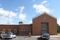
Mesilla Town Hall

See also
 In Spanish: Mesilla (Nuevo México) para niños
