Moel Cynghorion facts for kids
Quick facts for kids Moel Cynghorion |
|
|---|---|

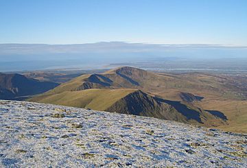
Moel Cynghorion with Moel Eilio behind from Crib y Ddysgl.
|
|
| Highest point | |
| Elevation | 674 m (2,211 ft) |
| Prominence | 176 m (577 ft) |
| Parent peak | Snowdon |
| Listing | Marilyn, Hewitt, Nuttall |
| Naming | |
| English translation | (bare/treeless) hill of counsels |
| Language of name | Welsh |
| Geography | |
| Location | Gwynedd, Wales |
| Parent range | Snowdonia |
| OS grid | SH586563 |
| Topo map | OS Landranger 115 |
Moel Cynghorion is a mountain in Snowdonia, North Wales. Its name means "the Hill of the Councillors" in Welsh. This mountain is located about two miles north-west of Snowdon, which is the highest mountain in Wales.
Moel Cynghorion is part of a popular walking route called the Moel Eilio Horseshoe. The very top of the mountain is a wide, flat area. You'll find a pile of stones marking the highest point.
Exploring Moel Cynghorion
The southern side of Moel Cynghorion has gentle slopes. This makes it easier to walk up from that direction. However, the northern side is very steep and rocky.
Amazing Views from the Top
When you reach the summit, you get fantastic close-up views. You can see Clogwyn Du'r Arddu, a famous climbing cliff. You also get a great look at Yr Wyddfa, the highest peak.
On a clear day, the views stretch even further. You might see Holyhead in Anglesey. Closer by, you can spot towns and villages in Gwynedd. These include Caernarfon, Llanrug, and Llanberis. If the weather is super clear, you might even see the Wicklow Mountains in Ireland. They are about 80 miles away across the Irish Sea!
What Kind of Mountain Is It?
Moel Cynghorion is listed as a few different types of hills. It's a Marilyn, which means it has a certain height and a drop on all sides. It's also a Hewitt and a Nuttall. These are all ways that hikers categorize mountains based on their height and prominence.
 | John T. Biggers |
 | Thomas Blackshear |
 | Mark Bradford |
 | Beverly Buchanan |

