Chimborazo facts for kids
Quick facts for kids Chimborazo |
|
|---|---|
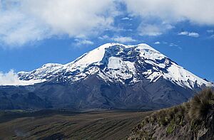
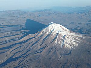
The summit of Chimborazo, the point on the Earth's surface that is farthest from the Earth's center
|
|
| Highest point | |
| Elevation | 6,263.47 m (20,549.4 ft) |
| Prominence | 4,118 m (13,510 ft) Ranked 18th |
| Listing | Country high point Ultra |
| Geography | |
| Country | Ecuador |
| Province | Chimborazo |
| Parent range | Andes, Cordillera Occidental |
| Topo map | IGM, CT-ÑIV-C1 |
| Geology | |
| Age of rock | Paleogene |
| Mountain type | Stratovolcano |
| Last eruption | 550 AD ± 150 years |
| Climbing | |
| Easiest route | Glacier/snow climb PD |
Chimborazo is a huge stratovolcano in Ecuador, located in the Andes mountain range. Its last known eruption happened a very long time ago, around the year 550 AD. Even though it's not the tallest mountain in the world when measured from sea level, Chimborazo has a special claim to fame. Its top is the farthest point on Earth's surface from the Earth's center! This is because of where it sits along the planet's equatorial bulge.
Chimborazo stands at 6,263 meters (20,548 feet) above sea level. This is much lower than Mount Everest, which is 8,849 meters (29,031 feet) tall. Still, Chimborazo is the highest mountain in Ecuador. It's also a popular spot for mountaineering, offering exciting challenges for climbers.
Contents
What's in a Name? The Story of Chimborazo
The name Chimborazo has several interesting possible origins. In many Quechua dialects, "chimba" means "on the other side," like "on the other side of the river." The word "razu" means "ice" or "snow." So, some local speakers believe Chimborazo comes from "chimbarazu," meaning "the snow on the other side."
Another idea is that the name combines "Schingbu" (meaning "Women" in Cayapa) and "Razo" (meaning "Ice/Snow" in Colorado/Quichua). This would mean "Women of Ice." Some also think "Chimbo" comes from the Shuar word for "Throne of Master/God," making it "Icethrone of God."
Locals also used to call the mountain Urcurazu. In Quichua, "Urcu" means "Mountain," so this name meant "Mountain of Ice." In local traditions, Chimborazo is seen as Taita (Father). Nearby Tungurahua is Mama (Mother), and Pichincha is Guagua (Child). So, they are known as Taita Chimborazo, Mama Tungurahua, and Guagua Pichincha.
Exploring Chimborazo's Geography
Where is Chimborazo Located?
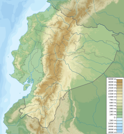
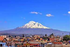
Chimborazo is in the Chimborazo Province of Ecuador. It is about 150 kilometers (93 miles) south-southwest of the city of Quito. A nearby inactive volcano, Carihuairazo, stands at 5,018 meters (16,463 feet). Chimborazo's peak rises about 2,500 meters (8,200 feet) above the surrounding land. Its base is about 20 kilometers (12 miles) wide.
On clear days, you can see Chimborazo's summit from Guayaquil, a coastal city almost 140 kilometers (87 miles) away. The closest cities are Riobamba, Ambato, and Guaranda. Chimborazo is part of the Reserva de Producción Faunistica Chimborazo. This protected area helps save the homes of native Andes animals like vicuña, llama, and alpaca.
Chimborazo is located in a region known as "the Avenue of Volcanoes." It has many microclimates, from dry deserts to humid mountains.
Chimborazo's Glaciers and Water
The very top of Chimborazo is covered in thick glaciers. Some parts of these glaciers reach down to 4,600 meters (15,090 feet). These glaciers are a vital source of water for people living in the Bolivar and Chimborazo provinces.
Over the last few decades, Chimborazo's glaciers have been getting smaller. Scientists believe this is mainly due to climate change. Ash from recent eruptions of the nearby Tungurahua volcano and the El Niño weather pattern also play a role.
In the past, local people called Hieleros (ice sellers) would harvest ice from Chimborazo's glaciers. They would sell this ice in markets in Guaranda and Riobamba. Long ago, they even transported ice to coastal towns for cooling.
How High is Chimborazo?
Chimborazo is 6,263 meters (20,548 feet) tall. This makes it the highest mountain in Ecuador. It is also the tallest peak in the Andes mountains north of Peru. No other mountain further north in the Americas is as high as Chimborazo.
The Farthest Point from Earth's Center
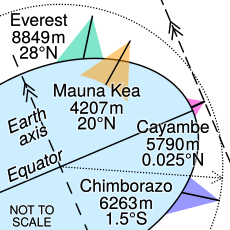
While Mount Everest is taller when measured from sea level, Chimborazo's summit is special. It is the point on Earth's surface that is farthest from the very center of our planet. Huascarán in Peru is a very close second.
Our Earth is not a perfect sphere; it's shaped more like a slightly flattened ball, wider around the Equator. This shape is called an oblate spheroid. Chimborazo is located very close to the Equator. Because of this "equatorial bulge," its summit is further from the Earth's center than Everest's. Everest is much farther north, where the Earth is not as wide.
Even though Chimborazo is 2,585 meters (8,481 feet) lower than Everest above sea level, it is 6,384.4 kilometers (3,967.1 miles) from the Earth's center. This is 2.1 kilometers (1.3 miles) farther than Everest's summit.
Chimborazo's Volcanic Nature
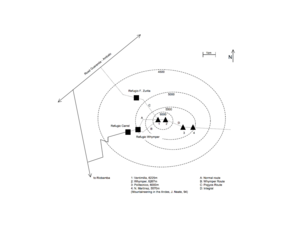
Chimborazo is an inactive volcano covered in ice. It's actually a "double volcano," meaning one volcanic structure sits on top of another. Chimborazo has four main peaks: Whymper, Veintimilla, Politecnica, and Nicolas Martínez. Whymper Peak is the highest point at 6,263 meters (20,548 feet).
This volcano is a stratovolcano. This type of volcano has gentle slopes at the bottom that become steeper as you go higher. Chimborazo is about 78 miles (126 kilometers) around and 30 miles (48 kilometers) across. Its upper parts are covered in glaciers and craters. The lava that formed Chimborazo was mostly andesitic to dacitic. This means the lava was thick and often flowed in blocky shapes down the volcano's sides.
A Look at Past Eruptions
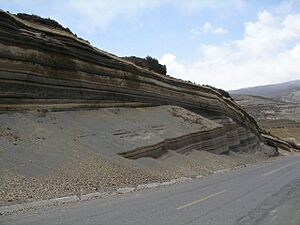
About 35,000 years ago, a large part of Chimborazo collapsed. This caused a huge debris avalanche that covered the area where the city of Riobamba now stands. This event even temporarily blocked the Río Chambo, creating a temporary lake.
After this collapse, Chimborazo erupted several times. The last eruption happened around 550 AD. These eruptions mainly produced thick, blocky lava flows. They also created fast-moving clouds of hot ash and gas, called pyroclastic surges, which traveled down the mountain.
Famous Explorers and Climbers
Early Attempts and Discoveries
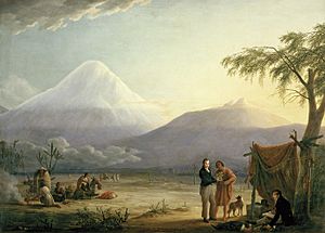
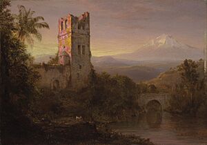
For a long time, people thought Chimborazo was the highest mountain on Earth. This belief led many explorers to try and reach its summit in the 17th and 18th centuries.
In 1746, French scientists explored the volcano. They were part of a mission to figure out the exact shape of the Earth. Their work helped prove that Earth is wider at the Equator, not a perfect sphere. They did not reach the top of Chimborazo.
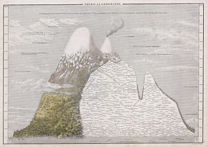
In June 1802, the famous explorer Alexander von Humboldt from Prussia, along with French botanist Aimé Bonpland and Ecuadorian Carlos Montúfar, tried to climb Chimborazo. They reached a very high point, about 5,875 meters (19,275 feet). This was higher than any European had ever climbed before. However, they had to turn back because of altitude sickness.
The First Successful Ascent
On January 4, 1880, the English climber Edward Whymper successfully reached the summit of Chimborazo. The path he took is now known as the Whymper route. Some people doubted his achievement, so later that same year, he climbed to the top again. This time, he used a different route called Pogyos, with the help of Ecuadorians David Beltrán and Francisco Campaña.
The Mystery of SAETA Flight 232
In August 1976, a plane called SAETA Flight 232, with 59 people on board, went missing. For many years, no one knew what happened to it. Then, in February 2003, climbers on Chimborazo discovered the aircraft and its passengers, solving the mystery of its disappearance.
Climbing Chimborazo: A Mountaineering Adventure
As Ecuador's highest mountain, Chimborazo is a very popular challenge for climbers. It can be climbed all year round, but the best times are usually December to January and July to August.
Popular Climbing Routes
The easiest and most common ways to climb Chimborazo are the Normal and Whymper routes. Both of these routes follow the western ridge. They start at the Whymper hut and lead climbers up to the Ventemilla summit, and then to the main Whymper summit.
There are also other routes on different sides of the mountain. These are often more difficult and lead to one of Chimborazo's other peaks: Politecnico (Central) or N. Martinez (Eastern).
Mountain Huts for Climbers
There are two main huts for climbers on Chimborazo. These are the Carrel Hut (at 4,850 meters or 15,912 feet) and the Whymper Hut (at 5,000 meters or 16,404 feet). You can reach the Carrel Hut by car from nearby cities like Riobamba. On the northwest side, there was once a hut called Zurita, but it is no longer used.
The Challenges of Climbing Chimborazo
The "El Castillo" route is a very popular way to climb the volcano. This route usually involves climbing the west side of the mountain. Climbers often start from the Whymper hut. They then follow a glacier ridge to the Veintemilla summit. Many climbers stop at the Veintemilla summit. To reach the highest point, the Whymper summit, there's another 30-minute trek across a snow-filled area.
Climbing Chimborazo is a serious challenge. It can be dangerous because of avalanches, tough weather, and icy glaciers. Climbers usually start very early in the morning, before sunrise. This helps them reach the top when the snow is still firm, reducing the risk of avalanches and falling rocks. Special gear like crampons is a must. Sadly, sometimes accidents happen. For instance, in November 1993, an avalanche occurred, and some climbers were lost. In October 2021, another avalanche affected several climbers, and some did not survive. These events remind us how important safety is when climbing such a powerful mountain.
See also
 In Spanish: Volcán Chimborazo para niños
- Lists of volcanoes
- List of volcanoes in Ecuador
- List of mountains in the Andes
- List of Ultras of South America
- List of mountains in Ecuador
 | Roy Wilkins |
 | John Lewis |
 | Linda Carol Brown |


