
Mount Mystery facts for kids
Quick facts for kids Mount Mystery |
|
|---|---|

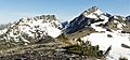
Mount Mystery's west face
|
|
| Highest point | |
| Elevation | 7,639 ft (2,328 m) |
| Prominence | 1,119 ft (341 m) |
| Isolation | 1.32 mi (2.12 km) |
| Geography | |

Mount Mystery
Location in Washington (state)

Mount Mystery
Location in the United States
|
|
| Location | Olympic National Park Jefferson County, Washington, US |
| Parent range | Olympic Mountains |
| Topo map | USGS Mount Deception |
| Geology | |
| Age of rock | Eocene |
| Type of rock | Tilted pillow Basalt |
| Climbing | |
| Easiest route | class 3 scrambling |
Mount Mystery is a tall mountain in Washington state, standing 7,639 feet (2,328 meters) high. It's found in the Olympic Mountains within Olympic National Park on the Olympic Peninsula. Mount Mystery is the sixth-tallest peak in the Olympic Mountains. Only Mount Olympus, Mount Deception, Mount Constance, Mount Johnson, and Inner Constance are taller. Its closest taller neighbor is Mount Deception, which is about 1.32 miles (2.12 km) away to the north-northwest. A smaller peak called Little Mystery (6,941 feet) is located just south of Mount Mystery.
Mount Mystery is in the eastern part of the Olympic Mountains, south of Mount Deception. It's at the start of Deception Creek. This area is in the rain shadow of the Olympic Range. This means it gets much less rain and snow than the western side of the mountains, like where Mount Olympus is.
The mountain sits on the edge of two drainage basins. To the north, water flows into the Dungeness River. To the east, it flows into the Dosewallips River. Deception Creek, which is part of the Dosewallips River system, drains the east and west sides of Mount Mystery. There's even a small melting glacier on the east side, sometimes called Mystery Glacier.
Mount Mystery got its name around 1915 from G.A. Whitehead of the U.S. Forest Service. He named it because he thought it looked grand and mysterious when it was foggy.
Contents
Weather Around Mount Mystery

Mount Mystery is in a marine west coast climate zone. This means it has mild, wet winters and cool, drier summers. Most weather fronts, which bring changes in weather, start in the Pacific Ocean. They then travel northeast towards the Olympic Mountains.
When these weather fronts hit the tall peaks of the Olympic Range, they are forced to rise. As the air rises, it cools and drops its moisture as rain or snow. This process is called Orographic lift. Because of this, the Olympic Mountains get a lot of rain and snow, especially in winter. The snow tends to be wet and heavy due to the ocean's influence. This can lead to a high risk of avalanches.
During winter, the weather is often cloudy. However, in summer, high-pressure systems over the Pacific Ocean often bring clear skies. The best time to visit or climb Mount Mystery is usually from July to September, when the weather is most pleasant.
How Mount Mystery Was Formed
The Olympic Mountains are made of different types of rock. These rocks were pushed up from the ocean floor a long time ago, during a period called the Eocene epoch. They are mostly sandstone, turbidite (a type of sedimentary rock), and basalt (a volcanic rock).
Over millions of years, the mountains were shaped by Pleistocene era glaciers. These huge sheets of ice moved across the land many times, carving out valleys and peaks as they advanced and retreated. This is how Mount Mystery and the other Olympic Mountains got their unique shapes.
Climbing Mount Mystery
Climbing Mount Mystery is not super technical, but it is very steep and exposed. This means there are places where a climber could fall a long way if they aren't careful. The rock can be loose, and the snow can be soft, making it hard to stop a fall once it starts.
Nearby peaks, known as The Needles, are often considered better for more challenging climbing adventures in the Royal Basin area.
Gallery
-
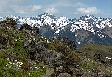
Mystery, Fricaba, and Deception from east
-
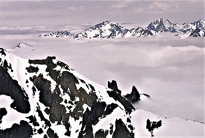
Mystery and Deception from Mt Constance
-
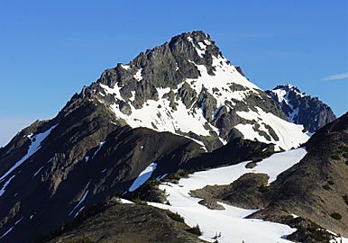
Mystery from southeast
-
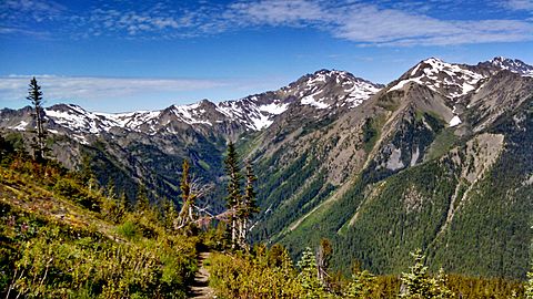
Mt. Mystery from the Pacific Northwest Trail


- Weather forecast: Mount Mystery
Images for kids
-
Mount Mystery (right) and Little Mystery (left) seen from the southeast

