
Mount Sefrit facts for kids
Quick facts for kids Mount Sefrit |
|
|---|---|

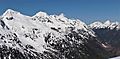
Mount Sefrit seen from Artist Point
|
|
| Highest point | |
| Elevation | 7,191 ft (2,192 m) |
| Prominence | 1,591 ft (485 m) |
| Isolation | 3.85 mi (6.20 km) |
| Parent peak | Nooksack Tower (8,285 ft) |
| Geography | |

Mount Sefrit
Location in Washington (state)

Mount Sefrit
Location in the United States
|
|
| Location |
|
| Parent range | North Cascades |
| Topo map | USGS Mount Sefrit |
| Type of rock | Gabbro and Greenschist |
| Climbing | |
| First ascent | 1930 by Jim Irving and Brick Spouse |
| Easiest route | Scrambling |
Mount Sefrit is a tall mountain in the North Cascades of Washington state. It stands about 7,191 ft (2,190 m) high. You can find it about three miles north of Mount Shuksan. This mountain is part of the Mount Baker Wilderness, which is looked after by the Mount Baker-Snoqualmie National Forest.
From the top of Mount Sefrit, you can see amazing views of Mount Shuksan, Mount Baker, and the Picket Range. The mountain is named after Frank Ira Sefrit (1867–1950). He was an editor and publisher for The Bellingham Herald newspaper for almost 40 years. The name was officially chosen in 1952 by the U.S. Board on Geographic Names. Water from the mountain flows into Ruth Creek and the Nooksack River. These rivers almost surround Mount Sefrit, except for Nooksack Ridge, which connects it to Ruth Mountain.
How Mount Sefrit Was Formed
The North Cascades area has some of the most rugged and wild mountains in the Cascade Range. You'll see sharp peaks, long ridges, and deep valleys carved by glaciers. These amazing shapes were created by geological events that happened millions of years ago. These events also caused big changes in height across the Cascade Range. This led to different climates and types of plants in various areas.

The Cascade Mountains began to form millions of years ago, during the late Eocene Epoch. At that time, the North American Plate was slowly moving over the Pacific Plate. This movement caused many volcanic eruptions. Also, small pieces of the Earth's crust, called terranes, came together to form the North Cascades about 50 million years ago.
Later, during the Pleistocene period (which was over two million years ago), huge sheets of ice called glaciers moved across the land. They advanced and then melted back many times. As they moved, these glaciers scraped away rock and left behind debris. The "U"-shaped valleys you see today were carved out by these glaciers. The lifting up of land and cracks in the Earth's crust (called faulting), along with glaciation, have been the main forces that created the tall peaks and deep valleys of the North Cascades.
Weather and Climate
Mount Sefrit is located in a "marine west coast" climate zone in western North America. This means it gets a lot of influence from the ocean. Most weather systems start over the Pacific Ocean. They then travel northeast towards the Cascade Range.
As these weather systems reach the North Cascades, the tall mountains force the air upwards. This causes the air to cool and drop its moisture as rain or snowfall onto the Cascades. Because of this, the western side of the North Cascades gets a lot of precipitation. This is especially true in winter, when most of it falls as snow.
Since the weather is influenced by the ocean, the snow tends to be wet and heavy. This can lead to a high risk of avalanches. During the winter months, the weather is often cloudy. However, in the summer, high-pressure systems over the Pacific Ocean become stronger. This often means there are clear skies with little or no clouds. The best months to visit or climb Mount Sefrit are usually July, August, and September, when the weather is most pleasant.
Gallery
-
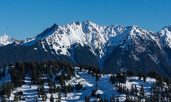
Mt. Sefrit from southwest
-
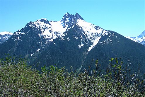
Northwest side, from Goat Mountain
-
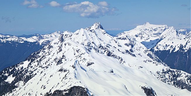
Sefrit from Ruth Mountain
-
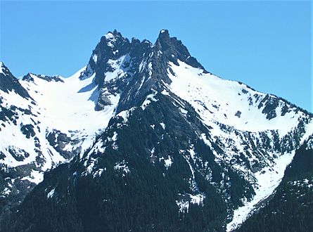
Northwest side


Images for kids
-
Mt. Sefrit from Hannegan Peak

