Mounth facts for kids
Quick facts for kids Mounth |
|
|---|---|
| The Mounth | |

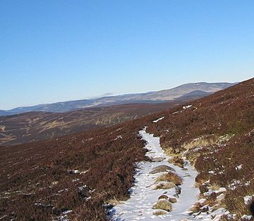
Typical Mounth Scenery
|
|
| Highest point | |
| Naming | |
| English translation | "Mountain" |
| Language of name | Pictish/Common Brittonic |
| Geography | |
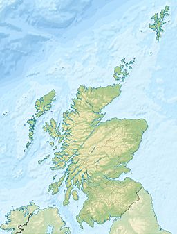
The Mounth is a large area of high land in northeast Scotland. It's like a big, hilly plateau between the Scottish Highlands and the River Dee, Aberdeenshire. It forms the eastern part of the Grampian Mountains.
Contents
What's in a Name? The Mounth's Meaning
The name Mounth comes from a very old language called Pictish. In Pictish, the word *monɪð meant "mountain." So, "The Mounth" simply means "The Mountain." People always call it "The Mounth" and say it like "munth."
Exploring The Mounth's Landscape
Where is The Mounth?
The Mounth is generally thought to begin at the Cairnwell Pass. This pass is home to the A93 road, which is the highest main road pass in Britain. You'll also find the Glen Shee ski centre here.
The area is a high, wavy plateau with deep valleys. These valleys were carved out by glaciers long ago. Some of these valleys include Glen Isla, Glen Callater, and Glen Muick. The highest point is Glas Maol, which is 1,068 meters (3,504 feet) tall. Nearby is the granite mountain Lochnagar, standing at 1,155 meters (3,789 feet).
To the east, the plateau becomes lower moorland. It has river valleys like Glen Esk and Glen Tanar. This land gently slopes down to the North Sea coast. This part of The Mounth shows how the ancient Highland surface looked before glaciers changed it.
The Mounth's Boundaries
The Mounth is surrounded by towns like Blairgowrie, Braemar, Ballater, Banchory, Stonehaven, and Kirriemuir. It includes parts of eastern Highland Perthshire, the Angus Glens, and southern Aberdeenshire. The highest parts of The Mounth are inside the Cairngorms National Park.
A Historical Barrier
For many years, The Mounth was a tough barrier. It made it hard to travel between northeast Scotland and the Scottish Lowlands. This physical barrier also created cultural differences.
In the Middle Ages, an old road called the Causey Mounth was built. This road helped connect Stonehaven to Aberdeen. It was designed like a raised rock path to cross the wet, boggy areas of the eastern Mounth. This route passed by Cowie Castle and Muchalls Castle.
This historic route was used by important figures. In 1639, Earl Marischal and the Marquess of Montrose led an army of 9,000 men along this path. This was during the first battle of the Wars of the Three Kingdoms.
Historic Crossings of The Mounth
Over time, many paths and roads were created to cross The Mounth. These crossings helped people travel and trade. Here are some of the important historic crossings:
- Causey Mounth: From Cowie Bridge near Stonehaven to the Bridge of Dee.
- Elsick Mounth: From Stonehaven to Drum, now partly followed by the B979 road.
- The Slug Road: From Stonehaven to Durris, now followed by the A957 road.
- Cryn's Cross Mounth: From Laurencekirk to Mills of Drum.
- The Stock Mounth: From Glenbervie to Strachan.
- Builg Mounth: From Glenfarquhar to Deeside.
- Cairnamounth: From Fettercairn to Kincardine o' Neill, now followed by the B974 road.
- Fungle Road: From Glen Esk to Aboyne through the Forest of Birse.
- Firmounth: From Glen Esk to Glen Tanar.
- Keenmounth: From Innermarkie to Deeside, going over Mount Keen.
- Capel Mounth: From Glen Clova to Glen Muick.
- Tolmounth or Jock's Road: From Glen Doll to Glen Callater.
- Carnvalage or Cairnwell Road: From Gleann Beag to Glen Clunie, over the Devil's Elbow. This route is now followed by the modern A93 road.
 | May Edward Chinn |
 | Rebecca Cole |
 | Alexa Canady |
 | Dorothy Lavinia Brown |


