
Murray-Darling Basin facts for kids

The Murray-Darling Basin is a very important area in Australia. It's named after its two main rivers, the Murray and Darling. Millions of Australians depend on the water from this basin every day.
This special area gets about 6% of all the rainwater that falls in Australia. A huge amount of farming happens here. About 85% of all irrigation (which means watering crops) in Australia takes place in the basin. This helps grow food and other products, creating an industry worth over $9 billion each year!
The Murray-Darling Basin is enormous. It covers about 1,061,469 square kilometers. That's about one-seventh, or 14%, of Australia's total land area. More than two million people call this basin home.
Important Rivers in the Murray–Darling Basin
The Murray-Darling Basin is home to many rivers and waterways. These rivers are vital for the environment, farming, and the people living in the area. They flow through different states, bringing water to many towns and farms. Here are some of the key rivers you can find in this large basin:
-
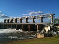
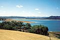
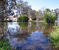
Yarrawonga Weir on the Murray River forms Lake Mulwala, 2010
-
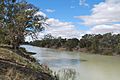
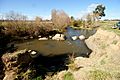
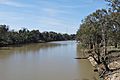
Darling River at Menindee, 2009
-
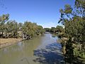
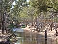
Warrego River at Cunnamulla, 2010
-
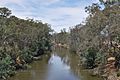
Barwon River at Collarenebri, 2008
-
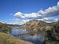
Lake Burrendong, formed at the confluence of the Macquarie River and Cudgegong River, 1995
-
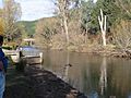
Macquarie River at Bathurst, 2009
-
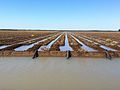
Siphon irrigation of cotton on the Balonne River near St George, 2012
-
Maranoa River at Mitchell, 2005
-
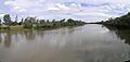
Macintyre River in flood at Goondiwindi, 1921
-
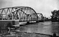
Taemas Bridge across the Murrumbidgee River, 2011
-
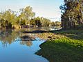
Goodradigbee River in the valley below the Brindabella Ranges, 2005
-
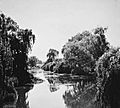
Molonglo River at Acton in 1920, prior to the damming of the river to form Lake Burley Griffin.
-
Wakool River, near Kyalite, 2012
-
A footbridge of the Avoca River at Charlton, 2005
-
Goulburn River at Murchison, 2009
-
Ovens River at Porepunkah, 2007
-
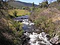
Mitta Mitta River, downstream from Dartmouth Dam, 2007


.JPG)


See also
 In Spanish: Cuenca del Murray-Darling para niños
