Nainital facts for kids
Quick facts for kids
Nainital
|
|
|---|---|
|
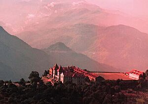
Clockwise from top:
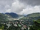
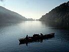
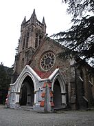
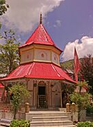
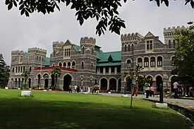
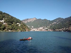
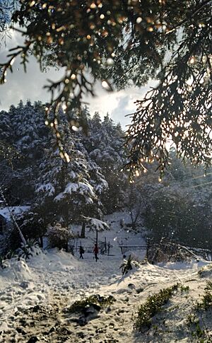
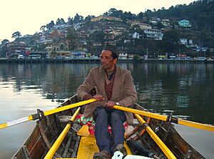
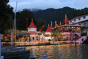
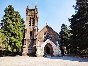
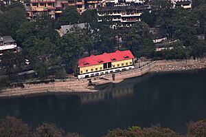
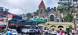
Nainital from Cheena Peak route, Kumaoni boatmen on Naini Lake, Naina Devi Temple, Raj Bhavan and Church of St. John in the Wilderness |
|
| Nickname(s):
Jewel of Kumaon
|
|
| Country | |
| State | Uttarakhand |
| Division | Kumaon |
| District | Nainital |
| Named for | Naini Lake |
| Government | |
| • Type | Municipal Council |
| • Body | Nainital Municipal Council |
| Area | |
| • Total | 11.73 km2 (4.53 sq mi) |
| Elevation | 2,084 m (6,837 ft) |
| Population
(2011)
|
|
| • Total | 41,377 |
| • Density | 3,527.5/km2 (9,136/sq mi) |
| Demonym(s) | Nainitalites (English) Naintalwal (Kumaoni) |
| Languages | |
| • Official | Hindi |
| • Additional official | Sanskrit |
| • Regional | Kumaoni |
| Time zone | UTC+5:30 (IST) |
| PIN |
263001/263002
|
| Telephone code | +91 - 5942 |
| Vehicle registration | UK-04 |
Nainital (pronounced Naintāl in Kumaoni) is a beautiful town in Uttarakhand, India. It's often called the "Jewel of Kumaon" because of its stunning lake and mountain views. This town is important for the state of Uttarakhand. It serves as the judicial capital, meaning the state's highest court is located here. It's also the main town for the Nainital district.
Nainital sits in the Kumaon foothills of the mighty Himalayas. It's about 276 kilometers (171 miles) from Dehradun, the state capital, and 314 kilometers (195 miles) from New Delhi, India's capital. The town is high up, at about 2,084 meters (6,837 feet) above sea level. It's nestled in a valley with a special eye-shaped lake, about two miles around. Tall mountains surround the lake, like Naina Peak to the north, Deopatha to the west, and Ayarpatha to the south. From these peaks, you can see amazing views of the plains below and the snowy Himalayan range. Many tourists visit Nainital throughout the year to enjoy its cool weather and natural beauty.
Contents
- Discovering Nainital: India's Beautiful Lake Town
- See also
Discovering Nainital: India's Beautiful Lake Town
The Story Behind Nainital's Name
Many people believe that Nainital Lake is one of 51 special holy places called Shakti Peeths. This belief comes from an ancient story about the goddess Sati. When Sati passed away, the god Shiva carried her body in sorrow. To help Shiva, the god Vishnu used his Sudarshana Chakra to divide Sati's body into parts. These parts fell to Earth, creating sacred sites. The place where Sati's right eye (called Nain) fell became known as Nain-tal, which means "lake of the eye." Today, people honor the goddess Shakti at the Naina Devi Temple, also known as Naini Mata Temple, located on the northern side of the lake.
A Glimpse into Nainital's Past
Early Days of Nainital
Historically, Nainital was part of the Kumaon region. After the Katyuri kings' rule ended in the 10th century, Kumaon was split into smaller kingdoms. The area around Nainital was controlled by different branches of a local family. Later, the Chand dynasty became powerful in Kumaon. It took many centuries for them to fully control the region, and Nainital was one of the last areas to join their kingdom. A king named Kirat Chand, who ruled from 1488 to 1503, finally brought Nainital and its surroundings under Chand rule.
How Nainital Was Founded
The Kumaon Hills came under British control after a war in 1814–1816. The hill station of Naini Tal was officially founded in 1841. This happened when P. Barron, a sugar trader, built the first European house there, called Pilgrim Lodge. He wrote that it was "by far the best site" he had seen in his travels across the Himalayas. By 1846, many houses were being built. The Church of St. John in the Wilderness was one of the first buildings. Soon, Nainital became a popular place for British soldiers and officials to escape the hot weather of the plains. It even became the summer home for the governor of the United Provinces.
The Great Landslide of 1880
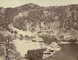
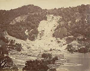
Nainital has steep hillsides, which can sometimes lead to landslides. The first known landslide happened in 1866. Another larger one occurred in 1869. But the biggest one, known as "the great slip," happened on September 18, 1880.
On that day, a huge amount of rain fell, making the hillsides very unstable. A small earthquake also shook the area. Around 10 AM, a part of the Victoria Hotel was swept away. Sadly, many people stayed near the area. Then, at about 1:45 PM, a massive landslide occurred. Within seconds, several buildings, including the Victoria Hotel, the old Naina Devi Temple, and other shops, were destroyed. Much of the debris was swept into the lake.
This disaster tragically buried 151 people, including 108 Indians and 43 Europeans. Many others barely escaped. After this event, a new recreation area called 'The Flats' was built on the site. A new Naina Devi Temple was also constructed. To prevent future disasters, new drainage systems were built, and building rules became much stricter.
Exploring Nainital's Natural Beauty
Mountains, Lake, and Land
The town of Nainital covers about 11.73 square kilometers (4.53 square miles). It is located at an average height of 2,084 meters (6,837 feet) above sea level. The surrounding mountains are quite populated, with altitudes ranging from 1,940 to 2,100 meters (6,360 to 6,890 feet). The highest point nearby is Naina Peak, which stands at 2,619 meters (8,593 feet). Nainital is nestled in the Kumaon foothills of the outer Himalayas.
The town is famous for Nainital Lake, an eye-shaped lake located about 1,935 meters (6,350 feet) above sea level. The lake is about 1,433 meters (1,567 yards) long and 463 meters (506 yards) wide, with a circumference of about two miles. Its deepest point is 24.6 meters (81 feet). Scientists believe the lake was formed by movements in the Earth's crust. Many streams, including three that flow all year, feed the lake.
Nainital is surrounded by several mountains. These include Ayarpata (2,344 meters or 7,689 feet), Devpata (2,435 meters or 7,989 feet), Handibandi (2,180 meters or 7,153 feet), Chini (2,612 meters or 8,568 feet), Alma (2,432 meters or 7,980 feet), Lariya Kanta (2,482 meters or 8,144 feet), and Sher ka Danda (2,400 meters or 7,869 feet).
Rocks and Earth: Nainital's Geology
The rocks around Nainital are mainly from the Krol group. These include slates, limestones, and sandstones. The area has a complex geological structure, meaning the rocks are fragile and relatively new. The entire town is within the area that drains into Nainital Lake. The rocks here are highly folded and faulted due to many past Earth movements.
Because of the steep slopes and fragile rocks, landslides happen often around the lake. These slopes are very prone to landslides due to natural geological reasons and human activities. As mentioned, major landslides occurred in 1866, 1879, and the largest one in 1880, which buried 151 people. Another significant landslide happened in 1898 outside the Nainital valley.
Nainital's Weather Seasons
Nainital has a subtropical highland climate, which means its weather is affected by its high elevation. Winters are a bit dry, and summers are very wet due to the South Asian monsoon. The least rain falls in November, while July gets the most.
Nainital has cool summers, like many places in temperate regions. July is the warmest month, with temperatures usually between 16.4°C and 23.5°C (61.5°F and 74.3°F). January is the coldest, with temperatures from 1.7°C to 10.7°C (35.1°F and 51.3°F). The highest temperature ever recorded was 30°C (86°F) on June 18, 1972, and the lowest was -5.6°C (21.9°F) on January 17, 1953.
Winter in Nainital starts around mid-November and lasts until mid-March. Temperatures drop, and January is the coldest month. You'll often see frost and mist in December and January. Sometimes, there's widespread rain from weather systems called western disturbances, and snow falls on peaks higher than 2,000 meters (6,560 feet). Temperatures start to rise by late February or early March, signaling the start of summer.
By mid-March, temperatures steadily increase, marking the beginning of the summer season. Days become warmer, but nights remain cool. May and early June are the hottest months. Hailstorms can occur in March and April, bringing short periods of cold.
The monsoon season usually begins in mid-May and continues until mid-October. During this time, the mean temperature drops, and humidity increases sharply. Nainital gets a lot of rain each year because it's close to the high Himalayan ranges. By mid-September, the monsoon weakens, and rain becomes less frequent. After the monsoon, the skies are bright, offering a pleasant transition between the rainy season and winter. Temperatures gradually decrease until mid-January.
| Climate data for Nainital (1961–1979, extremes 1953–1979) | |||||||||||||
|---|---|---|---|---|---|---|---|---|---|---|---|---|---|
| Month | Jan | Feb | Mar | Apr | May | Jun | Jul | Aug | Sep | Oct | Nov | Dec | Year |
| Record high °C (°F) | 18.4 (65.1) |
21.7 (71.1) |
24.6 (76.3) |
28.0 (82.4) |
29.6 (85.3) |
30.0 (86.0) |
26.1 (79.0) |
26.6 (79.9) |
24.6 (76.3) |
24.8 (76.6) |
21.4 (70.5) |
21.8 (71.2) |
30.0 (86.0) |
| Mean daily maximum °C (°F) | 10.9 (51.6) |
11.9 (53.4) |
16.1 (61.0) |
20.7 (69.3) |
23.2 (73.8) |
23.4 (74.1) |
21.7 (71.1) |
21.0 (69.8) |
20.5 (68.9) |
18.8 (65.8) |
15.3 (59.5) |
12.8 (55.0) |
18.0 (64.4) |
| Daily mean °C (°F) | 6.3 (43.3) |
7.6 (45.7) |
11.7 (53.1) |
16.2 (61.2) |
18.7 (65.7) |
19.8 (67.6) |
19.0 (66.2) |
18.5 (65.3) |
17.1 (62.8) |
14.2 (57.6) |
10.5 (50.9) |
7.8 (46.0) |
14.0 (57.1) |
| Mean daily minimum °C (°F) | 1.7 (35.1) |
3.3 (37.9) |
7.3 (45.1) |
11.8 (53.2) |
14.3 (57.7) |
16.2 (61.2) |
16.3 (61.3) |
16.0 (60.8) |
13.7 (56.7) |
9.7 (49.5) |
5.8 (42.4) |
2.9 (37.2) |
9.9 (49.8) |
| Record low °C (°F) | −5.6 (21.9) |
−4.3 (24.3) |
−3.0 (26.6) |
0.0 (32.0) |
5.0 (41.0) |
10.0 (50.0) |
10.4 (50.7) |
9.6 (49.3) |
4.4 (39.9) |
0.5 (32.9) |
−1.1 (30.0) |
−4.4 (24.1) |
−5.6 (21.9) |
| Average rainfall mm (inches) | 82.4 (3.24) |
66.1 (2.60) |
57.1 (2.25) |
33.8 (1.33) |
72.4 (2.85) |
339.1 (13.35) |
685.4 (26.98) |
556.4 (21.91) |
346.3 (13.63) |
54.7 (2.15) |
7.7 (0.30) |
23.9 (0.94) |
2,305.3 (90.76) |
| Average rainy days | 3.5 | 3.9 | 3.5 | 2.8 | 4.7 | 12.8 | 20.4 | 19.8 | 11.1 | 2.8 | 0.5 | 1.4 | 87.2 |
| Average relative humidity (%) (at 17:30 IST) | 65 | 60 | 53 | 49 | 48 | 66 | 82 | 84 | 79 | 65 | 62 | 59 | 64 |
| Source: India Meteorological Department | |||||||||||||
Plants and Animals of Nainital
The areas around Nainital, in the middle Himalayas, are rich in both plants (flora) and animals (fauna). You'll find many plants typical of a temperate climate here.
Some common trees and bushes around the lake include:
- Oak (Banj)
- Aesculus indica (Pangar or Horse chestnuts)
- Juglans regia (Akhrot or walnut)
- Populus ciliata (Hill Pipal, a sacred tree)
- Fraxinus micrantha (Ash tree or Angu)
- Platanus orientalis (Chinar)
- Rubus lasiocarpus (Hisalu)
- Rosa moschata (Kunj or Musk rose)
- Berberis asiatica (Kilmora)
- Cupressus torulosa (Surai or Himalayan cypress)
- Rhododendron arboreum (Buruns)
- Cedrus deodara (Deodar)
- Weeping Willow
- Pinus (Pine)
Many medicinal plants and garden plants also grow near the lake. Aquatic plants like Potamogeton pectinatus and Polygonum hydropiper (Water pepper) are found in the water.
The lake is home to several types of fish. You'll find carps like Mahseer and mirror carp. Mahseer fish, including the red-finned and yellow-finned types, are popular food fish that can grow quite large. Three types of Hill Trout also live in the lake. The imported Mirror carp is also bred here. Gambusia affinis, also called Mosquitofish, was introduced to help control Mosquito larvae.
Life in Nainital: People and Culture
Who Lives in Nainital?
According to the 2011 Indian census, Nainital had a population of 41,377 people. About 52.3% were males and 47.7% were females. This means there were 911 women for every 1000 men. The town's population density was about 3,527 people per square kilometer. About 9.54% of the population was under 6 years old. In 2011, Nainital had a high literacy rate of 92.93%, meaning most people could read and write.
The population of Nainital has changed over time. In 1881, it was 6,576. It grew to 8,455 in 1891. After some ups and downs, the population has been steadily increasing since 1941, reaching 41,377 in 2011.
| Religions in Nainital Town (2011) | ||||
|---|---|---|---|---|
| Religion | Percent | |||
| Hindus | 85.61% | |||
| Muslims | 11.91% | |||
| Sikh | 0.75% | |||
| Christian | 0.92% | |||
| Others† | 0.8% | |||
Hinduism is the largest religion in Nainital, with 85.61% of residents identifying as Hindus in 2011. The town also has many people from Muslim, Sikh, and Christian communities. Islam is the second most popular religion, followed by about 11.91% of the population. Christianity is followed by 0.92%, Jainism by 0.01%, Sikhism by 0.75%, and Buddhism by 0.77%. A small number of people (0.02%) were atheists or followed no particular religion. The Kumaoni people make up a large part of the town's population, along with people from all over India. Someone from Nainital is called a Naintālwāl in Kumaoni.
Languages Spoken Here
Hindi is the official language of Nainital, and Sanskrit is an additional official language. Kumaoni is the local language and is the most spoken language in the town. Hindi and English are also widely used for communication between locals and visitors.
How Nainital is Governed
Local Government
The local government of Nainital, called the municipal board, was first set up in 1845. It helped manage the town and its services for the people living there.
Political Representation
Nainital town is represented in the Lok Sabha, which is the lower house of the Indian Parliament. A representative is elected from the Nainital-Udhamsingh Nagar Constituency. As of today, Ajay Bhatt (politician) from the BJP is the current Member of Parliament. He won the 2024 Indian general elections. Before 2008, the town was part of a different constituency. Sarita Arya of the BJP is the current MLA (Member of the Legislative Assembly) from the Nainital Assembly constituency.
Fun Things to Do in Nainital
| Year | International | Domestic | Total |
|---|---|---|---|
| 2012 | 8,254 | 898,077 | 906,331 |
| 2013 | 7,088 | 737,130 | 744,218 |
| 2014 | 7,622 | 750,501 | 758,123 |
| 2015 | 6,902 | 808,903 | 815,805 |
| 2016 | 7,231 | 866,164 | 873,395 |
| 2017 | 8,329 | 910,323 | 918,652 |
| 2018 | 9,341 | 924,316 | 933,657 |
Nainital is a very popular hill station with many exciting places to visit. It's the most famous tourist spot in Kumaon. Some popular attractions include Nainital Lake, Naina Peak 8622ft, The Selva Valley, Hanumangarhi, and the G. B. Pant High Altitude Zoo.
Visit the Nainital Zoo
The Nainital Zoo is located on Tallital, Sher Ka Danda Hill, at a height of 2,100 meters (6,900 feet) above sea level. Its official name is the G. B. Pant High Altitude Zoo. Here, you can see animals that live in high-altitude regions.
Sailing at the Nainital Yacht Club
The Nainital Yacht Club is right by the lake and is managed by the Boat House Club. It's one of the highest yacht clubs in the world! It was started by the British in 1910. Today, visitors can enjoy a sailing session on the yachts.
The Jama Masjid Mosque
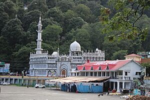
The Jama Masjid of Nainital is in the Mallital area. This mosque was built in 1882 during the British era for the Muslim community in Nainital. Above the main entrance, you can see beautiful Arabic writings. Inside, a special niche called a mihrab shows the direction towards Mecca.
The Naina Devi Temple
The Temple of Naina Devi is located at the top end of Naini Lake. This temple is dedicated to Naina Devi, the goddess of the town. Every year in September, the Nanda Devi Mela festival takes place here during Nandashtami.
St. John in the Wilderness Church
St. John in the Wilderness is one of the oldest and most beautiful churches in Nainital. It is dedicated to St. John the Baptist. This Anglican Church was built in 1846 and was one of the first buildings constructed in Nainital.
Shopping on The Mall Road
The Mall Road is a lively shopping area in Nainital. It's filled with many shops, restaurants, and street vendors where you can find souvenirs and local goods.
Explore Eco Cave Gardens
Eco Cave Gardens is a collection of natural rocky caves. It's located close to The Mall Road. There are six caves shaped like different animals. Tourists can visit these caves every day from 9:30 a.m. to 5:30 p.m.
Views from Naina Peak
Naina Peak is a fantastic sightseeing spot located at an altitude of 2,611 meters (8,566 feet). From here, you can get amazing views of the Himalaya range and a bird's-eye view of Nainital town.
Libraries for Learning
Nainital has several libraries. These include the Durga Lal Shah Municipal Public Library on the Mall, which was founded in 1934. There's also the Uttarakhand Academy of Administration, Library and Documentation Center, the ARIES Observatory Library, and the Kumaon University Library.
Getting Around Nainital
Roads to Nainital
You can reach Nainital by road using National Highway 109 (formerly National Highway 87) from Haldwani, which is about 40 kilometers (25 miles) away. You can also take State Highway 13 from Bajpur, about 60 kilometers (37 miles) away.
Flying to Nainital
The closest airport is in Pantnagar, near Rudrapur. It's about 71 kilometers (44 miles) from Nainital. Several airlines, including Alliance Air, Air Heritage, and Deccan Charters, connect this airport to cities like Delhi, Dehradun, and Pithoragarh.
Trains to Nainital
The nearest major railway station is Kathgodam. It's located on the outskirts of Haldwani and has train connections to almost all major cities across India.
Learning in Nainital
In the late 1800s, many "European" schools for boys and girls were started in Nainital. During the Victorian era and Edwardian period, these schools mostly taught the children of British officials or soldiers. All Saints' College, originally called the Diocesan Girls' High School, was founded in 1869. By 1906, there were more than half a dozen such schools, including Sherwood College (originally Diocesan Boys' School) and Birla Vidya Mandir (originally Philander Smith's college).
St. Joseph's College, Nainital (also known as SEM) is a school for both day students and boarders, built by Irish brothers. It celebrated its 125th anniversary in 2013. Another important school for girls, St. Mary's Convent High School, Nainital (known as Ramnee), was established in 1878 and celebrated its 125th anniversary in 2003.
Famous People from Nainital
- Amitabh Bachchan, a famous Bollywood actor, studied at Sherwood College.
- Kabir Bedi, a Bollywood actor, also studied at Sherwood College.
- Jim Corbett, a famous hunter, author, and conservationist, studied at St. Joseph's College. Jim Corbett National Park is named after him.
- Danny Denzongpa, a Bollywood actor, studied at Birla Vidya Mandir.
- Gopal Datt, an Indian actor and writer, graduated from Kumaon University.
- Sam Manekshaw, an Indian Army Chief of Staff during the Indo-Pakistani War of 1971, studied at Sherwood College.
- Lalit Modi, former chairman of the Indian Premier League (IPL), studied at St. Joseph's College.
- Naseeruddin Shah, a Bollywood actor, studied at St. Joseph's College.
- Major Som Nath Sharma, India's first Param Vir Chakra award winner, studied at Sherwood College.
- Narayan Dutt Tiwari, a notable Indian leader and politician, served as Chief Minister of Uttarakhand and Uttar Pradesh.
See also
 In Spanish: Nainital para niños
 | Stephanie Wilson |
 | Charles Bolden |
 | Ronald McNair |
 | Frederick D. Gregory |


