
National Register of Historic Places listings in New London County, Connecticut facts for kids

New London County in Connecticut is home to many amazing places that are listed on the National Register of Historic Places. This list includes buildings, areas, and even ships that are important because of their history, design, or what happened there. It's like a special hall of fame for historic spots!
There are over 200 places in New London County on this list, and 13 of them are even more special, called National Historic Landmarks. These landmarks are super important to the history of the whole United States. Let's explore some of these cool places!
Contents
- Historic Places in New London County
- Famous Landmarks
- Charles W. Morgan (ship)
- Emma C. Berry (sloop)
- Fort Shantok Archeological District
- Florence Griswold Museum
- L. A. Dunton (schooner)
- James Merrill House
- Monte Cristo Cottage
- Capt. Nathaniel B. Palmer House
- Sabino (steamer)
- John Trumbull Birthplace
- USS Nautilus (SSN-571)
- William Williams House (Lebanon, Connecticut)
- Old Homes and Buildings
- Alden Tavern Site
- Winslow Ames House
- Applewood Farm
- Avery Homestead
- Avery House (Griswold, Connecticut)
- Thomas Avery House
- Nathaniel Backus House
- Bacon Academy
- Acors Barns House
- Henry Champion House
- Joshua Hempstead House
- Nathaniel Hempstead House
- Col. Joshua Huntington House
- Gen. Jedidiah Huntington House
- Gov. Samuel Huntington House
- Nathan Lester House
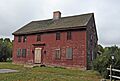
- Thomas Lee House
- Leffingwell Inn
- Capt. Enoch Lord House
- Peck Tavern
- Pequotsepos Manor
- Shaw Mansion (New London, Connecticut)
- Robert Stanton House
- Simon Tiffany House
- Dr. Philip Turner House
- Edward Waldo House
- Whitehall Mansion
- Ashbel Woodward House
- Important Industrial Sites
- Historic Districts
- Baltic Historic District
- Bean Hill Historic District
- Burnett's Corner Historic District
- Chelsea Parade Historic District
- Coit Street Historic District
- Colchester Village Historic District
- Downtown New London Historic District
- Downtown Norwich Historic District
- Eolia-Harkness Estate
- Gales Ferry Historic District No. 1
- Gales Ferry Historic District No. 2
- Graniteville Historic District (Waterford, Connecticut)
- Greeneville Historic District (Norwich, Connecticut)
- Groton Bank Historic District
- Hadlyme North Historic District
- Hadlyme Ferry Historic District
- Hallville Mill Historic District
- Hamburg Bridge Historic District
- Hartford Colony
- Hempstead Historic District
- Jail Hill Historic District
- Jordan Village Historic District (Waterford, Connecticut)
- Laurel Hill Historic District
- Lebanon Green Historic District
- Little Plain Historic District
- Mechanic Street Historic District
- Montauk Avenue Historic District
- Mystic Bridge Historic District
- Mystic River Historic District
- Noank Historic District
- North Stonington Village Historic District
- Norwich Hospital District
- Norwichtown Historic District
- Old Lyme Historic District
- Oswegatchie Historic District
- Poquetanuck Village Historic District
- Post Hill Historic District
- Preston City Historic District
- Prospect Street Historic District
- Quaker Hill Historic District (Waterford, Connecticut)
- Rossie Velvet Mill Historic District
- Salem Historic District (Salem, Connecticut)
- Taftville
- United States Housing Corporation Historic District
- Walnut Grove (Waterford, Connecticut)
- Whale Oil Row
- Williams Memorial Park Historic District
- Yantic Falls Historic District
- Lighthouses and Ships
- Other Interesting Places
- Anshei Israel Synagogue
- Old Bacon Academy
- Fort Griswold
- Fort Trumbull
- Lighthouse Inn (New London, Connecticut)
- New London County Courthouse
- New London Customhouse
- New London Public Library
- New London Railroad Station
- Norwich Town Hall
- Ohev Sholem Synagogue
- Rocky Neck Pavilion
- St. James Episcopal Church (New London, Connecticut)
- The Seaside (Waterford, Connecticut)
- US Post Office-New London Main
- US Post Office-Norwich Main
- War Office (Lebanon, Connecticut)
- Wheeler Block (Colchester, Connecticut)
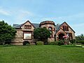
- Williams Memorial Institute
- Wylie School
- Famous Landmarks
- Images for kids
- Former listing
Historic Places in New London County
Famous Landmarks
Some places in New London County are so important they are called National Historic Landmarks. These are truly special!
Charles W. Morgan (ship)

The Charles W. Morgan is a very old wooden ship from the 1800s. It's the only one left from the American whaling fleet of that time! You can find this amazing ship at the Mystic Seaport Museum in Stonington.
Emma C. Berry (sloop)

The Emma C. Berry is one of the oldest commercial boats still around in the United States. This fishing boat is also located in the Mystic area of Stonington.
Fort Shantok Archeological District

This area in Montville was once a settlement for the Mohegan people. It was also the home of Uncas, a famous leader (sachem) in the 1600s. Today, it's a park you can visit.
Florence Griswold Museum

Located in Old Lyme, this house was a popular place for American Impressionist artists to stay. Famous painters like Childe Hassam and Willard Metcalf visited here. It's now a museum!
L. A. Dunton (schooner)

The L.A. Dunton is a classic fishing boat called a schooner. It's one of the last fishing boats built that used sails for power. You can see it at the Mystic Seaport Museum in Stonington.
James Merrill House

This house in Stonington was the home of the famous writer James Merrill. It became a National Historic Landmark in 2016.
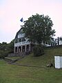
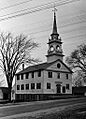
Monte Cristo Cottage

In New London, this cottage was the summer home of the famous playwright Eugene O'Neill. He wrote many plays here!
Capt. Nathaniel B. Palmer House

This house in Stonington was the home of Nathaniel Palmer. He was a brave explorer and seal hunter who helped explore Antarctica!
Sabino (steamer)

The Sabino is a small steamboat at the Mystic Seaport Museum in Stonington. It's one of only two "mosquito fleet" steamers left, which were small boats that traveled on inland waters.
John Trumbull Birthplace

This house in Lebanon was the home of Joseph Trumbull, a governor of Connecticut. It's also where his son, John Trumbull, was born. John Trumbull became known as the "painter of the Revolution" for his famous historical paintings.
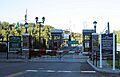
USS Nautilus (SSN-571)

The U.S.S. Nautilus is a very important submarine located at the Naval Submarine Base in Groton. It was the world's first submarine powered by nuclear energy!
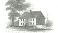
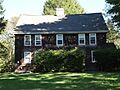
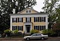
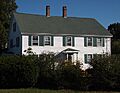
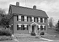
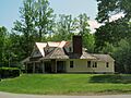
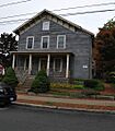
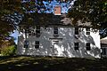
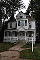
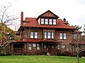
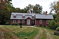
William Williams House (Lebanon, Connecticut)
.jpg)
This house in Lebanon belonged to William Williams. He was a delegate from Connecticut to the Continental Congress and signed the Declaration of Independence!
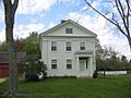
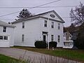
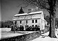
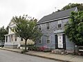
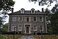
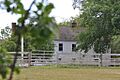
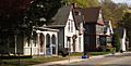
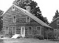
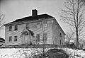
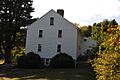
Old Homes and Buildings
Many historic homes and buildings in New London County tell stories of the past.
Alden Tavern Site
This is the spot in Lebanon where the Alden Tavern once stood. It's famous because British General Richard Prescott was whipped here during the American Revolution!
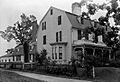
Winslow Ames House

In New London, this house was built in 1933. It was a special kind of house called a "Motohome," designed to be put together quickly.
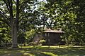
Applewood Farm

This farmhouse in Ledyard has a classic Colonial design with a chimney in the middle. It also has fancy Federal style details.
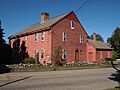
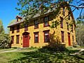
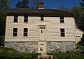
Avery Homestead

Built around 1696 in Ledyard, this house is special because it shows old designs. More than twelve generations (that's a lot of family!) of the Avery family have lived here.
Avery House (Griswold, Connecticut)
.jpg)
This house in Griswold was built around 1770. It was once part of a busy mill town called Hopeville. Now, it's the home for the park manager at Hopeville Pond State Park.
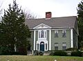
Thomas Avery House

This large farmhouse in East Lyme was built around 1845-1846. It has a style called Greek Revival, with a classic look. It's also known as the Smith-Harris House.
Nathaniel Backus House

This house in Norwich was built around 1750. It started as a Colonial style home but was later updated to a Greek Revival style. It was even moved to its current spot in 1952!
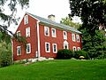
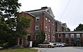
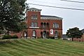
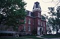
Bacon Academy

In Colchester, this school was built in 1803. It's a three-story brick building with Federal style details.
Acors Barns House

This house in New London was built in 1837. It's a two-and-a-half story house with a Greek Revival style.
Henry Champion House

This house in Colchester was the home of Henry Champion, a general.
Joshua Hempstead House

Located in New London, this house is a very old and important part of the city's history.
Nathaniel Hempstead House

Also in New London, this house is sometimes called the Old Huguenot House.
Col. Joshua Huntington House
.jpg)
This house in Norwich belonged to Colonel Joshua Huntington.
Gen. Jedidiah Huntington House
.jpg)
Another Huntington house in Norwich, this one belonged to General Jedidiah Huntington.
Gov. Samuel Huntington House

This house in Norwich was the home of Governor Samuel Huntington.
Nathan Lester House

Found in Ledyard, this house is another historic home.
Thomas Lee House
.jpg)
This house in East Lyme is a significant historic building.
Leffingwell Inn
.jpg)
The Leffingwell Inn in Norwich is a historic inn that has been preserved.
Capt. Enoch Lord House

This house in Old Lyme belonged to Captain Enoch Lord.
Peck Tavern

The Peck Tavern in Old Lyme is another historic building that served as a tavern.
Pequotsepos Manor

Located in the Mystic area of Stonington, this manor is a historic property.
Shaw Mansion (New London, Connecticut)
.jpg)
The Shaw Mansion in New London is a grand historic home.
Robert Stanton House
.jpg)
This house in Stonington belonged to Robert Stanton.
Simon Tiffany House

The Simon Tiffany House in Salem is a historic home.
Dr. Philip Turner House
.jpg)
This house in Norwich belonged to Dr. Philip Turner.
Edward Waldo House

This "saltbox" style home in Scotland (and partly in Sprague) was owned by the Waldo family for over 250 years!
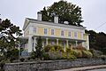
Whitehall Mansion

The Whitehall Mansion in Stonington is a beautiful historic mansion.
Ashbel Woodward House
.jpg)
This house in Franklin belonged to Ashbel Woodward.
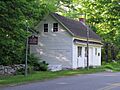
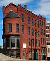
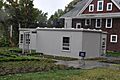
Important Industrial Sites
These places show how people worked and built things in the past.
American Thermos Bottle Company Laurel Hill Plant

This old factory in Norwich was important for showing how old mill designs could be used for new industries. It's now been updated and is used as a school!
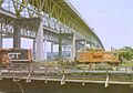
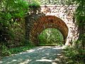
Blackledge River Railroad Bridge

This bridge in Colchester was built around 1912 for the railroad. It uses a special design called a Warren truss.
Lyman Viaduct

This viaduct in Colchester is a large bridge structure that was part of an old railroad line.
Main Sawmill

The Main Sawmill in Ledyard is a historic sawmill.
Occum Hydroelectric Plant and Dam

This power plant and dam in Norwich and Sprague used water power to create electricity.
Thames Shipyard
.jpg)
The Thames Shipyard in New London was a place where ships were built and repaired.
Williams Clark Company Thread Mill

This old mill in Stonington was used to make thread.
Winthrop Mill

The Winthrop Mill in New London is a historic mill.
Yantic Woolen Company Mill

This mill in Norwich was part of the Yantic Woolen Company.
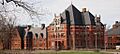
Historic Districts
Historic districts are areas with many important buildings or sites that together tell a story.
Baltic Historic District

This district in Sprague includes many historic buildings.
Bean Hill Historic District
_-_New_London_County_CT.jpg)
This historic area in Norwich has many old buildings.
Burnett's Corner Historic District

This district in Groton is a historic area.
Chelsea Parade Historic District
.jpg)
This large historic district in Norwich includes many important buildings and areas.
Coit Street Historic District

This district in New London has many historic buildings.
Colchester Village Historic District

This district in Colchester includes the historic center of the village.
Downtown New London Historic District

This district covers the historic downtown area of New London.
Downtown Norwich Historic District

This district includes the historic downtown area of Norwich.
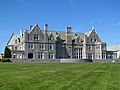
Eolia-Harkness Estate

This estate in Waterford is a large historic property.
Gales Ferry Historic District No. 1

This historic district is located in Ledyard.
Gales Ferry Historic District No. 2

Another historic district in Ledyard.
Graniteville Historic District (Waterford, Connecticut)

This district in Waterford is known for its historic buildings.
Greeneville Historic District (Norwich, Connecticut)

This district in Norwich has many historic buildings.
Groton Bank Historic District

This historic district in Groton is located near the Thames River.
Hadlyme North Historic District

This district in Lyme includes historic buildings.
Hadlyme Ferry Historic District

This district in Lyme is near the Chester–Hadlyme Ferry.
Hallville Mill Historic District

This district in Preston includes historic mill buildings.
Hamburg Bridge Historic District

This district in Lyme is centered around the Hamburg Bridge.
Hartford Colony

This historic area is located in Waterford.
Hempstead Historic District

This district in New London includes several historic streets.
Jail Hill Historic District

This district in Norwich includes historic streets and buildings.
Jordan Village Historic District (Waterford, Connecticut)

This district in Waterford is centered around Jordan Village.
Laurel Hill Historic District
.jpg)
This district in Norwich includes historic buildings.
Lebanon Green Historic District

This district in Lebanon is centered around the town green.
Little Plain Historic District

This district in Norwich includes historic buildings.
Mechanic Street Historic District

This district in Stonington includes historic buildings.
Montauk Avenue Historic District

This district in New London includes historic buildings.
Mystic Bridge Historic District

This district in the Mystic section of Stonington includes the historic bridge and surrounding area.
Mystic River Historic District

This district in the Mystic section of Groton includes the historic area along the Mystic River.
Noank Historic District

This district in Groton includes the historic village of Noank.
North Stonington Village Historic District
.jpg)
This district includes the historic village of North Stonington.
Norwich Hospital District
.jpg)
This district in Norwich and Preston includes the historic hospital buildings.
Norwichtown Historic District

This district in Norwich includes the historic Norwichtown area.
Old Lyme Historic District

This district in Old Lyme includes the historic center of the town.
Oswegatchie Historic District

This district in Waterford includes historic buildings.
Poquetanuck Village Historic District

This district in Preston is a historic New England village.
Post Hill Historic District

This district in New London includes historic buildings.
Preston City Historic District
.jpg)
This district in Preston includes the historic Preston City area.
Prospect Street Historic District

This district in New London includes historic buildings.
Quaker Hill Historic District (Waterford, Connecticut)

This district in Waterford includes historic buildings.
Rossie Velvet Mill Historic District
This district in the Mystic section of Stonington includes the historic velvet mill.
Salem Historic District (Salem, Connecticut)

This district includes the historic center of Salem.
Taftville

This historic area in Norwich was once a mill town.
United States Housing Corporation Historic District

This district in New London includes housing built by the U.S. government.
Walnut Grove (Waterford, Connecticut)

This historic area is located in Waterford.
Whale Oil Row

This row of houses in New London is known for its historic architecture.
Williams Memorial Park Historic District

This district in New London includes a historic park and surrounding buildings.
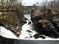
Yantic Falls Historic District
.jpg)
This district in Norwich is centered around the historic Yantic Falls.
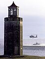
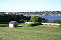
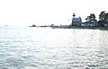
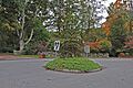
Lighthouses and Ships
New London County has a strong connection to the sea, and its lighthouses and ships are a big part of that history.
Avery Point Light

This lighthouse in Groton was built in 1943. It's officially the last lighthouse ever built in Connecticut!
New London Harbor Light

This lighthouse in New London guides ships into the harbor.
New London Ledge Light

This unique lighthouse in Groton is located at the entrance to New London Harbor.
Stonington Harbor Light

This lighthouse in Stonington helps guide ships in Stonington Harbor.
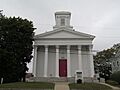
Other Interesting Places
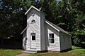
Anshei Israel Synagogue

This small, one-room synagogue in Lisbon was built in 1936 for an Orthodox Jewish community.
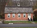
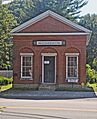
Old Bacon Academy
This three-story brick school in Colchester was built in 1803. It has a strong, simple design with Federal style details.
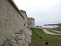
Fort Griswold

Located in Groton, Fort Griswold is an important historical site.
Fort Trumbull

Fort Trumbull in New London is another historic fort.
Lighthouse Inn (New London, Connecticut)

The Lighthouse Inn in New London is a historic inn.
New London County Courthouse

This courthouse in New London is an important government building.
New London Customhouse

This building in New London was used by customs officials.
New London Public Library

The New London Public Library in New London is a historic library building.
New London Railroad Station

This train station in New London is a historic transportation hub.
Norwich Town Hall

The Norwich Town Hall in Norwich is a historic government building.
Ohev Sholem Synagogue

This synagogue in New London is a historic place of worship.
Rocky Neck Pavilion

This pavilion in East Lyme is located in Rocky Neck State Park.
St. James Episcopal Church (New London, Connecticut)

This church in New London is a historic place of worship.
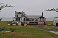
The Seaside (Waterford, Connecticut)

The Seaside in Waterford is a historic property.
US Post Office-New London Main

This post office in New London is a historic building.
US Post Office-Norwich Main
.jpg)
This post office in Norwich is a historic building.
War Office (Lebanon, Connecticut)

The War Office in Lebanon played an important role in history.
Wheeler Block (Colchester, Connecticut)

This building in Colchester is a historic block.
Williams Memorial Institute

This institute in New London is a historic building.
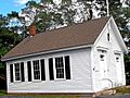
Wylie School

The Wylie School in Voluntown is a historic schoolhouse.
Images for kids
-
Alden Tavern Site
-
Anshei Israel Synagogue
-
Ashlawn
-
Avery Homestead
-
Avery House
-
Avery Point Lighthouse
-
Thomas Avery House
-
Nathaniel Backus House
-
Acors Barns House
-

Bean Hill Historic District
-
Gurdon Bill Store
-

Bozrah Congregational Church and Parsonage
-
Bradford-Huntington House
-
Branford House
-
Brewster Homestead
-
Bridge No. 1860
-
Broad Street School
-

William A. Buckingham House
-
Bulkeley School
-
Carpenter House
-

Joseph Carpenter Silversmith Shop
-
Carroll Building
-
Central Vermont Railroad Pier
-
David Chapman Farmstead
-

Capt. Richard Charlton House
-
Civic Institutions Historic District
-
Clark Homestead
-
Andrew Clark House
-
Edward Cogswell House
-
Coit Street Historic District
-
Commonwealth Works Site
-
Converse House and Barn
-
Deshon-Allyn House
-

East District School
-
Morton Freeman Plant Hunting Lodge
-
Abel H. Fish House
-
Fort Griswold
-
Fort Trumbull
-
Gales Ferry Historic District No. 1
-
Gales Ferry Historic District No. 2
-
William Gorton Farm
-
Groton Bank Historic District
-
Hadlyme Ferry Historic District
-
Jonathan Newton Harris House
-
Hartford Colony
-
Hayward House
-
Hempstead Historic District
-
House at 130 Mohegan Avenue
-
Huntington Street Baptist Church
-
Col. Joshua Huntington House
-
Gen. Jedidiah Huntington House
-
Jail Hill Historic District
-
Jordan Village Historic District
-
Kinne Cemetery
-
Lamb Homestead
-
Dr. Daniel Lathrop School
-
Dr. Joshua Lathrop House
-
Lathrop-Mathewson-Ross House
-
Laurel Hill Historic District
-
Noank Historic District
-
Kinne Cemetery
-
Mill Brook Bridge
-
Samuel Miner House
-
Montauk Avenue Historic District
-
Mystic Bank
-
Mystic Bridge Historic District
-
Mystic River Historic District
-

New England Hebrew Farmers of the Emanuel Society Synagogue and Creamery Site
-
North Stonington Village Historic District
-
Norwich Hospital District
-
William Noyes Farmstead
-

Oswegatchie Historic District
-
John Palmer House
-
William Park House
-
Pequot Fort
-
Perkins-Bill House
-

Perkins-Rockwell House
-
Post Hill Historic District
-
Preston City Historic District
-
Prospect Street Historic District
-
Quaker Hill Historic District
-
John Randall House
-
Raymond-Bradford Homestead
-
River Road Stone Arch Railroad Bridge
-
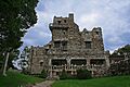
Seventh Sister (Gillette Castle)
-
Jabez Smith House
-
Samuel Smith House
-
Shubel Smith House
-
Springbank
-
Capt. Mark Stoddard Farmstead
-
Stonington High School
-
Telephone Exchange Building
-

Uncasville School
-
Nathan A. Woodworth House
-
Woodbridge Farm
-
Edward Yeomans House


_-_New_London_County_CT.jpg)
.jpg)

.jpg)


.jpg)

.jpg)
.jpg)
.jpg)


.jpg)


.jpg)
.jpg)
.jpg)

.jpg)


.jpg)


.jpg)
.jpg)


.jpg)


Former listing
One property was once on the list but has since been removed.
Ashland Mill Bridge

This bridge in Griswold was 65 feet long and built by the Berlin Iron Bridge Company. It was removed from the list in 2016.
