Newstead, New York facts for kids
Quick facts for kids
Newstead
|
|
|---|---|
| Town of Newstead | |

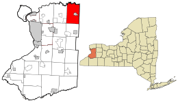
Location in Erie County and the state of New York.
|
|

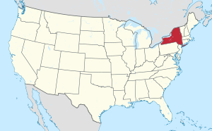
Location of New York in the United States
|
|
| Country | United States |
| State | New York |
| County | Erie County |
| Incorporated | 1823 |
| Named for | Newstead Abbey, England |
| Area | |
| • Total | 51.05 sq mi (132.21 km2) |
| • Land | 50.76 sq mi (131.46 km2) |
| • Water | 0.29 sq mi (0.74 km2) |
| Elevation | 659 ft (201 m) |
| Population
(2020)
|
|
| • Total | 8,689 |
| • Density | 170.81/sq mi (65.95/km2) |
| Time zone | UTC-5 (EST) |
| • Summer (DST) | UTC-4 (EDT) |
| ZIP code |
14001
|
| Area code(s) | 716 |
| FIPS code | 36-029-50716 |
| FIPS code | 36-50716 |
| GNIS feature ID | 0979273 |
Newstead is a town located in the northeastern part of Erie County, New York, in the United States. In 2020, about 8,689 people lived here. The town's name is believed to come from Newstead Abbey in England.
Newstead is located northeast of the city of Buffalo. The main community within the town is the village of Akron.
Contents
Discovering Newstead's Past
The first settlers arrived in the Newstead area around 1801.
How Newstead Got Its Name
The town of Newstead was created in 1823. It was first called the "Town of Erie." It was formed from the eastern part of the town of Clarence. In 1831, the town's name was changed to "Newstead." This change was reportedly suggested by Abigail Fillmore, who was a fan of the poet Lord Byron.
Unfortunately, a big fire in the 1870s destroyed many town records. This means there isn't much information about Newstead's early years, specifically between 1823 and 1870.
Growth of the Town
The discovery of a mineral called gypsum helped Newstead grow. Gypsum is used to make cement. The growth of the cement industry brought more people and businesses to the area.
Exploring Newstead's Geography
Newstead covers a total area of about 132.21 square kilometers (51.05 square miles). Most of this area is land, with a small part being water.
The town is in the northeast corner of Erie County. The Tonawanda Creek forms the northern border of Newstead.
Neighboring Towns and Areas
Newstead shares its borders with several other towns:
- Clarence to the west
- Royalton in Niagara County to the north
- Alabama in Genesee County to the east
- Pembroke in Genesee County to the east
- Darien in Genesee County to the southeast
- Alden to the south
- Lancaster to the southwest
The village of Akron is located inside the town of Newstead. It is east of the town's center.
Important Roads in Newstead
Several major highways pass through the Town of Newstead, making it easy to travel to and from the area:

 Interstate 90 (also known as the New York State Thruway) runs east to west through the southern part of town.
 New York State Route 5 (Main Street) is another east-west highway in the southern part of Newstead.
 New York State Route 93 (Maple Road, Lewis Road, Buell Street) travels north to south. It goes through Niagara County and into Newstead, ending south of Akron.
Newstead's Population Over Time
| Historical population | |||
|---|---|---|---|
| Census | Pop. | %± | |
| 1830 | 1,926 | — | |
| 1840 | 2,653 | 37.7% | |
| 1850 | 2,899 | 9.3% | |
| 1860 | 3,162 | 9.1% | |
| 1870 | 3,380 | 6.9% | |
| 1880 | 3,570 | 5.6% | |
| 1890 | 3,721 | 4.2% | |
| 1900 | 3,884 | 4.4% | |
| 1910 | 3,607 | −7.1% | |
| 1920 | 4,043 | 12.1% | |
| 1930 | 4,334 | 7.2% | |
| 1940 | 4,268 | −1.5% | |
| 1950 | 4,653 | 9.0% | |
| 1960 | 5,825 | 25.2% | |
| 1970 | 6,322 | 8.5% | |
| 1980 | 7,231 | 14.4% | |
| 1990 | 7,440 | 2.9% | |
| 2000 | 8,404 | 13.0% | |
| 2010 | 8,594 | 2.3% | |
| 2020 | 8,689 | 1.1% | |
| U.S. Decennial Census | |||
In 2000, there were 8,404 people living in Newstead. There were 3,371 households, and 2,332 families.
About 30% of households had children under 18 living with them. Most households (57%) were married couples. About 26% of households were individuals living alone.
The average age of people in Newstead in 2000 was 39 years old. About 24% of the population was under 18.
Places and Communities in Newstead
- Akron – This is a village located on NY-93, just north of NY-5.
- Akron Airport (9G3) – A small airport for general aviation. It is on a hilltop east of Akron village.
- Akron Falls County Park – A park within Akron village, next to Murder Creek. It's a great place for picnics, walking, and sports.
- Akron Junction – This was once a place where a railroad line branched off. Today, it's part of a hiking and bicycle trail.
- Falkirk – This was a community in Newstead that has now become part of Akron village.
- Hawkins Corners – A historical location south of Akron.
- Leisurewood Recreational Community – A large community where people stay in trailers and RVs, mostly during the summer. It's southwest of Akron.
- Murder Creek – A stream that flows through the town and into Tonawanda Creek. Its name comes from an old story about an Indian man who was killed there.
- Murrays Corner – A small community on NY-5, where it meets Crittenden Road, southeast of Akron village.
- Sand Hill – A tiny hamlet in the northwest part of town with a few homes and a church.
- South Newstead – An area near the border with the town of Alden. It has scattered homes and farms.
- Swifts Mills – A historical spot in the northern part of town, located on Murder Creek.
- Tonawanda Reservation – A small part of this Indian reservation is in the eastern part of Newstead.
Fun Things to Do in Newstead
Newstead and the nearby town of Clarence have created many miles of trails. These trails are perfect for biking and jogging and follow an old railroad path.
You can also visit the Octagon House in Akron village. It's a unique building with eight sides, and visitors can learn about its special architectural style.
Because Newstead has a lot of open space, it has become a popular place for building golf courses.
Notable People from Newstead
- Jack Davis – A well-known industrialist.
- Charles F. Tabor – A former New York State Attorney General.
See also
 In Spanish: Newstead (Nueva York) para niños
 | Leon Lynch |
 | Milton P. Webster |
 | Ferdinand Smith |

