
Oberlin, Kansas facts for kids
Quick facts for kids
Oberlin, Kansas
|
|
|---|---|
|
City and County seat
|
|

Downtown Oberlin (1999)
|
|

Location within Decatur County and Kansas
|
|

|
|
| Country | United States |
| State | Kansas |
| County | Decatur |
| Founded | 1872 |
| Platted | 1878 |
| Incorporated | 1885 |
| Named for | Oberlin, Ohio |
| Area | |
| • Total | 1.91 sq mi (4.95 km2) |
| • Land | 1.91 sq mi (4.95 km2) |
| • Water | 0.00 sq mi (0.00 km2) |
| Elevation | 2,569 ft (783 m) |
| Population
(2020)
|
|
| • Total | 1,644 |
| • Density | 860.7/sq mi (332.1/km2) |
| Time zone | UTC-6 (CST) |
| • Summer (DST) | UTC-5 (CDT) |
| ZIP code |
67749
|
| Area code | 785 |
| FIPS code | 20-52000 |
| GNIS ID | 485632 |
Oberlin is a city in Decatur County, Kansas, United States. It is the main city and the county seat of Decatur County. In 2020, about 1,644 people lived there.
Contents
History of Oberlin
Oberlin was first planned out in 1878. It was named after a town called Oberlin, Ohio. The city got its first post office in April 1878. It officially became a city in 1885.
On September 30, 1878, a group of Northern Cheyenne people passed near Oberlin. They were traveling north to their homes from Indian Territory. During this journey, they had a conflict with some settlers near the small town. A museum in Oberlin, the Decatur County Museum, has a special room about this event. There is also a monument in the town cemetery to remember the people involved.
Geography and Climate
Oberlin is located in the northwest part of Kansas. It sits near Sappa Creek, which flows into the Republican River. The city is part of the High Plains region.
You can find Oberlin where two major roads meet: U.S. Route 36 and U.S. Route 83. It is about 228 miles (367 km) northwest of Wichita. It is also about 238 miles (383 km) east of Denver and 320 miles (515 km) west-northwest of Kansas City.
The United States Census Bureau says that Oberlin covers an area of 1.91 square miles (4.95 km2). All of this area is land.
Oberlin's Weather
Oberlin has a humid continental climate. This means it has hot, dry summers and cold, dry winters. The hottest temperature ever recorded in Oberlin was 114 °F (46 °C) on July 24, 1936. The coldest temperature was -32 °F (-36 °C) on January 11, 1918.
| Climate data for Oberlin, Kansas, 1991–2020 normals, extremes 1913–2021 | |||||||||||||
|---|---|---|---|---|---|---|---|---|---|---|---|---|---|
| Month | Jan | Feb | Mar | Apr | May | Jun | Jul | Aug | Sep | Oct | Nov | Dec | Year |
| Record high °F (°C) | 78 (26) |
85 (29) |
93 (34) |
97 (36) |
103 (39) |
111 (44) |
114 (46) |
110 (43) |
107 (42) |
99 (37) |
88 (31) |
83 (28) |
114 (46) |
| Mean maximum °F (°C) | 65.3 (18.5) |
70.7 (21.5) |
81.4 (27.4) |
87.9 (31.1) |
94.4 (34.7) |
100.0 (37.8) |
103.3 (39.6) |
100.9 (38.3) |
97.1 (36.2) |
89.6 (32.0) |
77.9 (25.5) |
65.9 (18.8) |
104.4 (40.2) |
| Mean daily maximum °F (°C) | 41.7 (5.4) |
44.9 (7.2) |
56.1 (13.4) |
64.6 (18.1) |
74.1 (23.4) |
85.9 (29.9) |
90.9 (32.7) |
88.7 (31.5) |
80.9 (27.2) |
67.6 (19.8) |
53.9 (12.2) |
42.6 (5.9) |
66.0 (18.9) |
| Daily mean °F (°C) | 28.8 (−1.8) |
31.6 (−0.2) |
41.3 (5.2) |
50.3 (10.2) |
60.4 (15.8) |
72.1 (22.3) |
77.4 (25.2) |
75.1 (23.9) |
66.2 (19.0) |
52.6 (11.4) |
39.6 (4.2) |
29.8 (−1.2) |
52.1 (11.2) |
| Mean daily minimum °F (°C) | 15.8 (−9.0) |
18.4 (−7.6) |
26.4 (−3.1) |
36.0 (2.2) |
46.8 (8.2) |
58.3 (14.6) |
63.8 (17.7) |
61.5 (16.4) |
51.4 (10.8) |
37.5 (3.1) |
25.4 (−3.7) |
17.0 (−8.3) |
38.2 (3.4) |
| Mean minimum °F (°C) | −3.8 (−19.9) |
−0.2 (−17.9) |
7.9 (−13.4) |
20.3 (−6.5) |
30.9 (−0.6) |
44.8 (7.1) |
52.5 (11.4) |
50.2 (10.1) |
35.3 (1.8) |
20.2 (−6.6) |
8.4 (−13.1) |
−1.9 (−18.8) |
−9.9 (−23.3) |
| Record low °F (°C) | −32 (−36) |
−28 (−33) |
−25 (−32) |
0 (−18) |
22 (−6) |
34 (1) |
40 (4) |
35 (2) |
19 (−7) |
2 (−17) |
−19 (−28) |
−31 (−35) |
−32 (−36) |
| Average precipitation inches (mm) | 0.42 (11) |
0.68 (17) |
1.03 (26) |
2.13 (54) |
3.30 (84) |
3.01 (76) |
3.27 (83) |
3.07 (78) |
1.72 (44) |
1.69 (43) |
0.80 (20) |
0.67 (17) |
21.79 (553) |
| Average snowfall inches (cm) | 5.7 (14) |
6.2 (16) |
3.4 (8.6) |
1.9 (4.8) |
0.2 (0.51) |
0.0 (0.0) |
0.0 (0.0) |
0.0 (0.0) |
0.0 (0.0) |
1.3 (3.3) |
2.3 (5.8) |
4.2 (11) |
25.2 (64.01) |
| Average precipitation days (≥ 0.01 in) | 3.0 | 3.7 | 5.1 | 6.7 | 9.6 | 9.0 | 8.7 | 8.8 | 6.1 | 5.6 | 3.6 | 3.1 | 73.0 |
| Average snowy days (≥ 0.1 in) | 1.9 | 2.8 | 1.7 | 0.8 | 0.1 | 0.0 | 0.0 | 0.0 | 0.0 | 0.3 | 1.1 | 2.2 | 10.9 |
| Source 1: NOAA | |||||||||||||
| Source 2: National Weather Service | |||||||||||||
People in Oberlin
| Historical population | |||
|---|---|---|---|
| Census | Pop. | %± | |
| 1890 | 976 | — | |
| 1900 | 937 | −4.0% | |
| 1910 | 1,157 | 23.5% | |
| 1920 | 1,247 | 7.8% | |
| 1930 | 1,629 | 30.6% | |
| 1940 | 1,878 | 15.3% | |
| 1950 | 2,019 | 7.5% | |
| 1960 | 2,337 | 15.8% | |
| 1970 | 2,291 | −2.0% | |
| 1980 | 2,387 | 4.2% | |
| 1990 | 2,197 | −8.0% | |
| 2000 | 1,994 | −9.2% | |
| 2010 | 1,788 | −10.3% | |
| 2020 | 1,644 | −8.1% | |
| U.S. Decennial Census | |||
2020 Population Count
The 2020 United States census found that 1,644 people lived in Oberlin. There were 771 households and 428 families. Most people (93.31%) were white. A small number of people were black, Native American, Asian, or from two or more races. About 3.16% of the population was Hispanic or Latino.
About 21.8% of households had children under 18 living there. Many households (41.8%) were made up of single people. About 28.8% of the population was 65 years old or older. The average age in Oberlin was 49.1 years.
2010 Population Count
In 2010, there were 1,788 people living in Oberlin. There were 824 households. Most people (96.9%) were White.
About 20% of the people were under 18 years old. About 29.5% were 65 years old or older. The average age in the city was 52 years.
Fun Things to Do in Oberlin
Arts and Culture
Oberlin has the Last Indian Raid Museum. This museum has many old buildings from the late 1800s and early 1900s. These buildings are filled with items that show the history of the area and early settlers. For example, you can see a grocery store from the 1930s and a one-room schoolhouse built in 1922.
The city also has a recreation center, which opened in 2010. It has a movie theater where you can watch 3D movies and a bowling alley.
If you like music, the Oberlin Area Band is a group of people of all ages who play music together. They practice every week and perform a few times a year.
Parks and Recreation
The Oberlin City Park is a great place to visit. It is near Decatur Community High School. The park has a playground, a place for picnics, a band shell for performances, and a basketball court. The Oberlin swimming pool is also located here.
Sappa Park
The City of Oberlin owns Sappa Park, which is two miles east of town. This park used to be a state park. It has wetlands, paths for biking and hiking, and a nine-hole disc golf course. There is also a shelter house that was built in the 1930s by the Works Progress Administration (WPA). The park is currently being improved. A nine-hole golf course is right next to it.
Sappa Park was first developed in 1935 by the National Park Service. The WPA hired young men who needed jobs to build a dam and the shelter house. The park was officially opened in 1939. Over the years, the lake in the park filled with dirt and was drained. Recently, part of the lake has been brought back as wetlands.
Education in Oberlin
Students in Oberlin go to schools run by the Oberlin USD 294 public school district. There are two schools in the city:
- Oberlin Elementary School, for students in Pre-Kindergarten through 6th grade.
- Decatur Community Junior/Senior High School, for students in 7th through 12th grade.
Media in Oberlin
The Oberlin Herald is the only newspaper in the city. It is published once a week.
You can also listen to two FM radio stations that broadcast from Oberlin:
- K-LOVE (K217CY) at 91.3 FM, which plays Christian Contemporary music.
Oberlin is part of the Wichita-Hutchinson, Kansas television market. NBC channel KSNK broadcasts from studios west of Oberlin. It is a satellite station of KSNW in Wichita.
Famous People from Oberlin
Some notable people who were born or lived in Oberlin include:
- Brun Campbell – a composer and pianist known for ragtime music.
- Sam Francis – a top pick in the 1937 NFL draft. He was a great football player for the Nebraska Cornhuskers and later coached at Kansas State University.
- Elmer Hackney – an NFL running back.
- Richard Rogers – a judge for the U.S. federal court.
- Cora Simpson – a nurse and nurse educator. She started a nursing school in Fuzhou, China.
Images for kids
-
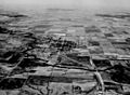
View of Oberlin, 1943
.jpg)
See also
 In Spanish: Oberlin (Kansas) para niños
