
Otoe County, Nebraska facts for kids
Quick facts for kids
Otoe County
|
|
|---|---|

Otoe County Courthouse in Nebraska City
|
|

Location within the U.S. state of Nebraska
|
|
 Nebraska's location within the U.S. |
|
| Country | |
| State | |
| Founded | 1855 |
| Named for | Otoe tribe |
| Seat | Nebraska City |
| Largest city | Nebraska City |
| Area | |
| • Total | 619 sq mi (1,600 km2) |
| • Land | 616 sq mi (1,600 km2) |
| • Water | 3.4 sq mi (9 km2) 0.5%% |
| Population
(2020)
|
|
| • Total | 15,912 |
| • Density | 25.706/sq mi (9.925/km2) |
| Time zone | UTC−6 (Central) |
| • Summer (DST) | UTC−5 (CDT) |
| Congressional district | 1st |
Otoe County is a place in Nebraska, a state in the USA. In 2020, about 15,912 people lived there. Its main town, called the county seat, is Nebraska City. The county started in 1854. It got its name from the Otoe people, a Native American tribe.
In Nebraska, license plates have a special system. Otoe County uses the number 11. This is because it had the 11th most registered vehicles when the system began in 1922.
Contents
About Otoe County's Land and Location
Otoe County is on the eastern side of Nebraska. The Missouri River forms its eastern border. Across the river are the states of Iowa and Missouri.
The land here has rolling hills that go down to the river. The soil is very rich. Farmers in Otoe County grow many crops. These include corn, soybeans, milo, wheat, and fruit. The county covers about 619 square miles. Most of this (616 square miles) is land. A small part (3.4 square miles) is water.
Otoe County got its name from the Otoe tribe, who used to live in this area.
Main Roads in Otoe County
These are the most important roads that go through Otoe County:
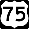
 U.S. Highway 75
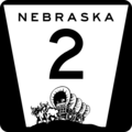
 Nebraska Highway 2
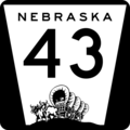
 Nebraska Highway 43
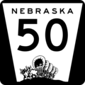
 Nebraska Highway 50
 Nebraska Highway 67
 Nebraska Highway 128
Neighboring Counties
Otoe County shares its borders with these other counties:
- Cass County to the north
- Fremont County, Iowa to the northeast
- Atchison County, Missouri to the east
- Nemaha County to the southeast
- Johnson County to the south
- Gage County to the southwest
- Lancaster County to the west
Population of Otoe County
| Historical population | |||
|---|---|---|---|
| Census | Pop. | %± | |
| 1860 | 4,211 | — | |
| 1870 | 12,345 | 193.2% | |
| 1880 | 15,727 | 27.4% | |
| 1890 | 25,403 | 61.5% | |
| 1900 | 22,288 | −12.3% | |
| 1910 | 19,323 | −13.3% | |
| 1920 | 19,494 | 0.9% | |
| 1930 | 19,901 | 2.1% | |
| 1940 | 18,994 | −4.6% | |
| 1950 | 17,056 | −10.2% | |
| 1960 | 16,503 | −3.2% | |
| 1970 | 15,576 | −5.6% | |
| 1980 | 15,183 | −2.5% | |
| 1990 | 14,252 | −6.1% | |
| 2000 | 15,396 | 8.0% | |
| 2010 | 15,740 | 2.2% | |
| 2020 | 15,912 | 1.1% | |
| 2023 (est.) | 16,335 | 3.8% | |
| US Decennial Census 1790-1960 1900-1990 1990-2000 2010 |
|||
In 2000, there were 15,396 people living in Otoe County. The population density was about 25 people per square mile. The average age of people in the county was 40 years old.
Towns and Villages in Otoe County
Otoe County has several communities.
Cities
- Nebraska City (This is the county seat, the main town)
- Syracuse
Villages
Other Places
- Woodland Hills (This is a census-designated place)
Education in Otoe County
Many school districts serve the students of Otoe County:
- Conestoga Public Schools
- Elmwood-Murdock Public Schools
- Freeman Public Schools
- Johnson-Brock Public Schools
- Johnson County Central Public Schools
- Norris School District 160
- Nebraska City Public Schools
- Palmyra District OR-1
- Sterling Public Schools
- Syracuse-Dunbar-Avoca Schools
- Waverly School District 145
The Nebraska Center for the Education of Children Who Are Blind or Visually Impaired is also located in Otoe County. This is a special school for children who cannot see well.
Images for kids
-
U.S. Highway 75 sign
-
Nebraska Highway 2 sign
-
Nebraska Highway 43 sign
-
Nebraska Highway 50 sign
-
Nebraska Highway 67 sign
-
Nebraska Highway 128 sign


See also
 In Spanish: Condado de Otoe para niños
