Phoenixville, Pennsylvania facts for kids
Quick facts for kids
Phoenixville, Pennsylvania
|
|
|---|---|
|
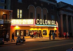
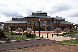
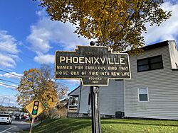
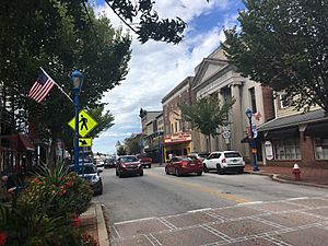
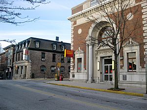
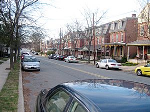
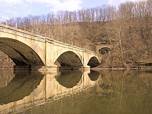
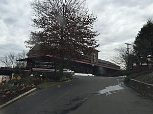
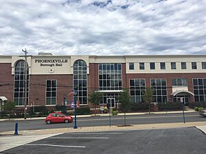
Top to bottom: Phoenixville Historic District, The Colonial Theatre, Phoenixville Foundry, Phoenixville Keystone Marker,
|
|
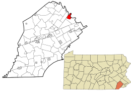
Location of Phoenixville in Chester County and the state of Pennsylvania
|
|
| Country | United States |
| State | Pennsylvania |
| County | Chester |
| Settled | 1732 |
| Incorporated | March 6, 1849 |
| Named for | Phoenix Iron Works |
| Area | |
| • Total | 3.72 sq mi (9.63 km2) |
| • Land | 3.51 sq mi (9.09 km2) |
| • Water | 0.21 sq mi (0.54 km2) |
| Elevation | 138 ft (42 m) |
| Population
(2020)
|
|
| • Total | 18,602 |
| • Density | 5,299.7/sq mi (2,046.2/km2) |
| Time zone | UTC−5 (EST) |
| • Summer (DST) | UTC−4 (EDT) |
| ZIP Code |
19460
|
| Area code(s) | 610 and 484 |
| FIPS code | 42-60120 |
Phoenixville is a town, also called a borough, in Chester County, Pennsylvania, United States. It is about 28 miles (45 km) northwest of Philadelphia. It sits where French Creek meets the Schuylkill River. In 2020, about 18,602 people lived there.
For a long time, Phoenixville was famous for the Phoenix Iron Works. This company closed in the 1980s, which caused a tough time for the town. However, in recent years, Phoenixville has seen a great economic comeback.
Contents
Discovering Phoenixville's Past
The area where Phoenixville is now was first called Manavon. This name came from David Lloyd, a judge who bought land here in 1713. He named it after his home parish in Wales. The town began to grow in 1732 around a mill on the French Creek.
In 1790, the French Creek Nail Works opened. This was the first nail factory in the United States. It later became the Phoenix Iron Works. This factory was the heart of the town's economy for almost 200 years. It made important things like the Griffen gun and the Phoenix column.
In the early 1800s, many Irish immigrants came to Manavon. They helped build the Schuylkill Canal in 1827 and the Black Rock Tunnel in 1838. Because of the tunnel, the north side of town became known as "Tunnel Hill." On March 6, 1849, Manavon officially became a borough and was renamed "Phoenixville."
Later, in the late 1800s and early 1900s, more immigrants arrived. These included people from Poland, Italy, Ukraine, and Slovakia. Other factories and shops also opened in Phoenixville. One special product made here was the beautiful Etruscan majolica pottery.
After World War II, the Phoenix Iron Company (then called Phoenix Steel Corporation) started to struggle. By the mid-1980s, it stopped making iron and steel. The company closed for good in 1987. This caused a difficult time for the town's economy. But in the early 2000s, a plan to bring the town back to life began. New businesses like breweries, restaurants, and shops opened. More people moved in, leading to new homes like townhouses and apartments.
Much of this history is protected in the Phoenixville Historic District. This district was created in 1987 and is the largest historic site in Chester County. Other historic places listed are the Black Rock Bridge, Gay Street School, and the Schuylkill Navigation Canal, Oakes Reach Section.
Why Phoenixville Got Its Name
Phoenixville is named after the Phoenix Iron Works. This factory was the town's main employer until it closed in 1987. It started in 1790 as the French Creek Nail Works. In 1813, an engineer named Lewis Wernwag bought it. He renamed it the Phoenix Iron Works because the heat from the furnaces reminded him of the mythical phoenix bird. When the town became a borough in 1849, it took the name of the iron works.
Fun Things to Do in Phoenixville
Phoenixville is home to the Colonial Theatre, which opened in 1903. The Colonial hosts concerts and special movie showings all year. It's famous for being in the 1958 science fiction horror movie The Blob. Every July, Phoenixville celebrates Blobfest. People can even act out the scene where moviegoers run from the theater! In 2017, the theater got a big expansion, adding the historic bank next door.
The Phoenixville Dogwood Festival has been celebrated every May since 1943. This tradition started when Army Major General Edward C. Shannon planted a dogwood tree in Reeves Park. It was a memorial to honor those in the Armed Forces. The festival has rides, food, a parade, and crowns a Dogwood Queen.
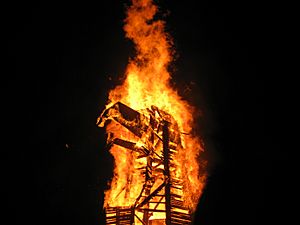
Since 2004, Phoenixville has held the annual Firebird Festival in December. This festival celebrates the town's "rebirth" by burning a large wooden phoenix bird. The bonfire also hardens clay birds that people make in the weeks before.
A documentary called Firebird: Built to Burn follows a year of life in Phoenixville and the festival. It was released in early 2025.
A Whole Lot of LuLu is a flea market held twice a year in Phoenixville. It features vintage and handmade items.
Phoenixville has over 16 parks and nature trails. These include Reeves Park, Reservoir Park, and Andre Thornton Park, named after the Major League Baseball player. You can also visit nearby places like Black Rock Sanctuary and the Schuylkill River Trail. Valley Forge National Historical Park is also close by.
Phoenixville's Economy
For most of its history, Phoenixville's economy depended on the Phoenix Iron Works. Many people in town worked there. When the company closed in 1987, the town faced a tough economic time. Many steel workers lost their jobs.
In the early 2000s, plans were made to bring the town back. By the early 2010s, new restaurants, shops, and apartment buildings were built, mostly in the downtown area.
One exciting result of Phoenixville's comeback is the many new craft breweries and distilleries. Having so many breweries has made Phoenixville a popular "destination-brewery location."
The town's economic growth has also led to a higher cost of living. This is partly because more people want to live here due to the new businesses. To help with this, the Phoenixville Borough Council created groups to work on affordable housing for residents.
Where is Phoenixville?
Phoenixville is located at 40.135201 degrees North latitude and -75.522699 degrees West longitude. The town covers about 3.8 square miles (9.8 km2). Most of this area is land, with a small part being water.
Phoenixville shares borders with East Pikeland Township to the west and Schuylkill Township to the south and east. Upper Providence Township is to the north and east.
The Schuylkill River forms most of the northern and eastern edges of the town. The French Creek flows from the Schuylkill River through the middle of Phoenixville.
Phoenixville's Weather
Phoenixville has a humid continental climate. This means it has warm summers and cold winters.
The average yearly rainfall is about 45.13 inches (114.6 cm). The average yearly snowfall is about 16.3 inches (41 cm).
Phoenixville holds the record for the highest temperature ever recorded in Pennsylvania. It was 111 degrees Fahrenheit (44 degrees Celsius) on July 10, 1936.
People and Population
In 2010, Phoenixville had 16,440 people living in 7,590 homes.
About 78% of the people were White, 8.6% were African American, and 3.5% were Asian. About 7.4% of the population was Hispanic or Latino.
About 6.3% of the population was under 5 years old. Most people, about 79.9%, were between 18 and 65. About 11.6% were 65 or older. The average age was 37.9 years. More than half, 52.6%, were female.
Getting Around Phoenixville
Roads and Highways
Phoenixville has about 53.89 miles (86.73 km) of public roads. Most of these are maintained by the borough itself.

Three main state highways serve Phoenixville: Pennsylvania Route 23, Pennsylvania Route 113, and Pennsylvania Route 29. These roads connect Phoenixville to other towns like Philadelphia, Downingtown, and Pottstown.
Public Transportation
Phoenixville has two SEPTA bus routes. The Route 99 bus goes to the Norristown Transportation Center. From there, you can connect to train service to Philadelphia. The Route 139 bus connects Phoenixville to the King of Prussia Mall and Limerick.
In the past, several major railroads served Phoenixville. The Reading Company Main Line had a station in town. Regular passenger trains stopped here until 1981. The old station is now used for events. The Black Rock Tunnel, one of the oldest railroad tunnels in the U.S., is also in Phoenixville.
Another line, the Pennsylvania Railroad Schuylkill Branch, also served the town. Passenger service on this line ended by the late 1900s.
Since 2000, there has been interest in bringing passenger train service back to Phoenixville. Several plans have been discussed to connect Phoenixville to Norristown, Reading, and even New York City. In 2022, the Schuylkill River Passenger Rail Authority was created to help make this project happen. Phoenixville's mayor, Peter Urscheler, is part of this authority.
How Phoenixville is Governed
Phoenixville is run by a mayor and a borough council. The Borough Council has eight members, two from each of the four areas (wards) of the town: North, East, Middle, and West.
The Borough Council makes laws, decides on the budget, and sets policies for the town. The Mayor is in charge of the police department. The Borough Manager handles the daily tasks of running the town's departments.
The current mayor of Phoenixville is Peter Urscheler. He has been mayor since January 2, 2018.
Borough Council Members
As of January 2, 2024
| Ward | Council member | Party | Position | Term ends |
|---|---|---|---|---|
| Middle | Jonathan M. Ewald | Democratic | President | 2027 |
| Middle | Beth Burckley | Democratic | Vice President | 2025 |
| West | Brian Moore | Democratic | Assistant Secretary | 2027 |
| East | James Carminito | Democratic | 2025 | |
| West | Dana Dugan | Democratic | 2025 | |
| North | Richard M. Kirkner | Democratic | 2025 | |
| North | David Strenfel | Democratic | 2027 | |
| East | Brian Weiss | Democratic | 2027 |
Phoenixville is part of Pennsylvania's 6th congressional District. It is also in District 26 of the Pennsylvania House of Representatives and District 44 of the Pennsylvania Senate.
Learning in Phoenixville
Public Schools
Phoenixville is served by the Phoenixville Area School District. This district also includes East Pikeland and Schuylkill Townships. The district has an early learning center and three elementary schools: Barkley, Manavon, and Schuylkill.
Phoenixville Area Middle School and Phoenixville Area High School serve all students in the borough for older grades. High school students can also go to the Chester County Intermediate Unit (CCIU) Technical College High School. There, they can get hands-on training in specific job fields.
Private Schools
Holy Family School is a private Catholic school for grades K-8. It opened in 1922.
Charter Schools
Renaissance Academy Charter School is a K-12 charter school in Phoenixville. It opened in 2000.
Higher Education
The University of Valley Forge is located very close to Phoenixville. The Phoenixville campus of the Lansdale School of Business is also in the borough.
Public Libraries
The Phoenixville Public Library serves the community.
Phoenixville in the Media
Newspapers
The Daily Local News is a newspaper that covers local news in Chester County, including Phoenixville.
Radio
WPHE-AM (690), called Radio Salvación, is a Spanish Christian radio station. It broadcasts from Phoenixville.
Television
Voxipop is an online TV channel that creates shows and news about the Phoenixville area.
Famous People from Phoenixville
Sports Stars
- Rick Allain, ice hockey player and coach
- Creighton Gubanich, former baseball player for the Boston Red Sox
- Hadley Hartmetz, professional ice hockey player
- Rich Kraynak, former football player for the Philadelphia Eagles
- Rob Lohr, football player
- Kevin Negandhi, ESPN anchor
- Neal Olkewicz, football player
- Mike Piazza, Hall of Fame baseball catcher
- John Smiley, baseball pitcher
- André Thornton, former Major League Baseball player
- Jake Walker, racing driver
- Frank Zinn, baseball player
Entertainment Figures
- Kevin Bacon, actor (spent weekends at his grandmother's home in Phoenixville)
- Terry Gilkyson, song composer (wrote "Memories Are Made of This")
- Jerry Spinelli, writer
- Jack Wall, video game soundtrack composer
- David White, actor
- William George Wilson, sports cinematographer
Other Notable People
- Everett W. Anderson, soldier who received the Medal of Honor
- Raymond P. Coffman, USMC Major General
- James F. Crow, famous population geneticist
- Elizabeth Wendell Ewing, Civil War nurse
- Levi B. Kaler, businessman and politician
- Samuel W. Pennypacker, soldier, writer, and former Governor of Pennsylvania
- Rebecca Lane Pennypacker Price, Civil War nurse and giver to charity
See also
 In Spanish: Phoenixville para niños
 | Shirley Ann Jackson |
 | Garett Morgan |
 | J. Ernest Wilkins Jr. |
 | Elijah McCoy |


