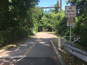
Schuylkill River Trail facts for kids
Quick facts for kids Schuylkill River Trail |
|
|---|---|
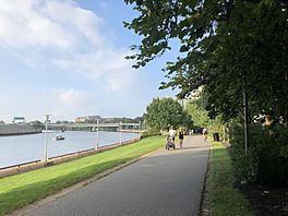
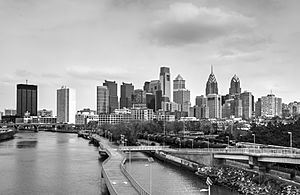
The trail runs along the Schuylkill River in Philadelphia, Pennsylvania, near the Art Museum
|
|
| Location | |
| Use | Multi-use trail |
| Season | All |
| Sights |
|
| Surface |
|
| Maintained by |
|
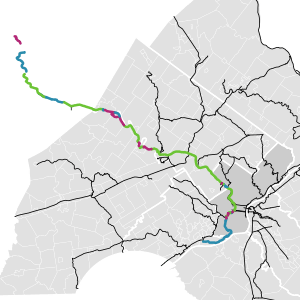
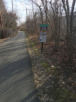
The Schuylkill River Trail (pronounced SKOOL-kil) is a long path for many uses. It runs along the Schuylkill River in southeastern Pennsylvania. This trail is still being built. When it's finished, it will be about 140 miles long. It will stretch from the river's start in Schuylkill County all the way to Fort Mifflin in Philadelphia.
Some parts of the trail are already open. These include sections from Auburn to Hamburg. There's also a 19.5-mile part from Reading to Pottstown. Another 23.2-mile section goes from Oaks to South Street in Center City, Philadelphia. Many parts of the trail used to be old railroad lines. These are called rail trails. The Schuylkill River Trail is also part of the East Coast Greenway. This is a huge 3,000-mile trail system that connects Maine to Florida.
You might see an older name for the trail on some maps. The part between Philadelphia and Valley Forge was once called the Philadelphia–Valley Forge Trail.
Contents
Exploring the Schuylkill River Trail
The Schuylkill River Trail offers many different experiences. It passes through cities, towns, and beautiful natural areas. Let's explore some of the main sections of this exciting trail.
From Auburn to Pottstown
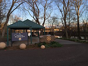
The trail starts near the Kernsville Dam in Auburn. This is just above Hamburg. It then goes through Reading and continues to Pottstown. In Pottstown, it reaches Riverfront Park. This area is known for great fishing.
In Berks County, a part of the trail is called the Thun Trail. It's named after Ferdinand Thun, who started a textile company in Reading long ago. There are plans to connect the trail further north from Reading to Hamburg. The northern end of this section links up with the Union Canal towpath.
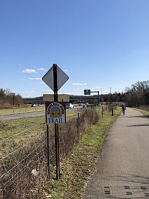
This part of the trail has different surfaces. You might walk or bike on pavement, gravel, or even old roads. It passes through towns like Birdsboro before becoming a smooth gravel path. This path leads to the paved Schuylkill River Trail in Pottstown.
Connecting Pottstown to Phoenixville
There are two ideas for how the trail will connect Pottstown to Phoenixville and Mont Clare. One idea is for the trail to run along the right side of the river (the Chester County side). It would then use town streets and the Mont Clare Bridge to link up with the trail in Mont Clare. The other idea is for the trail to stay on the left side of the river all the way to Mont Clare. It looks like both paths might be built eventually!
In 2011, a section from Spring City to Cromby opened. This part has a new starting point near the Cromby Power Plant. For a while, there was a small gap in the trail between Phoenixville and Mont Clare. But in 2019-2020, a new, wide path was built on the Mont Clare Bridge. This new path officially closed the gap, making it easy to travel between these towns.
From Mont Clare to Oaks
The trail section from Mont Clare to Oaks opened in 2008. This part of the trail follows an old section of the Schuylkill Canal. It's mostly paved, but there's a short gravel part. To cross streams, new tunnels were built. The trail also uses a historic aqueduct from the canal to cross Crossman's Run.
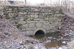
At first, the northern part of this section used local roads to connect to Mont Clare. But later, work began to fix up the old canal towpath. This will create an off-road path between Longford Road and Mont Clare. Construction started in 2013. It included improving the underpass at Route 29 and building a new bridge near Port Providence.
From Oaks to Philadelphia
This part of the trail starts in Oaks. It begins where the Perkiomen Trail ends. This paved section follows an old railroad track. It runs next to U.S. Route 422 for a bit. Then it goes through Valley Forge National Historical Park. After leaving the park, it continues along the river to Norristown. Here, it crosses over U.S. Route 202 and goes right through the Norristown Transportation Center.
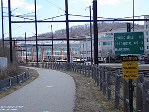
The trail keeps going east, next to the SEPTA train line. When it reaches Conshohocken, it passes through old industrial areas. It goes under Interstate 476 and meets another local path called the Cross County Trail.
The Trail in Philadelphia
When the trail enters Philadelphia, you'll briefly ride on Nixon and Shawmont Streets. You'll cross the train tracks at the old Shawmont station.
The trail then continues unpaved along the old Manayunk Canal Towpath. This part goes through the neighborhood of Manayunk. It ends at Lock Street. From there, you'll use Main Street or Ridge Avenue sidewalks to reach Fairmount Park. Here, the trail meets the Wissahickon Trail. You'll cross the historic Ridge Avenue Bridge and turn onto the paved path next to Kelly Drive.
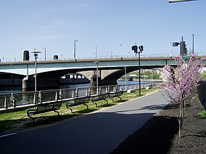
The trail winds along the east side of the Schuylkill River through the park. You'll see the Falls Bridge and pass under many other bridges. You'll also go by monuments and Laurel Hill Cemetery. It runs next to Boathouse Row and the Azalea Garden. These are behind the Philadelphia Museum of Art and next to the Fairmount Water Works.
After passing under more bridges, the trail becomes a waterfront park. This park is called Schuylkill Banks. At Locust Street, the trail splits. One part goes over railroad tracks to Schuylkill River Park. The other part is a 2,000-foot boardwalk that opened in 2014. This boardwalk goes over the river and continues to South Street. You can reach the South Street Bridge from here.
In 2009, more land was added to extend the trail. In 2018, a section from South Street to Christian Street opened. This part goes through land owned by Children's Hospital of Philadelphia.
Future plans include a new bridge to connect Christian Street to Grays Ferry Crescent. This bridge will help extend the trail even further. Another project is turning an old railway bridge into a bridge for walkers and bikers. This will connect Grays Ferry Crescent to Bartram's Mile. This bridge is expected to be finished by mid-2020.
The Trail's Past: A Look at its History
Many parts of the Schuylkill River Trail used to be old railroad lines. These are called rail trails. For example, the section from Oaks to Philadelphia follows the path of the old Schuylkill Branch of the Pennsylvania Railroad. You can still see some old catenary wires above the trail between Norristown and Philadelphia. These wires are still used to power trains on other lines.
The part of the trail from Shawmont to Manayunk follows the old towpath of the historic Schuylkill Canal. This canal was once a very important waterway.
 | Shirley Ann Jackson |
 | Garett Morgan |
 | J. Ernest Wilkins Jr. |
 | Elijah McCoy |


