Pyramid Lake (Los Angeles County, California) facts for kids
Quick facts for kids Pyramid Lake |
|
|---|---|
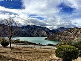
Pyramid Lake and San Emigdio Mountains.
|
|
| Location | Angeles National Forest / Los Padres National Forest Los Angeles County, California |
| Coordinates | 34°38′39″N 118°45′51″W / 34.644153°N 118.764258°W |
| Type | Reservoir |
| Primary inflows | West Branch California Aqueduct Piru Creek |
| Primary outflows | West Branch California Aqueduct Piru Creek |
| Basin countries | United States |
| Water volume | 222,000 acre⋅ft (274,000,000 m3) |
| Surface elevation | 786 m (2,579 ft) |
Pyramid Lake is a large reservoir (which is like a big, artificial lake) in Southern California. It was created by the Pyramid Dam on Piru Creek. This lake is an important part of the California State Water Project. This project moves water all across California. Water for Pyramid Lake is pumped from the San Joaquin Valley and through the Tehachapi Mountains.
Contents
The Story of Pyramid Lake
In 1843, people found a small amount of gold near where Pyramid Lake is now. This discovery happened in the Santa Feliciana Canyon. However, this small find did not cause a big "gold rush" to the area. Only a few ranchers tried to settle there.
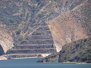
Pyramid Lake itself was built much later. It was created in 1972 and finished in 1973. Its main purpose is to hold water for the California State Water Project. The lake got its name from a special pyramid-shaped rock. Engineers carved this rock when they were building U.S. Route 99. People traveling between Los Angeles and Bakersfield called it "Pyramid Rock." This landmark is still there, right next to the dam.
Where is Pyramid Lake?
Pyramid Lake is the deepest lake in the California Water Project system. It was built along the steep canyon walls that surround Piru Creek.
The reservoir holds about 180,000 acre⋅ft (220,000,000 m3) of water. It sits on the edge of two big forests: the Angeles National Forest and the Los Padres National Forest. You can find it in the northwestern part of Los Angeles County. The lake is west of Interstate 5 (I-5), south of Tejon Pass. The old road, US 99, is now under the lake's water.
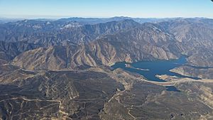
Right below the dam, Piru Creek flows naturally again. It winds through the Topatopa Mountains and eventually reaches Lake Piru. From there, it flows into the Santa Clara River. Water is also pumped from Pyramid Lake to Castaic Lake. These two lakes work together for a large power plant. This plant uses the water moving between them to create electricity.
What is Pyramid Lake Like?
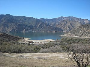
The Pyramid Dam is 118 m (387 ft) tall and made of earth and rock. The California Department of Water Resources built it, finishing in 1973. Pyramid Lake is a key part of the California Aqueduct. This aqueduct is like a giant water canal. Water from Pyramid Lake flows downstream to Castaic Lake. Castaic Lake is the end point of this part of the aqueduct.
Pyramid Lake and Castaic Lake are like two giant batteries for the Castaic Power Plant. This plant is a 1,495 megawatt pumped storage hydroelectric plant. It uses the difference in height between the two lakes to make power. Pyramid Lake is the deepest lake in the entire California Water Project system. Its name comes from the "Pyramid Rock." This rock was formed in 1932 when a ridge was cut through for the old US 99 road. Pyramid Rock is still there, right in front of the dam.
Fun Things to Do at Pyramid Lake
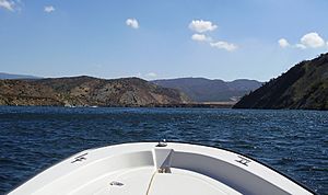
Pyramid Lake is a great place for outdoor activities! You can go boating, fishing, and jet skiing. There are also picnic areas, including five special spots you can only reach by boat. You'll find courtesy docks for boats too. The Vista del Lago Visitors Center offers amazing views of the lake. You can get to the lake from the Interstate 5 exit on Vista Del Lago.
Fishing is allowed almost everywhere at Pyramid Lake. You can catch many types of fish, such as large mouth bass, small mouth bass, striped bass, blue gill, crappie, and some trout. It's always a good idea to check for any local advisories about eating fish from the lake to make sure they are safe.
 | Charles R. Drew |
 | Benjamin Banneker |
 | Jane C. Wright |
 | Roger Arliner Young |


