River Sence facts for kids
Quick facts for kids River Sence |
|
|---|---|

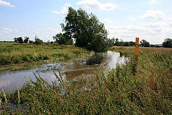
The River Sence, near Sheepy Magna
|
|
|
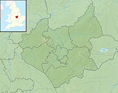
Location of the mouth within Leicestershire
|
|
| Country | England |
| Counties | Leicestershire, East Midlands |
| Towns | Sheepy Magna, Ibstock, Coalville |
| Physical characteristics | |
| Main source | Copt Oak, Leicestershire, United Kingdom 52°43′04″N 1°18′01″W / 52.7179°N 1.3003°W |
| River mouth | River Anker Atherstone, West Midlands, Warwickshire, United Kingdom 52°35′20″N 1°32′13″W / 52.5889°N 1.5370°W |
The River Sence is a river that flows through Leicestershire, England. It is part of a larger river system that eventually joins the River Trent, which covers much of central England. Many smaller streams, like the Saint and the Tweed, join the Sence. These streams spread out across western Leicestershire, from Charnwood Forest in the north to areas near Hinckley in the south. In 1881, people sometimes called this river Shenton Brook or Sibson Brook.
Contents
Understanding the Name Sence
Sometimes, the name "Sence" can be a bit confusing. It has also been used for another river called the Saint and a stream that flows into it from Stapleton. Old stories about the Battle of Bosworth Field called the stream near Shenton the "Tweed." Even today, some maps show a "Tweed River" southwest of Stapleton, while others don't name it at all. The lower parts of the river, from Shenton to Ratcliffe Culey, are often known locally as the Saint.
The River Sence's Journey
The River Sence starts its journey on Bardon Hill in Leicestershire. It then flows west, picking up water from other streams near Coalville, and passes through places like Hugglescote and Donington le Heath. The river then turns southwest, where it is joined by Blower's Brook and another stream from Ravenstone.
It continues its path between towns such as Heather and Ibstock, and then through Shackerstone. Finally, the River Sence joins the River Anker near the border with Warwickshire, close to Sheepy, Ratcliffe Culey, and Atherstone. From its start on Bardon Hill, the river flows for about 20 kilometers (12 miles).
Smaller Rivers Joining the Sence
Rivers often have smaller streams that flow into them. These are called tributaries. The River Sence has a few important ones.
Carlton Brook's Path
Carlton Brook is one of these tributaries. It gets its water from streams around Bagworth and Nailstone. This brook flows between Carlton and Market Bosworth before joining the Sence south of Congerstone.
The Tweed and Saint Brooks
The biggest tributary of the Sence is the Saint. It starts as a stream called the Tweed, which rises near Barwell. Another branch from Hinckley joins the Tweed southwest of Stapleton. The Tweed then flows west and north, eventually becoming the Saint near Shenton.
The Saint continues west past Sibson and then meanders (winds back and forth) to join the Sence between Sheepy and Ratcliffe Culey. The Tweed and Saint flow more slowly than the Sence, which makes their channels muddier and more winding.
The Area Around the Sence River System
The land around a river that drains into it is called its watershed. The Sence watershed is mostly in the Hinckley and Bosworth area of Leicestershire.
To the northwest, the Sence watershed is next to areas that drain into the River Mease and other parts of the Anker. To the northeast, near Charnwood Forest, the streams flow towards the River Soar. To the east and southeast, other brooks also flow into the Soar.
The land here was shaped by ancient geological events and the Ice Age. Much of the area is covered by red mudstones, which create a gently rolling landscape with mixed farms. The higher land in the northeast forms a plateau, where the Sence's tributaries have carved out narrow valleys.
Long ago, during the Ice Age, the Saint–Tweed valley was blocked by sand and gravel. Later, much of the Sence and Tweed–Saint valleys were filled with clays from a large ancient lake called Lake Harrison. This lake covered parts of Leicestershire and Warwickshire when ice blocked the drainage.
Old Names Connected to the Rivers
Many local place names tell us about the history of these rivers and the people who lived here.
- Ambion is a deserted village near a stream that feeds the Saint. Its name might come from an Old English phrase meaning "One-Beam bridge," suggesting how people crossed the stream. It's also linked to the Battle of Bosworth Field.
- Barwell means "boar spring" or "boar stream" in Old English. This suggests that wild boars lived in the area where the Tweed river starts.
- King Dick's Hole is a deep part of the Anker where the Sence joins it. It's a popular swimming spot. Local stories say King Richard III bathed there before the Battle of Bosworth, but the name likely comes from an Old English word for a flood plain area.
- Lovett's Bridge crosses the Sence near Sheepy Parva. This crossing point is very old, possibly from the Iron Age. The name might mean "smooth-flowing" or "deep pool" in an old Celtic language.
- Mythe comes from an Old English word meaning "place where waters meet." This is where the Sence joins the Anker.
- Ratcliffe means "road-cleave." Ratcliffe Culey is named after a ford where a road was "cleaved" (cut through) by the Sence.
- Sence and Saint probably come from an old Celtic word meaning "shining." This is common for rivers in central England.
- Sheepy might also come from a Celtic word meaning "shining water."
- Shenton means "settlement on the Saint," showing its connection to the river.
- Tweed comes from a Celtic word meaning "powerful" or "swollen," perhaps describing how the stream grows or the marshy areas during rainy times.
- Twitchell is a small stream and lane near Sheepy Magna. Its name might mean "Twice-wella," suggesting it rises from two springs.
Water Mills on the Sence
For many years, people used the power of the River Sence to run water mills. These mills ground corn and were important for the local community. The Sence has a good slope, which made it suitable for water power.
- There were at least eight corn mills on the Sence, including ones at Hugglescote, Ravenstone, Ibstock, and Sheepy.
- Help-Out Mill, near Shackerstone, was known for its reliable water supply. It used a water turbine instead of a waterwheel after 1902 and stopped working in the late 1960s.
- Temple Mill was first mentioned in 1279 and operated until after World War II.
- Sheepy Mill is mentioned in the Domesday Book, a very old survey from 1086. It was a major employer in the village and supplied flour to a wide area. It closed around 1970.
- The Saint river, with its gentler slope, was not as good for water power and probably had fewer mills.
Lakes Along the River
There are a few small lakes along the River Sence.
- Two lakes between Heather and Ibstock are used for fishing. These were once clay workings.
- Sheepy Lake used to be fed by the river and helped supply the mill during dry periods. It is also used for fishing now and gets its water from underground sources.
Fishing and Wildlife in the Sence Valley
The River Sence is home to many different types of fish, including roach, chub, dace, perch, and trout. Grayling fish were added to the river in 2007.
In the 12th century, fishing rights in the Sence were given to a priory (a type of monastery). There's also a legend that King Richard III gave fishing rights to the people of Sheepy as a thank you, but these rights usually stayed with the manor owners.
In recent years, an area of old clay workings and coal pits in the Sence Valley has been turned into the Sence Valley Forest Park. This park has woodlands, lakes connected to the river, grasslands, and a wild flower meadow. It's a great place for wildlife!
- Over 150 species of birds have been seen here, including herons, coots, and different types of ducks.
- Kestrels nest in the park every year, and you might spot barn owls and short-eared owls.
- Many birds of prey, like ospreys and buzzards, have also been seen.
- Long grassy areas are home to small mammals like field voles, shrews, rabbits, and foxes.
- Water voles live in the streams, and otters are now using the river again.
- Different types of bats, such as pipistrelle and Daubenton's bat, live here.
- In summer, you can see many insects like butterflies (e.g., gatekeeper, peacock) and dragonflies (e.g., southern hawker).
Efforts are being made to protect the riverbanks and help wildlife, especially otters, in the middle parts of the Sence.
How the Sence Area Connects People
The Sence watershed has been important for travel and trade for a very long time. Several old routes, some from the Iron Age and one Roman road, cross the area. Today, modern roads also follow some of these ancient paths.
Old Roads and Paths
- The Redway: This very old road runs from Derby in the north, through western Leicestershire, towards Coventry. It crossed the Sence near Temple Mill and the Saint near Sibson.
- Hinckley–Upton–The Mythe Route: This route, possibly from the Iron Age or Danish times, connected Wykin to Ratcliffe Culey and then crossed the Sence to Mythe Hall.
- Salt Street: This route entered the watershed near Norton-juxta-Twycross and crossed the Sence by Temple Mill, possibly leading to Barwell.
- Swepstone Way: This prehistoric route follows the northwest edge of the Sence watershed, connecting Ravenstone to Polesworth.
- Packington–Bagworth–Hinckley Road: This road, dating back to at least Anglian times, runs south from Packington through Ravenstone to Bagworth and possibly on to Hinckley.
- Fenn Lane (Roman Road): This Roman road connected Leicester to Mancetter. It crossed the Saint watershed and was used by Richard III on the eve of the Battle of Bosworth Field.
Canals and Railways
- Ashby Canal: Opened in 1804, this canal connected coalfields to the Coventry Canal. It crosses the Sence using an aqueduct near Shackerstone Station.
- Railways: The Battlefield Line Railway is a preserved part of an old railway line that opened in 1873. It runs from Cadeby to Shackerstone and used to connect to Coalville. Another railway line, from Burton on Trent to Leicester, opened in 1845 and helped transport coal from the Leicestershire coalfield.
 | John T. Biggers |
 | Thomas Blackshear |
 | Mark Bradford |
 | Beverly Buchanan |


