Roan Mountain (Roan Highlands) facts for kids
Quick facts for kids Roan Mountain |
|
|---|---|
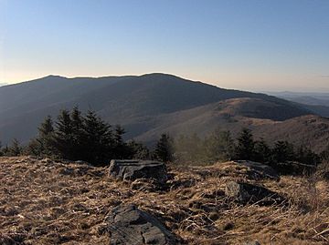
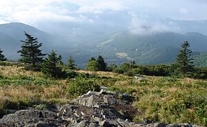
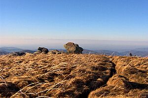
Roan Mountain, looking northwest from Grassy Ridge Bald
|
|
| Highest point | |
| Peak | Roan High Knob |
| Elevation | 6,285 ft (1,916 m) |
| Prominence | 3,485 ft (1,062 m) |
| Parent peak | Potato Knob |
| Geography | |
| Location | |
| Parent range | Unaka Mountains |
| Topo map | USGS Bakersville, Carvers Gap |
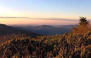
Roan Mountain is a very tall mountain in the Unaka Range of the Southern Appalachian Mountains. It's located in the southeastern part of the United States. This mountain is covered in thick forests of spruce and fir trees. It also has the world's largest natural garden of rhododendron flowers. Plus, it has the longest stretch of "grassy bald" areas in the Appalachian range.
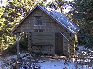
A "grassy bald" is a special kind of high meadow. It has thick grass and only a few trees. The Cherokee National Forest and Pisgah National Forest meet at the top of Roan Mountain. Roan Mountain State Park is found near the mountain's northern base. The famous Appalachian Trail goes across most of Roan's top. The Roan High Knob Shelter is the highest shelter for hikers on the entire 2,174-mile (3,499 km) trail.
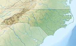
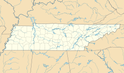
Roan Mountain is a big part of the Roan Highlands. This is a group of mountains stretching about 20-mile (32 km) long. Most of these mountains are along the border between Tennessee and North Carolina. This area is between Carter County and Mitchell County.
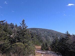
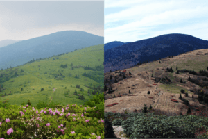
Roan Mountain has five main peaks. They are split into two parts by a place called Carver's Gap. The first part is west of Carver's Gap. It includes Roan High Bluff and Roan High Knob. This area is known for its thick evergreen forests. It looks a bit like a camel with two humps. The Rhododendron Gardens are between these two peaks. This is the biggest rhododendron garden in the world.
The second part of Roan Mountain is east of Carver's Gap. It's called Grassy Ridge. This is the longest stretch of grassy bald in the Appalachian Mountains, about 7 mi or 11 km long. The three peaks on Grassy Ridge are Round Bald, Jane Bald, and Grassy Ridge Bald. The bald area covers all three peaks. It's about 1,000 acres (4.0 km2) big.
The Appalachian Trail crosses Roan Mountain. It goes over Roan High Knob, Carver's Gap, and Grassy Ridge. Roan Mountain is special because it's the only place on the Appalachian Trail that goes above 6,000-foot (1,800 m). This is true for about 150 miles (240 km) to the south and 1,500 miles (2,400 km) to the north.
Contents
Exploring Roan Mountain's Peaks
Roan Mountain has five important peaks:
Roan High Knob: The Highest Point
Roan High Knob is the highest spot on Roan Mountain. It is 6,285 feet (1,916 m) tall. The border between Tennessee and North Carolina runs right over its top. High Knob is the tallest peak in Tennessee outside of the Great Smoky Mountains. It's also the 15th highest peak in the eastern United States. The Appalachian Trail goes near its western side. A short path leads right to the very top. The Roan High Knob Shelter is very close to the summit.
Roan High Bluff: A Steep View
Roan High Bluff is on the western side of the mountain. It is 6,267 feet (1,910 m) tall and is completely in North Carolina. This peak is very steep. It drops sharply about 1,000-foot (300 m) on its northwest side. You can't go to the very top of High Bluff. But there's a viewing platform a little below it. From there, you can see a wide view of the valley. You can reach this platform by the Cloudland Trail.
Round Bald: A Panoramic View
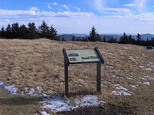
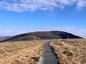
Round Bald is near the middle of the Roan mountains. It is about 5,823 feet (1,775 m) tall. It looks over Carver's Gap. The Appalachian Trail crosses its top. There are some trees on its lower slopes. But near the top, it opens up into a wide grassy area. You can see amazing views from the summit.
Jane Bald: A Local Legend
Jane Bald is a smaller peak between Round Bald and Grassy Ridge Bald. It is about 5,810 feet (1,771 m) tall. A local story says it's named after a woman named "Jane." She supposedly died there from a sickness while crossing the mountain. The grassy area on Jane Bald is smaller than its neighbors. It's also partly covered by rhododendron bushes. The Appalachian Trail crosses its summit.
Grassy Ridge Bald: A Wide Open Space
Grassy Ridge Bald is the main peak of Grassy Ridge. It is about 6,184 feet (1,885 m) tall. This makes it one of the highest grassy balds in the Appalachian Mountains. The bald area on top covers many 100 acres (40 hectares). It has some patches of trees and bushes. The Appalachian Trail crosses the northern side of the mountain. Other paths lead to the very top. There's a pile of rocks and a special bronze plaque at the summit. It honors a local farmer named Cornelius Rex Peake. From the top, you can see wide views. You can see Grandfather Mountain to the east and the Black Mountains to the south. Most of Grassy Ridge Bald is in North Carolina.
Yellow Mountain (5,371 ft or 1,637 m) and Little Hump Mountain (5,446 ft or 1,660 m) are at the far end of the Roan Highlands. The Appalachian Trail also goes over both of these mountains.
How Roan Mountain Was Formed
The rocks that make up Roan Mountain are very, very old. Some are called Cranberry gneiss. These rocks formed over a billion years ago from old ocean mud. They are some of the oldest rocks in the United States. Another rock, Roan gneiss, formed about 800 million years ago. There's also a lot of Beech granite, which is about 700 million years old.
The mountains themselves were formed between 200 million and 400 million years ago. This happened during a time called the Appalachian orogeny. It's when the North American and African plates (huge pieces of Earth's crust) crashed into each other. This collision pushed the rocks upward to create the mountains we see today.
Roan Mountain's History
Native Americans were the first people to visit Roan Mountain. The Catawba tribe has a legend. It says a big battle happened with the Cherokee tribe on the mountain. The legend claims the battle made the rhododendron flowers turn red. It also says parts of the mountain became treeless. We don't have proof of this battle. But many Native American villages have been found around the mountain's base.
Early Explorers and Plants
In the 1700s and 1800s, scientists who study plants often visited Roan Mountain. They came to collect plant samples. John Bartram explored the area in the late 1730s. He studied the plants of the southeastern United States. Andre Micheaux came in 1794. He found mountain plants rarely seen outside of New England and Canada. In 1799, John Fraser explored Roan Mountain. He collected rhododendron plants. He also noticed the fir tree that is now named after him. Other early explorers included Elisha Mitchell and Asa Gray.
The American Revolutionary War
In 1780, during the American Revolutionary War, British General Charles Cornwallis was fighting in the southern colonies. He sent a group of British supporters, called Loyalists, to raid Western Carolina. To stop them, a group of frontiersmen gathered. They came from the mountains of what is now East Tennessee, North Carolina, and Virginia. They met at Fort Watauga in Elizabethton.
These frontiersmen were known as the Overmountain Men. They crossed the Roan Highlands. Then they fought and defeated the British Loyalists at the Battle of Kings Mountain. This was an important American victory. To help the Overmountain Men, gunpowder was made by Mary Patton and her husband. They had a powder mill in Elizabethton. On the first night of their march, the Overmountain Men stored the gunpowder in a dry cave. It was called "Shelving Rock." This protected it from the rain. Shelving Rock is near Roan Mountain State Park.
Mining and Logging History
In 1826, three brothers found iron ore deposits on the North Carolina side of Roan Mountain. This led to the discovery of a huge iron ore deposit. It was called the Cranberry vein. The Cranberry Mine was built to dig out the ore. It operated for almost 100 years. It closed because of the Great Depression.
In the late 1800s, logging was a big business. New tools like the band saw and logging railroads helped. As forests in lower areas were cut down, loggers moved to the mountains. On Roan Mountain, a steam engine was set up. It was in the gap between Round Bald and Jane Bald. This gap is still called "Engine Gap." It moved wood from the Tennessee side to mills in North Carolina. Too much logging caused a lot of erosion. This likely led to a huge flood in 1901 that damaged the area.
The Cloudland Hotel: A Mountain Resort
People started visiting Roan Mountain as tourists in the mid-1800s. They loved the amazing views. In 1857, two tourists wrote about their visit. They said looking out from the mountain was like seeing a "vast blue ocean."
This beauty convinced John T. Wilder to build a lodge on Roan Mountain in 1877. Wilder was a former general and a rich mining businessman. The lodge was built in an area now called Tollhouse Gap. Wilder soon saw that people wanted to escape the hot lowlands in summer. So, he started building a much bigger hotel in the early 1880s. To get building materials up the mountain, he built a road across Carver's Gap.
The hotel was finished in 1885 and was called the Cloudland Hotel. It was a health resort, especially for people with Hay fever. Many important people stayed there, including politicians and even European royalty. It cost $2 a day to stay there. The hotel was built right on the state line. A white line was even painted across the dining room floor to show the border! Back then, alcohol was legal in Tennessee but not in North Carolina. So, drinks could only be served on the Tennessee side of the line.
It cost a lot to run a hotel on top of a mountain. The Cloudland Hotel was abandoned by 1910. It fell apart quickly. Wilder sold the hotel before he died. The new owner sold off the decaying building room by room. By 1927, only a pile of rubble was left.
Roan in the 20th Century: Conservation Efforts
In 1933, the Civilian Conservation Corps built a fire tower and a cabin on Roan High Knob. The tower didn't work well, but the cabin was fixed up in 1980. It is now the Roan High Knob Shelter for hikers.
In 1941, the United States Forest Service bought 7,000 acres (28 km2) of land on Roan Mountain. This stopped harmful logging practices. Between 1959 and 1974, Tennessee bought over 2,000 acres (8.1 km2) of land. This land became Roan Mountain State Park.
In the mid-1900s, Cornelius Rex Peake had the highest farm in the eastern U.S. He helped start the conservation movement on the mountain. A plaque on Grassy Ridge Bald honors him. More recently, S. Kenneth Wilson, a descendant of the Peake family, has farmed parts of the same land. His family has worked to bring back medicinal plants that were almost gone from the area. In 2007, his livestock farm was recognized as the highest operating farm on the entire East Coast of the USA.
How to Visit Roan Mountain
State Routes TN-143 and NC-261 go up Roan Mountain. They connect the village of Roan Mountain, Tennessee, with Bakersville, North Carolina. These roads cross the top of the mountain at Carver's Gap.
You can get on the Appalachian Trail from Carver's Gap. There's a small parking lot there. To the east, the trail goes up Round Bald and across Grassy Ridge. To the west, the trail goes around Roan High Knob. It leads to Tollhouse Gap, about one mile (1.6 km) away.
A paved road also crosses the south side of Roan High Knob. It connects Carver's Gap with Tollhouse Gap. This road is closed in winter. It leads to the Cloudland Trailhead. This trail goes through the Rhododendron Gardens. It then goes up Roan High Bluff to the observation platform. The trail is just over a mile long.
The Roan High Knob Shelter is near the top of Roan High Knob. It can fit 15 backpackers. The Tennessee Eastman Hiking and Canoeing Club takes care of the shelter.
 | Delilah Pierce |
 | Gordon Parks |
 | Augusta Savage |
 | Charles Ethan Porter |


