Rosenheim facts for kids
Quick facts for kids
Rosenheim
|
|||
|---|---|---|---|
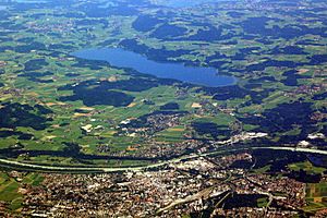
Aerial view of Rosenheim (foreground) and Simssee (background); in between from left to right the Inn river
|
|||
|
|||
| Country | Germany | ||
| State | Bavaria | ||
| Admin. region | Oberbayern | ||
| District | urban district | ||
| Elevation | 440 - 470 m (−1,102.0 ft) | ||
| Population
(2022-12-31)
|
|||
| • Total | 64,403 | ||
| Time zone | CET/CEST (UTC+1/+2) | ||
| Postal codes |
83001-83028
|
||
| Dialling codes | 08031 | ||
| Vehicle registration | RO | ||
| Website | rosenheim.de | ||
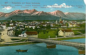
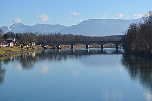
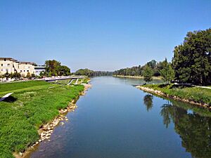
Rosenheim is a city in Bavaria, Germany. It is an independent city, meaning it governs itself. It is located in the middle of the Rosenheim district and is also where the district's main offices are. The city sits on the west side of the Inn river, right where the Inn and Mangfall rivers meet. This area is known as the Bavarian Alpine Foreland, which is near the Alps. Rosenheim is the third largest city in Upper Bavaria, with over 64,000 people living there. It is a very important place for business and activity in its region.
Contents
Geography of Rosenheim
About 60,000 people live in Rosenheim itself. If you include the areas around the city, the population goes up to 125,000. Rosenheim is located in the foothills of the Bavarian Alps. It is about 450 meters (1,476 feet) above sea level. The city covers an area of about 37.52 square kilometers (14.49 square miles).
Munich, the capital of Bavaria, is about 52 kilometers (32 miles) northwest of Rosenheim. The Rosenheim station is a busy train hub. It connects train lines going to Munich, Salzburg, and Kufstein.
The land around Rosenheim was shaped by the last ice age. A huge glacier, called the Inn Valley Glacier, moved through this area. Later, a large lake, called the Rosenheim lake, formed here. This lake existed about 10,000 years ago. It covered the entire Inn valley up to Wasserburg am Inn, which is about 25 kilometers (15.5 miles) north of Rosenheim. Even today, you can see where the old shoreline was. The flat lake bed suddenly changes into a steep bank in many places around the city.
History of Rosenheim
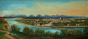
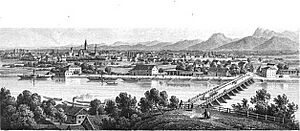
Rosenheim grew because it was located where important trade routes crossed. From early times, this busy crossroads helped it become a market town. Over time, it changed from a market town to a center for salt trade. Then it became a railway town, and today it is known for its wood industry and colleges.
Pons Aeni: Roman Times
The Inn river and its valley were very important for Rosenheim's beginning. The Romans arrived in the area in 15 BC. They were led by Drusus and Tiberius. The Romans set up two provinces: Noricum to the east of the Inn and Rhaetia to the west.
They built a road from the Brenner Pass to Castra Regina (modern-day Regensburg). They also built an east-west road from Iuvavum (modern-day Salzburg) to Augusta Vindelicum (modern-day Augsburg). Where these two major trade routes met, the Romans built a military station. They called it "Pons Aeni," which means "Bridge on the Inn." This Roman-Celtic settlement lasted for about 500 years. You can still see parts of this old name in local places like "Pfunzen" and "Leonhardspfunzen."
What Does "Rosenheim" Mean?
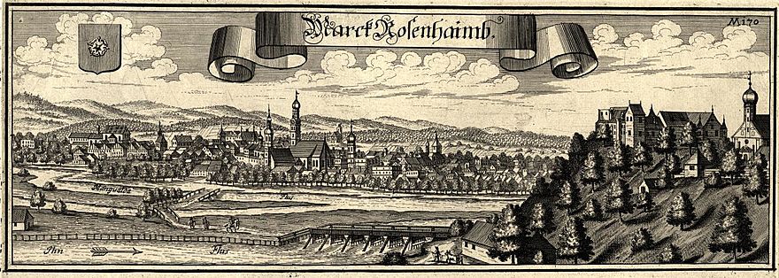
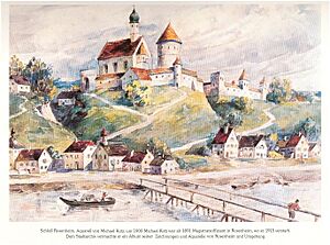
The exact meaning of the city's name is not fully clear. The first mention of Rosenheim castle was in 1234. This castle was on the east bank of the Inn river, overlooking a new bridge.
One idea is that the name comes from the rose symbol. This rose was on the coat of arms of the Earl Hall family from Wasserburg am Inn, who built the castle.
Another idea is that "Ross" (which sounds like "Rose") comes from the word for "horses" (Rössern). In medieval times, horses were used to pull river boats. There were large stables in Rosenheim for these horses. Street names like Am Esbaum (where horses grazed) and Am Roßacker (horse field) support this idea.
A third idea is that the name might come from old words like Roas, Roze, or Ried. These words used to mean "swamp" or "peat bogs." There are still swamps around Rosenheim, and a nearby town is called Kolbermoor (moor means swamp).
The most charming idea is that "Rose" used to mean a beautiful girl. Sailors on the Inn river knew that there were many beautiful girls in this town. So, they liked to call the town "home of the Rose," or Rosenheim.
How Rosenheim Grew
Around the time Rosenheim castle was first mentioned in 1234, a settlement of boatmen began on the western shore. The area right by the Inn Bridge was too marshy to build on for a long time. This was because it was close to where the Mangfall river joined the Inn. So, the settlement was built a few hundred meters away from the river. This is why the center of Rosenheim is not directly on the riverside.
Rosenheim Becomes a Market Town
Rosenheim quickly became important as a place for trading all sorts of goods. These goods, like livestock, grain, silk, weapons, and salt, were transported on the Inn river. In 1328, Rosenheim was given "market town" status. This meant it could hold regular markets.
The ship masters of Rosenheim became very rich during this time. They transported goods between Hall in Tirol and the Inn river, and then down the Danube river to Vienna and Budapest. By about 1600, Rosenheim had grown into one of the biggest and most important markets in Bavaria. However, it only officially became a city in 1864, thanks to the Bavarian King Ludwig II.
Rosenheim faced tough times in the 17th century. River shipping declined, and the city suffered from the Thirty Years' War. There was also a terrible plague in 1634 and a big fire in 1641.
In the 19th century, Rosenheim grew into an important economic center in Southeast Bavaria. This was thanks to brine, which is salty water. In 1810, a wooden pipeline was built to bring brine from the salt mines in Bad Reichenhall and Traunstein to Rosenheim. Boiling this brine to make salt made Rosenheim the main place for salt production in Bavaria until 1958.
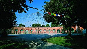
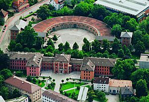
The expansion of railways connected Rosenheim to the train network early on. In 1858, the first Rosenheim train station opened. But it soon became too small and blocked the city's growth. So, in 1876, the station moved to its current location. The old railway line became a straight road (now City Hall and Prince Regent Street). The old roundhouse of the first station is now an exhibition center. The old station building, built in 1878, is now the City Hall. It is also used as the police headquarters in the TV show "Die Rosenheim-Cops".
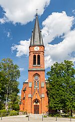
The late 19th and early 20th centuries saw a big economic boom. This led to many buildings being built in the Gründerzeit and Art Nouveau styles. These styles, including the local Swiss chalet style, still define the city's look today. The Evangelical Church of the Redeemer was built in a neo-Gothic brick style, which is quite rare for Rosenheim.
At the start of the 20th century, Rosenheim had nine breweries. Only two, "Auerbräu" and "Flötzinger Bräu", are still active today. They supply the "Märzen" beer for the "Rosenheimer Herbstfest", a local festival.
Rosenheim During the Nazi Era
At the beginning of the 20th century, about 50 Jewish people lived in Rosenheim. They tried to set up their own religious group, but the city council said no. So, Jewish people in Rosenheim remained connected to the state capital's Jewish community.
In 1920, the first local Nazi group started outside of Munich. This led to more hostility towards Jewish people in Rosenheim. A major incident happened in June 1920. Some people raided a villa where Jewish families lived. The city college later said it was "regrettable" that the movement against Jewish people was "discredited" by such actions.
On April 1, 1933, soon after the Nazis took power, guards were placed outside Jewish shops. They warned people not to buy from these stores. However, many people ignored these warnings and continued to shop there. This annoyed the Nazi activists. Despite public support, six of the eleven Jewish business owners had to close their businesses by 1937.
On November 10, 1938, during Krystallnacht, Nazi stormtroopers (SA) attacked the last two Jewish shops in Rosenheim. They destroyed the goods inside. Many Jewish people from Rosenheim tried to leave Germany, mostly for the United States. However, many faced difficulties and some died in concentration camps.
Bombing During World War II
Rosenheim was bombed during World War II. By November 1943, there were shelters for only 650 people, even though the city had about 22,000 residents. By February 1944, shelters were built for about 6,400 people. With other shelters, a total of 10,525 people could be protected.
During 14 bomb attacks, 201 people were killed and 179 were injured. The main targets were the train station and railway tracks. This was because Rosenheim was an important transport hub connecting Munich, Salzburg, and Innsbruck. The first major attack was on October 20, 1944. Over a hundred planes dropped 1,000 bombs, killing 27 people. The heaviest air raid happened on April 18, 1945. About 200 planes dropped 1,300 bombs near the station, killing 53 people and leaving 800 homeless. The station building was almost completely destroyed.
Important Dates in Rosenheim's History
|
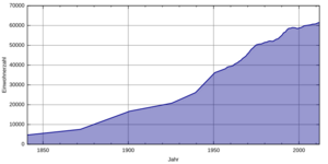
How Rosenheim's Population Grew
| Year | Population | Notes |
|---|---|---|
| 1808 | 1,600 | |
| 1840 | 3,100 | |
| 1871 | 5,779 | |
| 1900 | 14,246 | |
| 1925 | 17,998 | |
| 1939 | 20,692 | |
| 1946 | 27,979 | Population grew due to refugees after World War II. |
| 1970 | 46,018 | |
| 2010 | 61,299 | (December 31) |
| 2018 | 63,324 |
Rosenheim's Coat of Arms
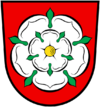 Rosenheim's coat of arms shows a white rose on a red background. This design comes from the old coat of arms of Wasserburg am Inn. Wasserburg used to rule Rosenheim until 1247. The oldest known seal of Rosenheim, from 1374, already had this rose. It has stayed the same ever since. The city also uses this rose in its modern logo.
Landmarks and Culture
Theatre and Events
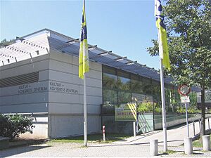
The Kultur- und Kongresszentrum Rosenheim (KU'KO) is a large center for culture and events. It was built on the site of old salt works. Opened in 1982, it has become a major event venue. About 400 events are held here each year in its 3,000-square-meter (32,000 sq ft) building.
Museums to Explore
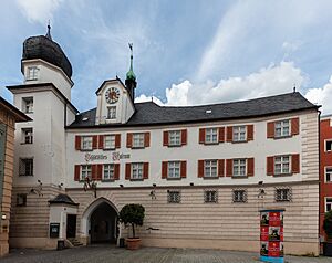
Since 1885, the Mittertor (a historic gate) has been home to the Municipal Museum. It has a huge collection of about 5,000 items. These show the cultural history of the city and the Rosenheim district. You can see things from ancient Roman times up to the 20th century. It is one of the most important history collections in Southeast Upper Bavaria.
The Inn Museum is located in the old river master's building by the Inn Bridge. It shows the history of hydraulic engineering and river technology. The museum has many original objects that tell the story of Inn river shipping. This shipping made Rosenheim very wealthy in the Middle Ages. You can also learn about the river landscape, geology, and how bridges were built.
The Wood Technology Museum opened in 1990. It is in the historic Ellmaierhaus. This unique museum shows wood as a raw material. It explains its importance and how it has been processed, both in the past and today. This is very fitting for Rosenheim, which is known as a "timber town" and has training centers for wood-related jobs. The museum shows not only finished wood products but also how they are made and the tools used.
The Municipal Gallery was built between 1935 and 1937. It hosts about six art exhibitions every year. You can see modern art, as well as works from the 19th and 20th centuries. The gallery often features art from the region and the Munich School.
The Lokschuppen is a famous exhibition center. It is located in a former railway locomotive roundhouse. It hosts new exhibitions every year.
The brine pump house is one of the few buildings left that reminds us of Rosenheim's salt industry (1810 to 1958). The city restored this historic building. It now has an exhibition room about Rosenheim's brine history.
The Klepper museum has various items. It shows the history of the Klepper folding boat, coats, and tents. It also tells the story of the Klepper company, which used to be Rosenheim's biggest employer.
Architecture and Buildings
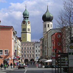
The Mittertor is the only one left of five old market gates. Before 1350, it was the eastern gate of the market town. It also served as a customs office. After a big fire in 1641, the famous Rosenheim onion dome was added. The Mittertor is the oldest building in the city. On the side facing the square, you can see Rosenheim's emblem: a white rose on a red background. The Bavarian crest is also there.
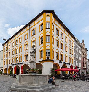
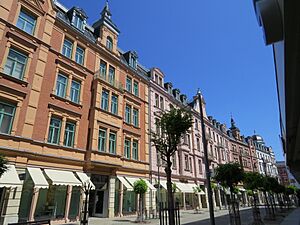
The Münchener Strasse features the Gillitzerblock, also called the "small pedestrian zone." You can see the beautifully restored fronts of buildings from the Gründerzeit era. The Gillitzerblock is named after Thomas Gillitzer, who built 15 houses here in the late 19th century, including the Hotel Deutscher Kaiser.
The Quest-Kunstmühle was built in several stages from 1855 to 1916. Kunstmühle meant a technically advanced mill that wasn't powered by water or wind. The mill was renovated in the 1990s and is now a restaurant and office space. The former mill buildings now house exhibition halls for the Rosenheim arts club.
The Rosenheim ballroom is located in the former Rosenheim Hofbräu brewery buildings. The hall was built in 1878. It was renovated in 1994 and has been used for events since 2001.
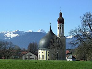
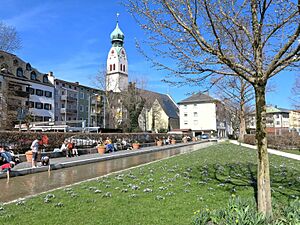
The city's most famous landmark is the gothic spire (65 meters or 213 feet tall) of the parish church St. Nikolaus. It has a baroque onion dome (built in 1641).
| Name | Sculptor |
|---|---|
| Wasserrad | Josef Hamberger |
| Stehende | Rolf Märkl |
| Liegende | Marianne Lüdicke |
| Mensch und Pferd | Prof. Heinrich Kirchner |
| Norne | Louise Stomps |
| Passantengruppe | Erika Maria Lankes |
| Stele | Alfred Regnat |
Parks and Green Spaces
The Kunstwiese (Art Meadow) displays three-dimensional modern art by local artists all year round.
The Riedergarten was started in 1729 as a private herb garden. In 1925, it was sold to the town to be used as a summer garden. In 2002, the garden was redesigned.
Since 1987, the Salingarten, located in front of the Ku'Ko Culture and Congress Centre, has been used as a sculpture garden. You can see large sculptures by important artists from Rosenheim and the surrounding area here.
Transportation
Rosenheim has regular train connections to Munich and Salzburg. It is also part of the EuroCity network, which offers international train travel.
Twin Towns – Sister Cities
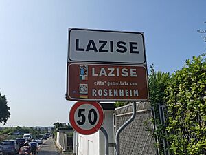
Rosenheim has sister city relationships with:
Sports
Ice Hockey
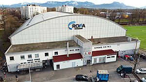
The local ice hockey team is called Starbulls Rosenheim. They currently play in the DEL2, which is Germany's second-highest professional league. Their former team, Sportbund Rosenheim, won the German championship three times (in 1982, 1985, and 1989).
Football
TSV 1860 Rosenheim and Sportbund Rosenheim are the local football clubs. They play in Germany's sixth and ninth highest leagues, respectively.
Notable People from Rosenheim
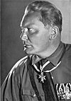
- Hermann Göring (1893–1946), a political and military leader during World War II.
- Hans-Ulrich Rudel (1916–1982), a World War II pilot, lived and died here.
- Edmund Stoiber (born 1941), a politician and lawyer, who was a former Minister President of Bavaria.
- Ray Manzarek (1939–2013), an American musician and member of the band The Doors, died here.
- Siegfried Fischbacher (1939–2021), a famous magician and entertainer.
- George Dzundza (born 1945), an actor.
- Jupp Kapellmann (born 1949), a footballer.
- Mark Benecke (born 1970), a biologist.
- Mario Jann (born 1980), a professional ice hockey player.
- Martin Tomczyk (born 1981), a racing driver.
- Tobias Schweinsteiger (born 1982), a footballer.
- Danijel Kovacic (born 1987), a professional ice hockey player.
- Nadine Samonte (born 1988), an actress.
- Lars Bender (born 1989), a footballer.
- Sven Bender (born 1989), a footballer.
- Philipp Grubauer (born 1991), an ice hockey player.
See also
 In Spanish: Rosenheim para niños
 | James Van Der Zee |
 | Alma Thomas |
 | Ellis Wilson |
 | Margaret Taylor-Burroughs |


