Sanda Island facts for kids
| Gaelic name | Sandaigh/?Abhainn |
|---|---|
| Norse name | Sandey/Havn |
| Meaning of name | Sandy Island (Norse) |
| OS grid reference | NR730043 |
| Coordinates | 55°17′N 5°35′W / 55.28°N 5.58°W |
| Physical geography | |
| Island group | Firth of Clyde |
| Area | 127 hectares (0.49 sq mi) |
| Area rank | 131 |
| Highest elevation | 123 metres (404 ft) |
| Administration | |
| Sovereign state | United Kingdom |
| Country | Scotland |
| Council area | Argyll and Bute |
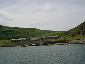
Sanda Island (Scottish Gaelic: Sandaigh) is a small island located in the Firth of Clyde, a sea area off the coast of Scotland. It's found near the southern tip of the Kintyre peninsula, close to the villages of Southend and Dunaverty Castle.
When the weather is clear, you can easily spot Sanda Island from the Kintyre peninsula, the Isle of Arran, and even from the northeast coast of County Antrim in Northern Ireland. People living on Arran and the Antrim coast sometimes call it "Spoon Island." This is because it looks a bit like an upside-down spoon when seen from a distance.
Contents
Who Lives on Sanda Island?
Sanda Island is a very quiet place. In 2001, only one person lived there, making it one of Scotland's least populated islands. By 2008, the population grew slightly to three people.
The island was put up for sale in 2008 by its owners. It was later bought by a businessman from Switzerland named Michi Meier. He wanted the island for his own personal use. By the time of the 2011 census, no one was living on Sanda Island permanently.
Amazing Wildlife on Sanda Island
Sanda Island is a very important place for birds. It has been named a Site of Special Scientific Interest. This means it's a protected area because it's vital for both birds that live there all year and those that stop by during their long migrations.
The island is also home to the first bird observatory on Scotland's west coast. A bird observatory is a special place where scientists study birds, their movements, and their habits.
Island Shape and Rocks
Sanda Island is located in the Straits of Moyle, which is the narrow stretch of water between Scotland and Ireland. It's part of a small group of islands southeast of the Mull of Kintyre. The other islands in this group are Glunimore and Sheep Island.
On the north side of Sanda, there's a sandy area called the Oitir Buidhe, which means "yellow sand spit." This sandy area becomes visible when the tide is low and has two slipways, which are ramps for boats. To the east, there's a dangerous underwater rock formation known as "Paterson's Reef."
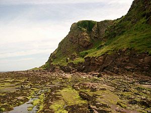
The island has steep cliffs on most of its sides. You can find caves along the west coast. There are also a couple of natural arches, which are rock formations shaped like bridges, especially near the lighthouse. Sanda has two main hills, with a valley in between them. This valley is a great spot because it's protected from strong winds and gets a lot of sunshine.
Sanda Island's Long History
Sanda Island has a rich history and is connected to many famous historical figures. These include the Bruce family, William Wallace, and Saint Ninian, who was one of the first Christian missionaries in Scotland.
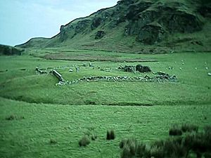
The island is known for the ruins of a chapel that was supposedly built by Saint Ninian. There are also ancient Celtic crosses and a holy well on the island. It is believed that Saint Ninian might have been buried here. The island was owned by the Priory of Whithorn until the Scottish Reformation, a time of big changes in Scotland's religious practices.
The Norsemen, who were Vikings, called the island "Sandey," meaning "sandy island." This name likely came from the Oitir Buidhe sand spit on the north shore. Another old name for the island was Havoin, which means "haven" or a safe place for ships. This probably refers to the good anchorage where boats could safely stop on the north coast.
In the Middle Ages, Sanda Island had ties to the Bruce family, including Robert the Bruce, a famous Scottish king. Robert the Bruce once had to hide on Sanda Island while being chased by the English navy in 1306. He later found shelter on Rathlin Island, which is not far away. It was on Rathlin Island that he is said to have seen the legendary spider that inspired him to keep trying.
In the southern part of Sanda, there are "Wallace's Rocks," which are linked by legend to the Scottish hero William Wallace. Later, in the 16th and 17th centuries, the island was connected to the MacDonald clan of Kintyre. Over time, Sanda Island has had many different owners, including Jack Bruce from the famous rock band Cream in 1969.
The Sanda Island Lighthouse
| Construction | masonry tower |
|---|---|
| Tower shape | cylindrical tower with balcony and lantern attached to 1-storey keeper’s house |
| Markings / pattern | white tower, black lantern, ochre trim |
At the very southern tip of Sanda Island, there is a lighthouse that was built in 1850 by Alan Stevenson. When you look at the island from the sea to the south, the natural arch and the lighthouse on the rock can look like a ship. Because of this, the lighthouse is sometimes called "The Ship" on marine maps.
The Byron Darnton Pub
In 2003, a pub (a type of restaurant and bar) was opened on the island. It was named Byron Darnton after a ship that was wrecked near the island in 1946. The Byron Darnton ship was named after an American war reporter. His son, John Darnton, also became a journalist and visited the island in 2005.
Sanda Island Stamps
Since 1962, Sanda Island has issued its own local stamps. These stamps were used by the lighthouse staff, the island's owners, and the many visitors who wanted to send mail from the island. The mail would then be carried to the nearest official post box on the mainland.
 | Jackie Robinson |
 | Jack Johnson |
 | Althea Gibson |
 | Arthur Ashe |
 | Muhammad Ali |


