Saratoga, New York facts for kids
Quick facts for kids
Saratoga
|
||
|---|---|---|
| Town of Saratoga | ||
|
||

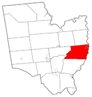
Location within Saratoga County
|
||
| Country | United States | |
| State | New York | |
| County | Saratoga | |
| Area | ||
| • Total | 42.90 sq mi (111.11 km2) | |
| • Land | 40.56 sq mi (105.05 km2) | |
| • Water | 2.34 sq mi (6.06 km2) | |
| Elevation | 440 ft (134 m) | |
| Population
(2020)
|
||
| • Total | 5,808 | |
| • Density | 135.385/sq mi (52.273/km2) | |
| Time zone | UTC-5 (Eastern (EST)) | |
| • Summer (DST) | UTC-4 (EDT) | |
| FIPS code | 36-65244 | |
| GNIS feature ID | 0979461 | |
Saratoga is a town in Saratoga County, New York, United States. In 2020, about 5,808 people lived there. People often use "Saratoga" to mean the nearby city of Saratoga Springs, which has more people. The main village in the town of Saratoga is Schuylerville. It is sometimes called Old Saratoga. Another village in the town is Victory.
The name Saratoga comes from a Mohawk word. It was the name for Native American hunting grounds along the Hudson River. The town's history says it means "the hillside country of the quiet river."
Saratoga is on the eastern side of Saratoga County. It is east of Saratoga Springs. The town is next to Saratoga Lake and the Hudson River. Students from Saratoga go to schools in the Saratoga Springs, Schuylerville, and Stillwater school districts.
Contents
Exploring Saratoga's Past
The name "Saratoga" might come from the Iroquoian words se-rach-ta-gue or sa-ra-ta-ke. Early Dutch settlers wrote it as "Sarachtoge." Another old version of the name is "Saraghtogo." The exact origin of the name is still a bit of a mystery.
Early Settlements and Conflicts
People first settled here in the late 1600s. It was known as "Fort Saratoga." This area became a battleground between British and French forces. In 1745, during King George's War, the French destroyed the village of Saratoga, which is now Schuylerville.
Saratoga was once a large area of Albany County. It stretched from north of the Mohawk River to Northumberland. It included land six miles on both sides of the Hudson River. By 1775, this area was divided into three smaller parts: Ballstown, Halfmoon, and Saratoga.
The American Revolution's Turning Point
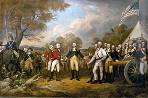
Saratoga is famous for a very important event in American history. On October 17, 1777, British General John Burgoyne surrendered to American General Horatio Gates. This happened after the Battles of Saratoga. Many people say this surrender was the turning point for the United States in the American Revolution. The main battles took place in the town of Stillwater, which is to the south. However, the last 10 days of the British camp and the surrender ceremony itself happened in Saratoga (Schuylerville).
How Saratoga's Borders Changed
In 1788, a law was passed to create towns instead of districts. Stillwater was formed from the Saratoga District. This made four towns in what would become Saratoga County. These original four towns were later divided into the 19 towns we know today. The first town of Saratoga was much larger than it is now. It included areas that are now Easton, Northumberland, Moreau, Wilton, parts of Greenfield and Corinth, and the city of Saratoga Springs.
The town lost some land in 1789 to the town of Easton. Easton is now in Washington County. In 1798, several towns split off from Saratoga. These included Corinth, Greenfield, Northumberland, Moreau, and Wilton. In 1805, a small piece of land in southwestern Saratoga was added to the town of Malta. Finally, in 1819, the town of Saratoga Springs was formed from the western part of Saratoga. This area later became the city of Saratoga Springs.
The Saratoga Race Course is a very old horse-racing track. It is in the city of Saratoga Springs, which is next to the town of Saratoga.
Saratoga's Natural Landscape
The town of Saratoga covers about 42.9 square miles (111.1 square kilometers). Most of this area, about 40.7 square miles (105.4 square kilometers), is land. The rest, about 2.2 square miles (5.7 square kilometers), is water.
The Hudson River forms the eastern border of the town. This river also marks the border with Washington County. Fish Creek flows into the Hudson River. Fish Creek is the water that flows out of Saratoga Lake.
Getting Around Saratoga
Several important roads help people travel through Saratoga.
- U.S. Route 4 (also called Turning Point Trail) runs along the Hudson River on the eastern side of the town.
- New York State Route 29 (General Philip Schuyler Commemorative Highway) goes from east to west. It crosses US-4 in Schuylerville.
- New York State Route 32 is a north-south road. Part of it joins with US-4 near Schuylerville.
Who Lives in Saratoga?
| Historical population | |||
|---|---|---|---|
| Census | Pop. | %± | |
| 1820 | 2,233 | — | |
| 1830 | 2,461 | 10.2% | |
| 1840 | 2,624 | 6.6% | |
| 1850 | 3,492 | 33.1% | |
| 1860 | 3,843 | 10.1% | |
| 1870 | 4,052 | 5.4% | |
| 1880 | 4,539 | 12.0% | |
| 1890 | 3,855 | −15.1% | |
| 1900 | 3,999 | 3.7% | |
| 1910 | 3,942 | −1.4% | |
| 1920 | 3,680 | −6.6% | |
| 1930 | 3,027 | −17.7% | |
| 1940 | 3,212 | 6.1% | |
| 1950 | 3,225 | 0.4% | |
| 1960 | 3,515 | 9.0% | |
| 1970 | 4,206 | 19.7% | |
| 1980 | 4,595 | 9.2% | |
| 1990 | 5,069 | 10.3% | |
| 2000 | 5,141 | 1.4% | |
| 2010 | 5,674 | 10.4% | |
| 2020 | 5,808 | 2.4% | |
| U.S. Decennial Census | |||
In 2000, there were 5,141 people living in Saratoga. There were 2,026 households and 1,387 families. The population density was about 126 people per square mile.
About 31.5% of households had children under 18 living with them. About 54.9% were married couples. Around 24.5% of all households were made up of people living alone. About 9.7% of these were people aged 65 or older. The average household had 2.51 people.
The median age in the town was 38 years old. About 24.6% of the population was under 18. About 12.9% were 65 or older.
Communities and Places in Saratoga
Here are some of the smaller communities and important places you can find in the town of Saratoga:
- Burgoyne – A small community in the northern part of the town. It is named after the British general, John Burgoyne.
- Cedar Bluffs – A community on the eastern shore of Saratoga Lake.
- Coveville – A community along the Hudson River, near a spot called The Cove.
- The Cove – An arm of the Hudson River.
- Deans Corners – A community in the northwestern part of the town. It is at the crossing of County Roads 67 and 70.
- Gates – A community in the northern part of the town. It is named after the American general, Horatio Gates.
- Grangerville – A community near the northern town line, west of Schuylerville on NY-29.
- Maple Shade – A community on the eastern shore of Saratoga Lake, south of Cedar Bluffs.
- Meyer Corners – A place in the southwestern part of Saratoga. It is at the intersection of County Roads 70 and 71.
- Quaker Springs – A community in the southern part of the town on NY-32.
- Saratoga Lake – This name refers to two things:
- A community at the northern end of the lake.
- The lake itself, named Saratoga Lake.
- Saratoga National Historical Park – A special historical park. It includes the Schuyler House, Saratoga Monument, Victory Woods, and the Battlefield (which is in Stillwater).
- Schuylerville – A village in the northeastern part of the town. It is located on US-4, NY-29&32, the Champlain Canal, and the Hudson River.
- Victory – A village in the northeastern part of the town, located on NY-32.
- Victory Mills – This is the name of a post office and the last big mill in the village of Victory.
See also
 In Spanish: Saratoga (Nueva York) para niños
 | Roy Wilkins |
 | John Lewis |
 | Linda Carol Brown |


