
Sherman Island (California) facts for kids
.jpg)
Sherman Island from the air. The bridge at bottom connects it to Antioch. The small D-shaped island at the top right is Decker Island.
|
|

Sherman Island
Location in Sacramento-San Joaquin River Delta

Sherman Island
Location in San Francisco Bay Area

Sherman Island
Location in California
|
|
| Geography | |
|---|---|
| Location | Sacramento–San Joaquin River Delta |
| Coordinates | 38°03′34″N 121°44′00″W / 38.0593642°N 121.7332878°W |
| Adjacent bodies of water | Sacramento-San Joaquin River Delta |
| Area | 14,000 acres (5,700 ha) |
| Length | 9.5 mi (15.3 km) measured SW–NE |
| Width | 3.0 mi (4.8 km) measured SE–NW |
| Demographics | |
| Population | 233 (2000) |
Sherman Island is a large island located in the Sacramento–San Joaquin River Delta in California. It sits where the Sacramento River and San Joaquin River meet. This island is about 1.2 miles (1.9 km) northeast of the city of Antioch.
Sherman Island covers about 14,000 acres (5,500 hectares). It is a special place because it is where three different counties meet: Sacramento, Solano, and Contra Costa. The island is surrounded by water. The Sacramento River is to its north and northwest. Three Mile Slough is to its northeast. The San Joaquin River borders it on the east and southwest.
This island is very popular for water sports like kiteboarding and windsurfing.
Contents
Island History and Land Changes
Sherman Island has been on maps for a long time. It appeared on an 1850 map of the San Francisco Bay Area. Back then, it looked a bit different than it does today.
Today, parts of Sherman Island are actually below sea level. This happened because the wetlands in the Delta were drained a long time ago. When wetlands are drained, the soil, which is often made of peat (decayed plant matter), dries out and shrinks. This shrinking of the land is called land subsidence. In some areas of Sherman Island, the land has sunk by as much as 25 feet (7.6 meters) since the late 1800s. It continues to sink a little bit each year.
Scientists are concerned that if strong earthquakes happen, the protective walls around the island, called levees, could break. If this happens on Sherman Island and nearby islands, it could affect the fresh water supply for a large area called the Central Valley.
.jpg)
How to Visit Sherman Island
You can get to Sherman Island by boat or by car using California State Route 160. This highway crosses the Antioch Bridge, which connects Sherman Island to Antioch in the south. It also uses the Three Mile Slough Bridge to connect the island to Brannan Island State Recreation Area in the north. Once on the island, you can drive south on Sherman Island Road to reach Mayberry Slough.
Exploring the Wildlife Area
The southwestern part of the island is called the Lower Sherman Island Wildlife Area. This area covers about 3,100 acres (1,255 hectares). It has a large marshy area and a lake called Sherman Lake. These areas are great for fishing and other water sports.
This wildlife area was created in 1976 to protect the animals and plants that live there. After a big flood in 1986, new projects were started to improve flood control on Sherman Island and other nearby islands. Laws were also put in place to make sure that these islands did not lose any of their natural habitats.

Park Hours and Fees
The park on Sherman Island is open from sunrise to sunset every day of the year. If there isn't a person collecting fees, you can pay for your visit yourself.
Camping Rules
You can camp overnight on Sherman Island, but there are some rules:
- You can stay for a maximum of 14 nights. After that, you need to leave for 30 days before camping again.
- Only self-contained vehicles like RVs, trailers, and vans are allowed for camping.
- You cannot camp in the boat launch parking lot.
Entrance and Camping Fees
- Vehicle: $7
- Vehicle with Trailer or Oversized Vehicle (over 22 feet / 6.7 meters): $16
- Bus: $24
- Nightly Camping: $35
Images for kids
-
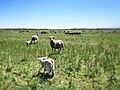
Sheep grazing on Sherman Island, March 2014
-
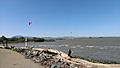
Kiteboarding at Sherman Island, California, April, 2015.
