
Sherpa Peak facts for kids
Quick facts for kids Sherpa Peak |
|
|---|---|

Sherpa Peak
|
|
| Highest point | |
| Elevation | 8,605 ft (2,623 m) |
| Prominence | 405 ft (123 m) |
| Geography | |

Sherpa Peak
Location in Washington (state)

Sherpa Peak
Location in the United States
|
|
| Location | Chelan County, Washington, U.S. |
| Parent range | Cascades |
| Topo map | USGS Mount Stuart |
| Geology | |
| Age of rock | Cretaceous |
| Type of rock | Granite |
| Climbing | |
| First ascent | 1955 Dave Mahre, Bill Prater, and Gene Prater |
| Easiest route | class 4 scrambling |
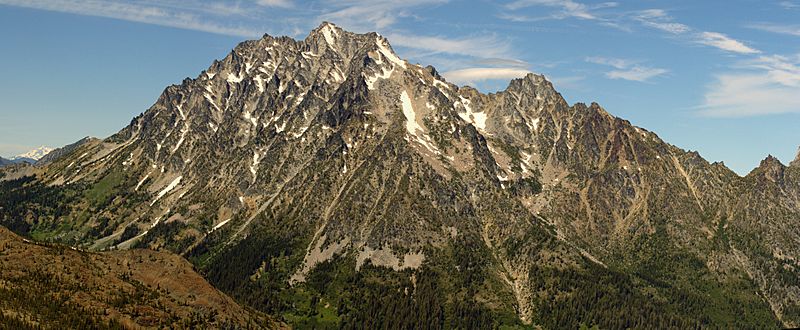
Sherpa Peak is a tall mountain, 8,605 feet (2,623 meters) high, made of strong granite rock. It is located in the Stuart Range in Chelan County, Washington state. This area is part of the Alpine Lakes Wilderness.
The mountain is named after a local climbing club that was active there since the 1950s. The name "Sherpa" also reminds us of the Sherpa people, like Tenzing Norgay. He was the first Sherpa to reach the top of Mount Everest with Sir Edmund Hillary in 1953.
The closest higher mountain is Mount Stuart, which is about 0.41 miles (0.66 km) to the west. Argonaut Peak is about 1.29 miles (2.08 km) to the east. A glacier called the Sherpa Glacier sits on the northern side of Sherpa Peak. Water from the peak flows into Mountaineer Creek or Ingalls Creek, and eventually reaches the Wenatchee River.
Mountain Weather
Most weather fronts that affect Sherpa Peak come from the Pacific Ocean. They travel east towards the Cascade Mountains. When these weather fronts hit the tall mountains, they are forced to rise. This causes them to drop their moisture as rain or snow. This process is called Orographic lift.
Because of this, the Cascade Mountains get a lot of rain and snow, especially in winter. Winters are usually cloudy. But in summer, high pressure systems over the Pacific Ocean often bring clear skies. This means there is usually little or no cloud cover during the warmer months.
How the Mountains Formed
The Alpine Lakes Wilderness has very rugged land. It features sharp peaks, long ridges, deep valleys carved by glaciers, and huge granite walls. There are also more than 700 mountain lakes in this area.
The different shapes of the land and the big changes in height were created by geological events over millions of years. These events also led to the different climates you find across the Cascade Range.
The Cascade Mountains started forming millions of years ago, during the late Eocene Epoch. This happened when the North American Plate slowly moved over the Pacific Plate. This movement caused many volcanic eruptions. Also, small pieces of the Earth's crust, called terranes, helped form the North Cascades about 50 million years ago. Sherpa Peak is part of a large area of solid granite rock called the Mount Stuart batholith. This batholith forms the entire Stuart Range.
About two million years ago, during the Pleistocene period, large glaciers moved across the land. They advanced and then melted back many times. As they moved, they scraped the landscape and left behind rock debris. The last time glaciers melted away from the Alpine Lakes area was about 14,000 years ago. By 10,000 years ago, they had moved north of the Canada–US border.
The river valleys in this area have a "U" shape. This shape was created by these recent glaciers. The rising of the land (called uplift) and cracks in the Earth's crust (called faulting), combined with the action of glaciers, have created the tall peaks and deep valleys of the Alpine Lakes Wilderness.
Images for kids
-
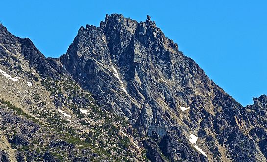
Sherpa Peak seen from Longs Pass
-
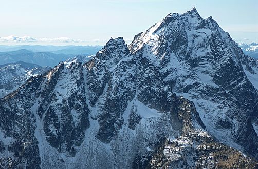
Sherpa Peak centered with Mt. Stuart to right
-
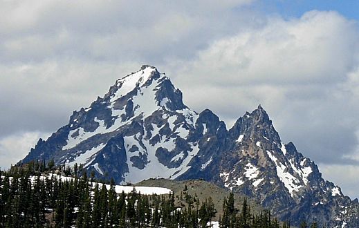
Mount Stuart with Sherpa Peak to right
-
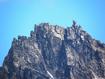
Sherpa Peak's balanced rock
-
Mt. Stuart with Sherpa Peak to right of center


- Sherpa Peak weather: Mountain Forecast
- Sherpa Peak rock climbing: Mountainproject.com
