Slidell, Louisiana facts for kids
Quick facts for kids
Slidell
|
|
|---|---|
| City of Slidell | |

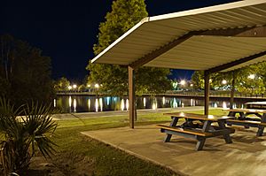
Heritage Park
|
|
| Nickname(s):
The Camellia City (official), The Dell, The Dirty Dell (Owing to graffiti above I-12 East before the city limits)
|
|

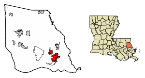
Location of Slidell in St. Tammany Parish, Louisiana
|
|
| Country | |
| State | |
| Parish | St. Tammany |
| Named for | John Slidell |
| Government | |
| • Type | Mayor |
| • Body | Greg Cromer (R) |
| Area | |
| • Total | 15.38 sq mi (39.83 km2) |
| • Land | 15.04 sq mi (38.96 km2) |
| • Water | 0.34 sq mi (0.87 km2) |
| Population
(2020)
|
|
| • Total | 28,781 |
| • Density | 1,913.50/sq mi (738.82/km2) |
| Time zone | UTC−6 (CST) |
| • Summer (DST) | UTC−5 (CDT) |
| ZIP code |
70458, 70459, 70460, 70461, 70469
|
| Area code(s) | 985 |
Slidell (say "sly-DELL") is a city in Louisiana, United States. It is located on the northeast side of Lake Pontchartrain in St. Tammany Parish. In 2020, about 28,781 people lived there, making it one of Louisiana's larger cities. Slidell is part of the bigger New Orleans area.
Contents
History of Slidell
How Slidell Started
Slidell was founded in 1882 and 1883. This happened when workers were building the New Orleans and Northeastern Railroad (N.O.N.E.). This railroad line connected New Orleans to Meridian, Mississippi. The town was named after John Slidell, an American politician. Slidell officially became a city in 1888.
One of the first people to settle in the area was Foster Willie. He arrived in 1836 and started a lumber mill. The road he used to travel between his home and the mill is now known as Gause Boulevard, a main street in Slidell.
Slidell in the 1900s and Today
Around 1910, Slidell started to grow with new businesses. A large plant that treated wood with creosote was built. Also, the Fritz Salmen Brickyard, which made many bricks, opened. A lumber mill and a shipyard were also important.
Later, major highways like Interstate 10, Interstate 59, and Interstate 12 were built. This made Slidell an important meeting point for travelers in the Gulf States.
In 1915, the creosote plant burned down but was rebuilt. However, the plant caused pollution in a nearby bayou, which was a source of drinking water. The plant was closed in 1986, and the area was cleaned up. Now, a park called Heritage Park is located there.
In the 1960s, the U.S. space program helped Slidell grow a lot. NASA opened facilities nearby, which caused Slidell's population to almost triple in ten years. The city became a big suburb of New Orleans. The National Weather Service also has an office in Slidell.
Slidell has faced natural challenges. On August 29, 2005, Hurricane Katrina caused a lot of damage to the city. Parts of Slidell experienced a storm surge (a rise in water level) of over 10 feet. More recently, on April 10, 2024, an EF2 tornado hit the southern part of the city.
Slidell Museum
The Slidell Museum is a small museum that tells the story of how the city began as a railroad town. You can find it in Old Town Slidell on 1st Street. The museum is open from Tuesday to Saturday, and it's free to visit.
Geography and Climate
Where is Slidell?
Slidell is located at 30°16′45″N 89°46′40″W / 30.27917°N 89.77778°W. It is about 3 miles north of Lake Pontchartrain. The city is part of the larger New Orleans area. The total area of Slidell is about 15.38 square miles (39.83 square kilometers). Most of this area is land, with a small part being water.
Slidell's Weather
Slidell has a humid subtropical climate. This means it has short, mild winters and hot, humid summers. Rain often falls in winter when cold fronts pass through. Hurricanes are a risk for the area because the city is at a low elevation, making it more vulnerable to storm surges.
| Climate data for Slidell, Louisiana (1991–2020 normals, extremes 1956–present) | |||||||||||||
|---|---|---|---|---|---|---|---|---|---|---|---|---|---|
| Month | Jan | Feb | Mar | Apr | May | Jun | Jul | Aug | Sep | Oct | Nov | Dec | Year |
| Record high °F (°C) | 81 (27) |
86 (30) |
89 (32) |
92 (33) |
95 (35) |
104 (40) |
102 (39) |
108 (42) |
99 (37) |
94 (34) |
90 (32) |
86 (30) |
104 (40) |
| Mean maximum °F (°C) | 75.1 (23.9) |
77.1 (25.1) |
81.5 (27.5) |
84.4 (29.1) |
90.1 (32.3) |
93.5 (34.2) |
95.2 (35.1) |
95.0 (35.0) |
93.0 (33.9) |
88.6 (31.4) |
81.7 (27.6) |
77.1 (25.1) |
96.2 (35.7) |
| Mean daily maximum °F (°C) | 60.6 (15.9) |
64.3 (17.9) |
70.1 (21.2) |
76.1 (24.5) |
83.0 (28.3) |
88.2 (31.2) |
89.6 (32.0) |
89.7 (32.1) |
86.7 (30.4) |
79.3 (26.3) |
69.7 (20.9) |
63.0 (17.2) |
76.7 (24.8) |
| Daily mean °F (°C) | 51.1 (10.6) |
54.7 (12.6) |
60.8 (16.0) |
66.9 (19.4) |
74.4 (23.6) |
80.1 (26.7) |
81.7 (27.6) |
81.6 (27.6) |
78.2 (25.7) |
69.2 (20.7) |
59.5 (15.3) |
53.5 (11.9) |
67.6 (19.8) |
| Mean daily minimum °F (°C) | 41.6 (5.3) |
45.0 (7.2) |
51.6 (10.9) |
57.7 (14.3) |
65.7 (18.7) |
72.1 (22.3) |
73.8 (23.2) |
73.5 (23.1) |
69.7 (20.9) |
59.2 (15.1) |
49.2 (9.6) |
44.1 (6.7) |
58.6 (14.8) |
| Mean minimum °F (°C) | 24.9 (−3.9) |
29.3 (−1.5) |
33.3 (0.7) |
40.9 (4.9) |
51.4 (10.8) |
64.4 (18.0) |
68.9 (20.5) |
67.9 (19.9) |
58.1 (14.5) |
42.0 (5.6) |
32.3 (0.2) |
28.7 (−1.8) |
23.6 (−4.7) |
| Record low °F (°C) | 8 (−13) |
15 (−9) |
22 (−6) |
32 (0) |
41 (5) |
50 (10) |
57 (14) |
58 (14) |
42 (6) |
31 (−1) |
24 (−4) |
9 (−13) |
8 (−13) |
| Average precipitation inches (mm) | 5.92 (150) |
4.39 (112) |
5.26 (134) |
5.47 (139) |
5.84 (148) |
5.75 (146) |
7.68 (195) |
7.57 (192) |
4.95 (126) |
4.17 (106) |
4.22 (107) |
4.95 (126) |
66.17 (1,681) |
| Average snowfall inches (cm) | 0.0 (0.0) |
0.0 (0.0) |
0.1 (0.25) |
0.0 (0.0) |
0.0 (0.0) |
0.0 (0.0) |
0.0 (0.0) |
0.0 (0.0) |
0.0 (0.0) |
0.0 (0.0) |
0.0 (0.0) |
0.0 (0.0) |
0.1 (0.25) |
| Average precipitation days (≥ 0.01 in) | 10.5 | 9.2 | 9.0 | 7.8 | 7.5 | 11.2 | 13.7 | 13.9 | 9.6 | 7.0 | 7.5 | 10.2 | 117.1 |
| Average snowy days (≥ 0.1 in) | 0.0 | 0.0 | 0.0 | 0.0 | 0.0 | 0.0 | 0.0 | 0.0 | 0.0 | 0.0 | 0.0 | 0.0 | 0.0 |
| Source: NOAA | |||||||||||||
People in Slidell
Population and Diversity
| Historical population | |||
|---|---|---|---|
| Census | Pop. | %± | |
| 1890 | 364 | — | |
| 1900 | 1,129 | 210.2% | |
| 1910 | 2,188 | 93.8% | |
| 1920 | 2,958 | 35.2% | |
| 1930 | 2,807 | −5.1% | |
| 1940 | 2,822 | 0.5% | |
| 1950 | 3,383 | 19.9% | |
| 1960 | 6,356 | 87.9% | |
| 1970 | 16,101 | 153.3% | |
| 1980 | 26,718 | 65.9% | |
| 1990 | 24,124 | −9.7% | |
| 2000 | 25,695 | 6.5% | |
| 2010 | 27,068 | 5.3% | |
| 2020 | 28,781 | 6.3% | |
| U.S. Decennial Census | |||
In 2020, Slidell had 28,781 people living in 9,818 households. About 6,430 of these were families. The city's population has grown a lot over the years.
Slidell is a diverse city. Here's a look at the different groups of people living there in 2020:
| Race | Number | Percentage |
|---|---|---|
| White (non-Hispanic) | 17,398 | 60.45% |
| Black or African American (non-Hispanic) | 6,815 | 23.68% |
| Native American | 135 | 0.47% |
| Asian | 505 | 1.75% |
| Pacific Islander | 14 | 0.05% |
| Other/Mixed | 1,526 | 5.3% |
| Hispanic or Latino | 2,388 | 8.3% |
In 2019, the average age of people in Slidell was about 36.7 years old. Most of the people (73.2%) were 18 or older. About 15.9% of the population was 65 or older. The average household income was $54,906.
Economy
Slidell is home to the main office for Textron Marine & Land Systems. This company makes vehicles for both cars and the military.
Education
Schools in Slidell
Public schools in Slidell are managed by the St. Tammany Parish Public Schools. There are three public high schools in the city:
- Northshore High School
- Salmen High School
- Slidell High School
A small part of Slidell is also served by Pearl River High School, which is in nearby Pearl River.
Slidell also has two private high schools:
- Pope John Paul II High School
- First Baptist Christian School
For college, the main campus of Northshore Technical Community College is in Lacombe. Other nearby colleges include Nunez Community College and Delgado Community College.
Transportation
Trains, Roads, and Airports
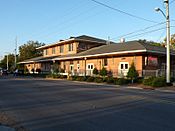
You can travel to Slidell by train! The Amtrak Crescent train stops at Slidell station. This train connects Slidell to big cities like New York City, Washington, D.C., Atlanta, Birmingham, and New Orleans. The train station is on Front Street in Olde Towne Slidell.
Slidell is a major hub for highways. It's located where Interstate 10, Interstate 12, Interstate 59, and U.S. Highway 11 all meet. The I-10 Twin Span Bridge connects Slidell to New Orleans East across Lake Pontchartrain.
Slidell also has its own airport, called Slidell Airport (ASD). It's located a few miles northwest of the city center.
Notable People
Many interesting people have connections to Slidell, including:
- Clayton Adams, a soccer player
- Brett Bech, a former NFL wide receiver who played at Slidell High School
- John Besh, a famous chef
- Terreal Bierria, a former NFL safety
- Clarence "Gatemouth" Brown, a Grammy Award-winning musician
- Kalani Brown, a basketball player
- P. J. Brown, an NBA player
- Tony Canzoneri, a world boxing champion
- Arthur Chevrolet, who helped start the Chevrolet car company
- Rich Clementi, a mixed martial arts fighter
- Chris Duhon, a former Duke University and NBA point guard
- Isame Faciane, a former NFL player
- Chris Faulk, a former NFL offensive tackle
- Michael Federico, a college baseball coach
- Mike Fontenot, an MLB infielder
- Matt Forte, an NFL running back
- Will Harris, an MLB pitcher
- Rodney Holman, a former NFL tight end
- Arthur Jones, an inventor and TV producer
- Juvenile, a Southern rapper
- LaRon Landry, an NFL strong safety
- Paul Mauffray, a conductor
- Logan Morrison, a former MLB outfielder
- Xavier Paul, a former MLB outfielder
- Daniel Sams, a former college football quarterback
See also
 In Spanish: Slidell (Luisiana) para niños
 | Aurelia Browder |
 | Nannie Helen Burroughs |
 | Michelle Alexander |


