Soledad, California facts for kids
Quick facts for kids
Soledad, California
|
|
|---|---|
| City of Soledad | |
|
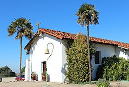
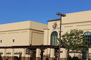
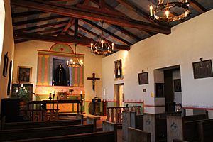
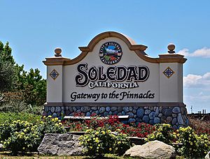
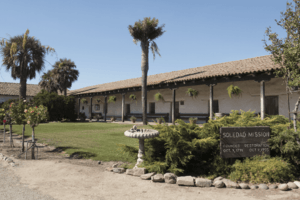
Clockwise: Mission Nuestra Señora de la Soledad; Soledad High School; Mission Soledad.
|
|
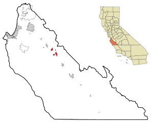
Location in Monterey County and the state of California
|
|
| Country | United States |
| State | California |
| County | Monterey |
| Incorporated | March 9, 1921 |
| Area | |
| • Total | 4.65 sq mi (12.0 km2) |
| • Land | 4.46 sq mi (11.6 km2) |
| • Water | 0.19 sq mi (0.5 km2) 4.09% |
| Elevation | 190 ft (58 m) |
| Population
(2020)
|
|
| • Total | 24,925 |
| • Density | 5,588.6/sq mi (2,157.8/km2) |
| Time zone | UTC-8 (Pacific) |
| • Summer (DST) | UTC-7 (PDT) |
| ZIP code |
93960
|
| Area code | 831 |
| FIPS code | 06-72520 |
Soledad is a city in Monterey County, California, United States. It is located in the Salinas Valley, about 21 miles (34 km) southeast of Salinas, which is the main city of the county. In 2020, Soledad had a population of 24,925 people.
The city's story began with Mission Nuestra Señora de la Soledad, a historic Spanish mission founded in 1791. Later, in the 1860s, a woman named Catalina Munrás started to develop the town of Soledad. It officially became a city in 1921. Today, Soledad is a popular place for tourists. People visit the restored mission, the nearby Pinnacles National Park, and the many vineyards in the Monterey wine region.
Contents
History of Soledad
Early Inhabitants and Mission Founding
For thousands of years, the Chalon tribe of the Ohlone nation lived in the area where Soledad is now. They were indigenous Californians. The Paraíso Hot Springs, located west of Soledad, were used by the Chalon for a very long time.
Soledad began as a settlement in 1791. This is when the Spanish founded Mission Nuestra Señora de la Soledad. Padre Fermín de Lasuén led its establishment. Besides the Spanish and Chalon people, the Esselen and Yokuts people also came to live in Soledad. Unlike many other missions in California, Soledad did not immediately grow into a town outside the mission walls.
Catalina Munrás and Town Development
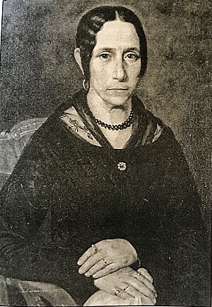
A famous artist named Esteban Munrás arrived in the area in the 1820s with his wife, Catalina Munrás. In 1835, he was given land called Rancho San Vicente by Governor José Castro. However, Esteban and his family lived in Monterey until he passed away in 1850. Before he died, Munrás told his wife Catalina that she should not sell Rancho San Vicente. Instead, he wanted her to keep it and build a town there when the time was right.
Catalina Munrás started to divide the rancho into smaller pieces and develop a town in the 1860s. She gave land for a school, a church, and a cemetery to be built. Later, in 1872, she allowed the Southern Pacific Railroad to build tracks through her land. This led to a train station being built in Soledad, which helped the town become an important farming area.
The Los Coches Adobe, built in the 1840s, became a popular stopping point. Travelers on Southern Pacific trains between Los Angeles and San Francisco would often stop there.
The Soledad post office opened in 1869. On February 6, 1876, the Monterey County Board of Supervisors officially made Soledad a town. In 1921, Soledad became an incorporated city.
In 1898, Fort Romie was founded just west of Soledad. Today, it is part of the Soledad community. In the early 1900s, the Paraíso Hot Springs became a popular resort for people traveling by train.
Soledad is also mentioned in John Steinbeck's 1937 novel Of Mice and Men. This story is about two friends who work on a farm in the Salinas Valley.
Geography and Climate
Where is Soledad Located?
Soledad is in the middle of Monterey County. It is about 8 miles (13 km) southeast of Gonzales and 9 miles (14 km) northwest of Greenfield. You can reach both cities using U.S. Route 101.
The city covers about 4.65 square miles (12.04 km²). Most of this area is land, with a small part being water. The Salinas River flows northwest past the southern edge of the city.
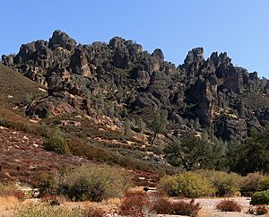
Soledad is also about 10 miles (16 km) by road southwest of Pinnacles National Park. This park is nestled among the nearby Gabilan Range mountains.
Soledad's Weather
Soledad has a type of weather called a warm-summer Mediterranean climate. This means it has warm, dry summers. The average monthly temperatures do not go above 71.6 °F (22 °C).
| Climate data for Soledad, California | |||||||||||||
|---|---|---|---|---|---|---|---|---|---|---|---|---|---|
| Month | Jan | Feb | Mar | Apr | May | Jun | Jul | Aug | Sep | Oct | Nov | Dec | Year |
| Mean daily maximum °F (°C) | 61.6 (16.4) |
63.5 (17.5) |
66.2 (19.0) |
70.0 (21.1) |
73.5 (23.1) |
76.5 (24.7) |
77.4 (25.2) |
78.4 (25.8) |
79.0 (26.1) |
75.3 (24.1) |
67.0 (19.4) |
61.2 (16.2) |
70.8 (21.6) |
| Mean daily minimum °F (°C) | 40.6 (4.8) |
42.1 (5.6) |
43.4 (6.3) |
44.4 (6.9) |
47.8 (8.8) |
50.7 (10.4) |
52.9 (11.6) |
53.0 (11.7) |
51.9 (11.1) |
47.9 (8.8) |
43.3 (6.3) |
39.8 (4.3) |
46.5 (8.1) |
| Average precipitation inches (mm) | 2.05 (52) |
1.92 (49) |
2.11 (54) |
0.57 (14) |
0.10 (2.5) |
0.05 (1.3) |
0.04 (1.0) |
0.06 (1.5) |
0.22 (5.6) |
0.46 (12) |
1.11 (28) |
1.40 (36) |
10.09 (256) |
Population and People
| Historical population | |||
|---|---|---|---|
| Census | Pop. | %± | |
| 1880 | 136 | — | |
| 1890 | 217 | 59.6% | |
| 1930 | 594 | — | |
| 1940 | 861 | 44.9% | |
| 1950 | 2,441 | 183.5% | |
| 1960 | 2,837 | 16.2% | |
| 1970 | 4,222 | 48.8% | |
| 1980 | 5,928 | 40.4% | |
| 1990 | 7,146 | 20.5% | |
| 2000 | 11,263 | 57.6% | |
| 2010 | 25,738 | 128.5% | |
| 2020 | 24,925 | −3.2% | |
| U.S. Decennial Census | |||
Soledad's Population in 2000
In 2000, Soledad had 11,263 people living there. About 60.2% of households had children under 18. The average household had 4.54 people.
The population was quite young, with 36.7% of people under 18. The median age was 25 years old. For every 100 females, there were about 108 males.
Most of the population, 86.82%, identified as Hispanic or Latino.
Soledad's Population in 2010
By 2010, Soledad's population grew to 25,738 people. About 60.7% of the population lived in homes. The average household size was 4.27 people.
The population was spread out in age groups. About 22.0% were under 18, and 39.3% were between 25 and 44 years old. The median age was 34.9 years.
In terms of race, 49.1% were White, and 31.8% were from other races. A large portion, 71.1%, were Hispanic or Latino.
Most households, 67.4%, had children under 18. About 65.1% were married couples living together.
Economy and Jobs
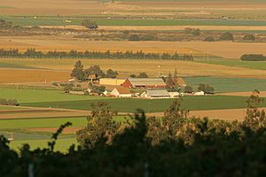
Soledad is in the middle of a very productive farming area. This region is sometimes called the "Salad Bowl of the World." Many large agricultural companies work here, such as Dole Fresh Vegetables and Taylor Farms.
Farming in Soledad
The land around Soledad is known as "Prime Farmland." This means the soil is excellent for growing crops. Because of this, protecting farmland is very important for the city. Farming is a key part of Soledad's economy. The climate also allows crops to be grown all year round.
Dole Food Company has a large plant in Soledad. It opened in 1994 and is known as the "world's largest pre-cut salad plant."
Since 2007, Soledad has also had a weekly Farmers' Market on Soledad Street.
Wine Production
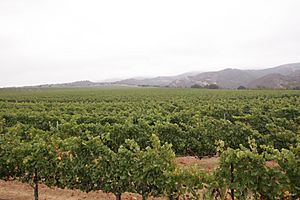
Soledad is in one of California's main wine grape-growing areas. There are over twenty vineyards and wineries within 30 miles (48 km) of the city. Many of these places have tasting rooms where you can try and buy different wines. Some well-known vineyards and wineries nearby include Chalone, Scheid, and Hahn Estate.
Community and Schools
Local Media and Safety
Television service for Soledad comes from the Monterey-Salinas-Santa Cruz area. Local newspapers include the Monterey County Herald, Salinas Californian, and Soledad Bee.
In a 2013 report, Soledad was ranked as California's eleventh-safest city. The report praised Soledad for its strong community spirit and high number of volunteers. In 2014, another report rated Soledad as the ninety-fourth-safest city out of one hundred cities nationwide.
Schools in Soledad
Most of Soledad is served by the Soledad Unified School District. Some parts of the area outside the city are served by the Mission Union School District.
Soledad High School is the main high school in the area. There is also Pinnacles High School, which is a continuation school. Soledad Main Street Middle School is the only middle school in the city. There are five different elementary schools: Rose Ferrero, Jack Franscioni, Gabilan, Frank Ledesma, and San Vicente Elementary Schools.
Transportation
Soledad is located on U.S. Route 101. You can get on and off the highway using exit ramps on Front Street, at both the north and south ends of town. Soledad is also the western end of California State Route 146, which connects the city to Pinnacles National Park.
The city is served by the Monterey-Salinas Transit bus line 23, which travels between Salinas and King City. Bus stops in Soledad are located at the correctional facility, Front & San Vicente, and Monterey & East.
Images for kids
See also
 In Spanish: Soledad (California) para niños
 | Isaac Myers |
 | D. Hamilton Jackson |
 | A. Philip Randolph |


