South Walls facts for kids
| Norse name | Vágaland/Vágar |
|---|---|
| Meaning of name | The southern inlets |
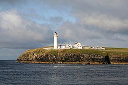 Cantick Head lighthouse, on South Walls, viewed looking west |
|
| OS grid reference | ND304895 |
| Coordinates | 58°47′16″N 3°12′18″W / 58.78788°N 3.2049°W |
| Physical geography | |
| Island group | Orkney |
| Area | 1,100 ha (4.2 sq mi) |
| Area rank | 47 |
| Highest elevation | 57 m (187 ft) |
| Administration | |
| Sovereign state | United Kingdom |
| Country | Scotland |
| Council area | Orkney Islands |
| Demographics | |
| Population | No estimate available |
| Largest settlement | Longhope |
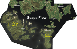
South Walls, also known as Walls (or Sooth Waas in Scots), is an island in Orkney, Scotland. It's right next to another island called Hoy. Its name comes from "Sooth Was," meaning "southern inlets." People thought it was a mistake for "walls," similar to how the name Kirkwall came about.
South Walls forms the southern edge of Longhope harbour. It used to be a tidal island, meaning it was connected to Hoy only at low tide. In 1912, a narrow causeway was built over a sandbank called the Ayre. Now, the causeway itself is often called the Ayre. Even though it's connected by a causeway, many still consider it an island.
South Walls is a popular spot for barnacle geese. These birds often stop here during their long migrations.
Contents
Island Features and Landscape
This island, like most of the Orkney islands, is made of Old Red Sandstone. This type of rock is very old and gives the land its reddish color. The Rousay Flagstone Group is the main type of rock found here.
South Walls is mostly oval in shape. However, there's a small point of land called Cantick Head in the southeast. This point is formed by a bay known as Kirk Hope, or Church Bay. The island is separated from Hoy by a stretch of sea, also called Longhope. The area south of the causeway is known as Aith Hope.
Some official lists, like the 2001 and 2011 censuses, don't always mention South Walls as a separate inhabited island. This is because the causeway connects it to Hoy. However, many sources still consider it an island. For example, old maps from 1856 show a gap between Hoy and South Walls before the causeway was built. Also, historical writings from the 1500s and 1600s describe Walls as an island.
Island History
Norse Period Stories
South Walls was important during the Norse period. It was often the first land sailors would see when coming from Caithness or Sutherland in Scotland. The Orkneyinga saga, an old Norse story, mentions the island several times.
One story tells of Earl Erlend and Swein, who sailed to South Walls with six longships. They were trying to surprise Earl Rögnvald, who was nearby with thirteen ships. Swein decided to attack at night, even though they had fewer men. This shows how important South Walls was as a landing spot for Viking ships.
South Walls also played a key role in bringing Christianity to Orkney. Even though some people in the islands were Christian before the Norse arrived, many Norse people still followed their old pagan beliefs. Olaf Tryggvasson, the King of Norway, made Earl Sigurd Hloðvisson of Orkney get baptized at South Walls. Earl Sigurd agreed and became a Christian, though he was forced to. King Olaf was known for being very strict, and Earl Sigurd likely feared what would happen if he refused.
Modern Times
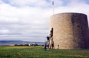
Overlooking Longhope in the northeast is the Hackness Martello Tower and Battery. This tower, along with another one at Crockness on the north side, was built in 1815. Their purpose was to protect British ships in Longhope bay during the Napoleonic Wars. Ships would wait there for a Royal Navy escort before sailing to Baltic ports. These towers were used again during World War I. There's a similar tower across the bay in South East Hoy. Hackness Martello Tower and Battery is now looked after by Historic Scotland.
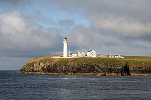
Cantick Head is famous for its lighthouse. It was designed and built by David and Thomas Stevenson, who were famous lighthouse builders. The light first shone in July 1858 and became automated in 1991.
South Walls also has many remains from World War II. During the war, Scapa Flow was a very important base for the Royal Navy. You can still see old structures like radar platforms and wireless stations from that time.
Nature Reserve
The Hill of White Hamars is a Scottish Wildlife Trust nature reserve. This area helps protect the local wildlife and plants.
 | Laphonza Butler |
 | Daisy Bates |
 | Elizabeth Piper Ensley |


